Category:Westmarsh
Jump to navigation
Jump to search
English: Westmarsh is a village in the Ash civil parish of East Kent, England. It is situated between Canterbury and Ramsgate.
Polski: Westmarsh to wieś we wschodniej części hrabstwa Kent, w Anglii. Znajduje się pomiędzy Canterbury a Ramsgate.

hamlet in the Ash civil parish of East Kent, England  | |||||
| Upload media | |||||
| Instance of | |||||
|---|---|---|---|---|---|
| Location | Ash, Dover, Kent, South East England, England | ||||
 | |||||
Subcategories
This category has the following 3 subcategories, out of 3 total.
O
- Oasts in Westmarsh (4 F)
W
- The Way Out Inn, Westmarsh (2 F)
Media in category "Westmarsh"
The following 42 files are in this category, out of 42 total.
-

-
 Drainage channel in Westmarsh - geograph.org.uk - 2236332.jpg 3,072 × 2,304; 2.02 MB
-
 Drainage ditch on the Ash Level - geograph.org.uk - 1162533.jpg 640 × 480; 180 KB
-

-
 Farm track across field on Ash Level - geograph.org.uk - 1146964.jpg 640 × 480; 196 KB
-

-

-
 I didn't risk the plank^ - geograph.org.uk - 1162483.jpg 640 × 480; 231 KB
-
 Idle Dyke Cottage - geograph.org.uk - 646156.jpg 640 × 480; 266 KB
-
 Looking N across the Ash Levels - geograph.org.uk - 1162467.jpg 640 × 480; 220 KB
-

-

-

-

-

-
 Old Chapel, Westmarsh - geograph.org.uk - 2236344.jpg 3,072 × 2,304; 1.87 MB
-
-
 Reeds along the bank of the River Stour - geograph.org.uk - 1621571.jpg 640 × 430; 112 KB
-
 Renovated house near Westmarsh in Ash, Dover, Kent.jpg 640 × 480; 244 KB
-

-
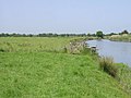
 Sheep to the South of the River Stour - geograph.org.uk - 457142.jpg 640 × 480; 56 KB
-
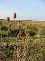 Teazles on Ash Level - geograph.org.uk - 1162575.jpg 480 × 640; 115 KB
-
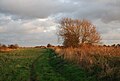
 Tree lined farm road near Westmarsh - geograph.org.uk - 633085.jpg 640 × 480; 266 KB
-

-
 View across Elmstone Valley, Westmarsh - geograph.org.uk - 633083.jpg 640 × 480; 223 KB
-

-
 View across marshland from Wass Drove. - geograph.org.uk - 313018.jpg 640 × 480; 222 KB
-

-
 View along farm track on Ash Level - geograph.org.uk - 1146968.jpg 640 × 480; 182 KB
-

-
 View along lane in Westmarsh - geograph.org.uk - 633080.jpg 640 × 480; 205 KB
-

-
 View NE along a dyke, Westmarsh - geograph.org.uk - 313033.jpg 640 × 480; 178 KB
-
 Wastmarsh Village hall. - geograph.org.uk - 313009.jpg 640 × 480; 98 KB
-
 Waterlogged field on Ash Level - geograph.org.uk - 1162557.jpg 640 × 480; 208 KB
-
 Westmarsh Village Hall - geograph.org.uk - 2236312.jpg 3,072 × 2,304; 1.54 MB
-
 Entrance to fields from Westmarsh - geograph.org.uk - 633075.jpg 640 × 480; 237 KB
-
 Footpath to Ware - geograph.org.uk - 645981.jpg 640 × 480; 177 KB
-

-
 Looking S from Saxon Shore Way - geograph.org.uk - 457148.jpg 640 × 480; 71 KB
-
-


