Category:Westleigh, North Devon
Jump to navigation
Jump to search
village and civil parish in North Devon, UK  | |||||
| Upload media | |||||
| Instance of | |||||
|---|---|---|---|---|---|
| Location | North Devon, Devon, South West England, England | ||||
 | |||||
Subcategories
This category has the following 7 subcategories, out of 7 total.
Media in category "Westleigh, North Devon"
The following 200 files are in this category, out of 240 total.
(previous page) (next page)-
 A 1960 ex-Thames Lighter, The Skandia, on the River Taw - geograph.org.uk - 5785984.jpg 6,000 × 4,000; 4.79 MB
-
 A bridge component at the eastern end of the Torridge Bridge - geograph.org.uk - 5677300.jpg 6,000 × 4,000; 5.46 MB
-

-
 A bus shelter on the B3233 near Westleigh - geograph.org.uk - 4951104.jpg 6,000 × 4,000; 5.86 MB
-

-
 A derelict boat on the River Torridge at East the Water - geograph.org.uk - 5780421.jpg 6,000 × 4,000; 4.62 MB
-

-
-
 A McDonald's restaurant ^ a Premier Inn - geograph.org.uk - 5235072.jpg 6,000 × 4,000; 5.37 MB
-

-
 A pill or tidal creek in East the Water - geograph.org.uk - 5780416.jpg 6,000 × 4,000; 4.78 MB
-

-

-
 A rivulet etched in the mud on the River Torridge - geograph.org.uk - 4951123.jpg 6,000 × 4,000; 4.53 MB
-
 A road from Barnacott which crosses the A39 - geograph.org.uk - 3028103.jpg 1,600 × 1,063; 532 KB
-
 A road junction in Westleigh - geograph.org.uk - 2589109.jpg 1,024 × 680; 305 KB
-
 A road junction in Westleigh - geograph.org.uk - 2589632.jpg 1,024 × 680; 192 KB
-
 A road junction near Treyhill Cottages - geograph.org.uk - 3028081.jpg 1,600 × 1,063; 574 KB
-

-
 A road to Westleigh on the B3233 - geograph.org.uk - 3027835.jpg 1,600 × 1,063; 385 KB
-

-

-

-

-
 A386 south bound - geograph.org.uk - 3127073.jpg 640 × 456; 48 KB
-
 A386 south bound - geograph.org.uk - 3127080.jpg 640 × 438; 55 KB
-
 A386 south bound - geograph.org.uk - 3127092.jpg 640 × 456; 52 KB
-

-
 A39 eastbound - geograph.org.uk - 3289420.jpg 640 × 480; 52 KB
-
 A39 eastbound - geograph.org.uk - 3289427.jpg 640 × 480; 41 KB
-
 A39 lay-by north of Eastleigh - geograph.org.uk - 3644330.jpg 769 × 1,024; 101 KB
-
 A39 trunk road - geograph.org.uk - 661450.jpg 640 × 480; 113 KB
-
 A39, Torridge Bridge - geograph.org.uk - 3289415.jpg 640 × 480; 41 KB
-
 Across the Horwood Stream valley - geograph.org.uk - 5298913.jpg 1,569 × 798; 236 KB
-
 An un-named trawler on the River Taw, now used as a dwelling - geograph.org.uk - 5785975.jpg 6,000 × 4,000; 4.21 MB
-

-
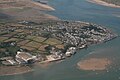 Appledore and Shipyard, aerial 2018 - geograph.org.uk - 5960424.jpg 640 × 427; 76 KB
-
 Appledore Shipyard, aerial 2018 - geograph.org.uk - 5960423.jpg 640 × 427; 69 KB
-
 Arable field beside Horwood Cross - geograph.org.uk - 6333858.jpg 3,913 × 2,434; 914 KB
-
 Arable field near Horwood Cross - geograph.org.uk - 6333839.jpg 2,617 × 1,712; 747 KB
-
 Ashridge, near Bideford. - geograph.org.uk - 727446.jpg 640 × 480; 115 KB
-
 Barnacott Cross - geograph.org.uk - 3028306.jpg 1,600 × 1,067; 353 KB
-
 Barnacott Cross - geograph.org.uk - 3028324.jpg 1,600 × 1,063; 288 KB
-
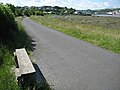 Bench beside the cycleway, Bideford - geograph.org.uk - 1357062.jpg 640 × 480; 92 KB
-

-
 Bideford College ^ Asda Supermarket - geograph.org.uk - 5234631.jpg 6,000 × 4,000; 6.33 MB
-
 Bideford Long Bridge, aerial 2018 - geograph.org.uk - 5960448.jpg 640 × 427; 58 KB
-
 Bideford viewed across the Torridge - geograph.org.uk - 1359450.jpg 640 × 480; 105 KB
-
 Blackgate Cross not far from Westleigh - geograph.org.uk - 3027942.jpg 1,600 × 1,063; 424 KB
-
 Bradavin (geograph 6336618).jpg 2,303 × 1,343; 451 KB
-
 Bradavin Cross - geograph.org.uk - 2143642.jpg 640 × 480; 75 KB
-
 Bridge over A39 carrying the road to Ball Hill - geograph.org.uk - 3641779.jpg 1,024 × 768; 127 KB
-
 By the Old Barnstaple Road - geograph.org.uk - 6336780.jpg 3,264 × 2,176; 1.48 MB
-
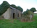
 Church gates - geograph.org.uk - 878126.jpg 640 × 427; 96 KB
-
 Church Rooms - geograph.org.uk - 878132.jpg 427 × 640; 91 KB
-
 Countryside by the A39 - geograph.org.uk - 6336650.jpg 2,888 × 1,573; 569 KB
-
 Crossing the A39 near Westleigh - geograph.org.uk - 2589642.jpg 1,024 × 680; 279 KB
-

-
 Drive to Bulworthy Forest Lodges - geograph.org.uk - 6333796.jpg 4,243 × 2,462; 2.53 MB
-
 Durrant House Hotel, Northam - geograph.org.uk - 4862816.jpg 4,000 × 3,000; 4.01 MB
-
 Entering Westleigh from the East - geograph.org.uk - 2589630.jpg 1,024 × 680; 281 KB
-
 Farmland near Bradavin - geograph.org.uk - 6336609.jpg 3,771 × 2,494; 1.82 MB
-
 Farmland near Bradavin - geograph.org.uk - 6336640.jpg 3,238 × 2,095; 1.42 MB
-
 Farmland near Eastleigh - geograph.org.uk - 5299099.jpg 2,245 × 1,042; 382 KB
-
 Farmland, Bradavin - geograph.org.uk - 6336633.jpg 3,235 × 2,100; 1.06 MB
-
 Field by Horwood Cross - geograph.org.uk - 6336498.jpg 3,633 × 2,496; 1.07 MB
-
 Field by stream, Watergate - geograph.org.uk - 6336161.jpg 4,275 × 2,606; 1.64 MB
-
 Field near Huish - geograph.org.uk - 942125.jpg 640 × 480; 107 KB
-
 Field near Southcott Cottages - geograph.org.uk - 6336777.jpg 4,288 × 2,848; 2.13 MB
-
 Field near Southcott Cottages - geograph.org.uk - 6336778.jpg 4,075 × 2,344; 1.55 MB
-
 Geneva College and some of Bideford - geograph.org.uk - 5234732.jpg 6,000 × 4,000; 4.13 MB
-

-
 Horwood Stream valley - geograph.org.uk - 5298902.jpg 640 × 340; 55 KB
-
 Houses at Eastleigh - geograph.org.uk - 6336540.jpg 2,970 × 2,324; 527 KB
-
 Houses at Eastleigh - geograph.org.uk - 6336602.jpg 2,792 × 1,622; 445 KB
-

-
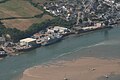
 Instow on a stormy day in October - geograph.org.uk - 4221886.jpg 3,334 × 2,381; 5.48 MB
-

-
 Kingsley School and surrounds - geograph.org.uk - 5234661.jpg 6,000 × 4,000; 6.56 MB
-
 Kitchen garden - geograph.org.uk - 878051.jpg 640 × 427; 85 KB
-
 Landing craft at Instow.jpg 3,800 × 2,736; 4.9 MB
-
 Lane and beechwood - geograph.org.uk - 623450.jpg 640 × 480; 135 KB
-
 Lane to Bradavin - geograph.org.uk - 6336676.jpg 3,228 × 1,921; 885 KB
-
 Lane to Watergate - geograph.org.uk - 6336119.jpg 4,288 × 2,690; 2.51 MB
-
 Lane to Watergate - geograph.org.uk - 6336128.jpg 4,288 × 2,848; 2.28 MB
-
 Lane to Westleigh - geograph.org.uk - 6336665.jpg 2,147 × 3,061; 473 KB
-

-

-

-
 Looking across the B3233 towards Tapeley Park, Westleigh - geograph.org.uk - 4950449.jpg 6,000 × 4,000; 4.56 MB
-

-
 Manteo Way approaching the junction with the B3233 - geograph.org.uk - 5776524.jpg 6,000 × 4,000; 4.74 MB
-
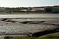
 Marshland in the Torridge estuary - geograph.org.uk - 1355608.jpg 640 × 480; 115 KB
-
 Milestone Cottage, Eastleigh - geograph.org.uk - 6336574.jpg 2,232 × 1,538; 239 KB
-
 Millrow Cross near Westleigh - geograph.org.uk - 3027924.jpg 1,600 × 1,068; 664 KB
-
 Millrow Cross near Westleigh - geograph.org.uk - 3027931.jpg 1,600 × 1,063; 662 KB
-
 Millrow Cross near Westleigh - geograph.org.uk - 3027937.jpg 1,600 × 1,063; 681 KB
-
 Minor road crossing the A39 near Treyhill - geograph.org.uk - 3644333.jpg 1,024 × 768; 124 KB
-
 Minor road drops to the B3233 - geograph.org.uk - 2143654.jpg 640 × 480; 71 KB
-
 Monterey Pine - geograph.org.uk - 749851.jpg 640 × 480; 101 KB
-
 Moreton House - geograph.org.uk - 5234673.jpg 6,000 × 4,000; 5.08 MB
-
 Mouna, a 5 bedroom detached house on Bidna Lane - geograph.org.uk - 5162286.jpg 4,000 × 3,000; 4.92 MB
-

-
 No Direction Home at Huish Moor - geograph.org.uk - 3028336.jpg 3,552 × 2,371; 5.48 MB
-
 North Devon , Road to A386 - geograph.org.uk - 3359305.jpg 4,288 × 2,848; 4.89 MB
-
 North Devon , The A386 - geograph.org.uk - 3594624.jpg 4,166 × 2,652; 5.52 MB
-
 North Devon , The A39 - geograph.org.uk - 3359300.jpg 3,843 × 2,553; 3.06 MB
-
 North Devon , The A39 - geograph.org.uk - 3359303.jpg 3,879 × 2,575; 2.65 MB
-
 North Devon , The A39 - geograph.org.uk - 3359307.jpg 4,288 × 2,848; 5 MB
-
 North Devon , The A39 - geograph.org.uk - 3359310.jpg 4,288 × 2,848; 4.46 MB
-
 North Devon , The B3233 - geograph.org.uk - 4076864.jpg 4,288 × 2,848; 5.35 MB
-
 North Devon arable - geograph.org.uk - 623431.jpg 640 × 319; 59 KB
-
 Northdown Road, Bideford - geograph.org.uk - 5235086.jpg 6,000 × 3,232; 4.99 MB
-
 Old Barnstaple Road - geograph.org.uk - 6333881.jpg 3,127 × 1,937; 713 KB
-
 Old stables - geograph.org.uk - 747249.jpg 640 × 480; 120 KB
-
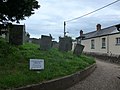
 One of many picturesque cottages in Westleigh - geograph.org.uk - 2589123.jpg 1,024 × 680; 275 KB
-

-
 Ordnance Survey 1GL Bolt - geograph.org.uk - 4570476.jpg 480 × 640; 129 KB
-
 Ordnance Survey Cut Mark with Bolt - geograph.org.uk - 3719916.jpg 4,000 × 3,000; 4.79 MB
-
 Ordnance Survey Flush Bracket G4641 - geograph.org.uk - 4742174.jpg 4,000 × 3,000; 4.12 MB
-

-
 Phone box in the middle of Westleigh - geograph.org.uk - 4556483.jpg 640 × 480; 72 KB
-
 Postbox near the church at Westleigh - geograph.org.uk - 4497895.jpg 469 × 640; 104 KB
-
 Premier Inn, Bideford - geograph.org.uk - 5235083.jpg 6,000 × 4,000; 4.36 MB
-
 Raleigh Estate ^ Torridge Bridge - geograph.org.uk - 2603563.jpg 1,024 × 662; 162 KB
-
 Redundant cart shed - geograph.org.uk - 878098.jpg 640 × 427; 95 KB
-
 River Torridge - geograph.org.uk - 5108818.jpg 1,600 × 1,067; 460 KB
-
 Road junction near Westleigh - geograph.org.uk - 2143629.jpg 640 × 480; 118 KB
-
 Road to Bideford - geograph.org.uk - 6336606.jpg 3,329 × 1,789; 943 KB
-
 Roundabout on the B3233 - geograph.org.uk - 5298930.jpg 2,732 × 1,773; 801 KB
-

-
 Seat near the War Memorial - geograph.org.uk - 4556503.jpg 640 × 480; 94 KB
-
 Sheep in the pasture - geograph.org.uk - 661446.jpg 640 × 319; 65 KB
-
 Shell House - geograph.org.uk - 878062.jpg 640 × 427; 109 KB
-
 Shepherd's shed - geograph.org.uk - 877971.jpg 640 × 427; 120 KB
-
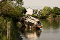
 Shipwreck on the Torridge - geograph.org.uk - 5533775.jpg 4,608 × 3,456; 813 KB
-
 Small field near Furze Ball - geograph.org.uk - 6336103.jpg 4,143 × 2,680; 1.96 MB
-
 Southcott, near Bideford - geograph.org.uk - 5248927.jpg 5,966 × 3,977; 6.95 MB
-
 Squashes at Tapeley Park Gardens, Devon - geograph.org.uk - 2005757.jpg 800 × 531; 127 KB
-
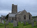
 St Peter's Church at Westleigh - geograph.org.uk - 3702281.jpg 4,000 × 3,000; 3.16 MB
-
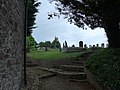
 St Peter, Westleigh, churchyard (xix) - geograph.org.uk - 4556504.jpg 640 × 472; 109 KB
-
 St. Margaret's church and Torridge Swimming Pool - geograph.org.uk - 5235076.jpg 6,000 × 4,000; 5.23 MB
-
 St. Peter, Westleigh, churchyard (i) - geograph.org.uk - 4556484.jpg 640 × 480; 75 KB
-
-

-

-

-
 St. Peter, Westleigh, churchyard (v) - geograph.org.uk - 4556488.jpg 640 × 480; 54 KB
-
-

-

-
 St. Peter, Westleigh, churchyard (x) - geograph.org.uk - 4556493.jpg 640 × 480; 62 KB
-

-

-

-
-

-

-

-

-
 Stagnant drainage pond - geograph.org.uk - 37912.jpg 640 × 512; 161 KB
-
 Stream near Wearland - geograph.org.uk - 6336783.jpg 3,264 × 2,176; 2.82 MB
-
 Stream, Watergate - geograph.org.uk - 6336154.jpg 2,848 × 4,288; 2.59 MB
-
 Tapeley Park in the parish of Westleigh - geograph.org.uk - 5048129.jpg 4,000 × 3,000; 5.11 MB
-
 Tapeley Park in the parish of Westleigh - geograph.org.uk - 5228763.jpg 6,000 × 4,000; 5.79 MB
-
 Tapeley Park in the parish of Westleigh - geograph.org.uk - 5229575.jpg 5,922 × 2,639; 5.72 MB
-
 Tapeley Park near Westleigh, Devon - geograph.org.uk - 2273992.jpg 1,600 × 1,074; 518 KB
-
 Tapeley Park, Westleigh - geograph.org.uk - 4950444.jpg 5,919 × 3,946; 4.91 MB
-
 Tapley Hall gardens - geograph.org.uk - 99316.jpg 640 × 480; 154 KB
-
 The 09-15 No. 21 bus from Ilfracombe to Westward Ho^ - geograph.org.uk - 5677064.jpg 6,000 × 4,000; 3.99 MB
-

-
 The A39 approaching Torridge Bridge - geograph.org.uk - 2603555.jpg 1,024 × 680; 199 KB
-
-

-
 The A39 heading towards Barnstaple near Barnacott - geograph.org.uk - 3028130.jpg 1,600 × 1,063; 555 KB
-
 The A39 heading towards Bideford near Barnacott - geograph.org.uk - 3028116.jpg 1,600 × 1,063; 501 KB
-
 The A39 near Westleigh - geograph.org.uk - 5144400.jpg 800 × 600; 77 KB
-
 The A39 north of Eastleigh - geograph.org.uk - 5144391.jpg 1,024 × 768; 139 KB
-
 The B3233 and the Tarka Trail alongside the River Torridge - geograph.org.uk - 5683307.jpg 3,556 × 5,334; 4.95 MB
-

-
 The church tower at Westleigh - geograph.org.uk - 4951133.jpg 6,000 × 4,000; 4.99 MB
-
 The Durrant House Hotel and properties in Orchard Hill - geograph.org.uk - 5235077.jpg 6,000 × 4,000; 4.71 MB
-
 The entrance gates of Tapeley Park - geograph.org.uk - 2143683.jpg 640 × 480; 106 KB
-

-
 The Home Front in Britain 1939-1945 TR247.jpg 1,772 × 2,407; 1.28 MB
-
 The Monkleigh of Hartlepool - geograph.org.uk - 5109370.jpg 1,600 × 1,067; 559 KB
-

-

-
 The Old Bideford Road near Cobley Lane - geograph.org.uk - 5234230.jpg 6,000 × 4,000; 4.95 MB
-
 The Old Bideford Road near Hill Head - geograph.org.uk - 5234233.jpg 6,000 × 4,000; 4.91 MB
-
 The Old School, Westleigh - geograph.org.uk - 3027911.jpg 1,600 × 1,067; 516 KB
-
 The Old School, Westleigh - geograph.org.uk - 3027918.jpg 1,600 × 1,068; 360 KB
-
 The River Torridge at Bideford - geograph.org.uk - 1355689.jpg 640 × 480; 103 KB
-

-

-
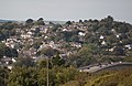
 The settlement of Westleigh Devon. Saxon in origin - geograph.org.uk - 3366025.jpg 1,257 × 1,102; 272 KB
-
 The summerhouse and lawn at Tapeley - geograph.org.uk - 5401328.jpg 1,600 × 899; 391 KB
-
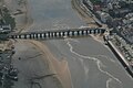
 The Torridge Bridge, Bideford - geograph.org.uk - 4862810.jpg 3,040 × 3,000; 4.55 MB
-
 The Torridge Estuary - geograph.org.uk - 1355602.jpg 480 × 640; 136 KB
-
 The Torridge estuary - geograph.org.uk - 747235.jpg 640 × 480; 107 KB


.jpg)


_-_geograph.org.uk_-_4556504.jpg)

_-_geograph.org.uk_-_4556484.jpg)
_-_geograph.org.uk_-_4556485.jpg)
_-_geograph.org.uk_-_4556486.jpg)
_-_geograph.org.uk_-_4556487.jpg)
_-_geograph.org.uk_-_4556492.jpg)
_-_geograph.org.uk_-_4556488.jpg)
_-_geograph.org.uk_-_4556489.jpg)
_-_geograph.org.uk_-_4556490.jpg)
_-_geograph.org.uk_-_4556491.jpg)
_-_geograph.org.uk_-_4556493.jpg)
_-_geograph.org.uk_-_4556494.jpg)
_-_geograph.org.uk_-_4556495.jpg)
_-_geograph.org.uk_-_4556496.jpg)
_-_geograph.org.uk_-_4556497.jpg)
_-_geograph.org.uk_-_4556498.jpg)
_-_geograph.org.uk_-_4556499.jpg)
_-_geograph.org.uk_-_4556500.jpg)
_-_geograph.org.uk_-_4556502.jpg)


