Category:Westernohe
Jump to navigation
Jump to search
community belonging to a Verbandsgemeinde – in the Westerwaldkreis in Rhineland-Palatinate, Germany    | |||||
| Upload media | |||||
| Instance of |
| ||||
|---|---|---|---|---|---|
| Location | Westerwaldkreis, Rhineland-Palatinate, Germany | ||||
| Population |
| ||||
| Area |
| ||||
| Elevation above sea level |
| ||||
| official website | |||||
 | |||||
Subcategories
This category has the following 5 subcategories, out of 5 total.
Media in category "Westernohe"
The following 12 files are in this category, out of 12 total.
-
 DEU Westernohe COA.svg 455 × 559; 183 KB
-
 Wappen Westernohe.png 472 × 585; 224 KB
-
 2016 Gedenkkreuz Pfadfinder Westernohe 1.jpg 4,312 × 2,875; 9.39 MB
-
 2016 Gedenkkreuz Pfadfinder Westernohe 2.jpg 4,278 × 2,852; 10.23 MB
-
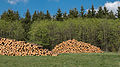 MK11105 Holzganter.jpg 2,797 × 1,573; 3.92 MB
-
 MK11106 Holzganter.jpg 2,797 × 1,573; 3.64 MB
-
 Westernohe im Westerwaldkreis.png 346 × 338; 9 KB
-
 Westernohe, Brunnen und Backhaus.JPG 4,928 × 3,264; 6.39 MB
-
 WesternoheOrtskern1.jpg 4,360 × 2,900; 7.07 MB
-
 WesternoheOrtskern2.jpg 4,654 × 3,096; 7.66 MB
-
 WesternoheOrtskern3.jpg 4,345 × 2,890; 6.79 MB
-
 WesternoheOrtskern4.jpg 3,711 × 2,468; 5.21 MB


