Category:West Putford
Jump to navigation
Jump to search
village in the United Kingdom  | |||||
| Upload media | |||||
| Instance of | |||||
|---|---|---|---|---|---|
| Location | Torridge, Devon, South West England, England | ||||
 | |||||
Subcategories
This category has only the following subcategory.
S
Media in category "West Putford"
The following 43 files are in this category, out of 43 total.
-
 Approaching Sanders Cross - geograph.org.uk - 4114399.jpg 800 × 507; 131 KB
-
 Colscott Village - geograph.org.uk - 1186651.jpg 640 × 480; 85 KB
-
 CoryArms.png 809 × 933; 72 KB
-
 Country lane near Sanders Cross - geograph.org.uk - 4114394.jpg 1,600 × 979; 450 KB
-
 Country lane near Sanders Cross - geograph.org.uk - 4114402.jpg 1,600 × 989; 579 KB
-
 Country road near Sanders Cross - geograph.org.uk - 411845.jpg 640 × 426; 157 KB
-
 Driveway to Thiverton - geograph.org.uk - 411855.jpg 640 × 426; 132 KB
-
 Field access track, Brendon - geograph.org.uk - 740956.jpg 640 × 480; 122 KB
-
 Garden Gnome at Gnome Reserve.jpg 768 × 1,280; 414 KB
-
 Gnome Reserve Photograph.jpg 752 × 1,248; 385 KB
-
 Historic Garden Gnomes.jpg 768 × 1,101; 176 KB
-
 Julian's Farm near Colscott - geograph.org.uk - 1186626.jpg 640 × 480; 119 KB
-
 Kismeldon Bridge - geograph.org.uk - 1820171.jpg 1,024 × 768; 224 KB
-
 Kismeldon Bridge - geograph.org.uk - 1820176.jpg 1,024 × 768; 259 KB
-
 Kismeldon Bridge as seen from downstream - geograph.org.uk - 1820182.jpg 1,024 × 768; 301 KB
-
 Kismeldon Bridge as seen from Upstream - geograph.org.uk - 1820192.jpg 1,024 × 768; 325 KB
-
 Lane by Worden Cottages - geograph.org.uk - 4114390.jpg 1,024 × 694; 206 KB
-
 Lane End Farm - geograph.org.uk - 718314.jpg 640 × 480; 142 KB
-
 Lane south of Worden Farm - geograph.org.uk - 4114395.jpg 800 × 499; 117 KB
-
 Little Silworthy - geograph.org.uk - 411868.jpg 640 × 426; 137 KB
-
 North Devon , Gnome Reserve - geograph.org.uk - 4586508.jpg 2,848 × 4,288; 6.4 MB
-
 North Devon , Gnome Reserve - geograph.org.uk - 4586515.jpg 4,288 × 2,848; 6.71 MB
-
 North Devon , Gnome Reserve - geograph.org.uk - 4586520.jpg 4,288 × 2,848; 5.95 MB
-
 North Devon , Gnome Reserve - geograph.org.uk - 4586521.jpg 4,288 × 2,848; 6.44 MB
-
 North Devon , Gnome Reserve - geograph.org.uk - 4586522.jpg 2,708 × 4,077; 6.37 MB
-
 North Devon , Gnome Reserve - geograph.org.uk - 4586527.jpg 2,848 × 4,288; 6.11 MB
-

-
 Ordnance Survey Cut Mark - geograph.org.uk - 3719998.jpg 4,000 × 3,000; 3.56 MB
-
 Putford Bridge (geograph 1821238).jpg 1,024 × 768; 291 KB
-
 Putford Bridge (geograph 1821239).jpg 1,024 × 768; 294 KB
-
 Putford Bridge as seen from downstream (geograph 1821240).jpg 1,024 × 768; 340 KB
-
 Putford Bridge as seen from Upstream (geograph 1821241).jpg 1,024 × 768; 408 KB
-
 River Torridge - geograph.org.uk - 742169.jpg 480 × 640; 115 KB
-
 Riverside Cottage, West Putford - geograph.org.uk - 689488.jpg 640 × 480; 83 KB
-
 Sanders Cross - geograph.org.uk - 4114404.jpg 1,024 × 667; 222 KB
-
 Signpost at Thriverton Cross - geograph.org.uk - 414706.jpg 640 × 426; 181 KB
-
 Tadpoles near Wheelers Cross - geograph.org.uk - 742932.jpg 640 × 477; 103 KB
-
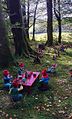
 The Gnome Reserve (picnic area) - geograph.org.uk - 745359.jpg 640 × 404; 111 KB
-
 The view downstream from Kismeldon Bridge - geograph.org.uk - 1820206.jpg 1,024 × 768; 353 KB
-
 The view upstream from Kismeldon Bridge - geograph.org.uk - 1820200.jpg 1,024 × 768; 356 KB
-
 Two lambs in a field near West Putford - geograph.org.uk - 411876.jpg 640 × 426; 123 KB
-
 Volehouse Farm - geograph.org.uk - 689546.jpg 640 × 480; 104 KB
-
 Wedfield Cottage - geograph.org.uk - 742154.jpg 640 × 480; 96 KB


.jpg)
.jpg)
.jpg)
.jpg)


_-_geograph.org.uk_-_745359.jpg)


