Category:West Hendon
Jump to navigation
Jump to search
human settlement in United Kingdom  | |||||
| Upload media | |||||
| Instance of | |||||
|---|---|---|---|---|---|
| Location | London Borough of Barnet, Greater London, London, England | ||||
| Located in or next to body of water | |||||
 | |||||
Subcategories
This category has the following 2 subcategories, out of 2 total.
W
- Pubs in West Hendon (3 F)
- West Hendon Broadway (31 F)
Media in category "West Hendon"
The following 51 files are in this category, out of 51 total.
-
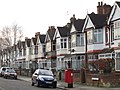
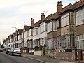
 Algernon Road, West Hendon - geograph.org.uk - 1930511.jpg 1,600 × 1,051; 540 KB
-
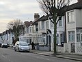
 Algernon Road, West Hendon,London NW4 - geograph.org.uk - 341323.jpg 640 × 479; 112 KB
-
 Audley Road - Montagu Road, NW4 (2) - geograph.org.uk - 2782927.jpg 640 × 480; 95 KB
-
 Audley Road - Montagu Road, NW4 - geograph.org.uk - 2782924.jpg 640 × 480; 87 KB
-
 Audley Road, Hendon - geograph.org.uk - 3722233.jpg 1,600 × 1,200; 570 KB
-
 Audley Road, Hendon in 1989 - geograph.org.uk - 3187275.jpg 1,228 × 1,776; 480 KB
-
 Audley Road, NW4 (2) - geograph.org.uk - 2782934.jpg 640 × 480; 78 KB
-
 Audley Road, NW4 - geograph.org.uk - 2782914.jpg 640 × 480; 74 KB
-
 Bertram Road, NW4 (2) - geograph.org.uk - 2786053.jpg 640 × 479; 76 KB
-
 Bertram Road, NW4 - geograph.org.uk - 2786050.jpg 640 × 480; 79 KB
-
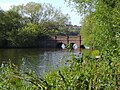
 Cool Oak Bridge, West Hendon - geograph.org.uk - 5428102.jpg 1,600 × 1,200; 769 KB
-
 Cool oak bridge2.jpg 1,600 × 1,200; 612 KB
-
 Cool Oak L2.jpg 1,600 × 1,200; 595 KB
-
 Cool Oak Lane.jpg 1,600 × 1,200; 594 KB
-
 Cool Oak Lane1.jpg 1,600 × 1,200; 572 KB
-
 Cool oak.jpg 1,600 × 1,200; 653 KB
-
 Crown Honda Hendon (35911307772).jpg 2,350 × 1,967; 621 KB
-
 Dallas Road, NW4 - geograph.org.uk - 2786128.jpg 640 × 480; 93 KB
-
 Dartmouth Road - Park Road, NW4 (2) - geograph.org.uk - 2786103.jpg 640 × 480; 73 KB
-
 Dartmouth Road - Park Road, NW4 - geograph.org.uk - 2786098.jpg 640 × 480; 78 KB
-
 Dartmouth Road, NW4 - geograph.org.uk - 2786073.jpg 640 × 480; 85 KB
-
 Dartmouth Road, NW4 - geograph.org.uk - 2786116.jpg 640 × 480; 71 KB
-
 Elliot Road, NW4 - geograph.org.uk - 2786034.jpg 640 × 480; 60 KB
-

-
 Graham Road, NW4 - geograph.org.uk - 2782929.jpg 640 × 480; 79 KB
-
 Hyde buildings.jpg 1,600 × 1,200; 577 KB
-
 Hyde corner.jpg 1,600 × 1,200; 534 KB
-
 Hyde rushgrove.jpg 1,600 × 1,200; 595 KB
-
-
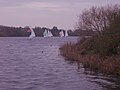
 Marina on the Welsh Harp Reservoir, West Hendon - geograph.org.uk - 6499161.jpg 4,000 × 3,000; 2.76 MB
-
 Montagu Road, NW4 - geograph.org.uk - 2782930.jpg 640 × 480; 87 KB
-
 Mount Road, NW4 - geograph.org.uk - 2786122.jpg 640 × 480; 78 KB
-
 Park Rd - geograph.org.uk - 5514398.jpg 640 × 426; 61 KB
-
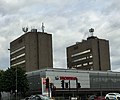
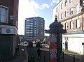
 Philex House, West Hendon - geograph.org.uk - 2780677.jpg 2,986 × 2,363; 2.15 MB
-
 Russell Road - geograph.org.uk - 1929117.jpg 1,600 × 1,076; 508 KB
-
 Sign for Elliot Road, NW4 - geograph.org.uk - 2786040.jpg 640 × 480; 97 KB
-
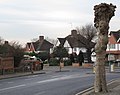
 Station Road, West Hendon - geograph.org.uk - 5317262.jpg 640 × 480; 64 KB
-
 Sunset over West Hendon Playing Fields - geograph.org.uk - 4246025.jpg 2,224 × 1,614; 955 KB
-
 Telford Road, Hendon - geograph.org.uk -3312421.jpg 4,209 × 3,114; 4.85 MB
-
 The tree with some red stuff on it - panoramio.jpg 3,648 × 2,736; 2.87 MB
-
 Vivian Avenue, NW4 - geograph.org.uk - 2782912.jpg 640 × 480; 77 KB
-
 Welsh Harp 2009e.jpg 1,600 × 1,200; 473 KB
-
 West Hendon (48083232132).jpg 3,264 × 2,448; 2.23 MB
-

-
 West Hendon flat.jpg 2,304 × 1,728; 947 KB
-
 West Hendon Playing Fields - geograph.org.uk - 4246022.jpg 2,304 × 1,728; 876 KB
-
 West hendon.jpg 1,600 × 1,200; 572 KB
-
 Wh bridge.jpg 1,600 × 1,200; 608 KB
-
 Wh broadway.jpg 1,600 × 1,200; 312 KB
-
 Wh path8.jpg 1,600 × 1,200; 607 KB
-
 York park.jpg 1,600 × 1,200; 665 KB


_-_geograph.org.uk_-_2782927.jpg)


_-_geograph.org.uk_-_2782934.jpg)

_-_geograph.org.uk_-_2786053.jpg)


.jpg)

_-_geograph.org.uk_-_2786103.jpg)


.jpg)


