Category:West Hanningfield
Jump to navigation
Jump to search
village in United Kingdom   | |||||
| Upload media | |||||
| Instance of | |||||
|---|---|---|---|---|---|
| Location | Chelmsford, Essex, East of England, England | ||||
 | |||||
Subcategories
This category has the following 2 subcategories, out of 2 total.
W
Media in category "West Hanningfield"
The following 173 files are in this category, out of 173 total.
-
 "The Three Compasses", West Hanningfield - geograph.org.uk - 4423850.jpg 4,958 × 3,661; 4.06 MB
-
 40 limit on B1007 - geograph.org.uk - 5665242.jpg 640 × 428; 105 KB
-
 A Gatekeeper - geograph.org.uk - 4565829.jpg 640 × 424; 53 KB
-
 A130, southbound - geograph.org.uk - 4971044.jpg 640 × 258; 19 KB
-
 Approaching Bluebell Wood - geograph.org.uk - 4565812.jpg 424 × 640; 87 KB
-
 B1007 near Farrow's Farm - geograph.org.uk - 3049466.jpg 640 × 428; 120 KB
-
 Blind Lane - geograph.org.uk - 2745701.jpg 2,000 × 1,500; 1.32 MB
-
 Blind Lane - geograph.org.uk - 3252322.jpg 640 × 480; 184 KB
-
 Bluebell Wood - geograph.org.uk - 2745715.jpg 2,000 × 1,500; 833 KB
-
 Borage on Helmons Farm - geograph.org.uk - 4565667.jpg 424 × 640; 89 KB
-
 Bridge on Church Road - geograph.org.uk - 3252354.jpg 640 × 480; 235 KB
-
 Bridleway to the Saints - geograph.org.uk - 2745686.jpg 1,559 × 2,000; 1.16 MB
-
 Bushy Wood - geograph.org.uk - 2265548.jpg 3,008 × 2,000; 1.48 MB
-
 Bushy Wood - geograph.org.uk - 2669794.jpg 3,648 × 2,255; 2.92 MB
-
 Caravan at Temple Farm - panoramio (1).jpg 4,160 × 3,120; 5.53 MB
-
 Caravan at Temple Farm - panoramio.jpg 4,160 × 3,120; 6.64 MB
-
 Catkins emerging in the hedgerow on St Peter's Way footpath - geograph.org.uk - 3899614.jpg 1,500 × 1,002; 1.31 MB
-
 Child care premises, Bakers Lane - geograph.org.uk - 5660675.jpg 640 × 480; 175 KB
-
 Church Lane ^ St Peters Way - geograph.org.uk - 4565472.jpg 640 × 424; 118 KB
-
 Churchyard with Gravestones, West Hanningfield - geograph.org.uk - 6097330.jpg 3,648 × 2,255; 4.78 MB
-
 Corner ahead on West Hanningfield Road - geograph.org.uk - 3049961.jpg 640 × 480; 188 KB
-
 Corner of a weedy field of beans - geograph.org.uk - 5663035.jpg 640 × 480; 194 KB
-
 Corner on West Hanningfield Road - geograph.org.uk - 5662494.jpg 640 × 480; 138 KB
-
 Crop Field near Cloville Hall, West Hanningfield - geograph.org.uk - 5964935.jpg 3,648 × 2,255; 1.96 MB
-
 Dead Oak by the Diverted path - geograph.org.uk - 4962197.jpg 424 × 640; 60 KB
-
 Diverted Footpath - geograph.org.uk - 4962184.jpg 640 × 424; 74 KB
-

-

-
 Drive away from Little Peverels - geograph.org.uk - 5662644.jpg 640 × 480; 196 KB
-
 Entrance to Temple Farm scrapyard - panoramio (1).jpg 4,160 × 3,120; 4.65 MB
-
 Entrance to Temple Farm scrapyard - panoramio (2).jpg 4,160 × 3,120; 4.32 MB
-
 Entrance to Temple Farm scrapyard - panoramio.jpg 4,160 × 3,120; 4.16 MB
-
 Existing entrance to the Temple Farm - panoramio.jpg 4,160 × 3,120; 6.33 MB
-
 Farm access Bridge, A130 - geograph.org.uk - 4971037.jpg 640 × 223; 21 KB
-
 Farm Track and Field Boundary, West Hanningfield - geograph.org.uk - 6097316.jpg 3,648 × 2,736; 4.06 MB
-
 Farmland View - geograph.org.uk - 2745713.jpg 2,000 × 1,500; 807 KB
-
 Field edge footpath - geograph.org.uk - 5662641.jpg 640 × 480; 196 KB
-

-
 Field near Kent's Farm - geograph.org.uk - 4570882.jpg 1,600 × 1,064; 415 KB
-
 Field of borage - geograph.org.uk - 4570914.jpg 1,600 × 1,064; 461 KB
-
 Footbridge to Tanfield Tye - geograph.org.uk - 4565678.jpg 640 × 424; 121 KB
-
 Footpath Bridge - geograph.org.uk - 2745704.jpg 1,500 × 2,000; 1.46 MB
-
 Footpath Convergence - geograph.org.uk - 2745711.jpg 2,000 × 1,500; 948 KB
-
 Footpath heading north from Tanfield Tye - geograph.org.uk - 4570928.jpg 1,064 × 1,600; 480 KB
-

-

-
 Footpath to Baker's Lane - geograph.org.uk - 4962172.jpg 424 × 640; 53 KB
-
 Footpath to Claydons Farm - geograph.org.uk - 4950700.jpg 640 × 424; 58 KB
-
 Footpath to Downham Rd - geograph.org.uk - 74622.jpg 640 × 482; 137 KB
-
 Footpath to Old Southend Road - geograph.org.uk - 4950696.jpg 424 × 640; 91 KB
-
 Footpath towards Gay Bowers Farm - geograph.org.uk - 4570975.jpg 1,600 × 1,064; 402 KB
-
 Footpath towards Gay Bowers Farm - geograph.org.uk - 5663045.jpg 640 × 480; 138 KB
-
 Footpath towards Gay Bowers Farm - geograph.org.uk - 5663052.jpg 640 × 480; 126 KB
-
 Footpath View - geograph.org.uk - 2745690.jpg 2,000 × 1,386; 535 KB
-
 Gascoignes Farmhouse, West Hanningfield (Listed Building) (geograph 6097491).jpg 3,648 × 2,255; 2.65 MB
-
 Grassland off Stock Road (B1007) - geograph.org.uk - 6152093.jpg 800 × 600; 139 KB
-
 Hanningfield Dam - geograph.org.uk - 72918.jpg 640 × 482; 79 KB
-
 Hanningfield Reservoir Dam - geograph.org.uk - 2898058.jpg 640 × 480; 30 KB
-
 Hanningfield Reservoir Valve Tower - geograph.org.uk - 3005567.jpg 4,608 × 3,456; 3.21 MB
-
 Hanningfield water treatment works - geograph.org.uk - 2221508.jpg 2,000 × 1,394; 1.42 MB
-
 Hazel Catkins on the St. Peter's Way long distance path - geograph.org.uk - 3899638.jpg 1,500 × 1,002; 1.13 MB
-
 Houses on Pynnings Farm Lane - geograph.org.uk - 5716685.jpg 640 × 480; 140 KB
-
 Intersection - panoramio (4).jpg 4,160 × 3,120; 5.93 MB
-
 Juvenile Skylark - geograph.org.uk - 4565571.jpg 640 × 424; 69 KB
-
 Long Road - geograph.org.uk - 2254154.jpg 2,000 × 1,500; 1.9 MB
-
 Lower Stock Road - geograph.org.uk - 4570888.jpg 1,064 × 1,600; 515 KB
-
 Lower Stock Road - geograph.org.uk - 5716689.jpg 640 × 428; 160 KB
-
 Middlemead Bay, Hanningfield Reservoir - geograph.org.uk - 3005576.jpg 4,608 × 3,456; 1.73 MB
-
 Middlemead towards West Hanningfield - geograph.org.uk - 5716672.jpg 640 × 428; 96 KB
-
 Middlemead towards West Hanningfield - geograph.org.uk - 5716676.jpg 640 × 428; 85 KB
-

-
 Oaks in the wheat - geograph.org.uk - 3049910.jpg 640 × 480; 140 KB
-
 Old rotaspreader - geograph.org.uk - 5661969.jpg 640 × 480; 167 KB
-
 On top of Hanningfield dam - geograph.org.uk - 2898072.jpg 640 × 480; 47 KB
-
 One of the existing building at Temple Farm - panoramio.jpg 4,160 × 3,120; 5.82 MB
-
 Outlet Tower On Hanningfield Reservoir - geograph.org.uk - 74640.jpg 640 × 482; 72 KB
-
 Paddock by St Peter's Way - geograph.org.uk - 4570904.jpg 1,600 × 1,064; 598 KB
-
 Paddock with Horses, near Blind Lane, West Hanningfield - geograph.org.uk - 5964944.jpg 3,648 × 2,736; 2.95 MB
-
 Paddocks ^ Pathway - geograph.org.uk - 4565854.jpg 640 × 424; 78 KB
-
 Path across wheat field - geograph.org.uk - 5662296.jpg 640 × 480; 190 KB
-
 Path across wheat field - geograph.org.uk - 5662298.jpg 640 × 480; 147 KB
-
 Path across wheat field - geograph.org.uk - 5662549.jpg 640 × 480; 158 KB
-
 Patten's Farm - geograph.org.uk - 2707252.jpg 2,000 × 1,476; 1.45 MB
-
 Pond at the junction - geograph.org.uk - 5662299.jpg 640 × 480; 200 KB
-
 Power ^ St Peter's Way - geograph.org.uk - 4565504.jpg 640 × 424; 80 KB
-
 Public footpath on arable land, West Hanningfield - geograph.org.uk - 4330850.jpg 3,648 × 2,736; 3.65 MB
-
 Pylon ^ Pattens Farm - geograph.org.uk - 4565547.jpg 430 × 640; 55 KB
-
 Pylons over arable land, West Hanningfield - geograph.org.uk - 4330853.jpg 3,648 × 2,432; 2.28 MB
-
 Road junction, close to Holiday Hill - geograph.org.uk - 739508.jpg 640 × 480; 102 KB
-
 Road to the Temple Farm - panoramio.jpg 4,160 × 3,120; 5.13 MB
-

-
 Sign for the Ship public house - geograph.org.uk - 6152098.jpg 629 × 800; 105 KB
-
 Skipper^ - geograph.org.uk - 4565842.jpg 424 × 640; 39 KB
-

-
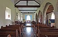
 St Mary ^ St Edward Church, West Hanningfield - geograph.org.uk - 4278078.jpg 1,024 × 768; 167 KB
-

-
-

-
 St Mary ^ St Edward, West Hanningfield - geograph.org.uk - 4051845.jpg 900 × 583; 194 KB
-
 St Mary ^ St Edward, West Hanningfield - geograph.org.uk - 4051846.jpg 900 × 551; 119 KB
-
 St Mary ^ St Edward, West Hanningfield - geograph.org.uk - 4051869.jpg 900 × 717; 242 KB
-
 St Mary ^ St Edward, West Hanningfield - geograph.org.uk - 4051870.jpg 900 × 580; 156 KB
-
 St Mary ^ St Edward, West Hanningfield - geograph.org.uk - 4051871.jpg 900 × 600; 246 KB
-

-

-

-

-

-

-

-
 St Peter's Way looking East - geograph.org.uk - 3899607.jpg 1,500 × 1,125; 1.63 MB
-
 St Peter's Way through Woodland, West Hanningfield - geograph.org.uk - 6097327.jpg 3,648 × 2,736; 5.75 MB
-

-
 St Peter's Way, West Hanningfield - geograph.org.uk - 6097312.jpg 3,648 × 2,736; 3.36 MB
-
 St Peters Way West Hanningfield - geograph.org.uk - 4565483.jpg 424 × 640; 99 KB
-
 St. Peter's Way, near Stock, Essex - geograph.org.uk - 3899562.jpg 1,500 × 1,125; 1.41 MB
-
 Stock Road (B1007) towards Chelmsford - geograph.org.uk - 6152094.jpg 800 × 600; 167 KB
-
 Stubble field, Little Claydons Farm - geograph.org.uk - 3252401.jpg 640 × 428; 102 KB
-
 Tanfield Tye - geograph.org.uk - 192989.jpg 640 × 480; 80 KB
-
 Tanfield Tye Drive - geograph.org.uk - 4565769.jpg 424 × 640; 62 KB
-
 Temple Farm - panoramio (1).jpg 4,160 × 3,120; 2.9 MB
-
 Temple Farm - panoramio (2).jpg 4,160 × 3,120; 4.16 MB
-
 Temple Farm - panoramio (3).jpg 4,160 × 3,120; 4.6 MB
-
 Temple Farm - panoramio (4).jpg 4,160 × 3,120; 6.72 MB
-
 Temple Farm - panoramio.jpg 4,160 × 3,120; 3.39 MB
-
 Temple Farm - South side (Location of the new Bethel) - panoramio.jpg 4,160 × 3,120; 4.91 MB
-
 Temple farm - South side - panoramio (1).jpg 4,160 × 3,120; 5.04 MB
-
 Temple Farm - South side - panoramio (2).jpg 4,160 × 3,120; 5.23 MB
-
 Temple Farm - South side - panoramio (3).jpg 4,160 × 3,120; 6.3 MB
-
 Temple Farm - South side - panoramio.jpg 4,160 × 3,120; 5.86 MB
-
 Temple Farm -Bethel- - South side - panoramio.jpg 4,160 × 3,120; 5.59 MB
-
 The A130 - geograph.org.uk - 2220477.jpg 2,000 × 1,500; 1.44 MB
-
 The A130 - geograph.org.uk - 2220481.jpg 2,000 × 1,500; 1.51 MB
-
 The Beginning - geograph.org.uk - 2745693.jpg 2,000 × 1,500; 1.47 MB
-
 The road to Tanfield Tye - geograph.org.uk - 684062.jpg 640 × 466; 104 KB
-
 The Ship public house - geograph.org.uk - 6152096.jpg 640 × 492; 67 KB
-
 The Three Compasses pub, West Hanningfield - geograph.org.uk - 4181925.jpg 4,320 × 3,240; 4.21 MB
-

-
 Three Compasses West Hanningfield - geograph.org.uk - 74613.jpg 640 × 482; 76 KB
-
 Towards Bushy Wood - geograph.org.uk - 4950697.jpg 640 × 424; 86 KB
-
 Towards Tanfield Tye - geograph.org.uk - 4565732.jpg 424 × 640; 69 KB
-
 Track on Farmland, near Wantz Corner, West Hanningfield - geograph.org.uk - 5964937.jpg 3,648 × 2,736; 3.03 MB
-
 Tractor tracks in the wheat - geograph.org.uk - 3049989.jpg 640 × 480; 154 KB
-
 View North-west from St. Peter's Way Footpath - geograph.org.uk - 3899548.jpg 1,500 × 1,125; 1.06 MB
-
 View of West Hanningfield - geograph.org.uk - 2898027.jpg 640 × 480; 50 KB
-
 View towards Barnard's Farm - geograph.org.uk - 4570871.jpg 1,600 × 1,064; 529 KB
-
 View towards Bluebell Wood - geograph.org.uk - 4570944.jpg 1,600 × 1,064; 334 KB
-
 Vines at Great Stocks Vineyard, Stock - geograph.org.uk - 4596809.jpg 3,648 × 2,432; 2.46 MB
-
 Water, Water Everywhere......... - geograph.org.uk - 74649.jpg 640 × 482; 59 KB
-
 West Hanningfield Road - geograph.org.uk - 4570954.jpg 1,600 × 1,064; 643 KB
-
 West hanningfield sign.jpg 2,296 × 3,133; 2.46 MB
-
 West Hanningfield's village sign - geograph.org.uk - 752665.jpg 640 × 480; 75 KB
-
 Wheat and woods - geograph.org.uk - 3049925.jpg 640 × 480; 129 KB
-
 Wheat suffering from lodging - geograph.org.uk - 5662632.jpg 640 × 480; 214 KB
-
 Wheatfield and view south near Tanfield Tye - geograph.org.uk - 4570920.jpg 1,600 × 1,064; 440 KB
-
 Wheatfield south of Little Peverels - geograph.org.uk - 4570990.jpg 1,600 × 1,064; 492 KB
-

-
 A130 near Howe Green - geograph.org.uk - 1081554.jpg 640 × 425; 34 KB
-
 Anti-invasion defence - geograph.org.uk - 105225.jpg 640 × 480; 111 KB
-

-
 Fields of blue - Patten's Farm - geograph.org.uk - 192876.jpg 640 × 480; 75 KB
-
 Footpath to Little Peverels - geograph.org.uk - 684074.jpg 640 × 480; 95 KB
-
 Hanningfield Waterworks - geograph.org.uk - 124681.jpg 640 × 480; 69 KB
-
 Hay Making - West Hanningfield - geograph.org.uk - 192992.jpg 640 × 480; 51 KB
-
 New A130 - geograph.org.uk - 105223.jpg 640 × 480; 81 KB
-
 New bridleway - West Hanningfield - geograph.org.uk - 192980.jpg 480 × 640; 168 KB
-
 Part of Holliday Hill - geograph.org.uk - 684087.jpg 640 × 480; 87 KB
-
 Part of Pan Lane - geograph.org.uk - 684330.jpg 640 × 441; 79 KB
-
 Right Turn on St Peters Way - geograph.org.uk - 74617.jpg 640 × 482; 119 KB
-
 Rural pipe-laying - geograph.org.uk - 192985.jpg 473 × 640; 101 KB
-
 The approach road to Patten's Farm - geograph.org.uk - 684318.jpg 640 × 406; 48 KB
-
 The new A130 link road - geograph.org.uk - 192875.jpg 640 × 480; 71 KB
-
 Wantz Corner, West Hanningfield - geograph.org.uk - 192991.jpg 640 × 480; 78 KB


.jpg)


.jpg)
.jpg)


_(geograph_6097491).jpg)
_-_geograph.org.uk_-_6152093.jpg)


.jpg)


_-_geograph.org.uk_-_6152101.jpg)


_towards_Chelmsford_-_geograph.org.uk_-_6152094.jpg)


.jpg)
.jpg)
.jpg)
.jpg)

_-_panoramio.jpg)
.jpg)
.jpg)
.jpg)


