Category:West Hagbourne
Jump to navigation
Jump to search
village and civil parish in South Oxfordshire, England  | |||||
| Upload media | |||||
| Instance of | |||||
|---|---|---|---|---|---|
| Location | South Oxfordshire, Oxfordshire, South East England, England | ||||
| Area |
| ||||
| Said to be the same as | West Hagbourne (Wikimedia duplicated page, civil parish) | ||||
| official website | |||||
 | |||||
English: West Hagbourne is a village and civil parish on the Berkshire Downs 2 miles south of Didcot. It is in South Oxfordshire and in 1974 was transferred from Berkshire.
Subcategories
This category has the following 3 subcategories, out of 3 total.
Media in category "West Hagbourne"
The following 133 files are in this category, out of 133 total.
-
 A reservoir by the Icknield Way - geograph.org.uk - 3703969.jpg 1,500 × 999; 181 KB
-
 A1258 from The Cornstore - geograph.org.uk - 3923702.jpg 640 × 396; 39 KB
-
 A34 northbound - geograph.org.uk - 5637527.jpg 640 × 428; 83 KB
-
 A417 embankment approaches A34 bridge - geograph.org.uk - 3284139.jpg 3,512 × 2,292; 1.05 MB
-
 A417 to Wantage - geograph.org.uk - 2640166.jpg 1,024 × 768; 238 KB
-

-
 An Old Pumping Station - geograph.org.uk - 2822484.jpg 1,024 × 683; 173 KB
-
 An old road - geograph.org.uk - 2633233.jpg 533 × 800; 97 KB
-
 Baling Straw in Hagbourne Field, Oxfordshire - geograph.org.uk - 3609176.jpg 1,024 × 795; 284 KB
-
 Barns at York Farm, West Hagbourne.jpg 1,200 × 800; 596 KB
-

-

-
 Benchmark on Lays Barn, Hagbourne Hill - geograph.org.uk - 2320696.jpg 600 × 800; 187 KB
-

-
 Benchmark on ^2 York Road - geograph.org.uk - 2405992.jpg 683 × 1,024; 244 KB
-
 Bend on the A417 near West Hagbourne - geograph.org.uk - 3709860.jpg 800 × 600; 139 KB
-
 Bridleway to West Hagbourne - geograph.org.uk - 2632167.jpg 533 × 800; 141 KB
-

-
 Cat and mouse in West Hagbourne - geograph.org.uk - 3709914.jpg 800 × 600; 50 KB
-
 Change at the Junction - geograph.org.uk - 4840974.jpg 1,600 × 1,200; 411 KB
-
 Change of Direction - geograph.org.uk - 5209331.jpg 1,024 × 768; 112 KB
-
 Changing the Layout - geograph.org.uk - 4797488.jpg 1,024 × 768; 127 KB
-
 Clear of traffic - geograph.org.uk - 4091893.jpg 1,600 × 1,200; 371 KB
-
 Cones ^ Fencing - geograph.org.uk - 4840978.jpg 1,600 × 1,200; 462 KB
-
 Corn store and Power Station - geograph.org.uk - 2822483.jpg 1,024 × 683; 74 KB
-

-
 Cows on West Hagbourne Moor - geograph.org.uk - 2655150.jpg 3,648 × 2,736; 2.57 MB
-
 Cut right Back - geograph.org.uk - 4797412.jpg 1,600 × 1,200; 152 KB
-
 Cycling Past - geograph.org.uk - 5074574.jpg 1,024 × 768; 95 KB
-
 Daffodils by the sign - geograph.org.uk - 3449519.jpg 1,024 × 768; 273 KB
-
 Didcot Power station - geograph.org.uk - 1041761.jpg 640 × 426; 34 KB
-

-
 Different shovels - geograph.org.uk - 5727623.jpg 1,024 × 768; 161 KB
-
 Digger behind the gates - geograph.org.uk - 5727546.jpg 1,024 × 768; 115 KB
-
 Duck Pond - geograph.org.uk - 669878.jpg 640 × 480; 116 KB
-

-
 Empty road - geograph.org.uk - 4091894.jpg 1,600 × 1,200; 372 KB
-
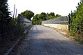
 Farm track in West Hagbourne - geograph.org.uk - 3709918.jpg 800 × 600; 225 KB
-
 Farm Vehicles, West Hagbourne - geograph.org.uk - 2656155.jpg 3,648 × 2,612; 2.21 MB
-

-
 Fence and Rose Hips - geograph.org.uk - 2656246.jpg 640 × 480; 108 KB
-
 Fenced Footpath, East Hagbourne - geograph.org.uk - 2651580.jpg 3,648 × 2,736; 2.32 MB
-
 Footpath and pasture, West Hagbourne - geograph.org.uk - 5989593.jpg 1,024 × 768; 212 KB
-
 Footpath to West Hagbourne - geograph.org.uk - 1690185.jpg 533 × 800; 108 KB
-
 Hagbourne Hill - geograph.org.uk - 1290139.jpg 640 × 427; 63 KB
-
 Hagbourne Hill Benchmark - geograph.org.uk - 2300231.jpg 600 × 800; 215 KB
-
 Hagbourne Hill Farm - geograph.org.uk - 3371679.jpg 1,689 × 1,227; 640 KB
-
 Hagbourne Hill Trig Point - geograph.org.uk - 2300212.jpg 1,024 × 683; 184 KB
-
 Into West Hagbourne - geograph.org.uk - 2632162.jpg 1,024 × 683; 201 KB
-
 Ivy Farm, West Hagbourne.jpg 900 × 675; 371 KB
-

-
 Junction on Hagbourne Hill - geograph.org.uk - 4797415.jpg 1,024 × 768; 79 KB
-
 Just the Stack - geograph.org.uk - 5078702.jpg 1,024 × 768; 97 KB
-
 Kissing gate by the sign - geograph.org.uk - 2791228.jpg 1,024 × 683; 224 KB
-
 Lays Barn, Hagbourne Hill Farm - geograph.org.uk - 2320683.jpg 800 × 533; 97 KB
-
 Left to West Hagbourne - geograph.org.uk - 2823447.jpg 1,024 × 683; 141 KB
-
 London Road-Main Street junction - geograph.org.uk - 3129952.jpg 640 × 480; 48 KB
-
 Looking across West Hagbourne Field - geograph.org.uk - 3338837.jpg 1,500 × 995; 304 KB
-
 Looking east on Main Street - geograph.org.uk - 3709896.jpg 800 × 600; 161 KB
-
 Looking over a field towards Didcot - geograph.org.uk - 3338842.jpg 1,500 × 986; 293 KB
-
 Looking over West Hagbourne Field - geograph.org.uk - 3338831.jpg 1,500 × 997; 224 KB
-
 Lots of Fencing - geograph.org.uk - 4840976.jpg 1,600 × 1,200; 426 KB
-

-
 Milestone near West Hagbourne - geograph.org.uk - 2640173.jpg 600 × 800; 146 KB
-
 New approach - geograph.org.uk - 5077501.jpg 1,024 × 768; 167 KB
-
 New Culvert - geograph.org.uk - 4797491.jpg 1,024 × 768; 160 KB
-
 New footpath - geograph.org.uk - 5727545.jpg 1,024 × 768; 110 KB
-
 New Junction - geograph.org.uk - 5078711.jpg 1,024 × 768; 190 KB
-
 New link road - geograph.org.uk - 5727549.jpg 1,024 × 768; 123 KB
-
 New Road - geograph.org.uk - 4840975.jpg 1,600 × 1,200; 410 KB
-
 New road layout ahead - geograph.org.uk - 5727542.jpg 1,024 × 768; 161 KB
-
 New Roundabout - geograph.org.uk - 5727543.jpg 1,024 × 768; 125 KB
-
 Pasture, West Hagbourne - geograph.org.uk - 2232385.jpg 640 × 480; 154 KB
-
 Path on the other side - geograph.org.uk - 5727620.jpg 1,024 × 768; 135 KB
-
 Path towards the roundabout - geograph.org.uk - 5727618.jpg 1,024 × 768; 113 KB
-
 Poppies on the hill - geograph.org.uk - 1926616.jpg 1,024 × 683; 185 KB
-
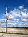
 Power station in the distance - geograph.org.uk - 2822481.jpg 1,024 × 683; 126 KB
-
-

-
 Rape field near West Hagbourne - geograph.org.uk - 1288978.jpg 640 × 427; 77 KB
-
 Reservoir by the A34 - geograph.org.uk - 3703975.jpg 1,500 × 999; 268 KB
-
 Reservoir on Hagbourne Hill - geograph.org.uk - 1290157.jpg 640 × 427; 60 KB
-
 Road junction near West Hagbourne - geograph.org.uk - 3923705.jpg 640 × 426; 49 KB
-
 Road on the right - geograph.org.uk - 2823453.jpg 1,024 × 683; 125 KB
-
 Road to Hagbournehill Farm - geograph.org.uk - 1290182.jpg 640 × 416; 54 KB
-
 Road to West Hagbourne - geograph.org.uk - 2791231.jpg 1,024 × 683; 163 KB
-
 Roundabout approach - geograph.org.uk - 5733495.jpg 1,024 × 768; 86 KB
-
 Roundabout near the farm - geograph.org.uk - 5727536.jpg 1,024 × 768; 121 KB
-
 Scotlands Ash Garage - geograph.org.uk - 2633230.jpg 1,024 × 683; 125 KB
-
 Sign on the corner - geograph.org.uk - 2791223.jpg 1,024 × 683; 102 KB
-
 Signs at the roundabout - geograph.org.uk - 5727539.jpg 1,024 × 768; 190 KB
-
 Stack on its Own - geograph.org.uk - 5078707.jpg 600 × 800; 61 KB
-
 Stuck on Hagbourne Hill - geograph.org.uk - 3081371.jpg 1,024 × 768; 155 KB
-
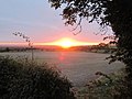 Sunrise towards Goring - geograph.org.uk - 3222227.jpg 1,024 × 768; 183 KB
-
 That way somewhere - geograph.org.uk - 2300273.jpg 1,024 × 683; 246 KB
-
 The A417 to Harwell - geograph.org.uk - 3338853.jpg 1,500 × 1,000; 261 KB
-
 The A417 to Upton - geograph.org.uk - 3338848.jpg 1,500 × 1,000; 293 KB
-
 The A417, West Hagbourne - geograph.org.uk - 2232406.jpg 640 × 480; 120 KB
-
 The Harwell Roundabout - geograph.org.uk - 5727547.jpg 1,024 × 768; 110 KB
-
 The Icknield Way crosses the A34 - geograph.org.uk - 3703970.jpg 1,500 × 999; 185 KB
-
 The New Hagbourne Roundabout - geograph.org.uk - 5209336.jpg 1,024 × 683; 91 KB
-
 The old Reading Road - geograph.org.uk - 2632160.jpg 1,024 × 683; 232 KB
-
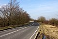
 The Old Road - geograph.org.uk - 5209340.jpg 1,024 × 768; 111 KB
-
 The West Hagbourne roundabout - geograph.org.uk - 5727535.jpg 1,024 × 686; 77 KB
-
 Three Trees and a Trough - geograph.org.uk - 2651642.jpg 3,648 × 2,736; 2.25 MB
-
 Top of the hill - geograph.org.uk - 2300281.jpg 1,024 × 683; 322 KB
-
 Top of the Pillar - geograph.org.uk - 2300244.jpg 1,024 × 683; 214 KB
-
 Towards the A34 - geograph.org.uk - 2652967.jpg 1,024 × 683; 153 KB
-
 Towards the London Road - geograph.org.uk - 2633231.jpg 1,024 × 683; 187 KB
-
 Towards the Power Station - geograph.org.uk - 2652968.jpg 1,024 × 683; 154 KB
-
 Towards Wittenham Clumps - geograph.org.uk - 2300260.jpg 1,024 × 683; 207 KB
-
 Tree on the edge - geograph.org.uk - 2652969.jpg 1,024 × 683; 178 KB
-
 Trig point in the field - geograph.org.uk - 2299084.jpg 1,024 × 683; 215 KB
-
 Ukrainian flag in West Hagbourne.jpg 900 × 675; 366 KB
-
 View From Hagbourne Hill - geograph.org.uk - 3371676.jpg 1,772 × 2,336; 1.03 MB
-
-
 View of Harwell - geograph.org.uk - 5961694.jpg 1,920 × 1,280; 992 KB
-
 View of the benchmark - geograph.org.uk - 2300223.jpg 533 × 800; 154 KB
-
 View of the junction - geograph.org.uk - 2633234.jpg 1,024 × 683; 149 KB
-
 View to the bridge - geograph.org.uk - 2652966.jpg 1,024 × 683; 274 KB
-
 Wantage 7 - geograph.org.uk - 2640202.jpg 600 × 800; 220 KB
-

-
 West Hagbourne - geograph.org.uk - 1288950.jpg 640 × 427; 69 KB
-
 West Hagbourne Field - geograph.org.uk - 80322.jpg 640 × 481; 39 KB
-
 West Hagbourne Pumping Station - geograph.org.uk - 1718961.jpg 640 × 478; 62 KB
-
 West Hagbourne Village Pond - geograph.org.uk - 1288938.jpg 640 × 396; 104 KB
-
 West Hagbourne, outbuildings at Manor Farm - geograph.org.uk - 6153413.jpg 773 × 1,024; 132 KB
-
 West Hagbourne, the farmhouse, Ivy Farm - geograph.org.uk - 6153421.jpg 1,024 × 776; 220 KB
-
 Wild Apples - geograph.org.uk - 2086480.jpg 2,592 × 3,264; 3.26 MB
-
 Woodleys, West Hagbourne, Oxfordshire - geograph.org.uk - 4731758.jpg 640 × 513; 106 KB
-
 Working in the Ditch - geograph.org.uk - 4797489.jpg 1,024 × 768; 126 KB
-

-
 York Road, West Hagbourne - geograph.org.uk - 2679857.jpg 640 × 480; 103 KB


