Category:West Dean, West Sussex
Jump to navigation
Jump to search
village and civil parish in West Sussex, UK .JPG) | |||||
| Upload media | |||||
| Instance of | |||||
|---|---|---|---|---|---|
| Location | Chichester, West Sussex, South East England, England | ||||
| Area |
| ||||
 | |||||
Subcategories
This category has the following 6 subcategories, out of 6 total.
Media in category "West Dean, West Sussex"
The following 200 files are in this category, out of 821 total.
(previous page) (next page)-
 145 Park Lane - geograph.org.uk - 3921220.jpg 800 × 530; 395 KB
-
 145 Park Lane - geograph.org.uk - 3921495.jpg 530 × 800; 456 KB
-
 145 Park Lane - geograph.org.uk - 4693310.jpg 800 × 530; 581 KB
-
 145 Park Lane - geograph.org.uk - 4693311.jpg 530 × 800; 544 KB
-
 162-163 Church Lane - geograph.org.uk - 3921544.jpg 800 × 530; 456 KB
-

-

-

-

-

-

-

-

-

-

-

-

-

-

-

-
-

-

-

-

-

-

-

-

-

-

-

-

-

-

-

-

-

-

-

-

-

-

-

-

-

-

-

-

-

-

-

-

-

-

-

-
-

-
 A 286 at West Dean - geograph.org.uk - 1279431.jpg 640 × 480; 131 KB
-
 A 286 at West Dean - geograph.org.uk - 1279443.jpg 640 × 480; 130 KB
-
 A partly clear benchmark - geograph.org.uk - 5822597.jpg 1,600 × 1,200; 1.26 MB
-
 A rural road - geograph.org.uk - 3085315.jpg 640 × 480; 125 KB
-
 A rural road - geograph.org.uk - 3085318.jpg 640 × 480; 184 KB
-
 A286 Binderton - geograph.org.uk - 1130540.jpg 640 × 480; 76 KB
-
 A286 passes Binderton House - geograph.org.uk - 2665688.jpg 640 × 428; 80 KB
-
 A286 south of West Dean - geograph.org.uk - 2665674.jpg 640 × 428; 102 KB
-
 A286, West Dean - geograph.org.uk - 2665646.jpg 640 × 428; 102 KB
-
 Access road to Canada Cottages and reservoir - geograph.org.uk - 2566441.jpg 4,000 × 3,000; 4.12 MB
-
 Access road to Upton Farm - geograph.org.uk - 3753195.jpg 800 × 600; 143 KB
-
 Adjacent track and road - geograph.org.uk - 3171926.jpg 4,000 × 3,000; 3.45 MB
-
 Algae on a benchmark - geograph.org.uk - 5822582.jpg 1,600 × 1,200; 1.3 MB
-
 All Saints, West Dean - - geograph.org.uk - 5130805.jpg 900 × 574; 629 KB
-
 All Saints, West Dean - Churchyard - geograph.org.uk - 5130799.jpg 900 × 499; 661 KB
-
 All Saints, West Dean - East end - geograph.org.uk - 5130831.jpg 900 × 600; 497 KB
-
 All Saints, West Dean - East end - geograph.org.uk - 5130834.jpg 900 × 600; 513 KB
-
 All Saints, West Dean - geograph.org.uk - 5130787.jpg 900 × 600; 728 KB
-
 All Saints, West Dean - geograph.org.uk - 5130793.jpg 900 × 610; 608 KB
-
 All Saints, West Dean - geograph.org.uk - 5130802.jpg 900 × 624; 696 KB
-
 All Saints, West Dean - Monument - geograph.org.uk - 5130827.jpg 599 × 900; 488 KB
-
 All Saints, West Dean - Pulpit - geograph.org.uk - 5130823.jpg 551 × 900; 338 KB
-

-

-

-
 All Saints, West Dean - Wall monument - geograph.org.uk - 5130822.jpg 667 × 900; 504 KB
-

-
 An entrance to the West Dean Estate - geograph.org.uk - 6151850.jpg 1,600 × 1,200; 835 KB
-
 Apples for sale - geograph.org.uk - 6274424.jpg 640 × 480; 379 KB
-
 Approach to Manor Farm at West Dean - geograph.org.uk - 2550293.jpg 4,000 × 3,000; 3.58 MB
-
 Approaching Colworth Barn - geograph.org.uk - 6165666.jpg 2,048 × 1,536; 1.21 MB
-
 Approaching Puttock’s Copse - geograph.org.uk - 6173062.jpg 1,600 × 1,200; 872 KB
-
 Approaching West Dean - geograph.org.uk - 6151845.jpg 2,048 × 1,536; 1.42 MB
-
 Arable land on the edge of Stubbs Copse - geograph.org.uk - 3213964.jpg 4,000 × 3,000; 3.5 MB
-
 Avenue of trees - geograph.org.uk - 2567966.jpg 4,000 × 3,000; 4.21 MB
-
 Avenue of trees - geograph.org.uk - 6153543.jpg 2,048 × 1,536; 1.59 MB
-
 B2141 - geograph.org.uk - 5208418.jpg 640 × 426; 41 KB
-
 B2141 approaching Chilgrove - geograph.org.uk - 3216687.jpg 4,000 × 3,000; 3.58 MB
-
 B2141 by Crows Hall Farm - geograph.org.uk - 3091450.jpg 640 × 428; 75 KB
-
 B2141 near Dean Cottages - geograph.org.uk - 5208343.jpg 640 × 426; 52 KB
-
 B2141 passing Crows Hall Farm - geograph.org.uk - 3230569.jpg 3,367 × 2,627; 2.26 MB
-
 B2141 passing Crows Hall Farm - geograph.org.uk - 3979826.jpg 1,536 × 1,152; 1.24 MB
-
 B2141 south of Crows Hall Farm - geograph.org.uk - 3091432.jpg 640 × 428; 83 KB
-
 Barns, Staple Ash Farm - geograph.org.uk - 3085333.jpg 640 × 428; 85 KB
-
 Benchmark by the Monarch's Way - geograph.org.uk - 5822570.jpg 1,600 × 1,200; 1.17 MB
-
 Benchmark detail - geograph.org.uk - 5822574.jpg 1,600 × 1,200; 1.31 MB
-
 Benchmark obscura - geograph.org.uk - 5822697.jpg 1,600 × 1,200; 1.03 MB
-
 Benchmark on the boundary wall - geograph.org.uk - 5822565.jpg 1,600 × 1,200; 1.22 MB
-
 Bend in the B2141 by Welldown - geograph.org.uk - 3216715.jpg 4,000 × 3,000; 3.6 MB
-
 Binderton Lane (Track) - geograph.org.uk - 2812253.jpg 768 × 1,024; 188 KB
-
 Binderton Lane - geograph.org.uk - 3146943.jpg 3,264 × 2,448; 4.68 MB
-
 Binderton Lane - geograph.org.uk - 4350273.jpg 800 × 530; 505 KB
-
 Binderton Lane - geograph.org.uk - 4350276.jpg 800 × 530; 480 KB
-
 Binderton Lane near Binderton House - geograph.org.uk - 3146956.jpg 3,264 × 2,448; 4.35 MB
-
 Breaking cover - geograph.org.uk - 6151817.jpg 2,048 × 1,536; 1.35 MB
-
 Brick and flint house in Chilgrove - geograph.org.uk - 425127.jpg 640 × 480; 119 KB
-
 Bricks in a flint wall - geograph.org.uk - 5822590.jpg 1,600 × 1,200; 1.3 MB
-
 Brickwork on the former Chichester to Midhurst line - geograph.org.uk - 2567697.jpg 4,000 × 3,000; 3.32 MB
-
 Bridge over dismantled railway line - geograph.org.uk - 4629796.jpg 1,600 × 1,200; 1.86 MB
-
 Bridge over dismantled railway south of West Dean - geograph.org.uk - 4629790.jpg 1,600 × 1,200; 1.95 MB
-
 Bridge over the Lavant - geograph.org.uk - 2002671.jpg 640 × 427; 232 KB
-
 Bridge, West Dean Gardens - geograph.org.uk - 3842220.jpg 800 × 530; 648 KB
-
 Bridlegate into field on Chilgrove Hill - geograph.org.uk - 3763030.jpg 800 × 600; 122 KB
-
 Bridleway 450 NE through Westdean Woods - geograph.org.uk - 2569198.jpg 4,000 × 3,000; 4.28 MB
-
 Bridleway 455 leaving the A286 by Ox Barn - geograph.org.uk - 3146903.jpg 3,264 × 2,448; 3.61 MB
-
 Bridleway 479 to Chilgrove - geograph.org.uk - 3216671.jpg 4,000 × 3,000; 3.48 MB
-
 Bridleway at Colworth Down - geograph.org.uk - 6153601.jpg 1,600 × 1,200; 897 KB
-

-
 Bridleway junction - geograph.org.uk - 6162649.jpg 1,600 × 1,200; 756 KB
-
 Bridleway near Colworth Barn - geograph.org.uk - 5334979.jpg 1,600 × 1,200; 907 KB
-
 Bridleway on Colworth Down - geograph.org.uk - 2347100.jpg 600 × 800; 193 KB
-
 Bridleway on Colworth Down - geograph.org.uk - 5334987.jpg 1,600 × 1,200; 1.07 MB
-
 Bridleway passing Calhouns Plantation on the right - geograph.org.uk - 2550304.jpg 4,000 × 3,000; 3.43 MB
-
 Bridleway reaches Hylter's Lane - geograph.org.uk - 2347107.jpg 640 × 577; 175 KB
-
 Bridleway to Binderton - geograph.org.uk - 6277961.jpg 4,032 × 3,024; 1.73 MB
-
 Bridleway to the A286 - geograph.org.uk - 2548648.jpg 4,000 × 3,000; 3.58 MB
-
 Bridleway to the top of Chilgrove Hill - geograph.org.uk - 3216676.jpg 4,000 × 3,000; 3.5 MB
-
 Bridleway to West Dean - geograph.org.uk - 2549807.jpg 4,000 × 3,000; 3.54 MB
-
 Bridleway towards Ox Barn - geograph.org.uk - 2882259.jpg 640 × 480; 120 KB
-
 Bridleways cross on Chilgrove Hill - geograph.org.uk - 3763027.jpg 800 × 600; 175 KB
-
 Building at Brickkiln Farm - geograph.org.uk - 2789547.jpg 1,024 × 768; 165 KB
-
 Building at Monkton - geograph.org.uk - 2176747.jpg 800 × 600; 156 KB
-
 Building at West Dean Gardens - geograph.org.uk - 2002674.jpg 640 × 426; 238 KB
-
 Buildings by West Dean Stores - geograph.org.uk - 3986646.jpg 4,320 × 3,240; 3.14 MB
-
 Bus stopping at the Selsey Arms - geograph.org.uk - 2665659.jpg 640 × 428; 85 KB
-
 Bus stops on A286 - geograph.org.uk - 2665624.jpg 640 × 428; 81 KB
-
 Bushes at a change in slope on Haye's Down - geograph.org.uk - 4627959.jpg 1,200 × 1,600; 1.59 MB
-
 Cedar of Lebanon, West Dean Gardens - geograph.org.uk - 3842047.jpg 530 × 800; 600 KB
-
 Centurions Way near West Dean - geograph.org.uk - 3822939.jpg 640 × 480; 75 KB
-

-

-

-
 Chalk ball in Newfarm Plantation - geograph.org.uk - 1747709.jpg 800 × 600; 204 KB
-

-
 Chalk Stone Sculpture near Lodge Hill Farm - geograph.org.uk - 2567947.jpg 4,000 × 3,000; 4.2 MB
-
 Charcoal burning site by bridleway - geograph.org.uk - 2347385.jpg 600 × 800; 173 KB
-
 Charcoal Clamps, West Dean Estate. - geograph.org.uk - 195790.jpg 640 × 438; 132 KB
-
 Charcoal production site in Westdean Woods - geograph.org.uk - 2569213.jpg 4,000 × 3,000; 3.13 MB
-
 Chichester District , West Sussex Scenery - geograph.org.uk - 3106929.jpg 3,216 × 2,136; 2.42 MB
-
 Chilgrove House.jpg 2,816 × 2,112; 1.44 MB
-
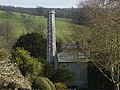 Chimney stack, West Dean College - geograph.org.uk - 4419910.jpg 1,999 × 1,499; 3.14 MB
-
 Church Lane - geograph.org.uk - 342092.jpg 479 × 640; 159 KB
-
 Church Lane - geograph.org.uk - 3921538.jpg 800 × 530; 505 KB
-
 Church Lane - geograph.org.uk - 6152646.jpg 1,600 × 1,200; 816 KB
-

-
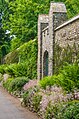 Churchyard wall, West Dean Gardens - geograph.org.uk - 5789790.jpg 678 × 1,024; 1.23 MB
-
 Clean cut benchmark - geograph.org.uk - 5822708.jpg 1,600 × 1,200; 1,014 KB
-
 Coldframe, West Dean Gardens - geograph.org.uk - 5791178.jpg 1,024 × 678; 714 KB
-
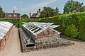 Coldframe, West Dean Gardens - geograph.org.uk - 5791182.jpg 1,024 × 678; 910 KB
-
 Colworth Barn - geograph.org.uk - 2347323.jpg 800 × 600; 181 KB
-
 Colworth Barn - geograph.org.uk - 3085327.jpg 640 × 480; 91 KB
-
 Colworth Barn - geograph.org.uk - 6162674.jpg 2,048 × 1,536; 1.36 MB
-
 Colworth Barn and house - geograph.org.uk - 2569178.jpg 4,000 × 3,000; 3.18 MB
-
 Colworth Barn near West Dean - geograph.org.uk - 3759681.jpg 1,024 × 768; 200 KB
-
 Colworth Down - geograph.org.uk - 6162639.jpg 2,048 × 1,536; 1.33 MB
-
 Colworth Farm - geograph.org.uk - 2052608.jpg 800 × 600; 183 KB
-
 Colworth Farm - geograph.org.uk - 2469542.jpg 800 × 600; 115 KB
-
 Colworth Farm - geograph.org.uk - 2566436.jpg 4,000 × 3,000; 3.08 MB
-
 Colworth Farm - geograph.org.uk - 6165673.jpg 1,600 × 1,200; 477 KB
-
 Combine harvester waiting - geograph.org.uk - 3091420.jpg 640 × 480; 119 KB
-
 Concrete farm track in West Dean Park - geograph.org.uk - 6274793.jpg 640 × 480; 303 KB
-
 Contrasting foliage at West Dean College - geograph.org.uk - 3970369.jpg 1,536 × 1,536; 1.23 MB
-
 Corner of field by Whitedown Plantation - geograph.org.uk - 3758650.jpg 800 × 600; 141 KB
-
 Corner of Highdown Plantation - geograph.org.uk - 6418268.jpg 1,024 × 683; 251 KB
-
 Cottage on minor road north of Chilgrove - geograph.org.uk - 3757469.jpg 800 × 600; 155 KB
-
 Cottages at Double Barn - geograph.org.uk - 2567912.jpg 4,000 × 3,000; 3.3 MB
-
 Cottages near Colworth Farm - geograph.org.uk - 6173049.jpg 1,600 × 1,200; 662 KB
-
 Creative writing stimulus - geograph.org.uk - 1143122.jpg 480 × 640; 90 KB
-
 Crops on Colworth Down - geograph.org.uk - 6162643.jpg 2,048 × 1,536; 1.27 MB
-

-
 Crossroads in Chilgrove - geograph.org.uk - 3216703.jpg 4,000 × 3,000; 3.69 MB
-
 Crosstracks in Westdean Woods - geograph.org.uk - 2347380.jpg 800 × 600; 147 KB
-
 Daffodils, West Dean Estate - geograph.org.uk - 4418950.jpg 2,048 × 1,536; 3.03 MB
-
 Dangerous Stacks - geograph.org.uk - 6162631.jpg 2,048 × 1,536; 1.59 MB
-
 Derelict site near Colworth Farm - geograph.org.uk - 2469532.jpg 800 × 600; 143 KB
-
 Dining en masse - geograph.org.uk - 2192347.jpg 800 × 528; 156 KB
-
 Disused pit on Haye's Down - geograph.org.uk - 4627953.jpg 1,600 × 1,200; 1.61 MB
-
 Disused railway bridge at West Dean - geograph.org.uk - 1747420.jpg 800 × 600; 205 KB
-
 Disused railway bridge at West Dean - geograph.org.uk - 2274521.jpg 600 × 800; 193 KB
-

-
 Diverging bridleways - geograph.org.uk - 6149242.jpg 2,048 × 1,536; 1.32 MB
-
 Downland meadow flowers on Haye's Down - geograph.org.uk - 5388635.jpg 3,256 × 2,157; 5.17 MB


_-_geograph.org.uk_-_3435299.jpg)
_-_geograph.org.uk_-_3435301.jpg)
_-_geograph.org.uk_-_3435309.jpg)
_-_geograph.org.uk_-_3435311.jpg)
_-_geograph.org.uk_-_3436343.jpg)
_-_geograph.org.uk_-_3436344.jpg)
_-_geograph.org.uk_-_3436346.jpg)
_-_geograph.org.uk_-_3436348.jpg)
_-_geograph.org.uk_-_3436351.jpg)
_-_geograph.org.uk_-_3436352.jpg)
_-_geograph.org.uk_-_3436356.jpg)
_-_geograph.org.uk_-_3436358.jpg)
_-_geograph.org.uk_-_3436361.jpg)
_-_geograph.org.uk_-_3436362.jpg)
_-_geograph.org.uk_-_3436378.jpg)
_-_geograph.org.uk_-_3436382.jpg)
_-_geograph.org.uk_-_3436405.jpg)
_-_geograph.org.uk_-_3436411.jpg)
_-_geograph.org.uk_-_3436449.jpg)
_-_geograph.org.uk_-_3436451.jpg)
_-_geograph.org.uk_-_3436454.jpg)
_-_geograph.org.uk_-_3436459.jpg)
_-_geograph.org.uk_-_3436461.jpg)
_-_geograph.org.uk_-_3436465.jpg)
_-_geograph.org.uk_-_3760816.jpg)
_-_geograph.org.uk_-_3760822.jpg)
_-_geograph.org.uk_-_3760828.jpg)
_-_geograph.org.uk_-_3761596.jpg)
_-_geograph.org.uk_-_3760833.jpg)
_-_geograph.org.uk_-_3760834.jpg)
_-_geograph.org.uk_-_3760835.jpg)
_-_geograph.org.uk_-_3760836.jpg)
_-_geograph.org.uk_-_3761598.jpg)
_-_geograph.org.uk_-_3761601.jpg)
_-_geograph.org.uk_-_3761602.jpg)
_-_geograph.org.uk_-_3761603.jpg)
_-_geograph.org.uk_-_3761604.jpg)
_-_geograph.org.uk_-_3761629.jpg)
_-_geograph.org.uk_-_3761605.jpg)
_-_geograph.org.uk_-_3761607.jpg)
_-_geograph.org.uk_-_3761696.jpg)
_-_geograph.org.uk_-_3761697.jpg)
_-_geograph.org.uk_-_3761700.jpg)
_-_geograph.org.uk_-_3761701.jpg)
_-_geograph.org.uk_-_3761702.jpg)
_-_geograph.org.uk_-_3761704.jpg)
_-_geograph.org.uk_-_3761706.jpg)
_-_geograph.org.uk_-_3762232.jpg)
_-_geograph.org.uk_-_3760798.jpg)
_-_geograph.org.uk_-_3760815.jpg)
_-_geograph.org.uk_-_3760804.jpg)
_-_geograph.org.uk_-_3760806.jpg)
_-_geograph.org.uk_-_3760809.jpg)


_-_geograph.org.uk_-_2812253.jpg)


