Category:West Bank, Cheshire
Jump to navigation
Jump to search
area in Widnes, Cheshire, UK  | |||||
| Upload media | |||||
| Instance of | |||||
|---|---|---|---|---|---|
| Location | Widnes, Halton, Cheshire, North West England, England | ||||
| Different from | |||||
 | |||||
Media in category "West Bank, Cheshire"
The following 200 files are in this category, out of 221 total.
(previous page) (next page)-
 A bevy of swans on St Helens Canal near Widnes - geograph.org.uk - 4411630.jpg 4,665 × 3,110; 3.61 MB
-
 A dog among the swans, St Helens Canal, Widnes - geograph.org.uk - 4411669.jpg 3,363 × 2,242; 3.11 MB
-

-
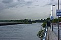
 A view of the Runcorn Bridge - geograph.org.uk - 2550095.jpg 4,461 × 2,968; 7.51 MB
-
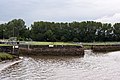
 A view of the Ship Canal and the swing bridge to Wigg Island - geograph.org.uk - 3005929.jpg 4,592 × 3,056; 4.41 MB
-
 A533 approaching the A562 exit - geograph.org.uk - 2883206.jpg 637 × 452; 117 KB
-
 A533 at the Widnes exit - geograph.org.uk - 2883186.jpg 636 × 451; 122 KB
-
 A533 at West Bank - geograph.org.uk - 2883165.jpg 638 × 451; 130 KB
-

-
 A533 nearing the A557 junction - geograph.org.uk - 2883170.jpg 639 × 456; 137 KB
-
 All Saints Church, Runcorn - geograph.org.uk - 2215176.jpg 4,000 × 3,000; 2.03 MB
-
 All Saints Church, Runcorn - geograph.org.uk - 2787241.jpg 480 × 640; 58 KB
-
 Between the bridges - geograph.org.uk - 5411549.jpg 5,706 × 3,804; 4.05 MB
-
 Between the bridges at Runcorn - geograph.org.uk - 2536477.jpg 640 × 378; 59 KB
-
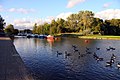 Boats and geese on the St Helens Canal - geograph.org.uk - 2725423.jpg 1,500 × 1,000; 219 KB
-
 Bridge Street, Runcorn Old Town - geograph.org.uk - 2786514.jpg 640 × 480; 65 KB
-
 Broken barbed wire fence on the banks of the Mersey - geograph.org.uk - 4411703.jpg 5,472 × 3,648; 2.29 MB
-
 Camden Buildings, High Street, Runcorn - geograph.org.uk - 2204715.jpg 480 × 640; 142 KB
-
 Canada Goose makes a big splash in the St Helens Canal - geograph.org.uk - 4412253.jpg 2,078 × 3,116; 2.11 MB
-
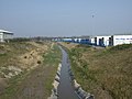
 Canal, Spike Island - geograph.org.uk - 2865310.jpg 640 × 468; 75 KB
-
 Catalyst Chemical Museum - Science Centre - geograph.org.uk - 1887889.jpg 4,224 × 3,168; 2.21 MB
-
 Catalyst Museum - geograph.org.uk - 2260362.jpg 1,200 × 800; 162 KB
-

-
 Chemicals Factory, West Bank Dock Estate - geograph.org.uk - 3435298.jpg 640 × 481; 428 KB
-
 Church Street, Runcorn - geograph.org.uk - 2787723.jpg 640 × 480; 79 KB
-
 Community Gardens, West Bank - geograph.org.uk - 3435154.jpg 640 × 481; 474 KB
-
 Crane, Stobart Rail Freight Terminal - geograph.org.uk - 4948764.jpg 640 × 426; 56 KB
-
 Demolition site on High Street - geograph.org.uk - 2203416.jpg 640 × 480; 116 KB
-
 Dock Road, Widnes - geograph.org.uk - 2851423.jpg 4,068 × 2,075; 6.11 MB
-
-
 Eddie Stobart depot in Widnes - geograph.org.uk - 5411501.jpg 6,000 × 4,000; 6.53 MB
-
 Embankment overlooking the Mersey - geograph.org.uk - 5411557.jpg 6,000 × 4,000; 3.99 MB
-
 Fishing lake with ducks Spike Island, Widnes - geograph.org.uk - 4411647.jpg 5,472 × 3,648; 2.8 MB
-
 Footpath along the Mersey in Runcorn - geograph.org.uk - 2786517.jpg 480 × 640; 76 KB
-
 Footpath alongside the Mersey - geograph.org.uk - 3958992.jpg 4,320 × 3,240; 4.25 MB
-
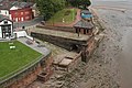
 Former dock at Widnes - geograph.org.uk - 5411543.jpg 5,514 × 3,676; 3.04 MB
-
 Garden of The Mersey Pub ^ Runcorn-Widnes Bridges - geograph.org.uk - 4972128.jpg 2,784 × 1,568; 2.01 MB
-
 Industry by the Runcorn Bridge - geograph.org.uk - 4948773.jpg 640 × 426; 52 KB
-

-
 Lamppost outside St Paul's Centre - geograph.org.uk - 2203390.jpg 480 × 640; 91 KB
-
 Lock chamber on the St Helens Canal - geograph.org.uk - 2725427.jpg 1,000 × 1,500; 165 KB
-
 Lock entrances used and disused at Spike Island - geograph.org.uk - 2056612.jpg 1,600 × 1,198; 420 KB
-
 Lock gates for the original West Bank Dock - geograph.org.uk - 2056598.jpg 1,600 × 1,198; 630 KB
-
 Lock on the Sankey Navigation - geograph.org.uk - 2865318.jpg 640 × 480; 53 KB
-
 Low tide at the Widnes Lock - geograph.org.uk - 2726606.jpg 1,500 × 984; 172 KB
-
 Manchester Ship Canal and river Mersey - geograph.org.uk - 2260372.jpg 1,200 × 803; 165 KB
-

-
 Marshland View - geograph.org.uk - 2260366.jpg 1,200 × 803; 141 KB
-
 Mersey Flat wreck, River Mersey near Widnes - geograph.org.uk - 4412273.jpg 4,871 × 3,247; 1.32 MB
-
 Mersey Multimodal Gateway - geograph.org.uk - 2304854.jpg 2,048 × 1,536; 1.46 MB
-

-
 Mersey waterfront, Spike Island - geograph.org.uk - 2865324.jpg 640 × 480; 73 KB
-
 Mud flats and the Runcorn Bridge - geograph.org.uk - 2852177.jpg 4,410 × 2,935; 5.54 MB
-
 No Fishing Until June 14th Spike Island, Widnes - geograph.org.uk - 4411686.jpg 4,281 × 2,854; 3.27 MB
-

-
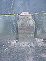 Old GPO cable marker in High Street - geograph.org.uk - 2203409.jpg 480 × 640; 177 KB
-
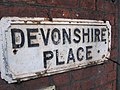 Old name plate in Devonshire Place - geograph.org.uk - 2203310.jpg 640 × 480; 154 KB
-
 On the Walkway - geograph.org.uk - 2260374.jpg 600 × 937; 137 KB
-
 Planes, Trains ^ Automobiles - Runcorn Crossing - geograph.org.uk - 4424704.jpg 3,214 × 2,143; 1.87 MB
-
 Plaque to a Runcorn WWI hero - geograph.org.uk - 2786506.jpg 640 × 480; 72 KB
-
 Power house of former Runcorn Transporter Bridge.jpg 3,456 × 2,304; 1.77 MB
-
 Railings on Spike Island - geograph.org.uk - 2726612.jpg 1,500 × 1,000; 203 KB
-
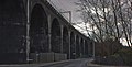
 Railway viaduct in Widnes - geograph.org.uk - 5411530.jpg 5,601 × 3,734; 4.78 MB
-
 Railway Viaduct, MacDermott Road - geograph.org.uk - 3435310.jpg 640 × 481; 459 KB
-
 ReFood anaerobic digestion plant - geograph.org.uk - 5411534.jpg 6,000 × 4,000; 7.5 MB
-

-
 River Mersey, Runcorn - geograph.org.uk - 3435195.jpg 640 × 481; 466 KB
-
 River Mersey, Spike Island - geograph.org.uk - 3435105.jpg 640 × 491; 451 KB
-
 River Mersey, Widnes - geograph.org.uk - 3435269.jpg 640 × 480; 497 KB
-
 River Mersey, Widnes Waterfront - geograph.org.uk - 3435069.jpg 640 × 481; 482 KB
-
 River, Rail, Road and Religion at Runcorn - geograph.org.uk - 2625497.jpg 2,576 × 1,932; 1.04 MB
-
 Runcorn - All Saints Parish Church - geograph.org.uk - 3076703.jpg 1,195 × 1,600; 555 KB
-
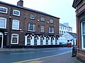
 Runcorn - Barley Mow - geograph.org.uk - 3085952.jpg 1,600 × 1,215; 675 KB
-
 Runcorn - Camden Buildings - geograph.org.uk - 3085962.jpg 1,600 × 1,232; 593 KB
-
 Runcorn - Chambers on High Street - geograph.org.uk - 3085966.jpg 1,600 × 1,200; 480 KB
-
 Runcorn - Devonshire Buildings - geograph.org.uk - 3085973.jpg 1,600 × 1,185; 583 KB
-
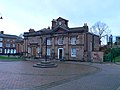
 Runcorn - former Town Hall - geograph.org.uk - 3085956.jpg 1,600 × 1,281; 632 KB
-
 Runcorn - JD's Bar on High Street - geograph.org.uk - 3085954.jpg 1,600 × 1,327; 583 KB
-
 Runcorn - Mersey Road arch of railway viaduct - geograph.org.uk - 3085949.jpg 1,600 × 1,208; 570 KB
-
 Runcorn - NatWest Bank and offices on High Street - geograph.org.uk - 3085959.jpg 1,600 × 1,200; 539 KB
-
 Runcorn - railway viaduct alongside Ashridge Street - geograph.org.uk - 3085939.jpg 1,600 × 1,200; 592 KB
-
 Runcorn - railway viaduct over Mersey Road - geograph.org.uk - 3085943.jpg 1,200 × 1,600; 650 KB
-
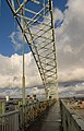
 Runcorn - Silver Jubilee Bridge - geograph.org.uk - 3085950.jpg 1,600 × 1,200; 623 KB
-
 Runcorn - Spiritualist Church - geograph.org.uk - 3076497.jpg 640 × 474; 99 KB
-
 Runcorn - terrace on Ashridge Street - geograph.org.uk - 3085935.jpg 1,600 × 1,205; 625 KB
-
 Runcorn - The Masonic - geograph.org.uk - 3076481.jpg 1,600 × 1,191; 422 KB
-
 Runcorn - The Royal - geograph.org.uk - 3076898.jpg 1,600 × 1,165; 609 KB
-
 Runcorn - Victoria Buildings - geograph.org.uk - 3085968.jpg 1,600 × 1,134; 442 KB
-
 Runcorn - Widnes Bridge - geograph.org.uk - 2072806.jpg 640 × 426; 87 KB
-
 Runcorn - Widnes Bridge - geograph.org.uk - 4948779.jpg 640 × 426; 40 KB
-
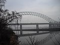
 Runcorn Bridge - geograph.org.uk - 2724153.jpg 4,000 × 3,000; 1.82 MB
-
 Runcorn Bridge - geograph.org.uk - 5238186.jpg 1,024 × 683; 324 KB
-
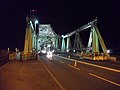
 Runcorn Bridge by night - geograph.org.uk - 2724132.jpg 3,000 × 4,000; 1.76 MB
-
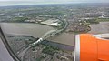
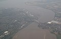 Runcorn Bridge from the air - geograph.org.uk - 1962698.jpg 3,872 × 2,480; 740 KB
-
 Runcorn Bridge over the River Mersey - geograph.org.uk - 2724128.jpg 4,000 × 3,000; 1.9 MB
-
 Runcorn Bridge Widnes - geograph.org.uk - 2724136.jpg 4,000 × 3,000; 1.99 MB
-
 Runcorn Bridges - geograph.org.uk - 2002974.jpg 480 × 640; 112 KB
-
 Runcorn Bridges - geograph.org.uk - 3435254.jpg 640 × 483; 507 KB
-
 Runcorn Bus Station - geograph.org.uk - 2786515.jpg 640 × 480; 54 KB
-
 Runcorn Church - geograph.org.uk - 2260373.jpg 1,200 × 803; 194 KB
-
 Runcorn rail and road bridges - geograph.org.uk - 2864605.jpg 640 × 480; 40 KB
-
 Runcorn Rail Bridge, Trans Pennine Trail - geograph.org.uk - 3435262.jpg 640 × 483; 447 KB
-
 Runcorn railway and road bridges - geograph.org.uk - 3959011.jpg 4,320 × 3,240; 3.7 MB
-
 Runcorn railway bridge - geograph.org.uk - 2864603.jpg 640 × 480; 37 KB
-
 Runcorn Widnes Bridge - geograph.org.uk - 2168373.jpg 480 × 720; 89 KB
-
 Runcorn Widnes Bridge - geograph.org.uk - 2260375.jpg 1,200 × 803; 246 KB
-
 Runcorn Widnes bridge - geograph.org.uk - 2333916.jpg 640 × 480; 52 KB
-
 Runcorn Widnes Bridge - geograph.org.uk - 4786119.jpg 1,600 × 1,064; 305 KB
-
 Runcorn, bridges - geograph.org.uk - 2614966.jpg 1,024 × 768; 129 KB
-
 Runcorn, canalside housing - geograph.org.uk - 2614980.jpg 1,024 × 768; 103 KB
-
 Runcorn-Widnes bridge - geograph.org.uk - 2784577.jpg 2,076 × 1,317; 262 KB
-
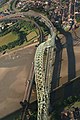
 Runcorn-Widnes Bridges from the Air - geograph.org.uk - 3153513.jpg 3,968 × 2,232; 5.15 MB
-
 Running Parallel - geograph.org.uk - 5463294.jpg 1,600 × 1,064; 323 KB
-
 Sankey (St Helens) Canal, Spike Island - geograph.org.uk - 3436020.jpg 640 × 480; 497 KB
-
 Sankey Canal at Spike Island - geograph.org.uk - 3436013.jpg 640 × 480; 505 KB
-
 Sankey Canal, Lock at Spike Island - geograph.org.uk - 3435094.jpg 640 × 480; 426 KB
-
 Sankey Canal, Spike Island - geograph.org.uk - 3435077.jpg 640 × 481; 478 KB
-
 Sankey Canal, Spike Island - geograph.org.uk - 3435344.jpg 640 × 480; 453 KB
-
 Sankey Canal, Widnes Lock - geograph.org.uk - 3435099.jpg 640 × 484; 489 KB
-
 Scrapped bus near Runcorn Bridge - geograph.org.uk - 4424679.jpg 5,337 × 3,558; 1.98 MB
-
 Scrapyard in Newtown - geograph.org.uk - 2720972.jpg 1,500 × 880; 161 KB
-
 Silver Jubilee Bridge, Widnes - geograph.org.uk - 3435213.jpg 640 × 480; 528 KB
-
 Spare ground, McDermot Road - geograph.org.uk - 5238593.jpg 1,024 × 683; 272 KB
-
 Spike Island and lock entrance - geograph.org.uk - 2056607.jpg 1,600 × 1,198; 283 KB
-
 Spike Island, Sankey Canal - geograph.org.uk - 3435339.jpg 640 × 480; 497 KB
-
 St Mary's Church from the ship canal - geograph.org.uk - 2536467.jpg 640 × 426; 78 KB
-
 St Mary's Church, Doorway Detail - geograph.org.uk - 3435184.jpg 640 × 640; 632 KB
-
 St Mary's Church, West Bank - geograph.org.uk - 3435145.jpg 640 × 480; 477 KB
-
 St Mary's Church, West Bank - geograph.org.uk - 5412423.jpg 6,000 × 4,000; 4.59 MB
-
 St Mary's Church, West Bank, Widnes - geograph.org.uk - 2865304.jpg 640 × 480; 105 KB
-
 St Mary's Church, West Bank, Widnes - geograph.org.uk - 3428785.jpg 1,024 × 768; 109 KB
-
 St Mary's Church, Widnes - geograph.org.uk - 4544465.jpg 2,775 × 4,163; 3.57 MB
-

-
 Standing traffic on The Bridge - geograph.org.uk - 4303428.jpg 1,000 × 1,000; 728 KB
-
 Tesco big shed, Widnes - geograph.org.uk - 5239264.jpg 1,024 × 683; 317 KB
-
 Tesco distribution centre - geograph.org.uk - 2864591.jpg 640 × 480; 44 KB
-
 Tesco Distribution Warehouse - geograph.org.uk - 4948766.jpg 640 × 332; 46 KB
-
 That tree is half as big as the Runcorn Bridge - geograph.org.uk - 2550041.jpg 4,321 × 2,876; 5.56 MB
-
 The Barge Barmere - geograph.org.uk - 2260368.jpg 1,200 × 803; 128 KB
-
 The Barley Mow, Runcorn - geograph.org.uk - 2215184.jpg 4,000 × 3,000; 1.87 MB
-
 The Barley Mow, Runcorn - geograph.org.uk - 2787719.jpg 640 × 480; 90 KB
-
 The BRIDGE - geograph.org.uk - 2883127.jpg 638 × 456; 141 KB
-
 The Catalyst Museum - geograph.org.uk - 2260363.jpg 1,200 × 815; 195 KB
-
 The Catalyst museum - geograph.org.uk - 2726645.jpg 1,500 × 1,000; 143 KB
-

-
 The Clarendon, Runcorn - geograph.org.uk - 2215169.jpg 4,000 × 3,000; 1.67 MB
-
-
 The ebbing tide from Runcorn bridge - geograph.org.uk - 4995583.jpg 1,024 × 709; 77 KB
-
 The former lock entrance to West Bank docks - geograph.org.uk - 2056595.jpg 1,600 × 1,198; 413 KB
-
 The former offices of the Transporter Bridge - geograph.org.uk - 2721820.jpg 989 × 1,500; 144 KB
-
 The marina on the St Helens Canal - geograph.org.uk - 2056628.jpg 1,600 × 1,198; 482 KB
-
 The Masonic, Runcorn - geograph.org.uk - 2215166.jpg 4,000 × 3,000; 1.64 MB
-
 The Mersey at Runcorn Bridge - geograph.org.uk - 2786516.jpg 640 × 480; 54 KB
-
 The Mersey estuary - geograph.org.uk - 4948790.jpg 640 × 426; 40 KB
-
 The Mersey Estuary below Runcorn Gap - geograph.org.uk - 5411539.jpg 6,000 × 4,000; 2.7 MB
-
 The Mersey Estuary below Spike Island - geograph.org.uk - 5412429.jpg 6,000 × 4,000; 2.14 MB
-

-
 The Mersey on Mersey Road - geograph.org.uk - 2721803.jpg 1,500 × 1,000; 143 KB
-
 The Mersey Pub - geograph.org.uk - 2865297.jpg 640 × 480; 61 KB
-
 The Mersey public house - geograph.org.uk - 2056601.jpg 1,600 × 1,198; 361 KB
-
 The Mersey Public House Beer Garden - geograph.org.uk - 2260371.jpg 1,200 × 829; 235 KB
-
 The Mersey Way at Halebank - geograph.org.uk - 2504713.jpg 800 × 600; 140 KB
-
-
 The Queen of Mercia - geograph.org.uk - 2787712.jpg 480 × 640; 85 KB
-
 The River Mersey - geograph.org.uk - 2721795.jpg 1,500 × 998; 166 KB
-
 The River Mersey at Spike Island - geograph.org.uk - 2726629.jpg 1,500 × 1,000; 118 KB
-
 The River Mersey by West Bank - geograph.org.uk - 5411561.jpg 6,000 × 4,000; 7.47 MB
-

-
 The Royal, Old Runcorn - geograph.org.uk - 2786508.jpg 640 × 480; 90 KB
-
 The Royal, Runcorn - geograph.org.uk - 2215194.jpg 4,000 × 3,000; 1.38 MB
-
 The Runcorn Bridge - geograph.org.uk - 1955905.jpg 4,578 × 3,047; 3.58 MB
-
 The Runcorn Bridge - geograph.org.uk - 2852161.jpg 4,549 × 2,299; 5.65 MB
-
 The Runcorn bridge - geograph.org.uk - 3958977.jpg 4,320 × 3,240; 3.48 MB
-
 The Runcorn Bridge from West Bank Dock Estate - geograph.org.uk - 2056585.jpg 1,600 × 1,198; 294 KB
-
 The Runcorn Bridge to Widnes - geograph.org.uk - 2720968.jpg 1,500 × 1,163; 241 KB
-
 The Runcorn-Widnes Bridge at the end of Parsonage Road - geograph.org.uk - 2721788.jpg 1,500 × 1,000; 181 KB
-
 The Runcorn-Widnes bridges on a misty winter's day - geograph.org.uk - 2215174.jpg 4,000 × 3,000; 1.58 MB
-
 The Sankey Canal at Spike Island - geograph.org.uk - 3435348.jpg 640 × 480; 473 KB
-
 The Sankey Canal, Spike Island - geograph.org.uk - 3435350.jpg 640 × 480; 493 KB
-
 The Sankey Valley Canal - geograph.org.uk - 2549901.jpg 4,191 × 2,789; 7.69 MB
-
 The Sankey Valley Canal meets the River Mersey - geograph.org.uk - 2549924.jpg 4,385 × 2,918; 7.39 MB
-
 The southern approach to the Runcorn Bridge - geograph.org.uk - 1955934.jpg 2,608 × 1,956; 1.58 MB
-
 The St Helens Canal on Spike Island - geograph.org.uk - 2725414.jpg 1,500 × 986; 171 KB
-

-
 The Trans Pennine Trail and the Runcorn Bridge - geograph.org.uk - 2851453.jpg 4,453 × 2,964; 7.77 MB
-
 The Trans Pennine Trail at West Bank - geograph.org.uk - 2721798.jpg 1,500 × 1,000; 153 KB
-
 The Trans Pennine Trail on Spike Island - geograph.org.uk - 2725403.jpg 1,500 × 997; 180 KB
-
 The Trans-Pennine Trail regains its riverside position - geograph.org.uk - 2550017.jpg 4,592 × 3,056; 6.67 MB
-
 The Trans-Pennine trail to Widnes - geograph.org.uk - 2720980.jpg 1,500 × 1,000; 199 KB
-
 The Widnes end of the former transporter bridge - geograph.org.uk - 3428804.jpg 1,024 × 768; 133 KB
-

-
 Traffic on the Runcorn-Widnes bridge (A533) - geograph.org.uk - 5227993.jpg 1,600 × 1,064; 590 KB
-
 Train on the Runcorn Bridge - geograph.org.uk - 2720974.jpg 1,500 × 1,000; 167 KB
-
 Train on the Viaduct - geograph.org.uk - 2260367.jpg 1,200 × 803; 170 KB
-
 Trans Pennine Trail at West Bank Dock Estate - geograph.org.uk - 4972111.jpg 2,784 × 1,568; 2.22 MB
-

-

-
-

-
 Trans Pennine Trail Near Runcorn-Widnes Bridge - geograph.org.uk - 4972121.jpg 2,784 × 1,568; 2.25 MB


_Canal,_Spike_Island_-_geograph.org.uk_-_3436020.jpg)


_-_geograph.org.uk_-_5227993.jpg)

