Category:Watercress beds in Dorset
Jump to navigation
Jump to search
Media in category "Watercress beds in Dorset"
The following 15 files are in this category, out of 15 total.
-
 Bere Regis, watercress beds - geograph.org.uk - 1268828.jpg 640 × 480; 102 KB
-
 Empool Bottom and Watercress Beds - geograph.org.uk - 424749.jpg 640 × 335; 70 KB
-
 Hollow Oak, watercress beds - geograph.org.uk - 1268699.jpg 640 × 480; 106 KB
-
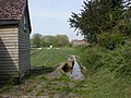
 Hollow Oak, watercress railway - geograph.org.uk - 1268710.jpg 640 × 480; 106 KB
-
 Water Cress Beds - geograph.org.uk - 723261.jpg 640 × 480; 145 KB
-
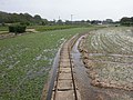
 Watercress Bed Irrigation channel - geograph.org.uk - 723290.jpg 640 × 458; 140 KB
-
 Watercress Beds, Lower Magiston - geograph.org.uk - 723277.jpg 640 × 444; 156 KB
-
 Watercress beds, Spetisbury - geograph.org.uk - 1063277.jpg 640 × 480; 64 KB
-
 Watercress beds, Tincleton - geograph.org.uk - 1179516.jpg 640 × 482; 163 KB
-
 Watercress beds, Wimborne St Giles - geograph.org.uk - 1285656.jpg 640 × 480; 135 KB
-
 Wimborne St Giles, watercress beds - geograph.org.uk - 1439557.jpg 640 × 480; 80 KB
-
 Watercress - geograph.org.uk - 25444.jpg 640 × 481; 132 KB
-
 Watercress beds at Bere Regis - geograph.org.uk - 162256.jpg 600 × 450; 81 KB
-
 Watercress beds disused Cranborne Dorset - geograph.org.uk - 130039.jpg 640 × 480; 163 KB
-
 Watercress beds Wimborne St Giles Dorset - geograph.org.uk - 192339.jpg 640 × 480; 104 KB


