Category:War Memorial (Wettmannstätten)
Jump to navigation
Jump to search
| Object location | | View all coordinates using: OpenStreetMap |
|---|
 | |||||
| Upload media | |||||
| Instance of | |||||
|---|---|---|---|---|---|
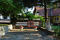
| Location | Wettmannstätten, Deutschlandsberg District, Styria, Austria | ||||
| Heritage designation | |||||
 | |||||
Media in category "War Memorial (Wettmannstätten)"
The following 3 files are in this category, out of 3 total.
-
 Wettmannstätten Kriegerdenkmal Bildnis.jpg 1,944 × 2,896; 1.69 MB
-
 Wettmannstätten Kriegerdenkmal Bildnis2.jpg 1,944 × 2,896; 1.73 MB
-
 Wettmannstätten Kriegerdenkmal gesamt.jpg 2,896 × 1,944; 2.31 MB

