Category:Walls in North Yorkshire
Jump to navigation
Jump to search
Ceremonial counties of England: Bedfordshire · Berkshire · Buckinghamshire · Cambridgeshire · Cheshire · Cornwall · Cumbria · Derbyshire · Devon · Dorset · Durham · East Riding of Yorkshire · East Sussex · Essex · Gloucestershire · Greater London · Greater Manchester · Hampshire · Herefordshire · Hertfordshire · Isle of Wight · Kent · Lancashire · Leicestershire · Lincolnshire · Merseyside · Norfolk · North Yorkshire · Northamptonshire · Northumberland · Nottinghamshire · Oxfordshire · Rutland · Shropshire · Somerset · South Yorkshire · Staffordshire · Suffolk · Surrey · Tyne and Wear · Warwickshire · West Midlands · West Sussex · West Yorkshire · Wiltshire · Worcestershire
City-counties: Bristol ·
Former historic counties:
Other former counties:
City-counties: Bristol ·
Former historic counties:
Other former counties:
Subcategories
This category has the following 5 subcategories, out of 5 total.
P
S
Y
Media in category "Walls in North Yorkshire"
The following 104 files are in this category, out of 104 total.
-

-

-
 An Ancient Ash - geograph.org.uk - 1165813.jpg 640 × 480; 100 KB
-
 Approaching the new footbridge - geograph.org.uk - 403183.jpg 640 × 480; 102 KB
-
 Approaching Wath Lane - geograph.org.uk - 1024097.jpg 640 × 480; 74 KB
-
 Back Lane, Carthorpe - geograph.org.uk - 250163.jpg 640 × 480; 99 KB
-
 Baldersby St James Church - geograph.org.uk - 419322.jpg 480 × 640; 95 KB
-
 Bastow Wood and Grass Wood. - geograph.org.uk - 68484.jpg 640 × 480; 64 KB
-

-
 Beningbrough Hall Gates - geograph.org.uk - 4610249.jpg 1,600 × 1,050; 418 KB
-
 Boundary wall of St Mary's Church, Studley Royal.jpg 4,608 × 3,456; 5.21 MB
-
 Boundary Wall on Carle Edge - geograph.org.uk - 286664.jpg 640 × 480; 79 KB
-
 Butcher Lane - geograph.org.uk - 123626.jpg 640 × 480; 78 KB
-
 Bycliffe Road - geograph.org.uk - 787910.jpg 427 × 640; 234 KB
-
 Bycliffe Road - geograph.org.uk - 797266.jpg 640 × 394; 201 KB
-
 Capplestone Gate - geograph.org.uk - 797149.jpg 640 × 427; 230 KB
-
 Cattle trough at Howgill - geograph.org.uk - 789270.jpg 640 × 453; 150 KB
-
 Cave Scar - geograph.org.uk - 824818.jpg 640 × 385; 154 KB
-
 Conistone Turf Road - geograph.org.uk - 795894.jpg 640 × 460; 285 KB
-
 Conistone Turf Road - geograph.org.uk - 797262.jpg 640 × 427; 216 KB
-
-

-

-

-

-
 Fell Lane - geograph.org.uk - 91127.jpg 640 × 480; 85 KB
-
 Fell Lane. - geograph.org.uk - 233112.jpg 640 × 480; 99 KB
-
 Fell Lane. - geograph.org.uk - 233117.jpg 640 × 480; 90 KB
-
 Fell Lane. - geograph.org.uk - 233119.jpg 640 × 480; 82 KB
-
 Fell Lane. - geograph.org.uk - 233120.jpg 640 × 480; 73 KB
-
 Fields and Walls near Little Stainforth - geograph.org.uk - 434053.jpg 640 × 480; 139 KB
-
 Fields North of Eastby - geograph.org.uk - 636867.jpg 640 × 480; 58 KB
-
-
 Elim Pentecostal Church - Park View - geograph.org.uk - 1621337.jpg 640 × 480; 84 KB
-
 Hawsker Lane, Whitby - geograph.org.uk - 1423492.jpg 640 × 480; 74 KB
-
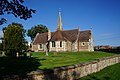
 Holtby Church.jpg 640 × 479; 60 KB
-

-
 Kitchen garden wall - geograph.org.uk - 685135.jpg 640 × 479; 174 KB
-
 Looking over Ribblesdale - geograph.org.uk - 766210.jpg 640 × 480; 72 KB
-
 Main Border, Beningbrough Hall gardens - geograph.org.uk - 2542040.jpg 480 × 640; 113 KB
-
 Newland Junction - geograph.org.uk - 1287216.jpg 640 × 480; 43 KB
-
 Not the City Walls (2083825167).jpg 1,479 × 1,012; 1.99 MB
-
 Old Level, Green SIde - geograph.org.uk - 730896.jpg 480 × 640; 139 KB
-
 Old wall near the top of Firth Fell. - geograph.org.uk - 732208.jpg 640 × 480; 75 KB
-
 Patterned wall in Sharow - geograph.org.uk - 327905.jpg 640 × 480; 130 KB
-
 Peter Lane to High Ousegate - geograph.org.uk - 1581464.jpg 640 × 480; 124 KB
-
 Pile of Boulders, Near North Ings - geograph.org.uk - 712761.jpg 640 × 427; 133 KB
-
 Roecliffe primary school, North Yorkshire.jpg 640 × 425; 65 KB
-
 Rooftop Sunrise (Unsplash).jpg 5,184 × 3,456; 1.32 MB
-
 Ruined Walls and Leaf Litter - geograph.org.uk - 706751.jpg 480 × 640; 149 KB
-
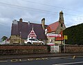 School (2), Baldersby St James.jpg 800 × 625; 108 KB
-
 Source of the River Skell - geograph.org.uk - 286645.jpg 640 × 480; 97 KB
-
 St Stephen's Church, Aldwark - geograph.org.uk - 4188540.jpg 1,600 × 1,064; 690 KB
-
 Stone wall and sheepfold - geograph.org.uk - 964868.jpg 640 × 480; 139 KB
-
 Stone wall junction near Old Accraplatts - geograph.org.uk - 718451.jpg 640 × 480; 193 KB
-
 Stone Wall, Hasty Bank - geograph.org.uk - 1624652.jpg 640 × 427; 266 KB
-
 Stone Wall, Slape Stones Beck - geograph.org.uk - 638149.jpg 640 × 427; 67 KB
-
 Stone Wall, South of Garfit Gap - geograph.org.uk - 712647.jpg 640 × 427; 96 KB
-
 Swinton Park - geograph.org.uk - 312212.jpg 640 × 480; 125 KB
-
 The Brimham Lodge sundial - geograph.org.uk - 712202.jpg 496 × 640; 144 KB
-
 The edge of Ray Wood - geograph.org.uk - 1005506.jpg 640 × 427; 174 KB
-
 The Hills - geograph.org.uk - 726461.jpg 640 × 480; 129 KB
-
 The long wall on Old Cote Moor Top - geograph.org.uk - 732194.jpg 640 × 480; 58 KB
-
 The Monk Wall - geograph.org.uk - 712059.jpg 640 × 480; 100 KB
-
 Tinkers Lane near Hebden - geograph.org.uk - 747915.jpg 640 × 426; 80 KB
-
 Top Mere Road, Wharfedale - geograph.org.uk - 731156.jpg 640 × 338; 65 KB
-
 Track - geograph.org.uk - 749189.jpg 640 × 480; 186 KB
-
 Two farms, Fryup Dale - geograph.org.uk - 726469.jpg 640 × 480; 156 KB
-
 View north from Weets Top trig - geograph.org.uk - 605450.jpg 640 × 480; 149 KB
-
 View over Oxnop Gill - geograph.org.uk - 539758.jpg 640 × 359; 86 KB
-
 View towards Oxen Close - geograph.org.uk - 740537.jpg 640 × 480; 77 KB
-
 Village street - Over Silton - geograph.org.uk - 716939.jpg 640 × 480; 101 KB
-
 Wall - geograph.org.uk - 474868.jpg 640 × 427; 301 KB
-
 Wall - geograph.org.uk - 487802.jpg 640 × 425; 278 KB
-
 Wall and Bee Hives - geograph.org.uk - 537552.jpg 640 × 427; 93 KB
-
 Wall by the Ouse - geograph.org.uk - 6027791.jpg 4,288 × 2,848; 1.86 MB
-
 Wall Corner at Hagg - geograph.org.uk - 712823.jpg 640 × 427; 288 KB
-
 Wall corner in Low Ox Pasture - geograph.org.uk - 1295050.jpg 640 × 480; 182 KB
-
 Wall corner near Mount Pleasant Farm - geograph.org.uk - 570817.jpg 640 × 427; 71 KB
-
 Wall Corner, Egton Cemetery - geograph.org.uk - 570693.jpg 640 × 427; 82 KB
-
 Wall in Carleton.jpg 3,072 × 2,304; 3.36 MB
-
 Wall in Scarborough.JPG 1,920 × 2,560; 1.21 MB
-
 Wall Near Low Gate - geograph.org.uk - 585078.jpg 640 × 427; 82 KB
-
 Wall on Birks Fell - geograph.org.uk - 732164.jpg 640 × 480; 89 KB
-
 Wall on Vulcan Street - geograph.org.uk - 76158.jpg 640 × 480; 63 KB
-
 Wall, Broughton Bank - geograph.org.uk - 712653.jpg 640 × 427; 134 KB
-
 Wall, Near Capon Hall - geograph.org.uk - 559219.jpg 640 × 427; 82 KB
-
 Wall, North Ings - geograph.org.uk - 712710.jpg 640 × 427; 85 KB
-
 Wall, Pen-y-ghent Side - geograph.org.uk - 762505.jpg 640 × 480; 100 KB
-
 Wall, Pen-y-ghent Side - geograph.org.uk - 763183.jpg 480 × 640; 75 KB
-
 Wall, Raisdale - geograph.org.uk - 716949.jpg 640 × 427; 75 KB
-
 Wall, Shunner Howe - geograph.org.uk - 685366.jpg 640 × 384; 54 KB
-

-
 Walled Lane towards Little Newton - geograph.org.uk - 632730.jpg 640 × 480; 107 KB
-
 Walls and meadowland near Muker - geograph.org.uk - 324139.jpg 455 × 640; 73 KB
-
 Walls on Birks Fell - geograph.org.uk - 732160.jpg 640 × 480; 63 KB
-
 Wasteland near the chemical works - geograph.org.uk - 1265472.jpg 640 × 480; 62 KB
-
 Waterfall on Crooke Gill - geograph.org.uk - 710810.jpg 640 × 480; 81 KB
-
 Wooded stream bed at Old Accraplatts - geograph.org.uk - 718171.jpg 640 × 480; 275 KB
-
 York0128.jpg 4,692 × 2,928; 969 KB
-
 Church Lane - geograph.org.uk - 426983.jpg 640 × 360; 84 KB
-
 Footpath - geograph.org.uk - 426782.jpg 640 × 360; 87 KB
-

-
 Wall, Pasture Lane - geograph.org.uk - 292321.jpg 480 × 640; 99 KB
_-_geograph.org.uk_-_831955.jpg)


.jpg)


.jpg)

,_Baldersby_St_James.jpg)


