Category:Wales Coast Path
Jump to navigation
Jump to search
long distance footpath in Wales  | |||||
| Upload media | |||||
| Instance of | |||||
|---|---|---|---|---|---|
| Location | Wales | ||||
 | |||||
Subcategories
This category has the following 6 subcategories, out of 6 total.
A
- Anglesey Coastal Path (71 F)
C
G
- Gower and Swansea Bay Coast Path (12 F)
L
- Llŷn Coastal Path (24 F)
N
- North Wales Coastal Path (18 F)
P
Media in category "Wales Coast Path"
The following 200 files are in this category, out of 207 total.
(previous page) (next page)-
 'Royal Charter' Memorial. - geograph.org.uk - 1031393.jpg 640 × 480; 66 KB
-
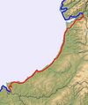
 1 North Wales - Wales Coast Path.png 350 × 418; 263 KB
-
 2 Mon.png 350 × 418; 171 KB
-
 3 Arfon Meirionnydd.png 350 × 418; 198 KB
-
 4 Ceredigion.png 350 × 418; 164 KB
-
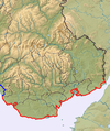
 5 Pembroke.png 350 × 418; 148 KB
-
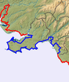
 6 Carmarthenshire.png 350 × 418; 198 KB
-
 7 Gower Swansea.png 350 × 418; 188 KB
-
 8 South Wales.png 350 × 418; 267 KB
-
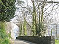
 A bend in the road near Ty'n-y-gate - geograph.org.uk - 769507.jpg 640 × 480; 52 KB
-

-
 A dip in the coast path, Pendine - geograph.org.uk - 942767.jpg 640 × 480; 134 KB
-

-

-
 A natural arch - geograph.org.uk - 53778.jpg 480 × 640; 52 KB
-
 A section of the Anglesey Coastal Path - geograph.org.uk - 381467.jpg 640 × 480; 161 KB
-
 Aberdyfi from the dunes - geograph.org.uk - 1432234.jpg 640 × 425; 55 KB
-
 Afon Afan - geograph.org.uk - 4058584.jpg 640 × 480; 77 KB
-
 Alexanders at Gelliswick Bay - geograph.org.uk - 369714.jpg 640 × 480; 145 KB
-
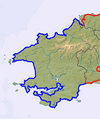
 All wales path.png 647 × 772; 201 KB
-
 Anglesey coastline - geograph.org.uk - 408481.jpg 640 × 480; 284 KB
-
 Arwydd terfyn Llwybr Arfordir Cymru, Cas-gwent.jpg 1,271 × 1,478; 306 KB
-
 At last, leaving the A497! - geograph.org.uk - 5473890.jpg 640 × 480; 290 KB
-
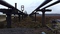 Baglan Bay abandoned plant (32492480171).jpg 3,264 × 1,836; 1.9 MB
-
 Baglan Bay abandoned plant (32574723696).jpg 3,264 × 1,836; 2.03 MB
-
 Boats at Pwllgwaelod - geograph.org.uk - 54760.jpg 640 × 480; 60 KB
-
 Cardiff , Wales Coast Path - geograph.org.uk - 3917301.jpg 4,288 × 2,848; 5.64 MB
-
 Cardiff Barrage, Wales Coast Path - geograph.org.uk - 3113752.jpg 640 × 481; 502 KB
-
 Castell Pared Mawr 01.jpg 4,000 × 3,000; 4.92 MB
-
 Castell Pared Mawr 02.jpg 4,000 × 3,000; 4.84 MB
-
 Castell Pared Mawr 03.jpg 4,000 × 3,000; 5.05 MB
-
 Cawell cimwch, edrych draw tuag at Harlech o aber afon Dwyfor.jpg 4,994 × 3,329; 7.37 MB
-
 Chepstow , Wales Coast Footpath - geograph.org.uk - 2805799.jpg 4,288 × 2,848; 6.36 MB
-
 Chepstow , Wales Coast Footpath - geograph.org.uk - 2805895.jpg 4,288 × 2,848; 6.36 MB
-
 Chepstow , Wales Coast Path - geograph.org.uk - 2805870.jpg 4,288 × 2,848; 6.29 MB
-
 Chepstow oct 2011 057.jpg 3,072 × 2,304; 1.59 MB
-
 Cliff-top path - geograph.org.uk - 653562.jpg 640 × 480; 62 KB
-
 Coast Path - geograph.org.uk - 723062.jpg 640 × 480; 100 KB
-
 Coast Path Footbridge over River Kenfig - NPT Bridgend Oct 2013 (11).JPG 4,000 × 3,000; 4.3 MB
-
 Coast path near Rams Tor - geograph.org.uk - 461024.jpg 640 × 480; 142 KB
-
 Coastal Path, East of Rotherslade - geograph.org.uk - 1481431.jpg 640 × 480; 136 KB
-
 Cows on the Wales Coast Path near Llantwit Major Beach.jpg 3,956 × 2,637; 3.82 MB
-
 Cycle route 5 - geograph.org.uk - 34136.jpg 512 × 384; 35 KB
-
 Cymru6.png 266 × 343; 120 KB
-
 Deer Park Wall, Martins Haven (MGK28317).jpg 5,184 × 3,456; 12.01 MB
-
 Descending towards Wallog - geograph.org.uk - 1168066.jpg 640 × 480; 233 KB
-
 Dock Feeder Canal, Cardiff, May 2023 02.jpg 6,000 × 4,000; 22.52 MB
-
 East Usk Lighthouse (32990547983).jpg 2,448 × 3,264; 2.63 MB
-
 Erosion of Wales Coastal Path.jpg 2,592 × 1,456; 1.66 MB
-

-
 Esplanade, with pier in background - geograph.org.uk - 1152031.jpg 640 × 427; 60 KB
-
 Freshwater East Banner.jpg 2,100 × 300; 129 KB
-
 Freshwater East Beach and Burrows.jpg 4,032 × 2,548; 1.85 MB
-
 Freshwater-east-beach.jpg 2,100 × 347; 131 KB
-
 Garden City, Deeside CH5, UK - panoramio.jpg 4,000 × 3,000; 3.02 MB
-
 Gates onto Saltmarsh Grasslands (geograph 6934827).jpg 5,179 × 3,451; 5.89 MB
-
 Gentle descent to Newgale Sands - geograph.org.uk - 581435.jpg 640 × 480; 184 KB
-

-
 Gower Peninsula from Worms Head.jpg 5,472 × 3,648; 19.44 MB
-
 Huw Irranca-Davies MS at Wales Coast Path 10 Year Anniversary.jpg 4,000 × 6,000; 14.21 MB
-
 Just married (18781989921).jpg 3,888 × 2,592; 6.88 MB
-
 Kenfig Burrows (4888).jpg 4,288 × 2,848; 6.27 MB
-
 Leys Beach towards Rhoose Point - geograph.org.uk - 89767.jpg 640 × 480; 122 KB
-
 Llwybr Afordir Cymru - geograph.org.uk - 2996775.jpg 1,600 × 1,200; 328 KB
-
 Llwybr Arfordir Cymru - geograph.org.uk - 2978439.jpg 1,600 × 1,200; 408 KB
-
 Llwybr Arfordir Cymru - geograph.org.uk - 2978486.jpg 1,600 × 1,200; 372 KB
-
 Llwybr Arfordir Cymru - geograph.org.uk - 2978750.jpg 1,600 × 1,200; 343 KB
-
 Llwybr Arfordir Cymru - geograph.org.uk - 2978885.jpg 1,600 × 1,200; 805 KB
-
 Llwybr Arfordir Cymru - geograph.org.uk - 2978981.jpg 1,600 × 1,200; 469 KB
-
 Llwybr Arfordir Cymru - geograph.org.uk - 2980471.jpg 1,600 × 1,200; 550 KB
-
 Llwybr Arfordir Cymru - geograph.org.uk - 2980730.jpg 1,600 × 1,200; 351 KB
-
 Llwybr Arfordir Cymru - geograph.org.uk - 2980787.jpg 1,600 × 1,200; 550 KB
-
 Llwybr Arfordir Cymru - geograph.org.uk - 2981890.jpg 1,600 × 1,200; 485 KB
-
 Llwybr Arfordir Cymru - geograph.org.uk - 2981916.jpg 1,600 × 1,200; 331 KB
-
 Llwybr Arfordir Cymru - geograph.org.uk - 2981931.jpg 1,600 × 1,200; 344 KB
-
 Llwybr Arfordir Cymru - geograph.org.uk - 2982259.jpg 1,600 × 1,200; 383 KB
-
 Llwybr Arfordir Cymru - geograph.org.uk - 2982285.jpg 1,600 × 1,200; 585 KB
-
 Llwybr Arfordir Cymru - geograph.org.uk - 2982347.jpg 1,600 × 1,200; 413 KB
-
 Llwybr Arfordir Cymru - geograph.org.uk - 2982452.jpg 1,600 × 1,200; 567 KB
-
 Llwybr Arfordir Cymru - geograph.org.uk - 2986328.jpg 1,600 × 1,200; 745 KB
-
 Llwybr Arfordir Cymru - geograph.org.uk - 2996846.jpg 1,600 × 1,200; 559 KB
-
 Llwybr Arfordir Cymru - geograph.org.uk - 2996856.jpg 1,600 × 1,200; 463 KB
-
 Llwybr Arfordir Cymru - Wales Coast Path (geograph 7594046).jpg 1,024 × 768; 276 KB
-
 Llwybr Arfordir Cymru - Wales Coast Path - geograph.org.uk - 3172685.jpg 4,000 × 3,000; 3.24 MB
-
 Llwybr arfordir Cymru - Wales coastal path - geograph.org.uk - 3704270.jpg 4,000 × 3,000; 2.99 MB
-
 Llwybr Arfordir Cymru ar Bronclydwr - geograph.org.uk - 2978841.jpg 1,600 × 1,200; 978 KB
-
 Llwybr Arfordir Cymru ar Bwlch - geograph.org.uk - 2980535.jpg 1,600 × 1,200; 518 KB
-
 Llwybr Arfordir Cymru ar Cefn Camberth - geograph.org.uk - 2978687.jpg 1,600 × 1,200; 721 KB
-
 Llwybr Arfordir Cymru ar Cefnfuesydd Fferm - geograph.org.uk - 2996679.jpg 1,600 × 1,200; 394 KB
-
 Llwybr Arfordir Cymru ar Tyddyn Meurig - geograph.org.uk - 2979009.jpg 1,600 × 1,200; 783 KB
-
 Llwybr Arfordir Cymru banner.jpg 3,024 × 432; 899 KB
-
 Llwybr Arfordir Cymru o Borthoer i Borth Iago, Pen Llŷn.jpg 4,000 × 6,000; 8.63 MB
-
 Llwybr Arfordir Cymru Wales Coast Path - geograph.org.uk - 3772424.jpg 4,000 × 3,000; 3.61 MB
-
 Llwybr Arfordir Cymru, ger Porth Oer, Pen Llŷn.jpg 6,000 × 4,000; 9.56 MB
-
 Llwybr Arfordir-Coast Path - geograph.org.uk - 1504091.jpg 640 × 480; 176 KB
-
 Loughor Bridges looking west, oct 2013.JPG 4,000 × 3,000; 5.33 MB
-
 Millennium Coastal Path near Llanelli, South Wales.JPG 3,664 × 2,748; 1.97 MB
-
 Monmouthshire (33008001793).jpg 3,264 × 2,448; 3.93 MB
-
 North Wales Coast Path - geograph.org.uk - 27197.jpg 512 × 384; 34 KB
-
 North Wales LDP - geograph.org.uk - 846551.jpg 640 × 480; 122 KB
-
 On Cardiff Bay Barrage - geograph.org.uk - 3859305.jpg 3,888 × 5,184; 5.36 MB
-

-

-
 Path closed due to storm damage - geograph.org.uk - 3833617.jpg 1,200 × 798; 452 KB
-

-
 Pembrokeshire Coast Path starts here - geograph.org.uk - 890646.jpg 480 × 640; 108 KB
-

-

-

-
 Penarth Beach - geograph.org.uk - 836808.jpg 640 × 480; 104 KB
-
 Penarth seafront 2.JPG 3,072 × 2,304; 3.18 MB
-
 Placyn llawr Llwybr Arfordir Cymru, Penarth.jpg 4,000 × 3,000; 4.03 MB
-

-
 Porth Iago, Pen Llŷn.jpg 5,784 × 3,856; 5.46 MB
-
 Porth y Nant and Penrhyn Glas.jpg 4,032 × 3,024; 3.59 MB
-
 Pwllcrochan from the north - geograph.org.uk - 842716.jpg 640 × 480; 103 KB
-

-
 Rebecca Tollgate.jpg 4,000 × 3,000; 2.1 MB
-
 Rhossili Bay (5366).jpg 4,288 × 2,848; 6.4 MB
-
 Rhossili Bay (5369).jpg 4,288 × 2,848; 5.56 MB
-
 Sea Wall from Breaksea Point - geograph.org.uk - 89781.jpg 640 × 480; 129 KB
-
 Sign near Oxwich Point (5188).jpg 4,288 × 2,848; 6.41 MB
-
 Stairway on the Wales Coast Path, Rhoose.jpg 6,000 × 4,000; 24.43 MB
-
 Start of Saint Illtyd's Walk - geograph.org.uk - 176603.jpg 640 × 480; 180 KB
-
 Start-end point of the Wales Coast Path at St Dogmaels.jpg 2,250 × 4,000; 4.3 MB
-

-
 The 360 Beach and Watersports Centre - geograph.org.uk - 3181621.jpg 1,744 × 1,156; 673 KB
-

-
 The cliff top path to Porth Meudwy - geograph.org.uk - 606065.jpg 640 × 386; 55 KB
-
 The coastpath near Porthclais - geograph.org.uk - 1525205.jpg 640 × 426; 104 KB
-
 The Esplanade, Penarth - geograph.org.uk - 1234765.jpg 480 × 640; 69 KB
-
 The North Wales Path - geograph.org.uk - 1071307.jpg 480 × 640; 74 KB
-
 The Wales Coast Path at Ffrith Beach (geograph 4963077).jpg 5,100 × 3,400; 3.78 MB
-
 Tomen Las (36597959540).jpg 5,184 × 3,888; 5.02 MB
-
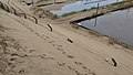
 Track out of nature reserve to Goldcliff Road (geograph 6935792).jpg 5,048 × 3,366; 5.06 MB
-

-
 View west from the Coast Path near Parrog - geograph.org.uk - 6278317.jpg 4,000 × 3,000; 2.93 MB
-
 Wales Coast Path (25739951504).jpg 4,000 × 3,000; 2.43 MB
-
 Wales Coast Path (25739993494).jpg 4,000 × 3,000; 3.02 MB
-
 Wales Coast Path (25740109874).jpg 4,000 × 3,000; 2.41 MB
-
 Wales Coast Path (25741875023).jpg 4,000 × 3,000; 3.3 MB
-
 Wales Coast Path (25741939703).jpg 4,000 × 3,000; 2.93 MB
-
 Wales Coast Path (25741958183).jpg 3,000 × 4,000; 3.05 MB
-
 Wales Coast Path (25742020183).jpg 3,000 × 4,000; 3.82 MB
-
 Wales Coast Path (25742180023).jpg 4,000 × 3,000; 2.7 MB
-
 Wales Coast Path (25742232403).jpg 3,000 × 4,000; 3.15 MB
-
 Wales Coast Path (26071786290).jpg 4,000 × 3,000; 2.81 MB
-
 Wales Coast Path (26071803170).jpg 4,000 × 3,000; 3.02 MB
-
 Wales Coast Path (26071818340).jpg 4,000 × 3,000; 2.51 MB
-
 Wales Coast Path (26071868750).jpg 4,000 × 3,000; 2.47 MB
-
 Wales Coast Path (26071887550).jpg 3,000 × 4,000; 2.46 MB
-
 Wales Coast Path (26318887676).jpg 4,000 × 3,000; 2.71 MB
-
 Wales Coast Path (26318949726).jpg 3,000 × 4,000; 3.34 MB
-
 Wales Coast Path (26319008576).jpg 4,000 × 3,000; 2.46 MB
-
 Wales Coast Path (26344886535).jpg 4,000 × 3,000; 2.95 MB
-
 Wales Coast Path (26344932945).jpg 4,000 × 3,000; 3.78 MB
-
 Wales Coast Path (36159142774).jpg 5,184 × 3,888; 5.17 MB
-
 Wales Coast Path (36159406764).jpg 5,184 × 3,888; 4.44 MB
-
 Wales Coast Path (36159422644).jpg 5,184 × 3,888; 5.03 MB
-
 Wales Coast Path (36159431654).jpg 5,184 × 3,888; 4.64 MB
-
 Wales Coast Path (36159469784).jpg 5,184 × 3,888; 5.2 MB
-
 Wales Coast Path (36159477714).jpg 5,184 × 3,888; 5.23 MB
-
 Wales Coast Path (36186389423).jpg 5,184 × 3,888; 5.41 MB
-
 Wales Coast Path (36598047660).jpg 5,184 × 3,888; 5.82 MB
-
 Wales Coast Path (36807215496).jpg 5,184 × 3,888; 5.24 MB
-
 Wales Coast Path (36807471156).jpg 5,184 × 3,888; 5.08 MB
-
 Wales Coast Path (36823414312).jpg 5,184 × 3,888; 5.06 MB
-
 Wales Coast Path (36823580772).jpg 5,184 × 3,888; 5.84 MB
-
 Wales Coast Path (36823718192).jpg 5,184 × 3,888; 5.55 MB
-
 Wales Coast Path (36854853311).jpg 5,184 × 3,888; 5.25 MB
-
 Wales Coast Path (36854863171).jpg 5,184 × 3,888; 5.09 MB
-
 Wales Coast Path (36854932881).jpg 5,184 × 3,888; 4.95 MB
-
 Wales Coast Path (36854974401).jpg 5,184 × 3,888; 5.19 MB
-
 Wales Coast Path (36854985411).jpg 5,184 × 3,888; 5.27 MB
-
 Wales Coast Path - geograph.org.uk - 4760096.jpg 480 × 640; 144 KB
-
 Wales Coast Path and Trwyn y Gorlech from Porth y Nant.jpg 6,000 × 4,000; 6.72 MB
-
 Wales Coast Path at Rhoose Point (1).jpg 5,920 × 3,947; 15.69 MB
-
 Wales Coast Path at Rhoose Point (2).jpg 6,000 × 4,000; 15.77 MB
-

-
 Wales Coast Path endstone in Chepstow (4251).jpg 4,288 × 2,848; 6.45 MB
-
 Wales Coast Path Footbridge over River Kenfig - from NPT toward Bridgend Oct 2013.JPG 4,000 × 3,000; 5.01 MB
-
 Wales coast path logo.JPG 800 × 800; 58 KB
-
 Wales Coast Path marker stone, Chepstow.jpg 1,920 × 2,560; 2.73 MB
-
 Wales Coast Path near Cefn Castell - geograph.org.uk - 4897870.jpg 640 × 480; 95 KB
-
 Wales Coast Path near Llantwit Major Beach, Oct 2023 01.jpg 5,987 × 3,991; 9.07 MB
-
 Wales Coast Path near Llantwit Major Beach, Oct 2023 02.jpg 6,000 × 4,000; 8.95 MB
-
 Wales Coast Path near Oxwich Point (5170).jpg 4,288 × 2,848; 6.9 MB
-
 Wales Coast Path near Splott - geograph.org.uk - 2884062.jpg 4,000 × 3,000; 3.47 MB
-
 Wales Coast Path near the Second Severn Crossing - geograph.org.uk - 5325868.jpg 4,000 × 3,000; 3.74 MB
-
 Wales Coast Path near the Second Severn Crossing - geograph.org.uk - 5325878.jpg 4,000 × 3,000; 3.24 MB
-
 Wales Coast Path sign at Rhoose Point.jpg 5,876 × 3,917; 10.05 MB
-
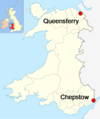
 Wales coast path start at Queensferry.jpg 2,915 × 2,077; 2.74 MB
-
 Wales Coast Path start in Chepstow.jpg 5,312 × 2,988; 7.71 MB
-

-
 Wales Coastal Path west of Criccieth - geograph.org.uk - 5317055.jpg 1,024 × 768; 299 KB
-
 Walk around Wales - geograph.org.uk - 3678194.jpg 2,304 × 1,704; 1.71 MB
-
 Walkers on the Welsh Coast Path - geograph.org.uk - 4898066.jpg 640 × 480; 96 KB
-
 Walkers on Wales Coastal Path (geograph 6278271).jpg 3,264 × 2,448; 2.61 MB
-
 Y Cei yn y Felinheli, ger Caernarfon, Gwynedd. 03.JPG 4,272 × 2,848; 3.85 MB
-
 Y Cei yn y Felinheli, ger Caernarfon, Gwynedd. 04.JPG 4,272 × 2,848; 4.16 MB


.jpg)
.jpg)


.JPG)


.jpg)


.jpg)


.jpg)


.jpg)
.jpg)


.jpg)


.jpg)


.jpg)
.jpg)

.jpg)


.jpg)
.jpg)
.jpg)


.jpg)
.jpg)
.jpg)
.jpg)
.jpg)
.jpg)
.jpg)
.jpg)
.jpg)
.jpg)
.jpg)
.jpg)
.jpg)
.jpg)
.jpg)
.jpg)
.jpg)
.jpg)
.jpg)
.jpg)
.jpg)
.jpg)
.jpg)
.jpg)
.jpg)
.jpg)
.jpg)
.jpg)
.jpg)
.jpg)
.jpg)
.jpg)
.jpg)
.jpg)
.jpg)
.jpg)
.jpg)


.jpg)
.jpg)

.jpg)


.jpg)


.jpg)


.jpg)