Category:Waalse Kerk, Dordrecht
Jump to navigation
Jump to search
| Object location | | View all coordinates using: OpenStreetMap |
|---|
church in Dordrecht, Netherlands  | |||||
| Upload media | |||||
| Instance of | |||||
|---|---|---|---|---|---|
| Location | Dordrecht, South Holland, Netherlands | ||||
| Street address |
| ||||
| Architect | |||||
| Heritage designation |
| ||||
| Inception |
| ||||
| Significant event |
| ||||
 | |||||
Nederlands: Waalse Kerk - anno 1840 - buiten gebruik als kerk
|
This is a category about rijksmonument number 13899
|
| Address |
|
Media in category "Waalse Kerk, Dordrecht"
The following 33 files are in this category, out of 33 total.
-
 Achtergevel - Dordrecht - 20061374 - RCE.jpg 957 × 1,200; 224 KB
-
 De Waalse Kerk, Dordrecht (13269866634).jpg 3,702 × 5,584; 9.05 MB
-
 Dordrecht (The Netherlands) 49.JPG 3,240 × 4,320; 2.04 MB
-
 Dordrecht Franschekerk en Vischmarkt 1745.jpg 1,500 × 1,200; 1,012 KB
-
 Dordrecht plattegrond Waalse kerk 1957.jpg 4,256 × 1,883; 2.19 MB
-
 Dordrecht Waalse kerk armenkist.jpg 3,500 × 3,528; 6.03 MB
-
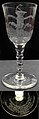 Dordrecht Waalse kerk gelegenheidglas.jpg 1,400 × 4,260; 2.53 MB
-
 Dordrecht waalse kerk koperen kaarsenkronen.jpg 5,490 × 3,000; 6.85 MB
-
 Dordrecht Waalse kerk palmboom.jpg 2,000 × 3,341; 1.73 MB
-
 Dordrecht Waalse kerk statenbijbel Coven en Mortier 1727.jpg 3,000 × 1,855; 2.55 MB
-
 Dordrecht, monumentaal straatzicht4 foto2 2010-06-27 18.03.JPG 3,456 × 2,592; 5.4 MB
-
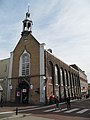
 Dordrecht, Voorstraat 296 - Waalse Kerk-AntonvD-2016-004.jpg 2,396 × 3,500; 1.15 MB
-
 Exterieur vanaf de visbrug - Dordrecht - 20061368 - RCE.jpg 979 × 1,200; 167 KB
-
 Exterieur vanaf Visbrug - Dordrecht - 20061369 - RCE.jpg 1,200 × 980; 163 KB
-
 Inside the Waals Hervormde Kerk, Visstraat, Dordrecht (21736640594).jpg 1,920 × 2,560; 1.37 MB
-
 Interieur naar de preekstoel - Dordrecht - 20061375 - RCE.jpg 953 × 1,200; 189 KB
-
 Interieur naar het orgel - Dordrecht - 20061377 - RCE.jpg 960 × 1,200; 202 KB
-
 Interieur, orgel met galerij - Dordrecht - 20411647 - RCE.jpg 1,200 × 906; 204 KB
-
 Klokkentorentje Waalse kerk, Dordrecht (46486570322).jpg 3,912 × 5,868; 12.52 MB
-
 Noord-west gevel - Dordrecht - 20061380 - RCE.jpg 953 × 1,200; 170 KB
-
 Oostgevel - Dordrecht - 20061381 - RCE.jpg 1,192 × 1,200; 385 KB
-
 Overzicht - Dordrecht - 20061457 - RCE.jpg 1,200 × 1,195; 397 KB
-
 Overzicht - Dordrecht - 20062743 - RCE.jpg 811 × 1,200; 135 KB
-
 Plafond - Dordrecht - 20061378 - RCE.jpg 960 × 1,200; 168 KB
-
 Preekstoel - Dordrecht - 20061376 - RCE.jpg 960 × 1,200; 159 KB
-
 RM13899 Dordrecht - Voorstraat 296.jpg 1,944 × 2,592; 1.07 MB
-
 Visstraat - Dordrecht - 20060189 - RCE.jpg 1,192 × 1,200; 252 KB
-
 Voor en zijgevel - Dordrecht - 20061371 - RCE.jpg 943 × 1,200; 187 KB
-
 Voorgevel - Dordrecht - 20061372 - RCE.jpg 943 × 1,200; 206 KB
-
 Voorstraat, aanzicht - Dordrecht - 20061367 - RCE.jpg 967 × 1,200; 161 KB
-
 Westgevel - Dordrecht - 20061379 - RCE.jpg 1,200 × 951; 204 KB
-
 Zij- en achtergevel - Dordrecht - 20061373 - RCE.jpg 959 × 1,200; 210 KB
-
 Zuidgevel - Dordrecht - 20061382 - RCE.jpg 1,195 × 1,200; 233 KB

.jpg)
_49.JPG)


.jpg)


.jpg)


