Category:Vrijthof 20, Hilvarenbeek
Jump to navigation
Jump to search
| Object location | | View all coordinates using: OpenStreetMap |
|---|
house in Hilvarenbeek, Netherlands  | |||||
| Upload media | |||||
| Instance of | |||||
|---|---|---|---|---|---|
| Part of | |||||
| Location | Hilvarenbeek, North Brabant, Netherlands | ||||
| Street address |
| ||||
| Located on street | |||||
| Heritage designation |
| ||||
 | |||||
|
This is a category about rijksmonumentcomplex number 469114
|
|
This is a category about rijksmonument number 469277
|
|
This is a category about rijksmonument number 469278
|
|
This is a category about rijksmonument number 469279
|
|
This is a category about rijksmonument number 469280
|
|
This is a category about rijksmonument number 469281
|
| Address |
|
Media in category "Vrijthof 20, Hilvarenbeek"
The following 24 files are in this category, out of 24 total.
-
 Exterieur BINNENPLAATS - Hilvarenbeek - 20284550 - RCE.jpg 1,181 × 1,200; 306 KB
-
 Exterieur BROUWERIJ RECHTER ZIJGEVEL - Hilvarenbeek - 20284548 - RCE.jpg 1,181 × 1,200; 338 KB
-
 Exterieur BROUWERIJ, BINNENPLAATS - Hilvarenbeek - 20284540 - RCE.jpg 1,186 × 1,200; 330 KB
-
 Exterieur BROUWERIJ, LINKER ZIJGEVEL - Hilvarenbeek - 20284539 - RCE.jpg 1,186 × 1,200; 323 KB
-
 Exterieur BROUWERIJ, RECHTER ZIJGVEL, GEDEELTE - Hilvarenbeek - 20284549 - RCE.jpg 1,186 × 1,200; 330 KB
-
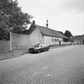
 Exterieur OVERZICHT - Hilvarenbeek - 20284533 - RCE.jpg 1,176 × 1,200; 344 KB
-
 Exterieur OVERZICHT - Hilvarenbeek - 20284538 - RCE.jpg 1,181 × 1,200; 444 KB
-
 Exterieur OVERZICHT BROUWERIJ - Hilvarenbeek - 20284535 - RCE.jpg 1,188 × 1,200; 470 KB
-
 Exterieur OVERZICHT BROUWERIJ, ACHTERGEVEL - Hilvarenbeek - 20284541 - RCE.jpg 1,188 × 1,200; 315 KB
-
 Exterieur OVERZICHT TOEGANGSPOORT - Hilvarenbeek - 20284534 - RCE.jpg 1,181 × 1,200; 280 KB
-
 Exterieur OVERZICHT VOORGEVEL - Hilvarenbeek - 20284536 - RCE.jpg 1,186 × 1,200; 286 KB
-
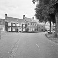 Exterieur OVERZICHT VOORGEVELS - Hilvarenbeek - 20284537 - RCE.jpg 1,191 × 1,200; 315 KB
-
 Exterieur TOEGANGSPOORT - Hilvarenbeek - 20284532 - RCE.jpg 1,179 × 1,200; 369 KB
-
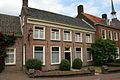 Hilvarenbeek - Vrijthof 20 - Woonhuis brouwerij.jpg 800 × 534; 319 KB
-
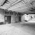
 INTERIEUR, BROUWERIJ - Hilvarenbeek - 20284547 - RCE.jpg 1,193 × 1,200; 349 KB
-
 INTERIEUR, BROUWERIJ, STOOKRUIMTE - Hilvarenbeek - 20284546 - RCE.jpg 1,184 × 1,200; 353 KB
-
 INTERIEUR, OVERZICHT BROUWERIJ - Hilvarenbeek - 20284542 - RCE.jpg 1,184 × 1,200; 335 KB
-
 INTERIEUR, OVERZICHT BROUWERIJ - Hilvarenbeek - 20284543 - RCE.jpg 1,200 × 1,199; 301 KB
-
 INTERIEUR, OVERZICHT BROUWERIJ - Hilvarenbeek - 20284544 - RCE.jpg 1,193 × 1,200; 304 KB
-
 INTERIEUR, OVERZICHT BROUWERIJ - Hilvarenbeek - 20284545 - RCE.jpg 1,191 × 1,200; 306 KB
-
 INTERIEUR, WOONHUIS, KAMER - Hilvarenbeek - 20284551 - RCE.jpg 1,190 × 1,200; 237 KB
-
 INTERIEUR, WOONHUIS, SCHOUW, SCHILDERIJ - Hilvarenbeek - 20284552 - RCE.jpg 1,188 × 1,200; 198 KB
-
 Overzicht - Hilvarenbeek - 20113053 - RCE.jpg 1,200 × 805; 258 KB
-


