Category:Vosbergerweg 34, Heerde
Jump to navigation
Jump to search
| Object location | | View all coordinates using: OpenStreetMap |
|---|
 | |||||
| Upload media | |||||
| Instance of | |||||
|---|---|---|---|---|---|
| Part of |
| ||||
| Location | Heerde, Gelderland, Netherlands | ||||
| Street address |
| ||||
| Heritage designation |
| ||||
 | |||||
|
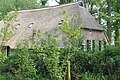
This is a category about rijksmonumentcomplex number 46757
|
|
This is a category about rijksmonument number 46764
|
|
This is a category about rijksmonument number 46765
|
| Address |
|
Media in category "Vosbergerweg 34, Heerde"
The following 8 files are in this category, out of 8 total.
-
 Achtergevel - Heerde - 20105596 - RCE.jpg 1,200 × 801; 190 KB
-
 Achtergevel nr. HD5-D - Heerde - 20476246 - RCE.jpg 1,200 × 900; 168 KB
-
 Heerde - Vosbergerweg - Boerderij.JPG 4,288 × 2,848; 6.34 MB
-
 Heerde Rijksmonument 46764 Boerderij bij Vosberg.jpg 4,288 × 2,848; 6.44 MB
-
 Voorgevel - Heerde - 20105595 - RCE.jpg 1,200 × 807; 217 KB
-
 Voorgevel nr. HD5-A - Heerde - 20476243 - RCE.jpg 1,200 × 900; 214 KB
-
 Zij- en achtergevel nr. HD5-C - Heerde - 20476245 - RCE.jpg 1,200 × 900; 196 KB
-
 Zijgevel nr. HD5-B - Heerde - 20476244 - RCE.jpg 1,200 × 900; 225 KB


