Category:Views of West Yorkshire
Jump to navigation
Jump to search
Wikimedia category | |||||
| Upload media | |||||
| Instance of | |||||
|---|---|---|---|---|---|
| Category combines topics | |||||
| West Yorkshire | |||||
metropolitan and ceremonial county in England, UK     | |||||
| Instance of |
| ||||
| Location |
| ||||
| Inception |
| ||||
| Population |
| ||||
| Area |
| ||||
| official website | |||||
 | |||||
England | ||
|---|---|---|
| ||
|

Subcategories
This category has the following 25 subcategories, out of 25 total.
*
C
- Views from Cupwith Hill (3 F)
F
H
I
L
- Views from Lady Anne Bridge (4 F)
M
P
- Views from Pellon Lane (5 F)
- Views from Penistone Hill (8 F)
Q
S
- Views from Scapegoat Hill (4 F)
T
- Views from Top Withens (3 F)
Media in category "Views of West Yorkshire"
The following 200 files are in this category, out of 248 total.
(previous page) (next page)-
 Aerial above Oxenhope - geograph.org.uk - 623730.jpg 640 × 480; 60 KB
-
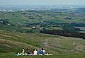 BBQ time - geograph.org.uk - 836348.jpg 640 × 439; 64 KB
-
 Booth House Lane - geograph.org.uk - 2162510.jpg 640 × 480; 111 KB
-
 Boundary stone, Flints, Soyland - geograph.org.uk - 2470158.jpg 2,000 × 1,500; 1.17 MB
-
 Corner of enclosure on Hind Hill, Marsden - geograph.org.uk - 862808.jpg 640 × 480; 100 KB
-

-
 Crow Hill - geograph.org.uk - 387555.jpg 640 × 482; 103 KB
-
 Cutsyke rooftops - geograph.org.uk - 538957.jpg 639 × 433; 107 KB
-
 Delfs, Sowerby - geograph.org.uk - 985234.jpg 640 × 480; 61 KB
-
 Down the Hill to Golcar - geograph.org.uk - 1593813.jpg 640 × 425; 105 KB
-
 Dry stone walls, Steeton Moor - geograph.org.uk - 57331.jpg 640 × 480; 170 KB
-

-
 Emley Moor - geograph.org.uk - 1738475.jpg 480 × 640; 47 KB
-
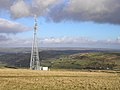
 Emley Moor Transmitter - geograph.org.uk - 1465953.jpg 640 × 480; 57 KB
-
 Erringden Moor - geograph.org.uk - 620362.jpg 640 × 466; 86 KB
-
 Fagley rainbow - geograph.org.uk - 302626.jpg 640 × 480; 71 KB
-
 Farm rooftops - geograph.org.uk - 838832.jpg 640 × 480; 63 KB
-
 Farmland, Severhills Clough - geograph.org.uk - 38159.jpg 640 × 427; 89 KB
-
 Farmland, Upper Brockholes - geograph.org.uk - 39476.jpg 640 × 427; 71 KB
-
 Farnley Wood (39423648002).jpg 6,000 × 4,000; 8.12 MB
-

-
 Fields above Jack Bridge - geograph.org.uk - 430578.jpg 640 × 426; 107 KB
-
 Fields and footpath, Stainland - geograph.org.uk - 740546.jpg 640 × 475; 69 KB
-
 Fields at Clayton, Bradford (3620232018).jpg 2,555 × 1,703; 2.86 MB
-
 Footpath - Withens Road - geograph.org.uk - 2040971.jpg 640 × 480; 60 KB
-
 Footpath above Luddenden - geograph.org.uk - 33744.jpg 640 × 427; 109 KB
-
 Footpath on Ovenden Moor - geograph.org.uk - 1359056.jpg 640 × 480; 88 KB
-
 Footpath over Ovenden Moor, Ovenden - geograph.org.uk - 1363194.jpg 640 × 480; 132 KB
-
 Footpath past the corner of Dawson Wood, Idle - geograph.org.uk - 2321682.jpg 2,000 × 1,500; 987 KB
-
 Fork in the track, Thornton Moor - geograph.org.uk - 2038008.jpg 2,000 × 1,441; 885 KB
-
-
 Foster's Stone, Calderdale - geograph.org.uk - 284636.jpg 640 × 479; 98 KB
-
 From the Harland Way - geograph.org.uk - 490320.jpg 640 × 478; 137 KB
-
 From the Wharfe viaduct - geograph.org.uk - 535277.jpg 640 × 478; 109 KB
-

-
 Fulshaw Clough, Warley - geograph.org.uk - 1279426.jpg 640 × 480; 121 KB
-
 Gateway to the moors (2969315463).jpg 2,560 × 1,920; 4.17 MB
-
 Gorple Gate - geograph.org.uk - 99695.jpg 1,280 × 960; 765 KB
-
 Gorple Gate Track, Widdop - geograph.org.uk - 53982.jpg 640 × 480; 95 KB
-
 Great Peat Moss - geograph.org.uk - 367928.jpg 640 × 456; 100 KB
-
 Greenbelt between Bradford and Leeds - geograph.org.uk - 111656.jpg 640 × 480; 76 KB
-
 Greening field, north of Lower Park Farm - geograph.org.uk - 4194982.jpg 1,024 × 614; 127 KB
-
 Grey Stone Edge. - geograph.org.uk - 100225.jpg 640 × 480; 39 KB
-
 Guiseley - A view from Carlton Lane - geograph.org.uk - 1627350.jpg 640 × 457; 80 KB
-
 Gully from Deep Nitch - geograph.org.uk - 1751773.jpg 2,592 × 1,944; 1.26 MB
-
 Hainworth - view over Worth Valley - geograph.org.uk - 1272810.jpg 640 × 480; 69 KB
-
 Hall Bower viewed from Castle Hill - geograph.org.uk - 1722951.jpg 1,536 × 1,024; 789 KB
-
 Hanging Falls (14742029134).jpg 4,608 × 2,592; 10.32 MB
-
 Hanging Falls (14744114492).jpg 4,458 × 2,508; 8.34 MB
-
 Hanging Falls (17908049822).jpg 3,987 × 2,648; 8.22 MB
-
 Harden Moss Road, Meltham - geograph.org.uk - 1339927.jpg 640 × 463; 111 KB
-
 Harvested Corn Fields - Badsworth - geograph.org.uk - 56482.jpg 640 × 479; 70 KB
-
 Haw Lane, Yeadon - geograph.org.uk - 3831993.jpg 1,200 × 803; 1.06 MB
-
 Heptonstall - Heptonstall Road - geograph.org.uk - 1435200.jpg 640 × 480; 108 KB
-
 Heptonstall Moor in Calderdale - geograph.org.uk - 625302.jpg 640 × 480; 62 KB
-
 High Stones Hill - geograph.org.uk - 388615.jpg 640 × 457; 77 KB
-
 Hill Farm above Walsden - geograph.org.uk - 84893.jpg 640 × 425; 111 KB
-
 Hollow-way, Ovenden - geograph.org.uk - 1363224.jpg 640 × 480; 118 KB
-
 Holme Valley - geograph.org.uk - 1305965.jpg 640 × 480; 104 KB
-
 Holme Valley - geograph.org.uk - 497082.jpg 640 × 359; 73 KB
-
 Horley Green Lane (1693673249).jpg 3,872 × 2,592; 4.65 MB
-
 Humps and holes, Soil Hill, Halifax - geograph.org.uk - 824820.jpg 640 × 480; 94 KB
-
 Hunter Hill - geograph.org.uk - 91632.jpg 640 × 480; 103 KB
-
 I can see for miles and miles - geograph.org.uk - 1775171.jpg 640 × 480; 59 KB
-

-
 Jagger Green Lane, Old Lindley - geograph.org.uk - 175599.jpg 640 × 480; 138 KB
-
 Keeper Lane to the A61 - geograph.org.uk - 430875.jpg 640 × 480; 92 KB
-
 Kell Butts, Wainstalls - geograph.org.uk - 27639.jpg 715 × 536; 120 KB
-
 Kershaw Farm, Erringden - geograph.org.uk - 362580.jpg 640 × 468; 107 KB
-
 Kirkthorpe Village - geograph.org.uk - 356329.jpg 640 × 480; 118 KB
-
 Laddow Moss looking to Holme Moss - geograph.org.uk - 1396347.jpg 640 × 480; 58 KB
-
 Lane, gate, hills (3357933546).jpg 2,550 × 1,700; 3.2 MB
-
 Langfield Edge - geograph.org.uk - 59480.jpg 640 × 480; 173 KB
-
 Leaning stone at Withens Gate (3379664345).jpg 3,843 × 2,527; 6.03 MB
-
 Leeds and Liverpool Canal (34372991872).jpg 5,623 × 2,936; 9.43 MB
-
 Leeds Views (26209544099).jpg 6,000 × 4,000; 15.74 MB
-
 Leeds-2-cropped.jpg 3,856 × 2,571; 6.21 MB
-
 Little Shaw Lane, Crow Hill - geograph.org.uk - 387542.jpg 480 × 640; 99 KB
-

-
 Long Causeway, near Stoodley Pike (October 2010). - panoramio.jpg 1,600 × 1,200; 316 KB
-
 Long Causeway, Rishworth - geograph.org.uk - 835209.jpg 640 × 475; 64 KB
-

-
 Looking down Perseverance Road - geograph.org.uk - 1911049.jpg 640 × 480; 49 KB
-
-

-
 Looking North - geograph.org.uk - 404582.jpg 640 × 480; 91 KB
-
 Looking south down Marsden Gate. - geograph.org.uk - 1264192.jpg 640 × 480; 72 KB
-
-
 Looking West from a snowy Otley Chevin - geograph.org.uk - 1715420.jpg 2,272 × 1,704; 1.17 MB
-
 Lower Shelf - geograph.org.uk - 494698.jpg 640 × 475; 102 KB
-
 Luddenden from Halifax Lane - geograph.org.uk - 1389059.jpg 640 × 480; 88 KB
-
 Luddenden from Halifax Lane - geograph.org.uk - 1389060.jpg 640 × 480; 82 KB
-
 Luddendenfoot in the autumn.jpg 4,608 × 3,456; 4.57 MB
-
 Mill Farm. - geograph.org.uk - 96035.jpg 640 × 480; 69 KB
-
 Mill Lodge, Ramsden Clough - geograph.org.uk - 175054.jpg 640 × 478; 77 KB
-
 Mill on the hill (3907278200).jpg 2,454 × 1,636; 3.56 MB
-
 Millcliff Wood. - geograph.org.uk - 292447.jpg 640 × 480; 127 KB
-

-
 Minor road at head of Widdop valley - geograph.org.uk - 1257208.jpg 640 × 480; 61 KB
-
 Moorland, above Cornholme, West Yorkshire (3360148793).jpg 4,000 × 3,000; 11.53 MB
-
 Moorlands Farm and Haigh Cote - geograph.org.uk - 27643.jpg 715 × 536; 120 KB
-
 Mountain Biking on the Pennine Way - geograph.org.uk - 723572.jpg 640 × 427; 230 KB
-
 Near Hebden Bridge - panoramio.jpg 3,358 × 2,280; 2.64 MB
-
 New Barton - geograph.org.uk - 387525.jpg 640 × 455; 108 KB
-

-
 Newsome High School - geograph.org.uk - 1064163.jpg 640 × 480; 84 KB
-
 North West from The Chevin - geograph.org.uk - 1021018.jpg 640 × 370; 52 KB
-
 On Gorple Stones - geograph.org.uk - 1528948.jpg 640 × 480; 106 KB
-
 On Ilkley Moor 1 (2549544618).jpg 2,560 × 1,778; 4.3 MB
-
 Otley Chevin - geograph.org.uk - 846760.jpg 597 × 400; 113 KB
-
 Outcrops on Shuttleworth Moor - geograph.org.uk - 1060499.jpg 640 × 426; 114 KB
-
 Ovenden and northern end of Halifax - geograph.org.uk - 609264.jpg 640 × 480; 93 KB
-
 Ovenden Moor viewed from Well Heads - geograph.org.uk - 840394.jpg 640 × 423; 51 KB
-
 Over Whiskers, Shibden Dale - geograph.org.uk - 354304.jpg 457 × 640; 118 KB
-
 Packhorse Causey across Whirlaw Common - geograph.org.uk - 488521.jpg 640 × 426; 102 KB
-
 Packhorse Causey crossing Whirlaw Common - geograph.org.uk - 488520.jpg 640 × 426; 115 KB
-
 Paddock Road, Dunkirk - geograph.org.uk - 354289.jpg 468 × 640; 113 KB
-
 Pasture Land At Bog Green - geograph.org.uk - 938756.jpg 640 × 480; 142 KB
-
 Path across the moor (5961542677).jpg 2,813 × 3,719; 7.99 MB
-
 Path and view, Stainland - geograph.org.uk - 720358.jpg 640 × 480; 93 KB
-
 Pennine Bridleway - geograph.org.uk - 1270679.jpg 480 × 640; 81 KB
-
 Pennine Bridleway, Erringden Moor - geograph.org.uk - 179779.jpg 640 × 480; 112 KB
-
 Pennine Bridleway, Gorple Gate - geograph.org.uk - 118913.jpg 1,024 × 683; 149 KB
-
 Pennine Way, Axletree Edge - geograph.org.uk - 576249.jpg 640 × 480; 91 KB
-
 Pennine Way, Heptonstall Moor - geograph.org.uk - 41066.jpg 640 × 427; 99 KB
-
 Pipe across Holden Beck - geograph.org.uk - 715431.jpg 640 × 480; 79 KB
-
 Pry Farm - geograph.org.uk - 40936.jpg 640 × 427; 98 KB
-
 Quarry track - geograph.org.uk - 366541.jpg 640 × 480; 137 KB
-
 Red Brink Road, Sowerby - geograph.org.uk - 993824.jpg 640 × 475; 110 KB
-
 Red Kite Above Bog Plantation - geograph.org.uk - 609810.jpg 640 × 427; 197 KB
-
 Remains of covered reservoir, Ogden - geograph.org.uk - 1247735.jpg 640 × 408; 123 KB
-
 Reservoir outlet - geograph.org.uk - 354290.jpg 640 × 480; 113 KB
-
 Ridings, Luddenden Dean - geograph.org.uk - 362859.jpg 640 × 480; 121 KB
-
 Road junction - geograph.org.uk - 1275590.jpg 640 × 480; 74 KB
-
 Road to Bedlam - geograph.org.uk - 1654130.jpg 640 × 480; 67 KB
-
 Rocks on Harden Moor - geograph.org.uk - 1258818.jpg 640 × 480; 67 KB
-
 Rocky landscape, Meltham - geograph.org.uk - 1356228.jpg 640 × 480; 144 KB
-
 Rough Edge, Erringden Moor - geograph.org.uk - 362577.jpg 640 × 487; 99 KB
-
 Royd Edge Dyeworks, Meltham - geograph.org.uk - 855387.jpg 640 × 480; 85 KB
-
 Ryburn reservoir from Baitings Dam - geograph.org.uk - 610080.jpg 559 × 640; 102 KB
-
 Ryburn Valley (24503056814).jpg 4,000 × 2,667; 7.87 MB
-
 Saw Hill (28033285006).jpg 3,000 × 3,000; 6.05 MB
-
 Shibden Valley from Magna Via - geograph.org.uk - 38267.jpg 640 × 480; 116 KB
-
 Shield Hall Road - geograph.org.uk - 1275595.jpg 640 × 480; 82 KB
-
 Skirden Clough, Ovenden Moor - geograph.org.uk - 1247810.jpg 640 × 480; 138 KB
-

-
 South Pennines.jpg 589 × 400; 72 KB
-

-
 Stile, Howcans Lane (4816250032).jpg 1,587 × 2,380; 3.22 MB
-
 Stonewalls and rocky fields around Todmorden and Hebden bridge.jpg 3,264 × 2,448; 1.84 MB
-
 Stream channel, West Nab Moss, Meltham - geograph.org.uk - 1356194.jpg 640 × 460; 157 KB
-
 Stream channel, West Nab Moss, Meltham - geograph.org.uk - 1356207.jpg 640 × 471; 112 KB
-
 Stream off New Road, Erringden - geograph.org.uk - 1520017.jpg 640 × 480; 164 KB
-
 Stunning views but needs some attention (5756380136).jpg 3,848 × 2,726; 7.8 MB
-
 Surprise view, Ovenden Moor - geograph.org.uk - 1247682.jpg 640 × 480; 131 KB
-
 Teal Lane - geograph.org.uk - 1750161.jpg 640 × 480; 134 KB
-
 Tenterfields, Luddenden Foot - geograph.org.uk - 391582.jpg 640 × 460; 129 KB
-
 The Common, Lepton Edge - geograph.org.uk - 729111.jpg 640 × 427; 69 KB
-
 The Holme valley from Flight Hill - geograph.org.uk - 836278.jpg 640 × 335; 50 KB
-
 The lane to Waterloo, Stainland - geograph.org.uk - 696186.jpg 640 × 480; 61 KB
-

-
 The Ridge next to The Pack Horse Inn - geograph.org.uk - 726166.jpg 640 × 427; 78 KB
-
 The Royalty - Yorkgate. - geograph.org.uk - 1630263.jpg 640 × 457; 54 KB
-
 The Southern End of Black Hill - geograph.org.uk - 720775.jpg 640 × 427; 244 KB
-
 The Towers and the "FA Cup" chimney, Clayton, in the snow (6832108711).jpg 2,284 × 3,466; 5.82 MB
-
 The valley of Caty Well Brook - geograph.org.uk - 1503487.jpg 480 × 640; 84 KB
-
 The valley of Lumb Brook, Coley - geograph.org.uk - 613482.jpg 640 × 447; 75 KB
-

-
-
 Thornton Moor - geograph.org.uk - 624355.jpg 640 × 480; 49 KB
-
 Three Dead Trees (3697177997).jpg 2,462 × 1,863; 4.54 MB
-
 Through the rectangular window - geograph.org.uk - 463341.jpg 640 × 480; 115 KB
-
 Thunnerley, Stainland - geograph.org.uk - 1258505.jpg 640 × 480; 69 KB
-
 Todmorden in Yorkshire.jpg 1,080 × 1,080; 165 KB
-
 Top of M62.jpg 2,048 × 1,200; 101 KB
-
 Towards Sowood from New Lane,Outlane - geograph.org.uk - 1428945.jpg 640 × 480; 42 KB
-
 Track over Thornton Moor - geograph.org.uk - 1363232.jpg 640 × 480; 128 KB
-
 Track over Thornton Moor, Ovenden - geograph.org.uk - 1363258.jpg 640 × 480; 123 KB
-
 Tree (4438109313).jpg 1,707 × 2,560; 3.96 MB
-

-
 Triangulation pillar, Norland Moor - geograph.org.uk - 2239563.jpg 2,000 × 1,500; 556 KB
-
 Turley Holes and Higher House Moor - geograph.org.uk - 463324.jpg 640 × 480; 83 KB
-
 Turvin Clough - geograph.org.uk - 401696.jpg 640 × 467; 165 KB
-
 Tyersal Lane, Pudsey - geograph.org.uk - 111647.jpg 640 × 463; 103 KB
-
 Upper Holme, Slaithwaite - geograph.org.uk - 746164.jpg 640 × 480; 58 KB
-
 Upper Schole Carr (3730677086).jpg 1,122 × 1,122; 1,022 KB
-
 Uppercaldervalley.jpg 1,193 × 450; 72 KB
-
 Valley (2518434483).jpg 2,560 × 1,920; 4.63 MB
-
 Vicars Lot, Stainland Moor - geograph.org.uk - 52534.jpg 640 × 480; 81 KB
-

-
 View from Brown Hurst over the valley of Hebble Brook (4838015189).jpg 2,401 × 1,601; 3.12 MB
-
 View from High Hoyland - geograph.org.uk - 1012581.jpg 640 × 480; 57 KB
-
 View from Jaw Hill - geograph.org.uk - 1009885.jpg 640 × 480; 98 KB
-

-
 View from Otley Chevin - geograph.org.uk - 1640236.jpg 640 × 529; 71 KB
-
 View from Otley Chevin - geograph.org.uk - 1640242.jpg 640 × 506; 40 KB
-
 View from Pole Hill (4400854193).jpg 2,474 × 1,629; 2.91 MB
-
 View from Reins Wood, Rastrick, Yorkshire - geograph.org.uk - 124337.jpg 640 × 480; 119 KB
-
 View from Rochdale Road, Greetland - geograph.org.uk - 2221722.jpg 640 × 480; 47 KB
-
 View from Scout Rock.jpg 2,560 × 1,440; 797 KB


.jpg)


.jpg)


.jpg)


.jpg)
.jpg)
.jpg)


.jpg)


.jpg)

.jpg)
.jpg)
.jpg)


._-_panoramio.jpg)


.jpg)


.jpg)


.jpg)


.jpg)


.jpg)
.jpg)


.jpg)


.jpg)


.jpg)


.jpg)


.jpg)


.jpg)
.jpg)

_-_geograph.org.uk_-_1607644.jpg)
.jpg)


.jpg)


