Category:Views from automobiles in Manatee County, Florida
Jump to navigation
Jump to search
Counties of Florida: Alachua · Baker · Bay · Bradford · Brevard · Broward · Calhoun · Citrus · Clay · Collier · Columbia · Dixie · Duval · Escambia · Flagler · Franklin · Gadsden · Gilchrist · Hamilton · Hernando · Highlands · Hillsborough · Holmes · Jackson · Jefferson · Lafayette · Lake · Lee · Leon · Levy · Liberty · Madison · Manatee · Marion · Miami-Dade · Monroe · Nassau · Okaloosa · Okeechobee · Orange · Osceola · Palm Beach · Pasco · Pinellas · Polk · Putnam · Santa Rosa · Sarasota · Seminole · St. Johns · St. Lucie · Sumter · Suwannee · Taylor · Union · Volusia · Wakulla · Walton · Washington
Media in category "Views from automobiles in Manatee County, Florida"
The following 51 files are in this category, out of 51 total.
-
 Blue Star Mem Hwy Plaque on US BUS 41 in Memphis.jpg 3,648 × 2,736; 2.06 MB
-
 Directional Sign near W End of FL 62.jpg 3,648 × 2,736; 2.05 MB
-
 Fishing Pier Sign from Sunshine Skyway South Rest Area.jpg 3,648 × 2,736; 2.04 MB
-
 FL64eRoadSign-DowntownBradenton (38549280192).jpg 2,400 × 1,600; 2 MB
-
 Florida- 1584 sunshine skyway bridge.JPG 3,072 × 2,304; 2.16 MB
-
 Homemade Camper on Ford Ranger @ Sunshine Skyway South Pier-1.jpg 3,648 × 2,736; 2.05 MB
-
 Homemade Camper on Ford Ranger @ Sunshine Skyway South Pier-2.jpg 3,648 × 2,736; 2.07 MB
-
 I-275 rest area 10370-01.jpg 3,648 × 2,736; 2.05 MB
-
 I-275 rest area 10370-02.jpg 3,648 × 2,736; 2.12 MB
-
 I-275 rest area 10370-13.jpg 3,648 × 2,736; 2.03 MB
-
 I-275 rest area 10370-14.jpg 3,648 × 2,736; 2.06 MB
-
 I-275 rest area 10370-15.jpg 3,648 × 2,736; 2.09 MB
-
 I-275 rest area 10370-16.jpg 3,648 × 2,736; 2.12 MB
-
 I-275 rest area 10370-17.jpg 3,648 × 2,736; 2.03 MB
-
 Interstate 75 - Florida - 6876522240.jpg 2,816 × 2,112; 315 KB
-
 Interstate 75 - Florida - 6876522450.jpg 2,816 × 2,112; 351 KB
-
 Interstate 75 - Florida - 6876522588.jpg 2,816 × 2,112; 324 KB
-
 Interstate 75 - Florida - 6876523164.jpg 2,816 × 2,112; 578 KB
-
 Interstate 75 - Florida - 6876523300.jpg 2,816 × 2,112; 327 KB
-
 Interstate 75 - Florida - 6876523550.jpg 2,816 × 2,112; 465 KB
-
 Interstate 75 - Florida - 6876523832.jpg 2,816 × 2,112; 391 KB
-
 Interstate 75 - Florida - 6876524566.jpg 2,816 × 2,112; 400 KB
-
 Interstate 75 - Florida - 6876530754.jpg 2,816 × 2,112; 481 KB
-
 Interstate 75 - Florida - 6876530910.jpg 2,816 × 2,112; 451 KB
-
 Interstate 75 - Florida - 6876531820.jpg 2,816 × 2,112; 474 KB
-
 JoJo's Taste of Chicago; Parrish, Florida.jpg 3,648 × 2,736; 2.06 MB
-
 Manatee County, FL, USA - panoramio.jpg 1,600 × 1,200; 480 KB
-
 NB I-275 Sunshine Skyway @ Hillsborough Co Line.jpg 3,648 × 2,736; 2.09 MB
-
 NB I-275 Sunshine Skyway; VMS north of South Rest Area.jpg 3,648 × 2,736; 2.16 MB
-
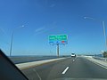 NB Sunshine Skyway; 4-and-a-Half Miles to North Fishing Pier & Rest Area.jpg 3,648 × 2,736; 2.1 MB
-
 NB US 41; First US 19 Overhead Gantry.jpg 3,648 × 2,736; 2.09 MB
-
 NB US 41; FSH Tamiami Trail Sign; Memphis.jpg 3,648 × 2,736; 2 MB
-
 NB US 41; Second US 19 Overhead Gantry.jpg 3,648 × 2,736; 2.14 MB
-
 NB US 41; Southbound U-Turn in Memphis, FL-1.jpg 3,648 × 2,736; 2.1 MB
-
 NB US 41; Southbound U-Turn in Memphis, FL-2.jpg 3,648 × 2,736; 2.09 MB
-
 NB US BUS 41 & Palmetto Subdivision under US 41 Bridge.jpg 3,648 × 2,736; 2.05 MB
-
 SB FL 37 near FL 62; Wauchula or Parrish.jpg 3,648 × 2,736; 2.11 MB
-
 SB FL 37; End @ FL 62-01.jpg 3,648 × 2,736; 2.09 MB
-
 SB FL 37; End @ FL 62-02.jpg 3,648 × 2,736; 2.02 MB
-
 SB FL 37; JCT FL 62 in Duette.jpg 2,007 × 944; 436 KB
-
 SB On-Ramp to I-275-US 19 from South Rest Area.jpg 3,648 × 2,736; 2.1 MB
-
 SB Sunshine Skyway; One Mile to South Fishing Pier & Rest Area.jpg 3,648 × 2,736; 2.09 MB
-
 SB Sunshine Skyway; South Fishing Pier & Rest Area Next Right.jpg 3,648 × 2,736; 2.03 MB
-
 SB Sunshine Skyway; South Rest Area Gore Sign.jpg 3,648 × 2,736; 2.05 MB
-
 SB US 41-US BUS 41 Overhead Gantry; Memphis, FL.jpg 3,648 × 2,736; 2.06 MB
-
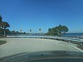
 South Skyway Picnic Area-1.jpg 3,648 × 2,736; 2.04 MB
-
 South Skyway Picnic Area-2.jpg 3,648 × 2,736; 2.06 MB
-
 South Skyway Picnic Area-3.jpg 3,648 × 2,736; 2.03 MB
-
 US41nRoad-FL684wSigns (38581700881).jpg 2,400 × 1,600; 2.06 MB
-
 W End FL 62 @ US 301; Parrish.jpg 3,648 × 2,736; 2.09 MB
-
 WB FL 62; JCT US 301; Parrish.jpg 3,648 × 2,736; 2.01 MB


.jpg)


.jpg)

