Category:Views from automobiles in Cook County, Georgia
Jump to navigation
Jump to search
Counties of Georgia: Appling · Atkinson · Bacon · Baker · Banks · Barrow · Bartow · Ben Hill · Berrien · Brooks · Bryan · Butts · Calhoun · Camden · Carroll · Charlton · Chatham · Chattooga · Clayton · Clinch · Cobb · Coffee · Colquitt · Cook · Coweta · Crawford · Crisp · Dade · Dawson · Decatur · DeKalb · Dodge · Dooly · Dougherty · Douglas · Early · Effingham · Evans · Floyd · Forsyth · Franklin · Fulton · Glynn · Gordon · Grady · Gwinnett · Habersham · Hall · Haralson · Harris · Hart · Henry · Houston · Irwin · Jasper · Jeff Davis · Jefferson · Lamar · Lanier · Laurens · Liberty · Long · Lowndes · Lumpkin · Macon · Marion · McIntosh · Mitchell · Monroe · Montgomery · Murray · Newton · Peach · Pulaski · Putnam · Randolph · Rockdale · Schley · Seminole · Spalding · Stephens · Stewart · Sumter · Talbot · Tattnall · Telfair · Terrell · Thomas · Tift · Toombs · Troup · Turner · Upson · Walker · Ware · Wayne · Wheeler · White · Whitfield · Wilcox · Worth
City-counties: Columbus–Muscogee · Georgetown–Quitman · Macon–Bibb · Statenville–Echols
City-counties: Columbus–Muscogee · Georgetown–Quitman · Macon–Bibb · Statenville–Echols
Media in category "Views from automobiles in Cook County, Georgia"
The following 61 files are in this category, out of 61 total.
-
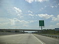
 Cook County, GA, USA - panoramio (1).jpg 2,592 × 1,944; 977 KB
-
 Cook County, GA, USA - panoramio (2).jpg 2,592 × 1,944; 1.45 MB
-
 Cook County, GA, USA - panoramio.jpg 2,592 × 1,944; 1,002 KB
-
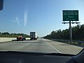
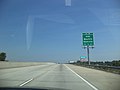
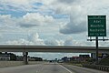
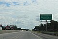
 Georgia I75nb Cecil city limit.JPG 4,320 × 3,240; 4.5 MB
-
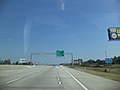
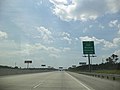
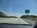
 Georgia I75nb Exit 32 .5 mile.JPG 4,320 × 3,240; 4.41 MB
-
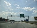
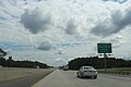
 Georgia I75nb Exit 32 1 mile.JPG 4,320 × 3,240; 4.44 MB
-
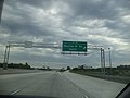
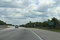
 Georgia I75nb Exit 32.JPG 4,320 × 3,240; 4.41 MB
-
 Georgia I75nb Exit 37 .5 mile.JPG 4,320 × 3,240; 4.48 MB
-
 Georgia I75nb Exit 37 1 mile.JPG 4,320 × 3,240; 4.46 MB
-
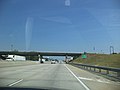 Georgia I75nb Exit 37 overpass Adel Quitman Rd, Adel city limit.JPG 4,320 × 3,240; 4.43 MB
-
 Georgia I75nb Exit 37.JPG 4,320 × 3,240; 4.44 MB
-
 Georgia I75nb Exit 39 .5 mile.JPG 4,320 × 3,240; 4.49 MB
-
 Georgia I75nb Exit 39 1 mile.JPG 4,320 × 3,240; 4.52 MB
-
 Georgia I75nb Exit 39.JPG 4,320 × 3,240; 4.52 MB
-
 Georgia I75nb Exit 41.JPG 4,320 × 3,240; 4.44 MB
-
 Georgia I75nb Exit 45 1 mile.JPG 4,320 × 3,240; 4.43 MB
-
 Georgia I75nb Exit 45.JPG 4,320 × 3,240; 4.42 MB
-
 Georgia I75nb Exit 49 .5 mile.jpg 4,320 × 3,240; 4.48 MB
-
 Georgia I75nb Exit 49 1 mile.JPG 4,320 × 3,240; 4.37 MB
-
 Georgia I75nb Exit 49.JPG 4,320 × 3,240; 4.46 MB
-
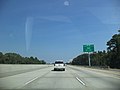
 Georgia I75nb Rest Stop 5 Exit.JPG 4,320 × 3,240; 4.45 MB
-
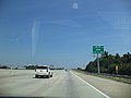
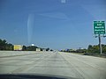
 Georgia I75nb Tift County border.JPG 4,320 × 3,240; 4.42 MB
-
 Georgia I75sb 4th St Overpass.jpg 5,184 × 3,456; 4.28 MB
-
 Georgia I75sb Adel city limit.JPG 5,184 × 3,456; 4.29 MB
-
 Georgia I75SB Cecil city limit.jpg 5,184 × 3,456; 4.35 MB
-
 Georgia I75sb Exit 32 .5 mile.JPG 5,184 × 3,456; 4.35 MB
-
 Georgia I75sb Exit 32 1 mile.JPG 4,320 × 3,240; 4.5 MB
-
 Georgia I75sb Exit 32.JPG 5,184 × 3,456; 4.67 MB
-
 Georgia I75sb Exit 37 .5 mile.JPG 5,184 × 3,456; 4.42 MB
-
 Georgia I75sb Exit 37 1 mile.JPG 4,320 × 3,240; 4.48 MB
-
 Georgia I75sb Exit 37.JPG 5,184 × 3,456; 4.65 MB
-
 Georgia I75sb Exit 39 .5 mile.JPG 4,320 × 3,240; 4.52 MB
-
 Georgia I75sb exit 39 .5 mile.jpg 5,184 × 3,456; 4.29 MB
-
 Georgia I75sb Exit 39 1 mile.JPG 4,320 × 3,240; 4.48 MB
-
 Georgia I75sb Exit 39.JPG 4,320 × 3,240; 4.35 MB
-
 Georgia I75sb Exit 41 .5 mile.JPG 4,320 × 3,240; 4.43 MB
-
 Georgia I75sb exit 41 .5 mile.jpg 5,184 × 3,456; 4.21 MB
-
 Georgia I75sb Exit 41 1 mile.JPG 4,320 × 3,240; 4.41 MB
-
 Georgia I75sb exit 41 1 mile.jpg 5,184 × 3,456; 4.09 MB
-
 Georgia I75sb Exit 41 Overpass.JPG 4,320 × 3,240; 4.45 MB
-
 Georgia I75sb Exit 41.JPG 4,320 × 3,240; 4.45 MB
-
 Georgia I75sb exit 41.jpg 5,184 × 3,456; 4.29 MB
-
 Georgia I75sb Exit 45 .5 mile.JPG 4,320 × 3,240; 4.43 MB
-
 Georgia I75sb exit 45 .5 mile.jpg 5,184 × 3,456; 4.21 MB
-
 Georgia I75sb Exit 45 1 mile.JPG 4,320 × 3,240; 4.45 MB
-
 Georgia I75sb exit 45 1 mile.jpg 5,184 × 3,456; 4.01 MB
-
 Georgia I75sb Exit 45.JPG 4,320 × 3,240; 4.39 MB
-
 Georgia I75sb exit 45.jpg 5,184 × 3,456; 4.32 MB
-
 Georgia I75sb Exit 49 .5 mile.JPG 4,320 × 3,240; 4.46 MB
-
 Georgia I75sb exit 49 .5 mile.jpg 5,184 × 3,456; 4.35 MB
-
 Georgia I75sb Exit 49 1 mile.JPG 4,320 × 3,240; 4.45 MB
-
 Georgia I75sb exit 49 1 mile.jpg 5,184 × 3,456; 4.23 MB
-
 Georgia I75sb exit 49.jpg 5,184 × 3,456; 4.4 MB
-
 Georgia I75sb Exit49.JPG 4,320 × 3,240; 4.47 MB
-
 Georgia I75sb Lenox limit.JPG 4,320 × 3,240; 4.49 MB
-
 Georgia I75Sb Lowndes County line.jpg 5,184 × 3,456; 4.09 MB
-
 Georgia I75sb Old Coffee Rd Overpass - Exit 32.jpg 5,184 × 3,456; 4.53 MB
-
 Georgia I75sb Old Quitman Rd Overpass - Exit 37.jpg 5,184 × 3,456; 4.33 MB
-
 Georgia I75sb Rest Stop 6 Exit.JPG 4,320 × 3,240; 4.41 MB
-
 Georgia I75sb Roundtree Bridge Rd Overpass.jpg 5,184 × 3,456; 3.98 MB
-
 Georgia I75sb W Central Ave Overpass.jpg 5,184 × 3,456; 4.25 MB
.jpg)
.jpg)


