Category:Vennebroek (Paterswolde)
Jump to navigation
Jump to search
| Object location | | View all coordinates using: OpenStreetMap |
|---|
estate in Paterswolde  | |||||
| Upload media | |||||
| Instance of | |||||
|---|---|---|---|---|---|
| Location |
| ||||
| Has part(s) | |||||
| Heritage designation |
| ||||
 | |||||
Nederlands: Vennebroek, Paterswolde
|
This is a category about rijksmonumentcomplex number 468714
|
Herenhuis (1848)
|
This is a category about rijksmonument number 468715
|
Toegangshek (Pottenpoort, 1913)
|
This is a category about rijksmonument number 468716
|
Toegangshek (Leeuwenpoort, 1915)
|
This is a category about rijksmonument number 468717
|
Schuur (ca. 1915)
|
This is a category about rijksmonument number 468718
|
Koetshuis (Hoofdweg 251, ca. 1915)
|
This is a category about rijksmonument number 468719
|
Buitenhuis Weltevreden (Frieselaan 4, 1910, G. Nijhuis)
|
This is a category about rijksmonument number 468720
|
Park
|
This is a category about rijksmonument number 515679
|
Tuinsieraden
|
This is a category about rijksmonument number 528424
|
| Address |
|
Subcategories
This category has the following 5 subcategories, out of 5 total.
K
- Koetshuis (Vennebroek) (10 F)
S
- Schuur (Vennebroek) (9 F)
T
- Toegangshekken (Vennebroek) (15 F)
- Tuinsieraden (Vennebroek) (3 F)
W
Media in category "Vennebroek (Paterswolde)"
The following 36 files are in this category, out of 36 total.
-
 20200526 Vennebroek1 Paterswolde.jpg 5,074 × 3,382; 4.31 MB
-
 20200526 Vennebroek2 Paterswolde.jpg 5,113 × 3,408; 4.77 MB
-
 20200526 Vennebroek3 Paterswolde.jpg 5,134 × 3,422; 4.49 MB
-
 Eelde Paterwolde De Braak Vennebroek 16 37 01 524000.jpeg 4,032 × 3,024; 7.06 MB
-
 Eelde Paterwolde De Braak Vennebroek 16 37 16 374000.jpeg 4,032 × 3,024; 4.26 MB
-
 Eelde Paterwolde De Braak Vennebroek 16 37 27 192000.jpeg 4,032 × 3,024; 6.03 MB
-
 Eelde Paterwolde De Braak Vennebroek 16 37 40 421000.jpeg 4,032 × 3,024; 6.23 MB
-
 Eelde Paterwolde De Braak Vennebroek 16 37 53 937000.jpeg 4,032 × 3,024; 3.35 MB
-
 Eelde Paterwolde De Braak Vennebroek 16 38 02 354000.jpeg 4,032 × 3,024; 4.42 MB
-
 Eelde Paterwolde De Braak Vennebroek.jpeg 4,032 × 3,024; 5.93 MB
-
 Eelderbaan, Roege Bos, De Held 01 17 50 201000.jpeg 3,024 × 4,032; 5.74 MB
-
 Eelderbaan, Roege Bos, De Held 01 18 02 499000.jpeg 4,032 × 3,024; 5.42 MB
-
 Eelderbaan, Roege Bos, De Held 01 18 54 141000.jpeg 4,032 × 3,024; 5.59 MB
-
 Eelderbaan, Roege Bos, De Held.jpeg 3,024 × 4,032; 4.9 MB
-
 Frieselaan.jpg 4,105 × 2,737; 8.51 MB
-
 Glas en loodraam villa Vennebroek.jpg 2,503 × 3,569; 6.97 MB
-
 HaHaVennebroekRaam.gif 567 × 1,054; 418 KB
-
 Kelder villa Vennebroek.jpg 4,000 × 3,000; 6.14 MB
-
 Landgoed Vennebroek.JPG 2,272 × 1,704; 1.52 MB
-
 Overzicht - Eelde - 20067181 - RCE.jpg 894 × 1,200; 199 KB
-
 Uitkijkje villa Vennebroek.jpg 4,000 × 3,000; 6.52 MB
-
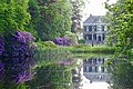
 Vennebroek - havezathe.jpg 4,446 × 2,779; 9.48 MB
-
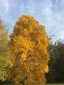
 Vennebroek Beuk.JPG 3,072 × 2,304; 3.03 MB
-
 Vennebroek De Braak 18 29 02 429000.jpeg 3,024 × 4,032; 3.54 MB
-
 Vennebroek De Braak 18 29 49 991000.jpeg 4,032 × 3,024; 5.96 MB
-
 Vennebroek De Braak 18 29 57 535000.jpeg 4,032 × 3,024; 4.48 MB
-
 Vennebroek De Braak 18 30 03 886000.jpeg 4,032 × 3,024; 3.94 MB
-
 Vennebroek De Braak 18 30 11 670000.jpeg 4,032 × 3,024; 5.48 MB
-
 Vennebroek De Braak 18 30 18 314000.jpeg 4,032 × 3,024; 5.49 MB
-
 Vennebroek De Braak 18 31 01 608000.jpeg 3,024 × 4,032; 1.63 MB
-
 Vennebroek De Braak 18 31 05 406000.jpeg 3,024 × 4,032; 2.66 MB
-
 Vennebroek De Braak.jpeg 3,024 × 4,032; 2.5 MB
-
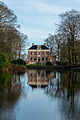
 Vennebroek met vijver (1).jpg 4,390 × 2,744; 9.95 MB
-
 Vennebroek met vijver (2).jpg 2,160 × 3,240; 5.35 MB
-
 Vennebroek.JPG 1,820 × 1,200; 961 KB
-
 Zolder villa Vennebroek.jpg 4,000 × 3,000; 6.24 MB


.jpg)
.jpg)

