Category:VEB Kombinat Geodäsie und Kartographie
Jump to navigation
Jump to search
1971 Zusammenlegung vom VEB Topographischer Dienst und der VEB Ingenieurvermessungswesen zum VEB Kombinat Geodäsie und Kartographie, Betrieb Erfurt mit Sitz in Berlin und unterstand der Verwaltung des Vermessungs- und Kartenwesen im Ministerium des Innern der DDR.
Subcategories
This category has the following 2 subcategories, out of 2 total.
V
- VEB Ingenieurvermessung (2 F)
- VEB Topographischer Dienst (3 F)
Media in category "VEB Kombinat Geodäsie und Kartographie"
The following 6 files are in this category, out of 6 total.
-
 20040402300DR Dresden-Lockwitz Rittergut Schloß.jpg 2,479 × 1,659; 3.55 MB
-
 Beispiel einer Topographischen Karten-Ausgabe für die Volkswirtschaft TK(AV).jpg 3,371 × 4,806; 4.97 MB
-
 Freiberger Platz 1960.jpg 2,220 × 2,432; 1.05 MB
-
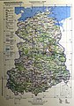
 Karte VEB Kombinat Geodäsie und Kartographie.jpg 3,576 × 2,206; 1.12 MB
-
 Touristikkarte der DDR.jpg 3,746 × 1,428; 1.17 MB
-
 VEB Kombinat Geodäsie.jpg 1,503 × 2,121; 664 KB

.jpg)


