Category:Uttoxeter Canal
Jump to navigation
Jump to search
former canal in England  | |||||
| Upload media | |||||
| Instance of | |||||
|---|---|---|---|---|---|
| Location |
| ||||
 | |||||
Subcategories
This category has only the following subcategory.
Media in category "Uttoxeter Canal"
The following 9 files are in this category, out of 9 total.
-
 Abandoned Canal Milepost and Railway - geograph.org.uk - 413700.jpg 480 × 640; 121 KB
-
 Crumpwood Weir - geograph.org.uk - 413004.jpg 640 × 480; 102 KB
-
 Froghall junction - geograph.org.uk - 582390.jpg 640 × 480; 76 KB
-
 LowerBasinFroghall.jpg 640 × 480; 70 KB
-
 Seventy Bridge - geograph.org.uk - 413486.jpg 640 × 480; 135 KB
-
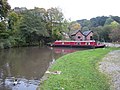
 The White House, Consall - geograph.org.uk - 1731619.jpg 1,280 × 960; 440 KB
-
 Uttoxeter Canal at Crumpwood Weir (geograph 5686281).jpg 640 × 427; 131 KB
-
 California Lock - geograph.org.uk - 413709.jpg 480 × 640; 122 KB
-
 Morris's Bridge - geograph.org.uk - 413725.jpg 480 × 640; 147 KB


.jpg)

