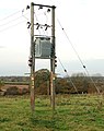
Category:Utility poles in Warwickshire
Jump to navigation
Jump to search
Media in category "Utility poles in Warwickshire"
The following 21 files are in this category, out of 21 total.
-
 Ailstone - geograph.org.uk - 60829.jpg 640 × 446; 123 KB
-

-
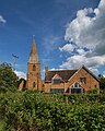
 The Church, Combrook - geograph.org.uk - 1057687.jpg 640 × 480; 272 KB
-
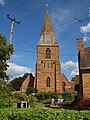
 St Peter's Church Grandborough - geograph.org.uk - 33478.jpg 640 × 480; 135 KB
-

-
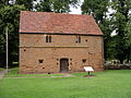 Ancient barn kenilworth fields 9l07.JPG 2,592 × 1,944; 2.89 MB
-
 The barn, Abbey Fields - geograph.org.uk - 673469.jpg 640 × 480; 97 KB
-
 Kenilworth AbbeyBarn SSW.jpg 1,185 × 1,280; 1.21 MB
-
 Kenilworth Methodist Church south.jpg 1,280 × 589; 408 KB
-
 Kenilworth Methodist Church west.jpg 1,280 × 1,278; 990 KB
-
 Kenilworth, Virgins and Castle - geograph.org.uk - 1739505.jpg 1,024 × 768; 209 KB
-
 Norton Lindsey Windmill-geograph.org-1842958.jpg 640 × 480; 402 KB
-
 Princethorpe - geograph.org.uk - 341093.jpg 640 × 480; 143 KB
-
 Radway BleakCottage west.jpg 1,023 × 1,280; 746 KB
-
 Radway StPeter west.jpg 960 × 1,280; 745 KB
-
 Rugby - New Bilton - geograph.org.uk - 147574.jpg 640 × 444; 100 KB
-

-
 Southam-Warwick Street - geograph.org.uk - 515282.jpg 640 × 498; 71 KB
-

-
-
 Tuckey's Bridge - geograph.org.uk - 777748.jpg 640 × 428; 107 KB


