Category:Utah State Route 55 (1927-1969)
Jump to navigation
Jump to search
former state highway in Iron County, Utah, United States  | |||||
| Upload media | |||||
| Instance of | |||||
|---|---|---|---|---|---|
| Located in protected area | |||||
| Location | Iron County, Utah | ||||
| Transport network | |||||
| Owned by |
| ||||
| Maintained by |
| ||||
| Inception |
| ||||
| Dissolved, abolished or demolished date |
| ||||
| Replaced by | |||||
 | |||||
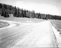
English: Media related to Utah State Route 55 (1927-1969) (SR-55), a former 2.5114 miles (4.0417 km) state highway within the Dixie National Forest in Iron County, Utah, United States, that connected Utah State Route 14 at Cedar Breaks Junction (south of Cedar Breaks National Monument) with the southern edge of Ceder Breaks National Monument. In 1969 the entire length of the highway was redesignated as part of Utah State Route 143 (SR-143), but did not conenect with the northern segment of that highway (which continued north from the nothern edge of the national monument. In 1985, the southern end of the northern segment of SR-143 was extended east to Panguitch and the entire length of the former SR-55 was redesignated as Utah State Route 148.
Subcategories
This category has the following 2 subcategories, out of 2 total.
Media in category "Utah State Route 55 (1927-1969)"
The following 5 files are in this category, out of 5 total.
-
 Begin North UT-148 to Cedar Breaks, Brian Head - panoramio.jpg 1,600 × 1,200; 801 KB
-
-
 Utah 55 2.svg 605 × 605; 4 KB
-
 Utah 55.svg 600 × 600; 11 KB
-
 Utah SR 55.svg 385 × 385; 8 KB
._;_ZION_Museum_(84485425568d493da8ac251897f08488).jpg)


