Category:Utah State Route 24
Jump to navigation
Jump to search
 | number: | (twenty-four) |
|---|---|---|
| State highways in Utah: | 4 · 5 · 6 · 7 · 8 · 9 · 10 · 11 · 12 · 13 · 14 · 15 · 16 · 17 · 18 · 19 · 20 · 21 · 22 · 23 · 24 · 25 · 26 · 27 · 28 · 29 · 30 · 31 · 32 · 33 · 34 · 35 · 36 · 37 · 38 · 39 · 40 · 41 · 42 · 43 · 44 |
state highway in southern Utah, United States   | |||||
| Upload media | |||||
| Instance of | |||||
|---|---|---|---|---|---|
| Location |
| ||||
| Transport network | |||||
| Connects with | |||||
| Owned by |
| ||||
| Maintained by |
| ||||
| Inception |
| ||||
| Length |
| ||||
| Terminus | |||||
 | |||||
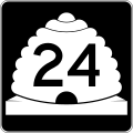
English: Media related to Utah State Route 24, a 160.5116-mile (258.3184 km) state highway in southern Utah, United States, that connects U.S. Route 50 in Salina (in Sevier County) with Four Corners Mine Road (immedidately north of the Hanksville Interstate 70/U.S. Route 50 interchange in Emery County, just east of the San Rafael Reef).
Subcategories
This category has the following 5 subcategories, out of 5 total.
*
Media in category "Utah State Route 24"
The following 3 files are in this category, out of 3 total.
-
 Utah 24.svg 600 × 600; 11 KB
-
 Utah SR 24 map.svg 1,475 × 860; 162 KB
-
 Utah SR 24.svg 385 × 385; 7 KB
