Category:Utah State Route 17 (1912-1969)
Jump to navigation
Jump to search
former state highway in Washington County, Utah, United States  | |||||
| Upload media | |||||
| Instance of | |||||
|---|---|---|---|---|---|
| Location | Washington County, Utah | ||||
| Transport network | |||||
| Connects with | |||||
| Owned by |
| ||||
| Maintained by |
| ||||
| Inception |
| ||||
| Dissolved, abolished or demolished date |
| ||||
| Length |
| ||||
| Terminus |
| ||||
| Replaced by | |||||
 | |||||
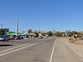
English: Media related to Utah State Route 17 (1912-1969), SR-17, a former 12.4643-mile (20.0593 km) state highway in Washington County, Utah, United States, that connected Interstate 15 (I-15) at Harrisburg Junction (northeast of Washington) with Utah State Route 15 (SR-15) at La Verkin Junction (in La Verkin). From 1927 to 1931, SR-17 also included a spur route that ran south from the main route in Hurricane to SR-16 at Big Plain Junction.
From 1912 to 1969 the westernmost section of SR-15 continued north from La Verkin Junction to end at I-15 at Anderson Junction (north of Toquerville). In 1969 the westernmost of SR-15 (north of La Verkin Junction) was switched with SR-17 so that the western terminus of SR-15 was at I-15 at Harrisburg Junction and SR-17 ran north from La Verkin Junction to Anderson Junction.
From 1912 to 1969 the westernmost section of SR-15 continued north from La Verkin Junction to end at I-15 at Anderson Junction (north of Toquerville). In 1969 the westernmost of SR-15 (north of La Verkin Junction) was switched with SR-17 so that the western terminus of SR-15 was at I-15 at Harrisburg Junction and SR-17 ran north from La Verkin Junction to Anderson Junction.
Subcategories
This category has only the following subcategory.
Media in category "Utah State Route 17 (1912-1969)"
The following 22 files are in this category, out of 22 total.
-
 East at SR-9 & SR-17, La Verkin, Utah, Oct 16.jpg 2,592 × 1,944; 2.38 MB
-
 East at SR-9 & SR-59, Hurricane, Utah, Oct 16.jpg 2,592 × 1,944; 2.4 MB
-
 END UT-9, JCT I-15, 1-2 Mile - panoramio.jpg 1,600 × 1,200; 386 KB
-
 North at SR-9 & SR-17, La Verkin, Utah, Oct 16.jpg 2,592 × 1,944; 2.39 MB
-
 North at SR-9 & SR-59, Hurricane, Utah, Oct 16.jpg 2,592 × 1,944; 2.43 MB
-
 South at SR-9 & SR-17, La Verkin, Utah, Oct 16.jpg 2,592 × 1,944; 2.45 MB
-
 South at SR-9 & SR-59, Hurricane, Utah, Oct 16.jpg 2,592 × 1,944; 2.41 MB
-

-
 Utah 17.svg 600 × 600; 11 KB
-
 Utah SR 17.svg 385 × 385; 6 KB
-
 Utah State Highway 9 - 9078948411.jpg 3,072 × 2,304; 431 KB
-
 Utah State Highway 9 - 9078949915.jpg 3,072 × 2,304; 847 KB
-
 Utah State Highway 9 - 9078950485.jpg 3,072 × 2,304; 565 KB
-
 Utah State Highway 9 - 9078957667.jpg 3,072 × 2,304; 711 KB
-
 Utah State Highway 9 - 9081171828.jpg 3,072 × 2,304; 548 KB
-
 Utah State Highway 9 - 9081172284.jpg 3,072 × 2,304; 503 KB
-
 Utah State Highway 9 - 9081172890.jpg 3,072 × 2,304; 643 KB
-
 Utah State Highway 9 - 9081174490.jpg 3,072 × 2,304; 635 KB
-
 Utah State Highway 9 - 9081176320.jpg 3,072 × 2,304; 498 KB
-
 Utah State Highway 9 - 9081180670.jpg 3,072 × 2,304; 357 KB
-
 West at SR-9 & SR-17, La Verkin, Utah, Oct 16.jpg 2,592 × 1,944; 2.36 MB
-
 West at SR-9 & SR-59, Hurricane, Utah, Oct 16.jpg 2,592 × 1,944; 2.32 MB


