Category:Upleadon
Jump to navigation
Jump to search
village in United Kingdom  | |||||
| Upload media | |||||
| Instance of | |||||
|---|---|---|---|---|---|
| Location | Forest of Dean, Gloucestershire, South West England, England | ||||
 | |||||
Subcategories
This category has the following 2 subcategories, out of 2 total.
U
- Upleadon War Memorial (4 F)
Media in category "Upleadon"
The following 88 files are in this category, out of 88 total.
-
 A very old looking postbox - geograph.org.uk - 5222100.jpg 768 × 1,024; 428 KB
-
 Bank of daffodils - geograph.org.uk - 1200971.jpg 640 × 480; 221 KB
-
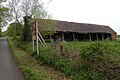
 Barns at Upleadon Court - geograph.org.uk - 4666760.jpg 1,024 × 768; 113 KB
-
 Belfry, St Mary's Church - geograph.org.uk - 5221754.jpg 768 × 1,024; 400 KB
-
 Bridge over the River Leadon - geograph.org.uk - 2224453.jpg 1,024 × 681; 248 KB
-
 Bridleway by The Woodings - geograph.org.uk - 2549442.jpg 800 × 600; 422 KB
-
 Collinpark Wood 1 - geograph.org.uk - 2549365.jpg 800 × 600; 480 KB
-
 Collinpark Wood 2 - geograph.org.uk - 2549370.jpg 800 × 600; 460 KB
-
 Country road near Okle Green - geograph.org.uk - 789486.jpg 640 × 426; 86 KB
-
 Crossroads near Okle Green - geograph.org.uk - 788988.jpg 640 × 426; 59 KB
-
 Derelict Nissen hut, 2015 - geograph.org.uk - 4589324.jpg 800 × 451; 208 KB
-
 Derelict shed - geograph.org.uk - 4677883.jpg 1,024 × 768; 275 KB
-
 Edge of pasture - geograph.org.uk - 2549052.jpg 800 × 600; 464 KB
-
 Fallen oak - geograph.org.uk - 2549406.jpg 800 × 600; 407 KB
-
 Fallen tree - geograph.org.uk - 2231357.jpg 1,024 × 681; 152 KB
-
 Farm buildings at Upleadon - geograph.org.uk - 2224463.jpg 1,024 × 681; 177 KB
-
 Farm buildings at Upleadon Court - geograph.org.uk - 4677994.jpg 1,024 × 768; 156 KB
-
 Farmland at Upleadon - geograph.org.uk - 2231359.jpg 1,024 × 681; 186 KB
-
 Footpath at The Orchards - geograph.org.uk - 5904306.jpg 1,024 × 768; 256 KB
-
 Footpath near Upleadon Court - geograph.org.uk - 774760.jpg 640 × 426; 101 KB
-
-
 Gloucester Road, Upleadon - geograph.org.uk - 5222104.jpg 1,024 × 768; 366 KB
-
 Horse jumps by a footpath - geograph.org.uk - 1971756.jpg 640 × 480; 262 KB
-
 House next to the Leadon watermill - geograph.org.uk - 1200985.jpg 640 × 480; 201 KB
-
 Looking west from Upleadon Court - geograph.org.uk - 679460.jpg 640 × 441; 100 KB
-
 Lower House Farm - geograph.org.uk - 5904333.jpg 1,024 × 768; 203 KB
-
 Meadows by the Leadon - geograph.org.uk - 1201334.jpg 640 × 480; 239 KB
-
 Meadows by the River Leadon - geograph.org.uk - 4666766.jpg 1,024 × 768; 146 KB
-
 Middletown Lane, Upleadon - geograph.org.uk - 1964119.jpg 640 × 480; 227 KB
-
 Narcissus pseudonarcissus - geograph.org.uk - 1200558.jpg 640 × 640; 318 KB
-

-
 Old waterwheel at Upleadon Mill - geograph.org.uk - 679468.jpg 440 × 640; 185 KB
-
 Orchard, Brand Green - geograph.org.uk - 5222105.jpg 1,024 × 768; 349 KB
-
 Orchards Farm and Limbury Hill - geograph.org.uk - 3881750.jpg 800 × 453; 147 KB
-
 Orchards Farm, near Upleadon - geograph.org.uk - 5395085.jpg 640 × 480; 59 KB
-
 Pastoral Leadon floodplain - geograph.org.uk - 1201355.jpg 640 × 480; 210 KB
-
 Pastoral scene near Upleadon - geograph.org.uk - 1971779.jpg 640 × 480; 217 KB
-
 Pasture land in the Leadon valley - geograph.org.uk - 4584331.jpg 800 × 451; 195 KB
-
 Path into Collinpark Wood - geograph.org.uk - 5081007.jpg 1,600 × 901; 838 KB
-
 Pond behind the hedge - geograph.org.uk - 4666763.jpg 1,024 × 768; 168 KB
-
 Pond, Upleadon - geograph.org.uk - 5222090.jpg 1,024 × 768; 331 KB
-
 Pool by the Upleadon to Corse road - geograph.org.uk - 1200995.jpg 640 × 480; 218 KB
-
 River Leadon - geograph.org.uk - 5221749.jpg 1,024 × 768; 426 KB
-

-
 River Leadon in flood - geograph.org.uk - 679519.jpg 640 × 480; 196 KB
-
 Road to Highleadon - geograph.org.uk - 4589330.jpg 800 × 451; 193 KB
-
 Roadside daffodils - geograph.org.uk - 1200551.jpg 640 × 480; 273 KB
-
 Rusty building 1 - geograph.org.uk - 1191608.jpg 640 × 480; 246 KB
-
 Rusty building 2 - geograph.org.uk - 1191610.jpg 640 × 480; 230 KB
-
 Rusty building 3 - geograph.org.uk - 1191611.jpg 640 × 480; 225 KB
-
 Rusty building 4 - geograph.org.uk - 1191615.jpg 640 × 480; 236 KB
-
 Short footpath by the church and farm - geograph.org.uk - 679441.jpg 640 × 465; 125 KB
-

-
 St Mary's Upleadon - geograph.org.uk - 5222079.jpg 1,024 × 768; 345 KB
-
 St Mary, Upleadon - geograph.org.uk - 3474932.jpg 3,456 × 2,592; 1.7 MB
-
 St Mary, Upleadon - geograph.org.uk - 3474937.jpg 3,456 × 2,592; 1.78 MB
-
 St Mary, Upleadon - geograph.org.uk - 3475749.jpg 3,329 × 2,510; 990 KB
-
 St Mary, Upleadon - geograph.org.uk - 3476073.jpg 2,793 × 1,838; 1,022 KB
-
 St Mary, Upleadon - geograph.org.uk - 3476106.jpg 3,128 × 2,336; 1.64 MB
-
 St. Mary, Upleadon, south side - geograph.org.uk - 4677873.jpg 1,024 × 768; 246 KB
-
 Stormclouds gather, St Mary Upleadon - geograph.org.uk - 3474648.jpg 3,255 × 2,140; 1.19 MB
-
 Telephone box, Upleadon - geograph.org.uk - 5222099.jpg 1,024 × 873; 415 KB
-
 The River Leadon by Upleadon Mill - geograph.org.uk - 4677897.jpg 1,024 × 768; 326 KB
-
 The tower, Upleadon St. Mary - geograph.org.uk - 4677855.jpg 768 × 1,024; 219 KB
-
 The Vale of Leadon - geograph.org.uk - 2549400.jpg 800 × 600; 433 KB
-
 Track into the distance - geograph.org.uk - 4058536.jpg 800 × 451; 179 KB
-
 Tumbledown barn - geograph.org.uk - 679537.jpg 640 × 480; 129 KB
-
 Two footpaths start here - geograph.org.uk - 1200966.jpg 640 × 480; 218 KB
-
 Tympanum, St Mary's Upleadon - geograph.org.uk - 5222086.jpg 1,024 × 768; 278 KB
-
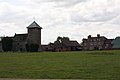
 Upleadon church and Court - geograph.org.uk - 4677836.jpg 1,024 × 768; 115 KB
-
 Upleadon Court - geograph.org.uk - 1354716.jpg 640 × 426; 84 KB
-
 Upleadon Court - geograph.org.uk - 2465436.jpg 3,088 × 2,056; 977 KB
-
 Upleadon Court - geograph.org.uk - 3475661.jpg 3,240 × 2,004; 1.21 MB
-
 Upleadon Court Farm - geograph.org.uk - 1201343.jpg 640 × 480; 198 KB
-
 Upleadon Crossroads - geograph.org.uk - 2465433.jpg 3,088 × 2,056; 1.5 MB
-
 Upleadon crossroads from Gloucester Road - geograph.org.uk - 623907.jpg 640 × 480; 111 KB
-
 Upleadon Mill - geograph.org.uk - 3475708.jpg 3,310 × 2,285; 2.16 MB
-
 Upleadon Mill - geograph.org.uk - 4666777.jpg 1,024 × 768; 294 KB
-
 Upleadon Mill - geograph.org.uk - 4677888.jpg 1,024 × 768; 256 KB
-
 Upleadon road sign - geograph.org.uk - 790296.jpg 640 × 426; 123 KB
-
 Upleadon Village Hall, Gloucester Road - geograph.org.uk - 623913.jpg 640 × 480; 176 KB
-
 Upleadon Village, Detached dwelling - geograph.org.uk - 2462344.jpg 3,088 × 2,056; 2.27 MB
-
 Upper House Farm - geograph.org.uk - 1971770.jpg 640 × 480; 241 KB
-
 Victorian letterbox, Upleadon - geograph.org.uk - 2231565.jpg 681 × 1,024; 225 KB
-
 View from Eden's Hill - geograph.org.uk - 2549426.jpg 800 × 451; 332 KB
-
 View to Grinnell's Wood - geograph.org.uk - 5015292.jpg 1,600 × 901; 668 KB
-
 Well stocked barn - geograph.org.uk - 679455.jpg 640 × 417; 125 KB
-
 Upleadon Parish Hall - geograph.org.uk - 49255.jpg 640 × 426; 171 KB


