Category:Unst
Jump to navigation
Jump to search
| Object location | | View all coordinates using: OpenStreetMap |
|---|
northernmost Shetland Island, Scotland, UK    | |||||
| Upload media | |||||
| Instance of | |||||
|---|---|---|---|---|---|
| Part of | |||||
| Location |
| ||||
| Located in or next to body of water | |||||
| Capital | |||||
| Owned by | |||||
| Operator | |||||
| Width |
| ||||
| Length |
| ||||
| Population |
| ||||
| Area |
| ||||
| Elevation above sea level |
| ||||
| official website | |||||
 | |||||

Subcategories
This category has the following 35 subcategories, out of 35 total.
- Flora of Unst (436 F)
- Maps of Unst (9 F)
B
- Balta Sound (17 F)
- Blue Mull (35 F)
C
- Colvadale (26 F)
F
- Flubersgerdie (41 F)
- Framgord (39 F)
G
- Geira (ship, 1988) (8 F)
H
- Head of Mula (9 F)
L
O
- Orknagable (12 F)
S
- Sandwick, Unst (16 F)
- SaxaVord Spaceport (8 F)
- Setters Quarry (9 F)
- Smirlees Dale (5 F)
- Snabrough Broch (4 F)
U
- Unst Show (48 F)
Media in category "Unst"
The following 147 files are in this category, out of 147 total.
-
 Above Scolla Wick - geograph.org.uk - 676703.jpg 640 × 426; 116 KB
-
 Beach below Buddabrake - geograph.org.uk - 1549804.jpg 640 × 480; 58 KB
-
 Beach near Swarta Skerry - geograph.org.uk - 1357940.jpg 640 × 426; 91 KB
-
 Boulders on Brough Taing - geograph.org.uk - 1617674.jpg 640 × 426; 65 KB
-
 Breck of Newgord - geograph.org.uk - 719566.jpg 640 × 443; 134 KB
-
 British Telecom Station at Unst, Shetland Islands - geograph.org.uk - 5884779.jpg 2,750 × 1,822; 1.7 MB
-
 Brough - geograph.org.uk - 873998.jpg 640 × 426; 67 KB
-
 Brough - geograph.org.uk - 921866.jpg 640 × 426; 101 KB
-
 Brough Taing - geograph.org.uk - 1617668.jpg 640 × 427; 98 KB
-
 Brough Taing - geograph.org.uk - 563099.jpg 640 × 426; 73 KB
-
 Buddabrake from Quoys - geograph.org.uk - 1120218.jpg 600 × 399; 138 KB
-
 Buel Houll, Buddabrake - geograph.org.uk - 1122986.jpg 640 × 426; 92 KB
-
 Burga Wick - geograph.org.uk - 563071.jpg 640 × 426; 57 KB
-
 Calm - geograph.org.uk - 858863.jpg 640 × 426; 51 KB
-
 Clammel Knowes - geograph.org.uk - 719585.jpg 640 × 426; 106 KB
-
 Clave Stack - geograph.org.uk - 525723.jpg 640 × 426; 92 KB
-
 Cliffs at Otters Geo, near Lund - geograph.org.uk - 1072054.jpg 640 × 426; 110 KB
-
 Cliffs south of the Blue Mull - geograph.org.uk - 871866.jpg 640 × 426; 110 KB
-
 Coast north of Bogligarths - geograph.org.uk - 525737.jpg 640 × 426; 56 KB
-
 Coast north of Brough - geograph.org.uk - 563114.jpg 640 × 426; 78 KB
-
 Coastline at Brough from the north - geograph.org.uk - 563123.jpg 640 × 426; 67 KB
-
 Coastline at Greff - geograph.org.uk - 933354.jpg 640 × 426; 114 KB
-
-

-

-
 Coastline north of Brough Taing - geograph.org.uk - 1617684.jpg 640 × 427; 75 KB
-
 Coastline north of Point of Burkwell - geograph.org.uk - 1378814.jpg 640 × 426; 88 KB
-
 Coastline north of Point of Burkwell - geograph.org.uk - 805349.jpg 640 × 426; 82 KB
-
 Coastline west of Skate Stack - geograph.org.uk - 921903.jpg 640 × 426; 121 KB
-
 Damp hollow on Swinna Ness, in the snow - geograph.org.uk - 1723648.jpg 800 × 534; 148 KB
-
 Dendritic drainage patterns - geograph.org.uk - 590287.jpg 640 × 426; 61 KB
-
 Dike across the end of Swinna Ness - geograph.org.uk - 1723655.jpg 800 × 533; 95 KB
-
 Drystane Dyke - geograph.org.uk - 563059.jpg 426 × 640; 76 KB
-
 Erns Hamar from the south - geograph.org.uk - 953874.jpg 640 × 426; 101 KB
-
 Fish farm at Point of Burkwell - geograph.org.uk - 1071186.jpg 640 × 426; 61 KB
-
 Frozen lochans west of Sobul - geograph.org.uk - 1616183.jpg 640 × 426; 34 KB
-
 Frozen pool west of Sobul - geograph.org.uk - 1657328.jpg 800 × 533; 99 KB
-
 Greenwell's Booth.jpg 768 × 472; 205 KB
-
 Gue - geograph.org.uk - 335663.jpg 640 × 426; 43 KB
-
 Gulls on a wall - geograph.org.uk - 424309.jpg 470 × 640; 59 KB
-
 Head of Mula from the sea - geograph.org.uk - 4763374.jpg 1,024 × 682; 148 KB
-
 Heavy sea in Scolla Wick - geograph.org.uk - 1078613.jpg 640 × 401; 66 KB
-
 HF Direction Finder - geograph.org.uk - 1548584.jpg 640 × 395; 43 KB
-
 Hill of Woodwick - geograph.org.uk - 921816.jpg 640 × 426; 58 KB
-
 Hoga Ness - geograph.org.uk - 1613755.jpg 640 × 427; 51 KB
-
 Hoga Ness - geograph.org.uk - 1613760.jpg 640 × 426; 73 KB
-
 Hoga Ness - geograph.org.uk - 1613774.jpg 640 × 427; 46 KB
-
 Hoga Ness - geograph.org.uk - 556190.jpg 640 × 426; 54 KB
-
 Hoga Ness to Blue Mull - geograph.org.uk - 1613771.jpg 640 × 426; 59 KB
-
 Ice on an un-named lochan west of Sobul - geograph.org.uk - 1717539.jpg 800 × 534; 189 KB
-
 Ice on Midga Water - geograph.org.uk - 676644.jpg 640 × 426; 42 KB
-
 Incoming fog - geograph.org.uk - 871930.jpg 640 × 426; 66 KB
-
 James Ingram after Charles Spence of Lerwick.png 1,170 × 1,512; 879 KB
-
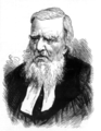
 James Ingram from Disruption Worthies.png 1,143 × 1,437; 2.5 MB
-
 Kidna Water - geograph.org.uk - 525714.jpg 640 × 426; 31 KB
-
 Kirkaby - geograph.org.uk - 525657.jpg 640 × 426; 73 KB
-
 Knowe of the Wick - geograph.org.uk - 426068.jpg 640 × 426; 56 KB
-
 Knowe of the Wick from the north - geograph.org.uk - 1378804.jpg 640 × 426; 81 KB
-
 Knowe, Caldback - geograph.org.uk - 986153.jpg 640 × 426; 82 KB
-
 Ladder and buoy, north of Colvadale - geograph.org.uk - 563118.jpg 640 × 426; 92 KB
-
 Longa Geo - geograph.org.uk - 525717.jpg 426 × 640; 73 KB
-
 Looking north from Brough - geograph.org.uk - 921858.jpg 640 × 413; 123 KB
-
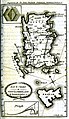 Map of Unst from the Old Statistical Account for Scotland.jpg 1,308 × 2,256; 1.74 MB
-
-
 Midga Water to Virda Field - geograph.org.uk - 676655.jpg 640 × 420; 95 KB
-
 MV Julie Rose - geograph.org.uk - 607026.jpg 640 × 480; 53 KB
-
 Ness of Queyhoose - geograph.org.uk - 533483.jpg 640 × 426; 34 KB
-

-
 North Geo of Brough - geograph.org.uk - 921863.jpg 640 × 426; 115 KB
-
 Old dyke - geograph.org.uk - 719548.jpg 640 × 426; 129 KB
-
 Outflow from the Lochs of Heuken - geograph.org.uk - 563140.jpg 426 × 640; 89 KB
-
 Pallid ivy - geograph.org.uk - 853847.jpg 640 × 426; 148 KB
-
 Peat track on Houllna Grouna - geograph.org.uk - 1124740.jpg 426 × 640; 131 KB
-
 Planticrubs - geograph.org.uk - 563086.jpg 640 × 426; 63 KB
-
 Pools above Vigga - geograph.org.uk - 597165.jpg 640 × 419; 120 KB
-
 Pools at Brough - geograph.org.uk - 563108.jpg 640 × 426; 75 KB
-
 Reservoir Reflection - geograph.org.uk - 943733.jpg 640 × 422; 35 KB
-
 Rocky beach at Point of Burkwell - geograph.org.uk - 1070814.jpg 640 × 426; 165 KB
-

-
 Ruined croft and coast at Quida - geograph.org.uk - 563041.jpg 640 × 426; 57 KB
-
 Ruined croft at Gossa Water - geograph.org.uk - 856549.jpg 640 × 426; 90 KB
-
 Ruined house at Wick, Lund - geograph.org.uk - 1182300.jpg 640 × 426; 90 KB
-
 Ruins at Sandwick, Unst - geograph.org.uk - 1509631.jpg 640 × 426; 58 KB
-
 Rumblie Geo, north of Brough Taing - geograph.org.uk - 1617699.jpg 640 × 427; 77 KB
-
 Scabious and Cottongrass - geograph.org.uk - 923077.jpg 640 × 422; 97 KB
-
 Scolla Wick - geograph.org.uk - 676711.jpg 640 × 426; 114 KB
-
 Scorda Skerry - geograph.org.uk - 1070772.jpg 640 × 426; 103 KB
-
 Sea Sandwort (Honkenya peploides) - geograph.org.uk - 858440.jpg 640 × 426; 160 KB
-

-
 Serpentine heath, Virda Field - geograph.org.uk - 317700.jpg 600 × 398; 33 KB
-
 Setter - geograph.org.uk - 335575.jpg 640 × 426; 103 KB
-
 Setter - geograph.org.uk - 719419.jpg 640 × 426; 103 KB
-
 Setter, Watlee, in the snow - geograph.org.uk - 1729605.jpg 640 × 427; 97 KB
-
 Sheep on Hill of Caldback - geograph.org.uk - 1657311.jpg 800 × 534; 176 KB
-
 Shetland Ponies 2.jpg 1,536 × 2,048; 662 KB
-
 Shetland Reel distillery.jpg 4,032 × 1,816; 2.18 MB
-
 Small burn at Buddabrake - geograph.org.uk - 1122998.jpg 640 × 426; 112 KB
-
 South Geo of Brough - geograph.org.uk - 921883.jpg 640 × 412; 120 KB
-
 Stones at Lunda Wick - geograph.org.uk - 779387.jpg 426 × 640; 113 KB
-
 Storm beach at Sheetaberg - geograph.org.uk - 1357946.jpg 426 × 640; 109 KB
-

-
 Stormy weather - geograph.org.uk - 709607.jpg 640 × 426; 43 KB
-
 Swinna Ness - geograph.org.uk - 553755.jpg 640 × 426; 62 KB
-
 Swinna Ness and Balta - geograph.org.uk - 1372705.jpg 640 × 426; 52 KB
-
 Swinna Ness in the snow - geograph.org.uk - 1723616.jpg 800 × 533; 117 KB
-

-
 The Rett - geograph.org.uk - 562318.jpg 640 × 426; 48 KB
-
 Thrift at Brough - geograph.org.uk - 921869.jpg 640 × 426; 141 KB
-
 Track to Hellier's Water - geograph.org.uk - 993489.jpg 640 × 418; 71 KB
-
 Trampmires - geograph.org.uk - 719510.jpg 640 × 426; 112 KB
-
 Trampmires - geograph.org.uk - 875831.jpg 640 × 426; 68 KB
-
 Trampmires and Vatnagarth - geograph.org.uk - 719521.jpg 640 × 426; 41 KB
-
 Trona Mires - geograph.org.uk - 798713.jpg 640 × 426; 117 KB
-

-

-
 Un-named lochan north of North Water - geograph.org.uk - 933328.jpg 640 × 426; 87 KB
-
 Unst White Wife of Watlee 01.jpg 4,080 × 3,072; 5.45 MB
-
 Unst.jpg 1,600 × 1,200; 198 KB
-
 Upper valley of the Burn of Voesgarth - geograph.org.uk - 529125.jpg 640 × 426; 59 KB
-
 Valaberg - geograph.org.uk - 873991.jpg 640 × 426; 44 KB
-
 Valaberg - geograph.org.uk - 873994.jpg 640 × 426; 43 KB
-
 Valaberg - geograph.org.uk - 921888.jpg 640 × 426; 114 KB
-
 Valley of the Burn of Caldback - geograph.org.uk - 549217.jpg 640 × 426; 54 KB
-

-
 Vatnagarth - geograph.org.uk - 394543.jpg 640 × 426; 64 KB
-
 Vatnagarth and Trampmires - geograph.org.uk - 1070901.jpg 640 × 426; 142 KB
-

-
 View from Framgord to Quida - geograph.org.uk - 943651.jpg 640 × 427; 45 KB
-
 View NE from Rekna Houll - geograph.org.uk - 818067.jpg 640 × 426; 120 KB
-
 View north from Hill of Colvadale - geograph.org.uk - 1617770.jpg 640 × 427; 56 KB
-

-
 View south from Whale Back, Colvadale - geograph.org.uk - 1617647.jpg 640 × 427; 100 KB
-

-
 View towards Huney - geograph.org.uk - 828103.jpg 640 × 383; 61 KB
-

-
 Voesgarth - geograph.org.uk - 305085.jpg 640 × 383; 61 KB
-
 Walls - geograph.org.uk - 563091.jpg 640 × 426; 67 KB
-
 West coast of Unst from Newgord - geograph.org.uk - 1322174.jpg 640 × 426; 71 KB
-
 West side of Houllna Grouna - geograph.org.uk - 862542.jpg 640 × 426; 81 KB
-
 Wet fields behind Lunda Wick - geograph.org.uk - 1182289.jpg 640 × 426; 70 KB
-
 Whale Back, Colvadale - geograph.org.uk - 1617643.jpg 640 × 427; 101 KB
-
 Wick of Brecknagarth - geograph.org.uk - 1071175.jpg 640 × 426; 109 KB
-

-
 Wick of Collaster, Westing - geograph.org.uk - 1582213.jpg 640 × 426; 64 KB
-
-
 Woolvershoull - geograph.org.uk - 654496.jpg 414 × 640; 119 KB
-
 Queyhoose - geograph.org.uk - 547950.jpg 640 × 426; 38 KB


_-_geograph.org.uk_-_858440.jpg)
_-_geograph.org.uk_-_953785.jpg)


