Category:United Kingdom photographs taken on 2020-06-09
Jump to navigation
Jump to search

Subcategories
This category has only the following subcategory.
L
Media in category "United Kingdom photographs taken on 2020-06-09"
The following 120 files are in this category, out of 120 total.
-
 -2020-06-09 Abat-son, Saint Andrew parish Church, Metton, Norfolk.JPG 5,152 × 3,864; 7.09 MB
-
 -2020-06-09 Apex cross, Saint Andrew parish Church, Metton, Norfolk.JPG 3,469 × 5,152; 2.28 MB
-
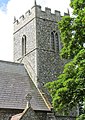 -2020-06-09 Bell tower, Saint Andrew parish Church, Metton, Norfolk.JPG 3,226 × 4,552; 3.28 MB
-
 -2020-06-09 Benchmark, Saint Andrew parish Church, Metton, Norfolk.JPG 3,134 × 3,993; 3.57 MB
-
 -2020-06-09 China City, Station Road, Cromer.JPG 3,315 × 4,317; 3.25 MB
-
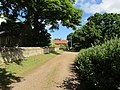 -2020-06-09 Church Lane, Metton, Norfolk.JPG 5,152 × 3,864; 6.94 MB
-
 -2020-06-09 Churchyard, Saint Andrew parish Church, Metton, Norfolk (1).JPG 5,152 × 3,864; 7.69 MB
-
 -2020-06-09 Churchyard, Saint Andrew parish Church, Metton, Norfolk (2).JPG 5,152 × 3,864; 7.99 MB
-
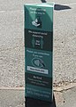 -2020-06-09 COVID-19 Social distance sign, Coop supermarket, Cromer (1).JPG 3,184 × 4,458; 4.21 MB
-
 -2020-06-09 COVID-19 Social distance sign, Coop supermarket, Cromer (2).JPG 3,574 × 4,921; 4.18 MB
-
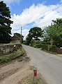
 -2020-06-09 Cromer Road, Metton, Norfolk (1).JPG 3,180 × 4,914; 3.74 MB
-
 -2020-06-09 Cromer Road, Metton, Norfolk (2).JPG 3,655 × 4,899; 3.54 MB
-
 -2020-06-09 North porch, Saint Andrew parish Church, Metton, Norfolk.JPG 3,597 × 4,400; 3.91 MB
-
 -2020-06-09 Old barn with solar panels, Metton, Norfolk.JPG 3,639 × 4,703; 4.63 MB
-
 -2020-06-09 Park Chippy, Station Road, Cromer.JPG 2,990 × 4,200; 2.28 MB
-

-

-
 -2020-06-09 Potato feild, Metton, Cromer.JPG 5,152 × 3,864; 7.97 MB
-
 -2020-06-09 Saint Andrew parish Church, Metton, Norfolk (1).JPG 5,152 × 3,864; 4.19 MB
-
 -2020-06-09 Saint Andrew parish Church, Metton, Norfolk (2).JPG 5,152 × 3,864; 7.24 MB
-
 -2020-06-09 Saint Andrew parish Church, Metton, Norfolk (3).JPG 5,152 × 3,864; 5.73 MB
-
 -2020-06-09 Saint Andrew parish Church, Metton, Norfolk (4).JPG 5,152 × 3,864; 5.41 MB
-
 -2020-06-09 Semi-detached cottage, Cromer Road, Metton, Norfolk.JPG 3,618 × 4,775; 4.55 MB
-
 -2020-06-09 Side door, Saint Andrew parish Church, Metton, Norfolk.JPG 3,611 × 4,900; 5.63 MB
-
 -2020-06-09 South elevation buttress, Saint Andrew parish Church, Metton, Norfolk.JPG 2,942 × 5,152; 4.31 MB
-
 -2020-06-09 Street name sign, Cromer Road, Metton, Norfolk.JPG 5,152 × 3,864; 7.76 MB
-
 -2020-06-09 The War memorial, Cromer Road, Metton, Norfolk (1).JPG 3,674 × 4,820; 4.59 MB
-
 -2020-06-09 The War memorial, Cromer Road, Metton, Norfolk (2).JPG 5,152 × 3,864; 8.09 MB
-
 -2020-06-09 The War memorial, Cromer Road, Metton, Norfolk.JPG 5,152 × 3,864; 6.21 MB
-
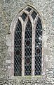
 -2020-06-09 Window, Saint Andrew parish Church, Metton, Norfolk (1).JPG 3,864 × 5,152; 6.75 MB
-
 -2020-06-09 Window, Saint Andrew parish Church, Metton, Norfolk (2).JPG 3,864 × 5,152; 6 MB
-
 -2020-06-09 Window, Saint Andrew parish Church, Metton, Norfolk (3).JPG 3,864 × 5,152; 6.52 MB
-
 -2020-06-09 Window, Saint Andrew parish Church, Metton, Norfolk (4).JPG 3,508 × 4,651; 3.54 MB
-
 -2020-06-09 Window, Saint Andrew parish Church, Metton, Norfolk (5).JPG 3,573 × 4,638; 4.64 MB
-
 -2020-06-09 Window, Saint Andrew parish Church, Metton, Norfolk (6).JPG 5,152 × 3,864; 6.13 MB
-
 -2020-06-09 Window, Saint Andrew parish Church, Metton, Norfolk (7).JPG 3,020 × 4,708; 3.74 MB
-
 508139 at Port Sunlight station.jpg 5,088 × 3,387; 21.58 MB
-
 Andricus kollari 77952465.jpg 2,048 × 1,365; 402 KB
-
 Baird Lane - geograph.org.uk - 6505077.jpg 1,024 × 683; 418 KB
-
 Baird Lane car parks - geograph.org.uk - 6505075.jpg 1,024 × 683; 462 KB
-
 Behind Langwith College - geograph.org.uk - 6505150.jpg 1,024 × 683; 464 KB
-
 BP petrol station on Brimstage Road.jpg 4,744 × 2,699; 13.27 MB
-
 Post box at Old Lancelyn Court Post Office.jpg 3,096 × 4,762; 16.39 MB
-
 Closterotomus trivialis 77827232.jpg 1,365 × 2,048; 271 KB
-
 College 10 construction - geograph.org.uk - 6505067.jpg 1,024 × 683; 518 KB
-
 Constantine College - geograph.org.uk - 6505080.jpg 1,024 × 683; 429 KB
-
 Construction at Baird Lane - geograph.org.uk - 6505076.jpg 1,024 × 683; 474 KB
-
 Construction of a new college - geograph.org.uk - 6505069.jpg 1,024 × 683; 474 KB
-
 Construction works for College 10 - geograph.org.uk - 6505072.jpg 1,024 × 683; 410 KB
-
 Construction works on Heslington East - geograph.org.uk - 6505073.jpg 1,024 × 683; 413 KB
-
 Construction works on Heslington East - geograph.org.uk - 6505143.jpg 1,024 × 683; 467 KB
-
 East Reach, Taunton (2020) 002.JPG 1,366 × 1,024; 608 KB
-
 East Reach, Taunton (2020) 003-004.JPG 1,366 × 1,366; 802 KB
-
 East Reach, Taunton (2020) 008.JPG 1,366 × 1,366; 826 KB
-
 East Reach, Taunton (2020) 009-010.JPG 1,366 × 1,024; 649 KB
-
 East Reach, Taunton (2020) 012.JPG 1,366 × 1,366; 760 KB
-
 East Reach, Taunton (2020) 013.JPG 1,366 × 1,366; 772 KB
-
 East Reach, Taunton (2020) 014.JPG 1,135 × 1,366; 218 KB
-
 East Reach, Taunton (2020) 024.JPG 1,366 × 1,024; 702 KB
-
 East Reach, Taunton (2020) 027-029.JPG 1,366 × 1,024; 552 KB
-
 East Reach, Taunton (2020) 035B-036.JPG 1,366 × 1,366; 731 KB
-
 East Reach, Taunton (2020) 038-042.JPG 1,366 × 910; 494 KB
-
 East Reach, Taunton (2020) 043-045.JPG 1,366 × 910; 565 KB
-
 East Reach, Taunton (2020) 057.JPG 1,366 × 1,024; 554 KB
-
 East Reach, Taunton (2020) 058-059.JPG 1,366 × 910; 475 KB
-
 East Reach, Taunton (2020) 060.JPG 1,366 × 1,366; 688 KB
-
 East Reach, Taunton (2020) 062-065.JPG 1,366 × 910; 630 KB
-
 East Reach, Taunton (2020) 143.JPG 1,366 × 1,366; 758 KB
-
 East Reach, Taunton (2020) 144.JPG 1,366 × 910; 522 KB
-
 East Reach, Taunton (2020) 150.JPG 1,366 × 1,024; 463 KB
-
 East Reach, Taunton (2020) 157 Racehorse Inn.JPG 1,366 × 1,366; 695 KB
-
 East Reach, Taunton (2020) Hospital entrance.JPG 1,024 × 1,366; 587 KB
-
 East Reach, Taunton (2020) Hospital.JPG 1,366 × 910; 604 KB
-
 East Reach, Taunton (2020) Nurses Institute.JPG 1,366 × 1,024; 591 KB
-
 East Reach, Taunton (2020) view westwards.JPG 1,366 × 820; 372 KB
-
 Eastgate, Taunton (2020).JPG 1,024 × 1,366; 451 KB
-
 Eurygaster testudinaria 86730324.jpg 1,943 × 1,939; 486 KB
-
 New path from Constantine College - geograph.org.uk - 6505083.jpg 1,024 × 683; 498 KB
-
 New path on Heslington East - geograph.org.uk - 6505084.jpg 1,024 × 683; 478 KB
-
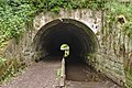 Otters Tunnel 1.jpg 5,198 × 3,462; 24.4 MB
-
 Otters Tunnel 2.jpg 5,113 × 3,405; 19.97 MB
-
 Otters Tunnel 3.jpg 5,020 × 3,343; 20.23 MB
-
 Otters Tunnel 4.jpg 5,180 × 3,450; 23.66 MB
-
 Otters Tunnel 5.jpg 5,148 × 3,428; 26.44 MB
-
 Our Lady and St Alphege's Church, Oldfield Park, Bath.jpg 1,819 × 1,944; 3.79 MB
-
 Path from Patrick Wood bridge.jpg 5,082 × 3,385; 24.28 MB
-
 Path near Constantine College - geograph.org.uk - 6505146.jpg 1,024 × 683; 484 KB
-
 Path to Brotherton Park.jpg 5,198 × 3,462; 27.32 MB
-
 Path to Constantine College - geograph.org.uk - 6505139.jpg 1,024 × 683; 485 KB
-
 Path to the Sports Village - geograph.org.uk - 6505087.jpg 1,024 × 683; 539 KB
-
 Path to the Sports Village - geograph.org.uk - 6505128.jpg 1,024 × 683; 551 KB
-
 Path to Vanderbyl Avenue.jpg 3,462 × 5,198; 25.84 MB
-
 Patrick Wood bridge 1.jpg 5,198 × 3,462; 29.61 MB
-
 Patrick Wood bridge 3.jpg 5,038 × 3,390; 21.82 MB
-
 Physcia adscendens 77946561.jpg 2,048 × 1,365; 956 KB
-
 Poa trivialis 77942767.jpg 1,365 × 2,048; 342 KB
-
 Polypogon monspeliensis flower (49).jpeg 1,536 × 2,048; 545 KB
-
 Polypogon monspeliensis plant (28).jpg 2,048 × 1,536; 1.36 MB
-
 Polypogon monspeliensis plant (29).jpeg 2,048 × 1,337; 870 KB
-
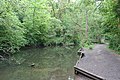
 Pool near Ron Cooke Hub - geograph.org.uk - 6505078.jpg 683 × 1,024; 414 KB
-
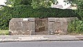
 Poplar Court lock-up garages (geograph 6503205).jpg 1,024 × 768; 97 KB
-
 Poplar Gardens lock-up garages (geograph 6503208).jpg 1,024 × 768; 175 KB
-
 Port Sunlight Post Office.jpg 4,276 × 3,270; 16.83 MB
-
 Puccinia urticata 84747146.jpg 1,294 × 1,275; 143 KB
-
 River Dibbin east of Patrick Wood bridge.jpg 5,198 × 3,462; 28.56 MB
-
 Spital pinfold exterior.jpg 4,829 × 2,770; 17.38 MB
-
 Spital pinfold interior.jpg 5,198 × 3,462; 28.03 MB
-
 Sports village and car park - geograph.org.uk - 6505133.jpg 1,024 × 683; 423 KB
-
 St Michaels House, Wakefield (geograph 6505299).jpg 1,600 × 1,200; 433 KB
-
 Substation and new path - geograph.org.uk - 6505131.jpg 1,024 × 683; 455 KB
-
 Telephone kiosks at Port Sunlight Post Office.jpg 5,077 × 3,406; 19.62 MB
-
 The route of Smithsons Tramroad, Wakefield (geograph 6502926).jpg 1,600 × 1,200; 485 KB
-
 Three Stags, Bebington.jpg 4,793 × 2,709; 11.93 MB
-
 Transport for Cornwall bus.jpg 4,128 × 2,322; 2.68 MB
-
 Uleiota planata 86729536.jpg 1,329 × 1,329; 222 KB
-
 Vanderbyl Avenue entrance to Dibbinsdale LNR.jpg 5,106 × 3,319; 21.49 MB
-
 Vent at Otter Bridge tunnel.jpg 3,388 × 5,091; 25.91 MB
-
 View east from Patrick Wood bridge.jpg 5,198 × 3,462; 28.95 MB
-
 View from above Otter Bridge tunnel.jpg 5,198 × 3,462; 24.88 MB
-
 Ynys Llanddwyn o'r mor.jpg 1,536 × 2,048; 647 KB


.JPG)
.JPG)
.JPG)
.JPG)
.JPG)
.JPG)


.JPG)
.JPG)

.JPG)
.JPG)
.JPG)
.JPG)


.JPG)
.JPG)

.JPG)
.JPG)
.JPG)
.JPG)
.JPG)
.JPG)
.JPG)


_002.JPG)
_003-004.JPG)
_008.JPG)
_009-010.JPG)
_012.JPG)
_013.JPG)
_014.JPG)
_024.JPG)
_027-029.JPG)
_035B-036.JPG)
_038-042.JPG)
_043-045.JPG)
_057.JPG)
_058-059.JPG)
_060.JPG)
_062-065.JPG)
_143.JPG)
_144.JPG)
_150.JPG)
_157_Racehorse_Inn.JPG)
_Hospital_entrance.JPG)
_Hospital.JPG)
_Nurses_Institute.JPG)
_view_westwards.JPG)
.JPG)


.jpeg)
.jpg)
.jpeg)

.jpg)
.jpg)


.jpg)


.jpg)


