Category:United Kingdom photographs taken on 2010-05-17
Jump to navigation
Jump to search

Subcategories
This category has only the following subcategory.
Media in category "United Kingdom photographs taken on 2010-05-17"
The following 100 files are in this category, out of 100 total.
-
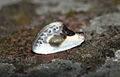 (1651) Chinese Character (Cilix glaucata) (4613859541).jpg 1,200 × 768; 848 KB
-
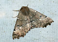 (1920) Scalloped Hazel (Odontopera bidentata) (4614474976).jpg 1,200 × 872; 1.15 MB
-
 (2092) Shuttle-shaped Dart (Agrotis puta) (4613857339).jpg 1,200 × 903; 983 KB
-
 41 Church Street (4615687695).jpg 3,064 × 4,080; 5.3 MB
-
 41 Church Street old and new (4615694799).jpg 2,807 × 5,837; 7.12 MB
-
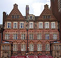 56-60 Newhall Street 1 (4616380370).jpg 4,658 × 4,438; 10.74 MB
-
 56-60 Newhall Street 2 (4615769339).jpg 1,926 × 3,803; 4.36 MB
-
 A Canongate templomkert (Canongate Kirkyard) - panoramio.jpg 1,600 × 1,200; 885 KB
-
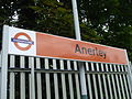
 Anerley station building 2010.JPG 2,592 × 1,944; 1.21 MB
-
 Anerley station signage 2010.JPG 2,592 × 1,944; 1.21 MB
-
 Anerley station west entrance 2010.JPG 1,944 × 2,592; 952 KB
-
 Balblair Distillery - geograph.org.uk - 1877709.jpg 1,024 × 768; 108 KB
-
 Baskerville House 1 (4616326566).jpg 7,574 × 3,608; 12.07 MB
-
 Baskerville House 2 (4616333084).jpg 3,168 × 4,592; 6.97 MB
-
 Bench mark, Wilford Street - geograph.org.uk - 1862765.jpg 1,280 × 862; 543 KB
-
 Birmingham Art Gallery Extension (4619122718).jpg 6,103 × 4,606; 11.61 MB
-
 Birmingham Main Art Gallery (4618516075) (2).jpg 4,164 × 4,159; 7.14 MB
-
 Blockbuster - Station Road - geograph.org.uk - 1865108.jpg 640 × 560; 86 KB
-
 Bright House - Station Road - geograph.org.uk - 1864602.jpg 640 × 580; 72 KB
-
 Cardiff, UK - panoramio (2).jpg 1,600 × 1,200; 418 KB
-
 Carpet Trader - Cross Gates Road - geograph.org.uk - 1864302.jpg 640 × 497; 85 KB
-
 Cash Generator - Station Road - geograph.org.uk - 1864584.jpg 492 × 640; 66 KB
-
 Central Library Brmingham (4620759355).jpg 3,894 × 3,138; 6 MB
-
 Church of St Cathen, Llangathen, Carmarthenshire.jpg 4,256 × 2,848; 6.25 MB
-

-
 Convoy of buses - geograph.org.uk - 1868928.jpg 640 × 480; 203 KB
-
 Cottage, Derrykerrib - geograph.org.uk - 1865470.jpg 640 × 480; 52 KB
-

-

-
 Crossgates Fish Bar - Austhorpe Road - geograph.org.uk - 1863907.jpg 438 × 640; 70 KB
-
 Derrykerib Townland - geograph.org.uk - 1865476.jpg 640 × 480; 65 KB
-
 Derrykerrib River - geograph.org.uk - 1865453.jpg 640 × 480; 62 KB
-
 Derrykerrib River - geograph.org.uk - 1865457.jpg 640 × 480; 45 KB
-
 Derrykerrib Road - geograph.org.uk - 1865479.jpg 640 × 480; 46 KB
-
 Derrykerrib Road - geograph.org.uk - 1865482.jpg 640 × 480; 90 KB
-
 Derrykerrib Townland - geograph.org.uk - 1865463.jpg 640 × 480; 56 KB
-
 Edinburgh, UK - panoramio (4).jpg 1,600 × 1,200; 942 KB
-
 Former National Provincial Bank (4615803163).jpg 3,984 × 2,910; 5.19 MB
-
 Former National Provincial Bank entrance (4615809651).jpg 2,929 × 4,336; 6.25 MB
-
 Gardens of Six Acres, The Ridgeway, Rothley, Leicestershire, LE7 7LE - panoramio.jpg 3,072 × 2,304; 3.03 MB
-
 GB-ENG - London - City of Westminster - Serpentine Bar And Kitchen (4897604761).jpg 4,288 × 2,848; 10.28 MB
-
 Goole station (geograph 1881215).jpg 3,456 × 2,304; 5.04 MB
-
 Goole, Boothferry Road - geograph.org.uk - 1881333.jpg 3,456 × 2,304; 5.59 MB
-
 Goole, Times Buildings, Boothferry Road - geograph.org.uk - 1881323.jpg 3,456 × 2,304; 5.62 MB
-
 Halifax - Station Road (geograph 1864579).jpg 640 × 349; 76 KB
-
 Hall of Memory 1 (4618549465).jpg 4,476 × 2,976; 6.93 MB
-
 Hall of Memory 2 (4619157002).jpg 3,156 × 4,286; 5.89 MB
-
 Hall of Memory Stained glass (4619151948).jpg 1,503 × 2,969; 2.43 MB
-
 Hotel Du Vin old eye hospital 1 (4616294986).jpg 4,296 × 3,156; 7.04 MB
-
 Hotel Du Vin old eye hospital 2 (4615673125).jpg 2,389 × 4,494; 5.92 MB
-
 HSBC - Station Road (geograph 1864610).jpg 640 × 487; 117 KB
-
 Ison harrison Solicitors - Austhorpe Road (geograph 1863906).jpg 445 × 640; 64 KB
-
 Joseph Chamberlain Memorial (4618522965).jpg 2,829 × 4,728; 6.95 MB
-
 Joseph Chamberlain Memorial 2 (4618534859).jpg 3,168 × 4,752; 7.19 MB
-
 Joseph Chamberlain Memorial 3 (4618529447).jpg 3,023 × 4,283; 8.01 MB
-
 KFC - Station Road (geograph 1862818).jpg 409 × 640; 60 KB
-

-
 Lane, Derrykerrib - geograph.org.uk - 1865474.jpg 640 × 480; 69 KB
-
 Laura Ashley and Pizza Express (geograph 1870132).jpg 640 × 480; 83 KB
-
 Leeds Building Society - Station Road (geograph 1864558).jpg 640 × 523; 80 KB
-
 Llangathen Church porch, Great War Memorial, and Grongaer Hill in the distance.jpg 4,256 × 2,848; 5.8 MB
-
 Lloyds TSB - Station Road (geograph 1864578).jpg 640 × 473; 63 KB
-
 Londis - Cross Gates Road (geograph 1864115).jpg 640 × 445; 74 KB
-
 London Sri Murugan Temple, Manor Park, E12 2.jpg 1,600 × 2,133; 380 KB
-
 London Sri Murugan Temple, Manor Park, E12 3.jpg 1,600 × 2,133; 427 KB
-
 London Sri Murugan Temple, Manor Park, E12.jpg 1,600 × 2,133; 399 KB
-
 London Sri Murugan Temple, Manor Park, London E12.jpg 2,133 × 1,600; 526 KB
-
 Looking towards Alexandra Park estate in Moss Side - panoramio.jpg 1,200 × 1,600; 390 KB
-
 Looking towards Alexandra Park from Princess Road - panoramio.jpg 1,600 × 1,200; 485 KB
-

-
 The Parish Church of Lytham, St Cuthbert - geograph.org.uk - 1884761.jpg 640 × 480; 135 KB
-
 Ocean Star (geograph 1871286).jpg 2,048 × 1,536; 1.28 MB
-
 Odessa Road VR Post Box, Forest Gate E7 - Flickr - sludgegulper.jpg 1,600 × 2,133; 792 KB
-
 Old Royal Birmingham 1 (4615644045) (2).jpg 2,532 × 4,326; 6.86 MB
-
 Old Royal Birmingham 2 (4616251944).jpg 4,464 × 3,156; 8.63 MB
-
 Penge West stn building 2010.JPG 2,592 × 1,944; 1.24 MB
-
 Penge West stn entrance 2010.JPG 1,944 × 2,592; 1.2 MB
-
 Penge West stn signage 2010.JPG 2,592 × 1,944; 1.22 MB
-
 Purple Bar. Cosmorhoe ocellata. - Flickr - gailhampshire (1).jpg 1,170 × 894; 315 KB
-
 Purple Bar. Cosmorhoe ocellata. - Flickr - gailhampshire.jpg 1,368 × 816; 185 KB
-
 Ramsay Garden - panoramio.jpg 1,200 × 1,600; 934 KB
-
 Revetment Steps and Promenade, Cleveleys - geograph.org.uk - 1872708.jpg 640 × 427; 109 KB
-
 Road at Derrykerrib - geograph.org.uk - 1865460.jpg 640 × 480; 85 KB
-
 Ronnie Lane, Manor Park, London E12 (3).jpg 2,133 × 1,600; 586 KB
-
 Santander - Station Road (geograph 1864532).jpg 640 × 630; 87 KB
-
 School bus on the way to Grittleton - geograph.org.uk - 1957810.jpg 800 × 629; 199 KB
-
 Sepentine Lake 4897615771.jpg 4,288 × 2,848; 9.81 MB
-
 Our Lady of Pity's Church, Harlescott.jpg 634 × 845; 180 KB
-
 Tower, Church of St Mary the Virgin - geograph.org.uk - 1863065.jpg 480 × 640; 153 KB
-
 St. Andrew's Church, Cleveleys - geograph.org.uk - 1872919.jpg 640 × 427; 139 KB
-
 Stone seat, Derrykerrib - geograph.org.uk - 1865485.jpg 640 × 480; 73 KB
-
 Sunset over Rhyl Flats - geograph.org.uk - 1871461.jpg 958 × 718; 255 KB
-
 Swinton Insurance - Station Road (geograph 1862826).jpg 410 × 640; 65 KB
-
 The Parish Church of Lytham, St Cuthbert - geograph.org.uk - 1884747.jpg 640 × 480; 160 KB
-

-

-

-
 The Salvation Army Town Centre Church - geograph.org.uk - 1867894.jpg 640 × 436; 103 KB
-
 The School Run... - geograph.org.uk - 1868915.jpg 640 × 480; 236 KB
-
 Trees and green space by Princess Road, Moss Side, Manchester - panoramio.jpg 1,600 × 1,200; 463 KB
_Chinese_Character_(Cilix_glaucata)_(4613859541).jpg)
_Scalloped_Hazel_(Odontopera_bidentata)_(4614474976).jpg)
_Shuttle-shaped_Dart_(Agrotis_puta)_(4613857339).jpg)
.jpg)
.jpg)
.jpg)
.jpg)
_-_panoramio.jpg)


.jpg)
.jpg)

.jpg)
_(2).jpg)


.jpg)


.jpg)


.jpg)


.jpg)
.jpg)
.jpg)

.jpg)
.jpg)


.jpg)
.jpg)
.jpg)
.jpg)
.jpg)
.jpg)
.jpg)
.jpg)
.jpg)
.jpg)
.jpg)
.jpg)


.jpg)
.jpg)

.jpg)
.jpg)


.jpg)

_(2).jpg)
.jpg)


.jpg)


.jpg)
.jpg)


.jpg)


