Category:United Kingdom photographs taken on 2010-03-30
Jump to navigation
Jump to search
Countries of Europe: Austria · Belgium · Czech Republic · Estonia · France‡ · Germany · Greece · Hungary · Italy · Latvia · Lithuania · Netherlands‡ · Norway · Poland · Portugal‡ · Romania · Russia‡ · Serbia · Slovakia · Spain‡ · Sweden · Switzerland · Turkey‡ · Ukraine · United Kingdom · Vatican City
‡: partly located in Europe
‡: partly located in Europe
| ← | 30 March 2010 | → | ||
| ← | March 2010 | → | ||

United Kingdom photographs taken on 30 March 2010.
Image files should be categorized here automatically using {{taken on}} template. Direct categorisation is also possible, if automatic is impossible.
Subcategories
This category has only the following subcategory.
L
Media in category "United Kingdom photographs taken on 2010-03-30"
The following 200 files are in this category, out of 330 total.
(previous page) (next page)-
 433 Weddings - panoramio.jpg 4,000 × 3,000; 7.13 MB
-
 A mug of coffee while the rain - panoramio.jpg 4,000 × 3,000; 4.91 MB
-
 A W Lymn. Funeral Directors, Beeston - geograph.org.uk - 1778324.jpg 640 × 480; 44 KB
-
 A14 and River Avon - geograph.org.uk - 1778696.jpg 1,014 × 761; 161 KB
-
 A419 roundabout, Cirencester - geograph.org.uk - 1778224.jpg 640 × 480; 245 KB
-
 Across fields to Catthorpe Interchange - geograph.org.uk - 1778611.jpg 1,014 × 761; 134 KB
-
 Adwalton 004.jpg 640 × 378; 47 KB
-
 Adwalton 006.jpg 2,000 × 1,427; 578 KB
-
 Adwalton 007.jpg 2,000 × 1,222; 525 KB
-
 Adwalton 008.jpg 2,000 × 1,365; 543 KB
-

-
 Alder Bank, Rawtenstall - geograph.org.uk - 1778974.jpg 640 × 480; 146 KB
-
 Lloyds Bank, Market Place, Alford (geograph 1784013).jpg 640 × 480; 88 KB
-
 All Saints' church, Viney Hill - geograph.org.uk - 1778197.jpg 640 × 480; 281 KB
-
 Anonymous Victorian cylindrical post box (narrow) E5 - Flickr - sludgegulper.jpg 1,600 × 2,133; 690 KB
-
 Approach to Brinkworth - geograph.org.uk - 1802446.jpg 640 × 480; 77 KB
-
 Approach to Purton - geograph.org.uk - 1802470.jpg 640 × 480; 84 KB
-

-
 Ashton New Road, Clayton - geograph.org.uk - 1778725.jpg 640 × 480; 128 KB
-
 Aston Drive - Aston Mount - geograph.org.uk - 1778527.jpg 640 × 480; 57 KB
-
 Aston View - Aston Mount - geograph.org.uk - 1778523.jpg 640 × 480; 58 KB
-
 Bargain Booze - Lower Town Street - geograph.org.uk - 1779022.jpg 640 × 480; 68 KB
-
 Barnardo's - Bramley Shopping Centre - geograph.org.uk - 1779509.jpg 640 × 480; 66 KB
-
 Rookery on Ferriby Road, Barton Upon Humber - geograph.org.uk - 1778735.jpg 1,000 × 610; 582 KB
-
 Beeston Ex-Servicemen's Victory Club - geograph.org.uk - 1778323.jpg 640 × 480; 71 KB
-
 Beeston Lodge, Meadow Road, Beeston - geograph.org.uk - 1778287.jpg 640 × 480; 71 KB
-
 Bend before the Blunsdon roundabout - geograph.org.uk - 1802489.jpg 640 × 480; 77 KB
-

-
 Blocked field entrance, Slugwash Lane - geograph.org.uk - 1778079.jpg 640 × 428; 106 KB
-
-

-

-
 Bridge at Ranby. - geograph.org.uk - 1777926.jpg 480 × 640; 65 KB
-
 Bridge LBE 1-22 - Swinnow Road - geograph.org.uk - 1778475.jpg 640 × 480; 97 KB
-
 Bridge LBE 1-22 - Swinnow Road - geograph.org.uk - 1778480.jpg 640 × 480; 77 KB
-
 Bridleway Crossing - geograph.org.uk - 1778731.jpg 2,816 × 2,112; 1.09 MB
-
 Bridleway towards Rayton Farm - geograph.org.uk - 1777988.jpg 480 × 640; 72 KB
-
 Bridleways beside River Avon - geograph.org.uk - 1778737.jpg 761 × 1,014; 171 KB
-
 Bright House - Bramley Shopping Centre - geograph.org.uk - 1779032.jpg 640 × 480; 101 KB
-
 Britain's most southerly bus stop - geograph.org.uk - 1780213.jpg 1,280 × 856; 148 KB
-

-
 Business opportunity for someone - geograph.org.uk - 1778969.jpg 608 × 456; 125 KB
-
 Cafe 24 - Bramley Shopping Centre - geograph.org.uk - 1779496.jpg 640 × 480; 63 KB
-
 Calf Hey Lane - geograph.org.uk - 1778338.jpg 2,816 × 2,112; 1.54 MB
-
 Cambria Drive, Dibden - geograph.org.uk - 1777890.jpg 640 × 480; 60 KB
-
 Cambridge eyesore - geograph.org.uk - 1778052.jpg 800 × 580; 120 KB
-

-

-

-

-
 Cashconverters - Bramley Shopping Centre - geograph.org.uk - 1779029.jpg 640 × 480; 108 KB
-

-

-
 Chesterfield canal . - geograph.org.uk - 1777953.jpg 640 × 480; 121 KB
-
 Chesterfield canal. - geograph.org.uk - 1777933.jpg 640 × 480; 104 KB
-
 Cheviot Drive, Dibden - geograph.org.uk - 1777876.jpg 640 × 480; 76 KB
-
 Church of St Anselm - geograph.org.uk - 1778960.jpg 1,841 × 2,454; 860 KB
-
 Clayton Chemical Works - geograph.org.uk - 1778564.jpg 640 × 493; 102 KB
-
-
 Club house St.Michael's Tennis Club - geograph.org.uk - 1778050.jpg 640 × 426; 314 KB
-
 Coastal view west of Lizard - geograph.org.uk - 1780325.jpg 1,280 × 856; 209 KB
-
 Cock and Magpie - geograph.org.uk - 1778963.jpg 2,816 × 2,112; 1.08 MB
-
 Coinagehall Street, Helston - geograph.org.uk - 1780344.jpg 1,280 × 856; 246 KB
-
 Coniston Turf Road - geograph.org.uk - 1779950.jpg 2,816 × 2,112; 1.63 MB
-
 Coniston Turf Road passing Plantation - geograph.org.uk - 1779968.jpg 2,816 × 2,112; 1.69 MB
-
 Coulsdon, Extractors at the back of restaurants - geograph.org.uk - 1778884.jpg 3,456 × 2,304; 5.22 MB
-
 Coulsdon, Surrey Garage - geograph.org.uk - 1778868.jpg 3,456 × 2,304; 3.42 MB
-
 Coulsdon, Very tall tree in Windermere Road - geograph.org.uk - 1778858.jpg 2,244 × 3,384; 7.1 MB
-
 Cowm Park Way North - geograph.org.uk - 1778970.jpg 2,816 × 2,112; 1,019 KB
-
 Cowm Park Way South - geograph.org.uk - 1778901.jpg 2,816 × 2,112; 1.51 MB
-

-
 Crop fields between Linton and Bromsash - geograph.org.uk - 1780860.jpg 640 × 438; 177 KB
-
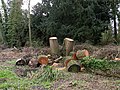
 Cross-section of felled willow - geograph.org.uk - 1778730.jpg 640 × 480; 140 KB
-
 Crossroads by Callow Hill - geograph.org.uk - 1802458.jpg 640 × 480; 52 KB
-
 Cumberland Way, Dibden - geograph.org.uk - 1777885.jpg 640 × 480; 72 KB
-
 Dales Way above Conistone Dib - geograph.org.uk - 1779892.jpg 2,816 × 2,112; 1.9 MB
-
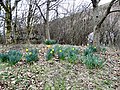 Daw Bank Daffodils - geograph.org.uk - 1778854.jpg 640 × 480; 210 KB
-
 Demolition at Clayton - geograph.org.uk - 1778688.jpg 640 × 397; 89 KB
-
 Demolition of Langness Street - geograph.org.uk - 1778704.jpg 640 × 466; 156 KB
-
 Dog and Partridge - geograph.org.uk - 1778889.jpg 2,575 × 1,932; 463 KB
-
 Drinking Fountain, Hornsea - geograph.org.uk - 1779347.jpg 1,600 × 986; 1.31 MB
-
 Dyke from Stavens Pool Bridge - geograph.org.uk - 1778472.jpg 640 × 426; 220 KB
-
 Cottage garden, East Hagbourne - geograph.org.uk - 1779350.jpg 3,008 × 2,000; 2.44 MB
-
 St. Andrew, East Hagbourne - geograph.org.uk - 1779343.jpg 2,874 × 1,911; 2.69 MB
-
 Thatched cottage, East Hagbourne - geograph.org.uk - 1779354.jpg 2,837 × 1,596; 1.92 MB
-
 All Saints, Lockinge - geograph.org.uk - 1779367.jpg 2,863 × 1,903; 1.91 MB
-
 All Saints. Lockinge - geograph.org.uk - 1779366.jpg 2,840 × 1,888; 2.18 MB
-
 East Mascalls Bridge - geograph.org.uk - 1778023.jpg 640 × 428; 144 KB
-
 East Parade, Rawtenstall - geograph.org.uk - 1778967.jpg 640 × 480; 107 KB
-
 Eastgate - geograph.org.uk - 1778939.jpg 2,816 × 2,112; 1.1 MB
-
 Eccleshall Street - geograph.org.uk - 1778574.jpg 640 × 480; 108 KB
-
 Eccleshall Street - geograph.org.uk - 1778643.jpg 640 × 543; 144 KB
-
 Egyptian Goose - panoramio (1).jpg 4,000 × 3,000; 5.75 MB
-

-
 Felled willows at Adams Road sanctuary - geograph.org.uk - 1778570.jpg 640 × 480; 163 KB
-
 Fern Road, Hythe - geograph.org.uk - 1777900.jpg 640 × 480; 53 KB
-
 Field and River crossings, near A14 - geograph.org.uk - 1778593.jpg 1,014 × 761; 180 KB
-
 Field footpath to A14 - geograph.org.uk - 1778567.jpg 1,014 × 761; 172 KB
-
 Field SW of Pound Lane, Colbury - geograph.org.uk - 1777854.jpg 640 × 480; 76 KB
-
 Fields towards Creeting Hall - geograph.org.uk - 1779018.jpg 1,024 × 768; 547 KB
-
 Fields, Catthorpe Interchange - geograph.org.uk - 1778549.jpg 1,014 × 761; 112 KB
-
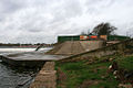 Flood alleviation works - geograph.org.uk - 1779954.jpg 1,024 × 683; 179 KB
-
 Flood alleviation works - geograph.org.uk - 1779972.jpg 1,024 × 683; 188 KB
-
 Flood tide on the River Wyre - geograph.org.uk - 1777994.jpg 640 × 426; 244 KB
-
 Footbridge across River Avon - geograph.org.uk - 1778645.jpg 1,014 × 761; 240 KB
-
 Footbridge on the Gipping path - geograph.org.uk - 1779052.jpg 768 × 1,024; 546 KB
-
 Footpath along River Braan - geograph.org.uk - 1779937.jpg 600 × 450; 136 KB
-
 Footpath meets bridleway, A14 - geograph.org.uk - 1778674.jpg 1,014 × 761; 188 KB
-
 Footpath towards A14, Swinford - geograph.org.uk - 1778573.jpg 1,014 × 761; 158 KB
-
 Footpath, Stanford Road, Swinford - geograph.org.uk - 1778538.jpg 1,014 × 761; 205 KB
-

-

-

-
 Gateway into woodland - geograph.org.uk - 1802324.jpg 640 × 480; 135 KB
-
 Get wings - panoramio.jpg 4,000 × 3,000; 5.27 MB
-

-
 Grange Terrace, Rawtenstall - geograph.org.uk - 1778975.jpg 608 × 456; 138 KB
-
 Greenfields Avenue, Totton - geograph.org.uk - 1777751.jpg 640 × 480; 58 KB
-
 Greenfields Close, Totton - geograph.org.uk - 1777744.jpg 640 × 480; 63 KB
-
 Greggs - Bramley Shopping Centre - geograph.org.uk - 1779546.jpg 640 × 511; 88 KB
-
 Halfway House - geograph.org.uk - 1778976.jpg 2,816 × 2,112; 987 KB
-
 Halifax - Bramley Shopping Centre - geograph.org.uk - 1779565.jpg 640 × 480; 75 KB
-
 Hall Street - geograph.org.uk - 1778906.jpg 2,597 × 1,948; 1.17 MB
-
 Hallford Bridge - geograph.org.uk - 1778924.jpg 2,816 × 2,112; 1.44 MB
-
 Hallford United Reformed Church - geograph.org.uk - 1778937.jpg 2,816 × 2,112; 1.07 MB
-
 Hamburger and fries - Goodman, Mayfair, London.jpg 3,312 × 2,208; 2.61 MB
-
 Hamptun Crescent, Totton - geograph.org.uk - 1777739.jpg 640 × 480; 117 KB
-
 Hessle Foreshore - panoramio.jpg 1,000 × 563; 218 KB
-
 Highfield Road - Eightlands Lane - geograph.org.uk - 1778515.jpg 640 × 480; 59 KB
-
 Hillview Road, Hythe - geograph.org.uk - 1777916.jpg 640 × 480; 53 KB
-
 Hollywood In London - panoramio.jpg 4,000 × 3,000; 5.9 MB
-

-
 Horsecroft Farm - geograph.org.uk - 1778887.jpg 2,816 × 2,112; 914 KB
-
 House at Blunsdon - geograph.org.uk - 1802495.jpg 640 × 480; 101 KB
-
 Industrial Unit at Inskip - geograph.org.uk - 1778038.jpg 640 × 426; 195 KB
-
 Inskip Baptist Church - geograph.org.uk - 1778033.jpg 640 × 426; 260 KB
-
 Killigrew Street, Falmouth - geograph.org.uk - 1780358.jpg 1,280 × 856; 247 KB
-
 Kilton Lock - geograph.org.uk - 1777980.jpg 480 × 640; 100 KB
-

-
 KW Estates - Upper Town Street - geograph.org.uk - 1779693.jpg 480 × 640; 89 KB
-
 Ladbrokes - Bramley Shopping Centre - geograph.org.uk - 1779539.jpg 640 × 480; 68 KB
-
 Lanehayes Road, Hythe - geograph.org.uk - 1777911.jpg 640 × 480; 57 KB
-
 Langness Street - geograph.org.uk - 1778586.jpg 640 × 480; 115 KB
-
 Lifeboat Station - panoramio.jpg 4,000 × 3,000; 4.45 MB
-
 Lighthouse Road, Lizard - geograph.org.uk - 1780292.jpg 1,280 × 857; 194 KB
-
 Limestone Pavement beside Bycliffe Road - geograph.org.uk - 1779924.jpg 2,816 × 2,112; 2.14 MB
-
 Lizard - geograph.org.uk - 1780297.jpg 1,280 × 856; 329 KB
-
 Lizard - geograph.org.uk - 1780306.jpg 1,280 × 856; 261 KB
-
 Lloyds pharmacy - Upper Town Street - geograph.org.uk - 1779655.jpg 640 × 527; 75 KB
-
 Lobden Golf Course - geograph.org.uk - 1778742.jpg 2,816 × 2,112; 823 KB
-

-
 Looking South East towards Light Wood - geograph.org.uk - 1778342.jpg 3,072 × 2,304; 1.22 MB
-
 Malaysian Flag.jpg 2,521 × 1,559; 613 KB
-
 Meadow Lodge, Meadow Road, Beeston - geograph.org.uk - 1778298.jpg 640 × 480; 117 KB
-
 Meandering River Avon, A14 - geograph.org.uk - 1778624.jpg 1,014 × 761; 204 KB
-
 Meandering River Avon, Swinford - geograph.org.uk - 1778656.jpg 1,014 × 761; 153 KB
-
 Memorial - panoramio (14).jpg 3,000 × 4,000; 7.69 MB
-
 Memorial Fountain,Dunkeld - geograph.org.uk - 1779918.jpg 600 × 450; 71 KB
-
-
 Mill demolition - geograph.org.uk - 1778934.jpg 2,112 × 2,816; 1.78 MB
-
 Milleniumbridge - panoramio.jpg 4,000 × 3,000; 3.9 MB
-
 Millgate Road, Rawtenstall - geograph.org.uk - 1778965.jpg 640 × 480; 100 KB
-
 Ministry Of Silly Walks - panoramio.jpg 4,000 × 3,000; 5.53 MB
-
 Minor road through Clanville - geograph.org.uk - 1802312.jpg 640 × 480; 64 KB
-

-
 Mobile Greenhouse-) - panoramio.jpg 4,000 × 3,000; 5.99 MB
-
 Moors at Capplestone Gate - geograph.org.uk - 1779997.jpg 2,816 × 2,112; 1.72 MB
-
 New Close Allotments - geograph.org.uk - 1779979.jpg 2,816 × 2,112; 2.11 MB
-
 New House Farm, Hall lane, St.Michael's - geograph.org.uk - 1778058.jpg 640 × 426; 192 KB
-
 Nutsey Close, Totton - geograph.org.uk - 1777754.jpg 640 × 480; 81 KB
-
 Old Milestone - geograph.org.uk - 1778190.jpg 1,200 × 1,600; 723 KB
-
 Old Milestone - geograph.org.uk - 1778219.jpg 1,200 × 1,600; 690 KB
-
 Old Trafford model.jpg 3,264 × 2,448; 2.16 MB
-
 Open area, near Nutsey Close, Totton - geograph.org.uk - 1777760.jpg 640 × 480; 108 KB
-
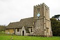
 Parish Church of St Bartholomew - geograph.org.uk - 1778429.jpg 2,586 × 1,940; 599 KB
-
 Parish Church of St Bartholomew - geograph.org.uk - 1778796.jpg 2,816 × 2,112; 1.07 MB
-
 Path to Prickshaw Lane - geograph.org.uk - 1778946.jpg 2,816 × 2,112; 1.53 MB
-
 Paul,Ringo,John And George - panoramio.jpg 4,000 × 3,000; 4.44 MB
-
 Pdsa - Bramley Shopping Centre - geograph.org.uk - 1779542.jpg 640 × 480; 86 KB
-
 Peatling's, what next^ - geograph.org.uk - 1778034.jpg 800 × 600; 149 KB
-
 Pipeline over The River Wyre - geograph.org.uk - 1777986.jpg 640 × 426; 306 KB
-
 Pizza Hut - Bramley Shopping Centre - geograph.org.uk - 1779026.jpg 640 × 480; 76 KB
-
 Polpeor Cove - geograph.org.uk - 1780199.jpg 1,280 × 856; 243 KB
-
 Polpeor Cove - geograph.org.uk - 1780201.jpg 1,280 × 856; 248 KB
-
 Polpeor Cove - geograph.org.uk - 1780204.jpg 1,280 × 856; 280 KB
-
 Polpeor Cove - geograph.org.uk - 1780207.jpg 1,280 × 856; 250 KB
-
 Polpeor Cove - geograph.org.uk - 1780211.jpg 1,280 × 856; 265 KB
-

-
 Pound Lane, Colbury - geograph.org.uk - 1777869.jpg 640 × 480; 104 KB
-

-
 Prisener Or Burger Gourmet - panoramio.jpg 3,000 × 4,000; 4.26 MB
-
 Public footpath, Bankey Wood - geograph.org.uk - 1778090.jpg 640 × 428; 149 KB
-
 Puddle on Plummerden Lane - geograph.org.uk - 1777978.jpg 640 × 428; 146 KB
-
 RAF Memorial - panoramio.jpg 4,000 × 3,000; 4.91 MB
-
 Railway - Misterton - geograph.org.uk - 1779576.jpg 640 × 480; 73 KB
-

-
 Railway bridge over River Braan - geograph.org.uk - 1779929.jpg 600 × 450; 130 KB
-

-
 Railway bridge over the River Gipping - geograph.org.uk - 1779060.jpg 1,024 × 823; 447 KB
-
 Rake Farm - geograph.org.uk - 1778831.jpg 2,816 × 2,112; 1.07 MB


.jpg)

_E5_-_Flickr_-_sludgegulper.jpg)


.jpg)


.jpg)


_-_panoramio.jpg)


