Category:United Kingdom photographs taken on 2010-03-15
Jump to navigation
Jump to search
Countries of Europe: Austria · Czech Republic · Denmark · Estonia · Finland · France‡ · Germany · Greece · Hungary · Republic of Ireland · Italy · Latvia · Malta · Netherlands‡ · Poland · Portugal‡ · Romania · Russia‡ · Slovakia · Spain‡ · Sweden · Switzerland · Turkey‡ · Ukraine · United Kingdom
Specific status: Isle of Man
‡: partly located in Europe
Specific status: Isle of Man
‡: partly located in Europe
| ← | 15 March 2010 | → | ||
| ← | March 2010 | → | ||

United Kingdom photographs taken on 15 March 2010.
Image files should be categorized here automatically using {{taken on}} template. Direct categorisation is also possible, if automatic is impossible.
Subcategories
This category has only the following subcategory.
L
Media in category "United Kingdom photographs taken on 2010-03-15"
The following 200 files are in this category, out of 546 total.
(previous page) (next page)-
 (1663) March Moth (Alsophila aescularia) (4434432211).jpg 1,400 × 1,095; 797 KB
-
 (1926) Pale Brindled Beauty (Phigalia pilosaria) (4434434557).jpg 1,400 × 1,026; 1,013 KB
-
 (2187) Common Quaker (Orthosia cerasi) (4435206104).jpg 1,400 × 1,250; 971 KB
-
 (2187) Common Quaker (Orthosia cerasi) (4435206608).jpg 1,400 × 1,092; 959 KB
-
 (2190) Hebrew Character (Orthosia gothica) (4434433497).jpg 1,400 × 1,204; 1.09 MB
-
 (2190) Hebrew Character (Orthosia gothica) (4435208768).jpg 1,400 × 1,161; 958 KB
-
 (2237) Grey Shoulder-knot (Lithophane ornitopus) (4434432809).jpg 1,400 × 1,099; 1.05 MB
-
 7-7-2005 bombings memorial, Hyde Park - geograph.org.uk - 1757618.jpg 3,648 × 2,736; 3.34 MB
-
 A field by Betterton - geograph.org.uk - 1761321.jpg 1,500 × 963; 176 KB
-
 A new track - geograph.org.uk - 1754918.jpg 640 × 428; 128 KB
-

-
 A ploughed field near West Hendred - geograph.org.uk - 1761202.jpg 1,500 × 982; 177 KB
-
 A rare view within Earshaig Forest down a forest ride. - geograph.org.uk - 1754796.jpg 3,872 × 2,592; 4.63 MB
-
-
 A view over to Walberswick Marshes - geograph.org.uk - 1758843.jpg 800 × 531; 98 KB
-
 A14 Closed Layby - geograph.org.uk - 1756923.jpg 1,024 × 768; 125 KB
-
 A14 East, Catthorpe - geograph.org.uk - 1756909.jpg 1,024 × 768; 115 KB
-
 A14 West near Catthorpe, south of Swinford - geograph.org.uk - 1756916.jpg 1,024 × 768; 116 KB
-
 A4175 north of Keynsham - geograph.org.uk - 1760422.jpg 640 × 501; 68 KB
-
 A4177 approaching Five Ways - geograph.org.uk - 1756434.jpg 640 × 427; 341 KB
-
 A431 at Swineford looking north west - geograph.org.uk - 1780631.jpg 640 × 533; 147 KB
-
 A431 Bath Road heading south east - geograph.org.uk - 1758767.jpg 640 × 359; 76 KB
-
 A52 to Grantham - geograph.org.uk - 1760628.jpg 640 × 480; 44 KB
-
 A612 Daleside Road East - geograph.org.uk - 1760523.jpg 640 × 480; 71 KB
-
 A612 Daleside Road East - geograph.org.uk - 1760525.jpg 640 × 480; 70 KB
-
 A612 Daleside Road East - geograph.org.uk - 1760527.jpg 640 × 480; 71 KB
-
 A612 roundabout - geograph.org.uk - 1760528.jpg 640 × 480; 62 KB
-
 A612 towards Burton Joyce - geograph.org.uk - 1760312.jpg 640 × 480; 63 KB
-
 A612, Nottingham Road - geograph.org.uk - 1760313.jpg 640 × 480; 73 KB
-
 A6211 to Gedling - geograph.org.uk - 1760286.jpg 640 × 480; 70 KB
-
 Abandoned greenhouses, Snowdrop Lane - geograph.org.uk - 1754575.jpg 640 × 428; 109 KB
-
 Adbolton Lane - geograph.org.uk - 1760548.jpg 640 × 480; 67 KB
-
 Adbolton Lane - geograph.org.uk - 1760560.jpg 640 × 480; 80 KB
-
 Air raid shelter, Belfast - geograph.org.uk - 1754869.jpg 640 × 499; 467 KB
-
 All Saints' Church in Lockinge - geograph.org.uk - 1769625.jpg 1,500 × 960; 295 KB
-
 Allied Mills, Manchester.jpg 3,456 × 2,592; 3.84 MB
-
 Allotments in Wych Lane - geograph.org.uk - 1762687.jpg 640 × 428; 80 KB
-
 Allt Iarairidh - geograph.org.uk - 1759741.jpg 640 × 480; 171 KB
-
 Along the Roman road to River's Farm - geograph.org.uk - 1754556.jpg 640 × 428; 167 KB
-
 Apple tree stands alone - geograph.org.uk - 1758849.jpg 531 × 800; 176 KB
-
 Appledown Lane - geograph.org.uk - 1759679.jpg 480 × 640; 101 KB
-

-
 Ardington Holy Trinity geo.uk 1769599.jpg 1,500 × 1,000; 195 KB
-
 Ardington Mill Offices - geograph.org.uk - 1769613.jpg 1,500 × 985; 255 KB
-
 Holy Trinity Church in Ardington - geograph.org.uk - 1769599.jpg 1,500 × 1,000; 148 KB
-
 Holy Trinity Church in Ardington - geograph.org.uk - 1769604.jpg 1,220 × 1,500; 339 KB
-
 Holy Trinity Church in Ardington - geograph.org.uk - 1769609.jpg 1,500 × 1,000; 169 KB
-
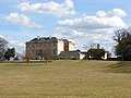
 Ardington House - geograph.org.uk - 1769594.jpg 1,500 × 975; 267 KB
-
 Ardington School - geograph.org.uk - 1769615.jpg 1,500 × 967; 176 KB
-
 Ardington Sports Field - geograph.org.uk - 1761489.jpg 1,500 × 1,000; 231 KB
-
 Ardington Sports Field - geograph.org.uk - 1769587.jpg 1,500 × 1,000; 230 KB
-
 Ardington War Memorial - geograph.org.uk - 1769602.jpg 978 × 1,500; 191 KB
-
 Ashwell Street - geograph.org.uk - 1760384.jpg 640 × 480; 70 KB
-
 Balmoral Close (1) - geograph.org.uk - 1773864.jpg 640 × 428; 76 KB
-
 Balmoral Close (2) - geograph.org.uk - 1773873.jpg 640 × 428; 52 KB
-
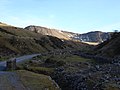 Bannau Sir Gar - geograph.org.uk - 1755218.jpg 2,816 × 2,112; 2.43 MB
-
 Barnego Road - geograph.org.uk - 1770220.jpg 640 × 480; 108 KB
-
 Barwell Lane - geograph.org.uk - 1762670.jpg 640 × 428; 73 KB
-
 Battens, Highbrook - geograph.org.uk - 1755215.jpg 640 × 428; 148 KB
-
 Bingham Road, Radcliffe on Trent - geograph.org.uk - 1760609.jpg 640 × 480; 64 KB
-
 Bluebell View - geograph.org.uk - 1754853.jpg 640 × 428; 124 KB
-
 Boats at Strawberry island. - geograph.org.uk - 1754395.jpg 640 × 480; 55 KB
-

-
 Borlum Bay, Loch Ness - geograph.org.uk - 1779187.jpg 3,648 × 2,736; 5.45 MB
-
 Botley Park Mansion - geograph.org.uk - 1755271.jpg 640 × 480; 139 KB
-
 Bottisham Locks - geograph.org.uk - 1754786.jpg 640 × 427; 55 KB
-
 Bowling Green, Whiteabbey - geograph.org.uk - 1754625.jpg 640 × 382; 105 KB
-
 Braemar Close - geograph.org.uk - 1773848.jpg 640 × 428; 50 KB
-
 Braemar Road (2) - geograph.org.uk - 1773811.jpg 640 × 428; 55 KB
-
 Braemar Road (3) - geograph.org.uk - 1773834.jpg 640 × 428; 58 KB
-
 Bridge over motorway - geograph.org.uk - 1770409.jpg 640 × 480; 75 KB
-
 Bridgend, UK - panoramio - cowbridgeguide.co.uk.jpg 2,048 × 1,536; 868 KB
-
 Bridgend, UK - panoramio.jpg 2,048 × 1,536; 676 KB
-
 Bridleway to the Downs - geograph.org.uk - 1761221.jpg 1,500 × 1,000; 313 KB
-
 Bridleway to Wantage - geograph.org.uk - 1770894.jpg 1,500 × 1,000; 244 KB
-
 Broken footbridge, south of Swinford - geograph.org.uk - 1756927.jpg 768 × 1,024; 283 KB
-
 Buffer Stop and Rail on the water edge - geograph.org.uk - 1758865.jpg 800 × 531; 165 KB
-
 Buffer Stop of the Harbour Branch - geograph.org.uk - 1758867.jpg 800 × 531; 145 KB
-
 Burton Joyce Railway Station - geograph.org.uk - 1760318.jpg 640 × 480; 86 KB
-
 Bus Stop by The Green - geograph.org.uk - 1772318.jpg 1,500 × 1,048; 346 KB
-
 Camp Road (2) - geograph.org.uk - 1773498.jpg 640 × 428; 61 KB
-
 Camp Road (3) - geograph.org.uk - 1773508.jpg 640 × 428; 57 KB
-
 Canadair Challenger 600 (4437979326).jpg 2,871 × 2,075; 4.25 MB
-
 Canal basin, Sheffield - geograph.org.uk - 1760460.jpg 518 × 389; 180 KB
-
 Car park for Vector Aerospace - geograph.org.uk - 1763815.jpg 640 × 428; 43 KB
-

-
 Car park, Parrog, Newport - geograph.org.uk - 1759737.jpg 640 × 480; 40 KB
-
 Carps Well - geograph.org.uk - 1756539.jpg 640 × 427; 430 KB
-
 Cathay Pacific Boeing 747-400F Lofting-1.jpg 1,280 × 847; 705 KB
-
 Cattle Grid - geograph.org.uk - 1760333.jpg 640 × 480; 98 KB
-
 Cheltenham Road - geograph.org.uk - 1762700.jpg 640 × 426; 87 KB
-
 Church of St Mary the Virgin, Haseley - geograph.org.uk - 1757271.jpg 640 × 480; 456 KB
-

-
 Church Street, Shelford - geograph.org.uk - 1760646.jpg 640 × 480; 73 KB
-

-
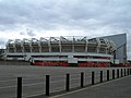 City Ground - stand - geograph-1760538.jpg 640 × 480; 54 KB
-
 Clarendon Place - geograph.org.uk - 1754628.jpg 640 × 480; 114 KB
-
 Claypit Lane Leeds - geograph.org.uk - 1763569.jpg 480 × 640; 59 KB
-
 Coat of Arms - Beith.JPG 2,288 × 1,712; 1.33 MB
-
 Colwick Country Park - geograph.org.uk - 1760411.jpg 640 × 480; 92 KB
-
 Colwick Loop Road - geograph.org.uk - 1760407.jpg 640 × 480; 61 KB
-
 Conifer Grove (1) - geograph.org.uk - 1762724.jpg 640 × 428; 59 KB
-
 Conifer Grove (2) - geograph.org.uk - 1762730.jpg 640 × 428; 50 KB
-
 Conifer Grove (3) - geograph.org.uk - 1762736.jpg 640 × 428; 65 KB
-
 Conifer Grove (4) - geograph.org.uk - 1762740.jpg 640 × 428; 61 KB
-
 Corner of a wood, Haseley - geograph.org.uk - 1756971.jpg 640 × 426; 340 KB
-
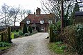
 Cottages south of Newland Wood - geograph.org.uk - 1755318.jpg 640 × 427; 466 KB
-
 Cow Lane to East Hanney - geograph.org.uk - 1770979.jpg 1,500 × 1,000; 305 KB
-
 Crocuses in Hyde Park - geograph.org.uk - 1757603.jpg 1,600 × 1,200; 760 KB
-
 Crossfield Mill - geograph.org.uk - 1754677.jpg 2,659 × 1,995; 1.05 MB
-
 Crossroads on Five Ways Road - geograph.org.uk - 1756652.jpg 640 × 427; 336 KB
-
 Cycle path beside Daleside Road - geograph.org.uk - 1760531.jpg 640 × 480; 72 KB
-
 Cycleway past Telford House - geograph.org.uk - 1761939.jpg 640 × 480; 82 KB
-
 Daffodils just opened in Hyde Park - geograph.org.uk - 1757675.jpg 1,949 × 2,424; 2.78 MB
-
 Deabill Street - geograph.org.uk - 1760390.jpg 640 × 480; 65 KB
-
 Denchworth Road at Grove - geograph.org.uk - 1770983.jpg 1,500 × 976; 185 KB
-
 Denchworth Road in Grove - geograph.org.uk - 1772320.jpg 1,500 × 982; 242 KB
-

-
 Desalis Hotel Stansed - geograph.org.uk - 1759983.jpg 640 × 429; 111 KB
-
 Disused Church, Trent Boulevard - geograph.org.uk - 1760543.jpg 480 × 640; 68 KB
-
 Disused Railway Bridge, Willow Lane - geograph.org.uk - 1760301.jpg 640 × 480; 81 KB
-
 Disused staith, Sheffield canal basin - geograph.org.uk - 1760462.jpg 518 × 389; 167 KB
-

-
 Donegall Pass PSNI station - geograph.org.uk - 1754858.jpg 640 × 576; 433 KB
-

-

-
 Drayton Lane - geograph.org.uk - 1758641.jpg 640 × 480; 207 KB
-
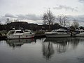
 Droylsden Marina - geograph.org.uk - 1764721.jpg 640 × 480; 69 KB
-
 Drumelzier Farm - geograph.org.uk - 1770300.jpg 960 × 600; 441 KB
-
 Dunmow - geograph.org.uk - 1762278.jpg 3,872 × 2,592; 4.3 MB
-
 Dwarf birch trees (betula nana) - geograph.org.uk - 1761249.jpg 712 × 537; 203 KB
-
 Eagle Hotel - geograph.org.uk - 1754662.jpg 2,993 × 2,245; 796 KB
-
 East Staffordshire pastoral - geograph.org.uk - 1754579.jpg 640 × 480; 260 KB
-
 Eden valley below Armathwaite - geograph.org.uk - 1776128.jpg 1,024 × 768; 175 KB
-
 Elms Farm near Wantage - geograph.org.uk - 1770961.jpg 1,500 × 1,000; 176 KB
-
 Embankment - aborted railway to Uckfield - geograph.org.uk - 1754492.jpg 640 × 428; 199 KB
-
 Embankment - aborted railway to Uckfield - geograph.org.uk - 1754500.jpg 640 × 428; 177 KB
-
 Emerys Road - geograph.org.uk - 1760370.jpg 640 × 480; 60 KB
-
 Entrance to Recycling Facility - geograph.org.uk - 1760283.jpg 640 × 480; 86 KB
-
 Entrance to the Upper Don Trail - geograph.org.uk - 1760469.jpg 389 × 518; 177 KB
-
 Eton Road - geograph.org.uk - 1762359.jpg 640 × 426; 75 KB
-
 Expanding car dealership - geograph.org.uk - 1761942.jpg 640 × 480; 87 KB
-
 Extending the showroom - geograph.org.uk - 1761941.jpg 640 × 480; 103 KB
-
 Factory alongside mill goit - geograph.org.uk - 1760470.jpg 518 × 389; 174 KB
-
 Fareham Road Dental Practice - geograph.org.uk - 1762677.jpg 640 × 428; 67 KB
-
 Farm house at Blakeshall, Worcestershire - geograph.org.uk - 1761203.jpg 480 × 640; 150 KB
-
 Farm track - geograph.org.uk - 1760360.jpg 640 × 480; 64 KB
-
 Farm track at West Ginge - geograph.org.uk - 1761293.jpg 1,500 × 978; 216 KB
-
 Farmland at Blakeshall, Worcestershire - geograph.org.uk - 1761725.jpg 800 × 507; 294 KB
-
 Farmland at Blakeshall, Worcestershire - geograph.org.uk - 1761733.jpg 640 × 477; 151 KB
-
 Farmland near Blakeshall, Worcestershire - geograph.org.uk - 1761760.jpg 1,024 × 593; 479 KB
-
 Farmland near Blakeshall, Worcestershire - geograph.org.uk - 1761771.jpg 800 × 524; 279 KB
-
 Farmland near Chase Farm - geograph.org.uk - 1760278.jpg 640 × 480; 106 KB
-
 Farmland near Spellow Farm - geograph.org.uk - 1760621.jpg 640 × 480; 61 KB
-
 Farmland off Adbolton Lane - geograph.org.uk - 1760546.jpg 640 × 480; 70 KB
-
 Farmland off Oatfield Lane - geograph.org.uk - 1760634.jpg 640 × 480; 68 KB
-
 Farmland off Stoke Ferry Lane - geograph.org.uk - 1760638.jpg 640 × 480; 54 KB
-
 Farmland off the A612 - geograph.org.uk - 1760309.jpg 640 × 480; 69 KB
-
 Field Access on the Disused Peebles to Galashiels Line - geograph.org.uk - 1772807.jpg 4,000 × 3,000; 3.73 MB
-
 Field at Loppingdale - geograph.org.uk - 1756819.jpg 640 × 429; 137 KB
-
 Field corner, Henfield Wood - geograph.org.uk - 1754642.jpg 640 × 428; 123 KB
-
 Field drain - geograph.org.uk - 1760356.jpg 640 × 480; 93 KB
-
 Field footpaths, Swinford - geograph.org.uk - 1756879.jpg 1,024 × 768; 286 KB
-
 Field path to A14 and M1 motorway - geograph.org.uk - 1756899.jpg 1,024 × 768; 150 KB
-
 Field path, Swinford - geograph.org.uk - 1756904.jpg 768 × 1,024; 159 KB
-
 Field paths south of Swinford - geograph.org.uk - 1756930.jpg 1,024 × 768; 193 KB
-

-
 Fields south of Swinford - geograph.org.uk - 1756910.jpg 768 × 1,024; 549 KB
-
 Finsbury Street - geograph.org.uk - 1755395.jpg 960 × 1,280; 212 KB
-
 Five Ways Road near Carps Well - geograph.org.uk - 1756564.jpg 640 × 480; 507 KB
-
 Footbridge over Letcombe Brook - geograph.org.uk - 1770957.jpg 1,500 × 1,000; 326 KB
-
 Footbridge over Letcombe Brook - geograph.org.uk - 1772331.jpg 1,500 × 965; 405 KB
-
 Footbridge over Letcombe Brook - geograph.org.uk - 1772350.jpg 1,500 × 1,000; 336 KB
-
 Footpath alongside Letcombe Brook - geograph.org.uk - 1772343.jpg 1,500 × 1,000; 378 KB
-
 Footpath at Lockinge - geograph.org.uk - 1769617.jpg 1,500 × 1,000; 373 KB
-
 Footpath beside disused railway - geograph.org.uk - 1760302.jpg 640 × 480; 123 KB
-
 Footpath besides Letcombe Brook - geograph.org.uk - 1770955.jpg 1,500 × 1,000; 232 KB
-
 Footpath by the hedgerow - geograph.org.uk - 1761195.jpg 1,500 × 1,000; 280 KB
-
 Footpath from fields, Swinford - geograph.org.uk - 1756935.jpg 1,024 × 768; 178 KB
-

-
 Footpath junction - geograph.org.uk - 1754955.jpg 640 × 428; 178 KB
-
 Footpath junction, outskirts of Swinford - geograph.org.uk - 1756933.jpg 1,024 × 768; 140 KB
-
 Footpath near Holme Pierrepont - geograph.org.uk - 1760586.jpg 640 × 480; 131 KB
-
 Footpath off Stoke Lane - geograph.org.uk - 1760352.jpg 640 × 480; 114 KB
-
 Footpath south of A14 - geograph.org.uk - 1756919.jpg 768 × 1,024; 174 KB
-
 Footpath to the corner of Hatton Wood - geograph.org.uk - 1755343.jpg 640 × 427; 332 KB
-
 Footpath to the Health Centre - geograph.org.uk - 1770965.jpg 1,500 × 977; 267 KB
-
 Footpath, Holme Pierrepont - geograph.org.uk - 1760594.jpg 640 × 480; 110 KB
-
 Footpath, Lady Bay Bridge - geograph.org.uk - 1760536.jpg 640 × 480; 73 KB
-

-
 Former Bethel Chapel - geograph.org.uk - 1766337.jpg 640 × 640; 108 KB
-
 Foxbury Lane - geograph.org.uk - 1763799.jpg 640 × 428; 57 KB
-
 Frogs in our pond - 1 - geograph.org.uk - 1765500.jpg 640 × 480; 140 KB
-
 Frogs in our pond - 2 - geograph.org.uk - 1765524.jpg 640 × 480; 143 KB
-
 Frogspawn in pond next to forest track - geograph.org.uk - 1754933.jpg 3,872 × 2,592; 4.42 MB
-
 Garden walls, Old Manor Farm, Haseley - geograph.org.uk - 1757294.jpg 640 × 426; 366 KB
-

-
 Glebe Farm, Haseley - geograph.org.uk - 1757320.jpg 640 × 480; 580 KB
-
 Glen Lednock - geograph.org.uk - 1755382.jpg 640 × 480; 125 KB
-
 Goldbury Hill near West Hendred - geograph.org.uk - 1761024.jpg 1,500 × 1,000; 137 KB
_March_Moth_(Alsophila_aescularia)_(4434432211).jpg)
_Pale_Brindled_Beauty_(Phigalia_pilosaria)_(4434434557).jpg)
_Common_Quaker_(Orthosia_cerasi)_(4435206104).jpg)
_Common_Quaker_(Orthosia_cerasi)_(4435206608).jpg)
_Hebrew_Character_(Orthosia_gothica)_(4434433497).jpg)
_Hebrew_Character_(Orthosia_gothica)_(4435208768).jpg)
_Grey_Shoulder-knot_(Lithophane_ornitopus)_(4434432809).jpg)


_-_geograph.org.uk_-_1773864.jpg)
_-_geograph.org.uk_-_1773873.jpg)


_-_geograph.org.uk_-_1773811.jpg)
_-_geograph.org.uk_-_1773834.jpg)


_-_geograph.org.uk_-_1773498.jpg)
_-_geograph.org.uk_-_1773508.jpg)
.jpg)


_-_geograph.org.uk_-_1762724.jpg)
_-_geograph.org.uk_-_1762730.jpg)
_-_geograph.org.uk_-_1762736.jpg)
_-_geograph.org.uk_-_1762740.jpg)


_-_geograph.org.uk_-_1761249.jpg)


