Category:United Kingdom photographs taken on 2010-02-24
Jump to navigation
Jump to search
Countries of Europe: Austria · Croatia · Czech Republic · Estonia · Finland · France‡ · Germany · Hungary · Italy · Latvia · Malta · Netherlands‡ · Norway · Poland · Romania · Russia‡ · Spain‡ · Sweden · Switzerland · Turkey‡ · Ukraine · United Kingdom
Specific status: Isle of Man
‡: partly located in Europe
Specific status: Isle of Man
‡: partly located in Europe
| ← | 24 February 2010 | → | ||
| ← | February 2010 | → | ||

United Kingdom photographs taken on 24 February 2010.
Image files should be categorized here automatically using {{taken on}} template. Direct categorisation is also possible, if automatic is impossible.
Subcategories
This category has the following 3 subcategories, out of 3 total.
Media in category "United Kingdom photographs taken on 2010-02-24"
The following 200 files are in this category, out of 358 total.
(previous page) (next page)-
-
 A first sign of spring - geograph.org.uk - 1724019.jpg 640 × 480; 202 KB
-
 A452 near Chesford bridge - geograph.org.uk - 1723887.jpg 2,000 × 1,503; 207 KB
-
 A46 Warwick bypass from the A452 roundabout - geograph.org.uk - 1723902.jpg 2,000 × 1,508; 210 KB
-
 Abandoned Mixer - geograph.org.uk - 1724241.jpg 427 × 640; 96 KB
-
 Abbey Grove, Llantarnam - geograph.org.uk - 1725607.jpg 640 × 452; 61 KB
-

-
 All Saints, Holbeton - Interior - geograph.org.uk - 1724584.jpg 834 × 577; 214 KB
-

-
 Alleyway between Black Lane and Buckley Road - geograph.org.uk - 1723871.jpg 1,500 × 1,991; 261 KB
-
 Ancient Sentinel - geograph.org.uk - 1724225.jpg 427 × 640; 107 KB
-
 Ancient track on the moor^ - geograph.org.uk - 1725062.jpg 1,024 × 1,365; 1.23 MB
-
 Approaching the summit - geograph.org.uk - 1725476.jpg 1,024 × 768; 522 KB
-

-
 Atmospheric Footpath - geograph.org.uk - 1724231.jpg 427 × 640; 76 KB
-
 B5098 to Bersham - geograph.org.uk - 1724102.jpg 640 × 427; 92 KB
-
 Beacon Lane - geograph.org.uk - 1729268.jpg 505 × 640; 154 KB
-
 Ben Geary - geograph.org.uk - 1725416.jpg 1,024 × 768; 730 KB
-
 Black Byre Burn in Black Byre Plantation - geograph.org.uk - 1725378.jpg 600 × 450; 431 KB
-
 Black Byre Burn near Lees Farm - geograph.org.uk - 1725017.jpg 600 × 450; 418 KB
-
 Blocked gateway, Knowlton - geograph.org.uk - 1734415.jpg 640 × 481; 155 KB
-
 Boars Head Pudsey - geograph.org.uk - 1724824.jpg 458 × 640; 100 KB
-
 Bridge and Byway over Black Byre Burn - geograph.org.uk - 1725381.jpg 600 × 450; 385 KB
-
 Bridge on the track to Scalpay House - geograph.org.uk - 1724522.jpg 640 × 480; 197 KB
-
 Broadway House, Topsham - geograph.org.uk - 1725089.jpg 1,024 × 768; 239 KB
-
 Bromsgrove Market Hall - Due for Demolition - geograph.org.uk - 1728767.jpg 1,600 × 1,200; 415 KB
-
 Bullimore Wood and A46 sliproad - geograph.org.uk - 1723915.jpg 2,000 × 1,492; 193 KB
-
 Bungalow near Threepwood - geograph.org.uk - 1726109.jpg 600 × 450; 256 KB
-
 Burton's Foods, Llantarnam - geograph.org.uk - 1763044.jpg 640 × 329; 65 KB
-

-
 Byway and Small Plantation - geograph.org.uk - 1725375.jpg 968 × 450; 318 KB
-
 Byway to Black Byre Plantation - geograph.org.uk - 1725370.jpg 600 × 450; 279 KB
-
 Byway to Langley Castle - geograph.org.uk - 1725409.jpg 600 × 450; 364 KB
-
 Byway to Langley Castle - geograph.org.uk - 1725412.jpg 600 × 450; 326 KB
-
 Byway to West Land Ends - geograph.org.uk - 1725391.jpg 600 × 450; 218 KB
-
 Caithness flagstone fencing - geograph.org.uk - 1724421.jpg 1,024 × 768; 292 KB
-
 Campion Hills cycle route - geograph.org.uk - 1723848.jpg 2,000 × 1,491; 212 KB
-

-
 Carrickfergus Road at Ballylagan - geograph.org.uk - 1724540.jpg 3,648 × 2,736; 2.21 MB
-
 Castle Farm Farmhouse, Langley - geograph.org.uk - 1725392.jpg 600 × 450; 213 KB
-
 Castle Farm, Langley - geograph.org.uk - 1725388.jpg 1,357 × 583; 122 KB
-
 Chinese Ornament in Museum of Methodism.jpg 480 × 640; 152 KB
-
 Church of St John the Baptist, Wasperton - geograph.org.uk - 1723930.jpg 2,000 × 1,473; 203 KB
-
 Church of St John the Baptist, Wasperton - geograph.org.uk - 1723947.jpg 2,000 × 1,493; 204 KB
-
 Church Plantation - geograph.org.uk - 1724008.jpg 640 × 480; 186 KB
-

-
 Cottage by Osier Carr - geograph.org.uk - 1724069.jpg 640 × 468; 111 KB
-
 Country lane in winter - geograph.org.uk - 1728818.jpg 518 × 389; 140 KB
-
 CourthouseArmagh.JPG 4,000 × 3,000; 2.52 MB
-
 Croes Foel Farm - geograph.org.uk - 1724189.jpg 640 × 427; 47 KB
-
 Croes Foel Smithy Site. - geograph.org.uk - 1724164.jpg 640 × 432; 88 KB
-
 Cross of Alastair's Son - geograph.org.uk - 1725047.jpg 1,024 × 768; 723 KB
-
 Cross of Alastair's Son - geograph.org.uk - 1725054.jpg 1,024 × 1,365; 1.07 MB
-
 Daniel's Lane, Broadhempston - geograph.org.uk - 1729260.jpg 640 × 480; 129 KB
-
 Debdale Outdoor centre. - geograph.org.uk - 1727289.jpg 640 × 443; 60 KB
-
 Derelict buildings by Scalpay jetty - geograph.org.uk - 1724508.jpg 640 × 480; 149 KB
-
 Digital TV switchover signs - geograph.org.uk - 1724127.jpg 480 × 640; 79 KB
-
 Disused barn and cottages - geograph.org.uk - 1724399.jpg 640 × 480; 85 KB
-
 Disused bridge across Gunnerside Gill - geograph.org.uk - 1728858.jpg 518 × 389; 171 KB
-
 Disused peat cutting - geograph.org.uk - 1724414.jpg 640 × 480; 112 KB
-
 Disused stile - geograph.org.uk - 1724032.jpg 640 × 480; 124 KB
-
 Ditch in field north of Gull Lane - geograph.org.uk - 1724033.jpg 480 × 640; 140 KB
-

-
 Dodgy bridge in a farm track - geograph.org.uk - 1725021.jpg 1,024 × 768; 831 KB
-
 Don rapids. - geograph.org.uk - 1724226.jpg 480 × 640; 71 KB
-
 Doorways to St Peter's School - geograph.org.uk - 1725811.jpg 683 × 1,024; 251 KB
-
 Drive to Hafod Y Bwch - geograph.org.uk - 1724115.jpg 427 × 640; 103 KB
-
 Driveway past high fence - geograph.org.uk - 1724073.jpg 640 × 480; 151 KB
-
 Driveway to Redhouse Farm - geograph.org.uk - 1723865.jpg 2,000 × 1,495; 229 KB
-
 Dromore Road, Omagh - geograph.org.uk - 1726086.jpg 640 × 480; 40 KB
-
 Drystone walls, Gunnerside Bottoms - geograph.org.uk - 1728850.jpg 518 × 389; 171 KB
-
 East Land Ends Farm - geograph.org.uk - 1724973.jpg 600 × 450; 234 KB
-
 East Land Ends Farm Cottages and Outbuildings - geograph.org.uk - 1724968.jpg 1,031 × 450; 259 KB
-
 Eastern slopes of Beinn Loch a' Mhuilinn - geograph.org.uk - 1724615.jpg 640 × 480; 137 KB
-
 Edgware High Street junction - geograph.org.uk - 1727904.jpg 1,594 × 1,085; 359 KB
-
 End of the track - geograph.org.uk - 1725411.jpg 1,024 × 768; 729 KB
-

-
 Entrance to Tile Barn Farm - geograph.org.uk - 1723979.jpg 2,000 × 1,479; 221 KB
-
 Entrance to Ty-Isaf Farm, Llantarnam - geograph.org.uk - 1763025.jpg 640 × 480; 75 KB
-

-
 Evidence of use - geograph.org.uk - 1727913.jpg 518 × 389; 148 KB
-
 Exeter , Burnthouse Lane - geograph.org.uk - 1724618.jpg 3,264 × 2,448; 3.31 MB
-
 Exeter , Burnthouse Lane - geograph.org.uk - 1724635.jpg 3,264 × 2,448; 3.45 MB
-
 Exeter , Burnthouse Lane and Wonford Methodist Church - geograph.org.uk - 1724653.jpg 3,264 × 2,448; 2.89 MB
-
 Exeter , Burnthouse Lane Lidl - geograph.org.uk - 1724623.jpg 3,264 × 2,448; 2.88 MB
-
 Exeter , Burnthouse Lane Lidl - geograph.org.uk - 1724643.jpg 3,264 × 2,448; 2.97 MB
-
 Exeter , Dryden and The Flying Horse - geograph.org.uk - 1724669.jpg 3,264 × 2,448; 2.96 MB
-
 Exeter , Polsloe Road - geograph.org.uk - 1724766.jpg 3,264 × 2,448; 3.21 MB
-
 Exeter , Royal Devon and Exeter Hospital - geograph.org.uk - 1724686.jpg 3,264 × 2,448; 3.13 MB
-
 Exeter , Royal Devon and Exeter Hospital - geograph.org.uk - 1724725.jpg 3,264 × 2,448; 3.18 MB
-
 Exeter , Royal Devon and Exeter Hospital - geograph.org.uk - 1724743.jpg 3,264 × 2,448; 3.46 MB
-
 Exeter , Royal Devon and Exeter Hospital Ambulance Bay - geograph.org.uk - 1724754.jpg 3,264 × 2,448; 3.24 MB
-
 Exeter , Royal Devon and Exeter Hospital, The Cedars - geograph.org.uk - 1724694.jpg 3,264 × 2,448; 3.08 MB
-
 Exeter , Royal Devon and Exeter Hospital, The Cedars - geograph.org.uk - 1724700.jpg 2,448 × 3,264; 3.87 MB
-

-
 Exeter , Wonford Street - geograph.org.uk - 1724661.jpg 3,264 × 2,448; 2.72 MB
-
 Farm track towards Trumpan - geograph.org.uk - 1725011.jpg 1,024 × 768; 801 KB
-
 Farm track towards Trumpan - geograph.org.uk - 1725030.jpg 1,024 × 768; 874 KB
-
 Fence and old wall - geograph.org.uk - 1725413.jpg 1,024 × 768; 851 KB
-
 Fence on Ben Geary - geograph.org.uk - 1725468.jpg 1,024 × 768; 446 KB
-
 Fencing to Regents Park London - geograph.org.uk - 1725776.jpg 1,024 × 860; 254 KB
-
 Field barn in winter - geograph.org.uk - 1728849.jpg 518 × 389; 164 KB
-
 Field boundary near Rhydcymerau - geograph.org.uk - 1724566.jpg 640 × 480; 100 KB
-
 Field by Coed y Fedw - geograph.org.uk - 1724320.jpg 640 × 428; 103 KB
-

-
 Footbridge Graffiti - geograph.org.uk - 1724838.jpg 1,600 × 1,067; 562 KB
-
 Footbridge in Hurn Forest - geograph.org.uk - 1727044.jpg 640 × 480; 121 KB
-
 Footbridge over the Great Central Railway - geograph.org.uk - 1723879.jpg 1,600 × 1,067; 527 KB
-
 Footbridge over the Great Central Railway - geograph.org.uk - 1724842.jpg 1,600 × 1,067; 578 KB
-

-

-
 Footpath through Lees Farm Cottages - geograph.org.uk - 1725026.jpg 600 × 450; 268 KB
-
 Footpath to Lees Farm - geograph.org.uk - 1725340.jpg 600 × 450; 236 KB
-
 Footpath to Mount Pleasant from Stratford Road - geograph.org.uk - 1723961.jpg 2,000 × 1,492; 290 KB
-
-
 Ford across Gunnerside Gill - geograph.org.uk - 1728855.jpg 518 × 389; 168 KB
-
 Forest track in south Scalpay - geograph.org.uk - 1724530.jpg 640 × 480; 173 KB
-
 Forestry footpath - geograph.org.uk - 1724557.jpg 640 × 480; 119 KB
-
 Forty years on. - geograph.org.uk - 1724833.jpg 640 × 483; 136 KB
-

-
 Friendship Tavern - geograph.org.uk - 1727282.jpg 640 × 537; 131 KB
-
 From stile to stile - geograph.org.uk - 1728833.jpg 691 × 518; 181 KB
-
 Frozen bog - geograph.org.uk - 1725525.jpg 1,024 × 768; 736 KB
-
 Gate in a new deer fence - geograph.org.uk - 1724605.jpg 640 × 480; 198 KB
-

-
-
 Green Lane to Hatton Rock - geograph.org.uk - 1723992.jpg 1,500 × 1,985; 296 KB
-
 Gull Lane - geograph.org.uk - 1723994.jpg 640 × 444; 137 KB
-
 Gunnerside Bottoms in winter - geograph.org.uk - 1728863.jpg 518 × 389; 141 KB
-

-
 Gunnerside Gill in winter - geograph.org.uk - 1727902.jpg 518 × 389; 157 KB
-
 H M S Trafalgar - geograph.org.uk - 1727296.jpg 640 × 381; 121 KB
-
 Haighs Cross - panoramio (1).jpg 3,872 × 2,592; 2.28 MB
-

-

-
 Heritage Court, Llantarnam - geograph.org.uk - 1725624.jpg 640 × 415; 64 KB
-
 Hillside above Loch na Cairidh - geograph.org.uk - 1724429.jpg 640 × 480; 141 KB
-
 Horse Power in Telford - geograph.org.uk - 1726376.jpg 1,500 × 1,125; 1,020 KB
-

-
-
 Humans to the left, dogs to the right - geograph.org.uk - 1727908.jpg 518 × 389; 149 KB
-
 Hyde Park corner, London - geograph.org.uk - 1725796.jpg 640 × 480; 102 KB
-
 Ice on the foreshore - geograph.org.uk - 1724135.jpg 640 × 480; 93 KB
-
 Icicles on the steep banks of the Swale - geograph.org.uk - 1728847.jpg 518 × 389; 181 KB
-
 Irishtown Road, Omagh - geograph.org.uk - 1723959.jpg 640 × 480; 59 KB
-
 Ivy-clad tree, Llantarnam - geograph.org.uk - 1725666.jpg 480 × 640; 114 KB
-

-
 John Fielding Gardens, Llantarnam - geograph.org.uk - 1725734.jpg 640 × 480; 62 KB
-
 John Pannell - Alquity launch - 2010-02-24 - DSC 0207 (4384267865).jpg 3,008 × 2,000; 2.32 MB
-
 John Pannell - Alquity launch - 2010-02-24 - DSC 0208 (4385034980).jpg 3,008 × 2,000; 1.43 MB
-
 John Pannell - Alquity launch - 2010-02-24 - DSC 0211 (4385038344).jpg 3,008 × 2,000; 2.2 MB
-
 John Pannell - Alquity launch - 2010-02-24 - DSC 0212 (4385040694).jpg 3,008 × 2,000; 2.31 MB
-
 John Pannell - Alquity launch - 2010-02-24 - DSC 0214 (4384280259).jpg 3,008 × 2,000; 2.36 MB
-
 John Pannell - Alquity launch - 2010-02-24 - DSC 0215 (4385044812).jpg 3,008 × 2,000; 2.25 MB
-
 John Pannell - Alquity launch - 2010-02-24 - DSC 0216 (4385046802).jpg 3,008 × 2,000; 2.3 MB
-
 John Pannell - Alquity launch - 2010-02-24 - DSC 0218 (4385048620).jpg 3,008 × 2,000; 2.13 MB
-
 John Pannell - Alquity launch - 2010-02-24 - DSC 0220 (4385050518).jpg 3,008 × 2,000; 2.19 MB
-
 John Pannell - Alquity launch - 2010-02-24 - DSC 0221 (4384290265).jpg 3,008 × 2,000; 2.4 MB
-
 John Pannell - Alquity launch - 2010-02-24 - DSC 0223 (4385054608).jpg 3,008 × 2,000; 2.24 MB
-
 John Pannell - Alquity launch - 2010-02-24 - DSC 0224 (4384294257).jpg 3,008 × 2,000; 2.41 MB
-
 John Pannell - Alquity launch - 2010-02-24 - DSC 0227 (4385058676).jpg 3,008 × 2,000; 2.4 MB
-
 John Pannell - Alquity launch - 2010-02-24 - DSC 0230 (4384298567).jpg 3,008 × 2,000; 2.47 MB
-
 John Pannell - Alquity launch - 2010-02-24 - DSC 0231 (4385063028).jpg 3,008 × 2,000; 2.37 MB
-
 John Pannell - Alquity launch - 2010-02-24 - DSC 0232 (4385065086).jpg 3,008 × 2,000; 2.43 MB
-
 John Pannell - Alquity launch - 2010-02-24 - DSC 0233 (4385067208).jpg 3,008 × 2,000; 2.39 MB
-
 John Pannell - Alquity launch - 2010-02-24 - DSC 0235 (4385069392).jpg 3,008 × 2,000; 2.54 MB
-
 John Pannell - Alquity launch - 2010-02-24 - DSC 0236 (4384309325).jpg 3,008 × 2,000; 2.65 MB
-
 John Pannell - Alquity launch - 2010-02-24 - DSC 0237 (4384311175).jpg 3,008 × 2,000; 2.28 MB
-
 John Pannell - Alquity launch - 2010-02-24 - DSC 0238 (4385074246).jpg 3,008 × 2,000; 906 KB
-
 John Pannell - Alquity launch - 2010-02-24 - DSC 0240 (4385076592).jpg 3,008 × 2,000; 2.52 MB
-
 John Pannell - Alquity launch - 2010-02-24 - DSC 0242 (4385078718).jpg 2,000 × 3,008; 2.18 MB
-
 John Pannell - Alquity launch - 2010-02-24 - DSC 0243 (4384319157).jpg 3,008 × 2,000; 2.54 MB
-
 John Pannell - Alquity launch - 2010-02-24 - DSC 0245 (4385082316).jpg 3,008 × 2,000; 1.3 MB
-
 John Pannell - Alquity launch - 2010-02-24 - DSC 0246 (4384322181).jpg 3,008 × 2,000; 2.13 MB
-
 John Pannell - Alquity launch - 2010-02-24 - DSC 0249 (4385086538).jpg 3,008 × 2,000; 2.14 MB
-
 John Pannell - Alquity launch - 2010-02-24 - DSC 0251 (4384326371).jpg 3,008 × 2,000; 2.1 MB
-
 John Pannell - Alquity launch - 2010-02-24 - DSC 0253 (4385090124).jpg 3,008 × 2,000; 1.91 MB
-
 John Pannell - Alquity launch - 2010-02-24 - DSC 0255 (4385090462).jpg 3,008 × 2,000; 350 KB
-
 John Pannell - Alquity launch - 2010-02-24 - DSC 0256 (4385092354).jpg 3,008 × 2,000; 1.91 MB
-
 John Pannell - Alquity launch - 2010-02-24 - DSC 0260 (4385094074).jpg 3,008 × 2,000; 2.02 MB
-
 John Pannell - Alquity launch - 2010-02-24 - DSC 0261 (4385096146).jpg 3,008 × 2,000; 2.15 MB
-
 John Pannell - Alquity launch - 2010-02-24 - DSC 0262 (4384336395).jpg 3,008 × 2,000; 2.36 MB
-
 John Street, Omagh - geograph.org.uk - 1723974.jpg 640 × 480; 55 KB
-
 John Wesley Ceramics.jpg 640 × 480; 147 KB
-
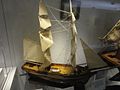 John Wesley Ship.jpg 640 × 480; 138 KB
-
 John Wesley's Death Mask.jpg 640 × 480; 138 KB
-
 Junction of green lane and Stratford Road - geograph.org.uk - 1729368.jpg 2,000 × 1,502; 316 KB
-
 Junction of Gresham Avenue and Black Lane - geograph.org.uk - 1723854.jpg 2,000 × 1,502; 237 KB
-

-

-
 Langley Burn, Haydon Bridge - geograph.org.uk - 1726132.jpg 600 × 450; 378 KB
-
 Langley Burn, Haydon Bridge - geograph.org.uk - 1726134.jpg 600 × 450; 429 KB
-
 Langley Burn, Haydon Bridge - geograph.org.uk - 1726141.jpg 600 × 450; 387 KB
-
 Langley Burn, Langley - geograph.org.uk - 1725396.jpg 600 × 450; 411 KB
-
 Langley Burn, Langley - geograph.org.uk - 1725400.jpg 600 × 450; 447 KB
-
 Langley Burn, Langley - geograph.org.uk - 1725407.jpg 600 × 450; 396 KB
-
 Lees Farm - geograph.org.uk - 1725031.jpg 600 × 450; 282 KB
-
 Llandough Hospital - Cardiff - geograph.org.uk - 1724023.jpg 1,200 × 800; 895 KB
-
 Llantarnam Church Hall - geograph.org.uk - 1725764.jpg 640 × 480; 56 KB
-
 Loch a' Mhuilinn - geograph.org.uk - 1724468.jpg 640 × 480; 162 KB


.jpg)


_-_Nils_double_neck_Wilco_London_on_24.2.10.jpg)

.jpg)
.jpg)
.jpg)
.jpg)
.jpg)
.jpg)
.jpg)
.jpg)
.jpg)
.jpg)
.jpg)
.jpg)
.jpg)
.jpg)
.jpg)
.jpg)
.jpg)
.jpg)
.jpg)
.jpg)
.jpg)
.jpg)
.jpg)
.jpg)
.jpg)
.jpg)
.jpg)
.jpg)
.jpg)
.jpg)
.jpg)
.jpg)
.jpg)
.jpg)


_-_geograph.org.uk_-_1740921.jpg)