Category:United Kingdom photographs taken on 2010-01-17
Jump to navigation
Jump to search
Countries of Europe: Austria · Belgium · Czech Republic · Denmark · Estonia · Finland · France‡ · Germany · Hungary · Italy · Latvia · Lithuania · Netherlands‡ · Norway · Poland · Romania · Russia‡ · Serbia · Slovakia · Spain‡ · Sweden · Switzerland · Turkey‡ · Ukraine · United Kingdom
‡: partly located in Europe
‡: partly located in Europe
| ← | 17 January 2010 | → | ||
| ← | January 2010 | → | ||

United Kingdom photographs taken on 17 January 2010.
Image files should be categorized here automatically using {{taken on}} template. Direct categorisation is also possible, if automatic is impossible.
Subcategories
This category has the following 2 subcategories, out of 2 total.
Media in category "United Kingdom photographs taken on 2010-01-17"
The following 200 files are in this category, out of 430 total.
(previous page) (next page)-
 (1799) Winter Moth (Operophtera brumata) (4284044467).jpg 600 × 517; 413 KB
-
 101 The Highway, New Inn - geograph.org.uk - 1670783.jpg 640 × 480; 76 KB
-
 1066 Country Walk - geograph.org.uk - 1671008.jpg 1,600 × 1,200; 485 KB
-
 109 The Highway, New Inn - geograph.org.uk - 1670686.jpg 640 × 480; 59 KB
-
 1GL Bolt, Eaglesham, Parish Church - geograph.org.uk - 1768974.jpg 640 × 480; 461 KB
-
 222010 , Claycross (4282045778).jpg 2,500 × 1,823; 2.37 MB
-
 A bit damp - geograph.org.uk - 1671732.jpg 4,000 × 3,000; 3.75 MB
-

-
 A wet Bank Road - geograph.org.uk - 1670583.jpg 640 × 480; 137 KB
-
 Across the road - geograph.org.uk - 1671798.jpg 4,000 × 3,000; 3.05 MB
-
 Aldington Post Office and store - geograph.org.uk - 1670360.jpg 640 × 480; 97 KB
-
 Aldington Post Office and store - geograph.org.uk - 1670366.jpg 640 × 480; 61 KB
-
 All Saints Church Barnacre - geograph.org.uk - 1670909.jpg 640 × 426; 304 KB
-
 Alpacas at West Chiltington - geograph.org.uk - 1672035.jpg 1,600 × 1,200; 759 KB
-
 Approach to footpath on Penns Lane - geograph.org.uk - 1670127.jpg 800 × 600; 162 KB
-
 Aqueduct over The River Wyre - geograph.org.uk - 1670864.jpg 640 × 426; 269 KB
-
 Ashton Old Road, Beswick - panoramio.jpg 3,072 × 2,304; 1.85 MB
-
 Autumn sown arable crop - geograph.org.uk - 1671552.jpg 640 × 480; 159 KB
-
 Aynho Bridge, Oxford Canal - geograph.org.uk - 1670196.jpg 1,280 × 856; 196 KB
-
 Aynho Wharf - geograph.org.uk - 1671518.jpg 1,280 × 856; 210 KB
-
 B2139 on the southern edge of Abingworth - geograph.org.uk - 1671314.jpg 1,600 × 1,200; 454 KB
-

-
 Bank Road from junction with Laws Lane - geograph.org.uk - 1672028.jpg 640 × 480; 131 KB
-
 Bank Road junction at Broad Oak - geograph.org.uk - 1672099.jpg 640 × 480; 152 KB
-
 Bank Road, leaving Aldington - geograph.org.uk - 1670496.jpg 640 × 480; 188 KB
-
 Barn conversion at Birks Farm - geograph.org.uk - 1670938.jpg 640 × 426; 228 KB
-
 Barns at Threal's Farm - geograph.org.uk - 1671238.jpg 1,600 × 1,200; 371 KB
-
 Beechamwell Road west of Drymere - geograph.org.uk - 1670069.jpg 640 × 446; 118 KB
-
 Beeches on Moles Lane - geograph.org.uk - 1671595.jpg 640 × 480; 101 KB
-
 Bench mark on 10 Market Street, Ruthin - geograph.org.uk - 1671747.jpg 640 × 480; 162 KB
-
 Bench mark on Ruthin Town Hall - geograph.org.uk - 1671580.jpg 640 × 480; 180 KB
-
 Bench mark on the Castle Hotel - geograph.org.uk - 1671598.jpg 640 × 480; 135 KB
-
 Bench mark on the lodge to Ruthin Castle - geograph.org.uk - 1671608.jpg 480 × 640; 171 KB
-
 Bench mark on the Old Gaol, Ruthin - geograph.org.uk - 1671751.jpg 640 × 480; 171 KB
-
 Birds eye view of traffic - geograph.org.uk - 1671303.jpg 1,600 × 1,200; 603 KB
-
 Bishop's Palace and Cathedral, Wells - geograph.org.uk - 1671714.jpg 640 × 480; 101 KB
-
 Bishop's Palace, Wells - geograph.org.uk - 1671702.jpg 480 × 640; 77 KB
-
 Bishop's Walk - geograph.org.uk - 1670665.jpg 640 × 427; 305 KB
-
 Brentford Locks - panoramio - Maxwell Hamilton (1).jpg 3,582 × 2,646; 2.43 MB
-
 Brew Tower - geograph.org.uk - 1670004.jpg 640 × 480; 96 KB
-
 Bridge Farm, Willington - geograph.org.uk - 1671782.jpg 4,000 × 3,000; 3.89 MB
-
 Bridge over M6 Motorway at Parkhead Farm - geograph.org.uk - 1670880.jpg 640 × 426; 250 KB
-
 Bridge over the River Lark - geograph.org.uk - 1670312.jpg 480 × 640; 186 KB
-
 Bridleway connecting Thakeham with West Chiltington - geograph.org.uk - 1671458.jpg 1,600 × 1,200; 412 KB
-
 Bus Stop on Lower Road near Kiln Court - geograph.org.uk - 1671972.jpg 1,932 × 2,580; 625 KB
-

-
 Button Oak this way^ - geograph.org.uk - 1670142.jpg 640 × 427; 107 KB
-
 Canal bridge, New Inn - geograph.org.uk - 1762533.jpg 640 × 480; 114 KB
-
 Canal, New Inn - geograph.org.uk - 1762492.jpg 640 × 480; 129 KB
-
 Castle Street, Bampton.jpg 640 × 480; 72 KB
-
 Chamossaire - geograph.org.uk - 1670130.jpg 2,592 × 1,944; 2.55 MB
-
 Chamossaire - geograph.org.uk - 1670143.jpg 1,621 × 2,160; 606 KB
-
 Chapel Road - geograph.org.uk - 1671432.jpg 640 × 480; 167 KB
-
 Clairwain, New Inn - geograph.org.uk - 1670719.jpg 640 × 480; 54 KB
-
 Clap Hill, Aldington - geograph.org.uk - 1670358.jpg 660 × 401; 60 KB
-

-
 Cockleycley Wood - geograph.org.uk - 1670020.jpg 640 × 480; 110 KB
-

-
 Conifer windbreak - geograph.org.uk - 1671565.jpg 640 × 480; 150 KB
-

-

-
 Corner tower, Bishop's Palace, Wells - geograph.org.uk - 1671712.jpg 480 × 640; 94 KB
-
 Cottages in Thames Street, Sonning-geograph-1977130.jpg 640 × 480; 100 KB
-
 Court Cottages - geograph.org.uk - 1670674.jpg 640 × 410; 300 KB
-
 Crossroads in Kings Sutton - geograph.org.uk - 1670053.jpg 856 × 1,280; 193 KB
-
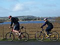 Cyclists, Herriotts Bridge - geograph.org.uk - 1670365.jpg 640 × 480; 117 KB
-
 Dere Street Farm sign - geograph.org.uk - 1668462.jpg 640 × 427; 119 KB
-
 Dismantled Railway (geograph 1667264).jpg 640 × 480; 94 KB
-
 Dowles Brook - geograph.org.uk - 1670158.jpg 640 × 427; 84 KB
-
 Dowles Brook, Wyre Forest. - geograph.org.uk - 1670129.jpg 640 × 427; 105 KB
-
 Downhill towards the River Stor - geograph.org.uk - 1670133.jpg 1,600 × 1,200; 706 KB
-
 Dragonhill Road - geograph.org.uk - 1671605.jpg 1,500 × 975; 173 KB
-
 Eachelhurst Road bridge, Penns Lane - geograph.org.uk - 1670236.jpg 480 × 640; 55 KB
-
 Earnwood Copse, Wyre Forest. - geograph.org.uk - 1670114.jpg 640 × 427; 80 KB
-
 Entering Aldington on Bank Road - geograph.org.uk - 1671024.jpg 640 × 409; 85 KB
-
 Entrance to Panteg Cemetery - geograph.org.uk - 1762436.jpg 640 × 480; 116 KB
-

-

-
 Entrance to the Arminghall car boot site - geograph.org.uk - 1670150.jpg 640 × 480; 120 KB
-
 Entrance to the Old Deanery, Wells - geograph.org.uk - 1671692.jpg 640 × 480; 84 KB
-
 Fallen tree by course of old Roman Road - geograph.org.uk - 1671204.jpg 1,600 × 1,200; 522 KB
-

-
 Farm Road near Burns Farm - geograph.org.uk - 1670933.jpg 640 × 426; 303 KB
-
 Farm road to Moorhouse and Oakenclough - geograph.org.uk - 1670947.jpg 640 × 426; 265 KB
-
 Farm Shop and joinery on West Chiltington Road - geograph.org.uk - 1672249.jpg 1,600 × 1,200; 669 KB
-
 Farm track across the M6 Motorway - geograph.org.uk - 1670895.jpg 640 × 426; 218 KB
-
 Farm track at Burns Farm - geograph.org.uk - 1670925.jpg 640 × 426; 293 KB
-
 Farm track off Bank Road - geograph.org.uk - 1671027.jpg 640 × 480; 205 KB
-
 Farmland and church - geograph.org.uk - 1671793.jpg 4,000 × 3,000; 2.98 MB
-
 Farmland on the flank of Warden Hill - geograph.org.uk - 1670984.jpg 1,600 × 1,200; 492 KB
-
 Field and drain - geograph.org.uk - 1670661.jpg 640 × 427; 290 KB
-
 Field edge footpath - geograph.org.uk - 1671791.jpg 640 × 480; 113 KB
-
 Field edge path - geograph.org.uk - 1671804.jpg 4,000 × 3,000; 3.14 MB
-
 Fields near Cockington Woods Farm - geograph.org.uk - 1671394.jpg 640 × 469; 58 KB
-
 Fields to the N of Bank Road - geograph.org.uk - 1670603.jpg 640 × 480; 170 KB
-
-
 Flats, off Penns Lane - geograph.org.uk - 1671635.jpg 640 × 480; 55 KB
-
 Flood meadow beside Stoke Road - geograph.org.uk - 1670220.jpg 640 × 480; 103 KB
-
 Flood on the River Tas - geograph.org.uk - 1670224.jpg 640 × 480; 130 KB
-
 Flooded fields near Aynho - geograph.org.uk - 1670743.jpg 1,280 × 856; 203 KB
-
 Flooded meadow beside Stoke Road - geograph.org.uk - 1670235.jpg 640 × 575; 133 KB
-
 Flooded pasture beside Stoke Road - geograph.org.uk - 1670215.jpg 640 × 502; 153 KB
-
 Flooded pastures by the River Tas - geograph.org.uk - 1670228.jpg 640 × 501; 124 KB
-
 Flooded pastures north of the A47 road - geograph.org.uk - 1670184.jpg 640 × 481; 108 KB
-

-
 Flyover, Birchfield Road, A34 - geograph.org.uk - 1671638.jpg 1,024 × 768; 111 KB
-
 Footbridge and Tunnel entrance, Handsworth Wood - geograph.org.uk - 1671649.jpg 1,024 × 768; 177 KB
-
 Footbridge on Millennium Way to Scorton - geograph.org.uk - 1670857.jpg 640 × 426; 337 KB
-

-
 Footpath by Long Crossey Wood - geograph.org.uk - 1670896.jpg 640 × 426; 336 KB
-
 Footpath by-pass - geograph.org.uk - 1670868.jpg 640 × 426; 324 KB
-

-
 Footpath down from Penshaw Hill near Sunderland - geograph.org.uk - 1672361.jpg 1,810 × 1,264; 972 KB
-
 Footpath junction with Southlands Lane West Chiltington - geograph.org.uk - 1671476.jpg 1,600 × 1,200; 859 KB
-
 Footpath opens out towards golf course - geograph.org.uk - 1671633.jpg 800 × 600; 159 KB
-
 Footpath through Sussex Mushroom Ltd - geograph.org.uk - 1671453.jpg 1,600 × 1,200; 581 KB
-
 Footpath to All Saints Church Barnacre - geograph.org.uk - 1670908.jpg 640 × 426; 305 KB
-
 Footpath to Burns Farm - geograph.org.uk - 1670939.jpg 640 × 426; 322 KB
-
 Footpath to Flood Street - geograph.org.uk - 1672070.jpg 640 × 480; 117 KB
-
 Footpath to Mill Road near Nutbourne Common - geograph.org.uk - 1672041.jpg 1,600 × 1,200; 787 KB
-
 Footpath to the car park - geograph.org.uk - 1671591.jpg 1,500 × 977; 221 KB
-
 Footpath to White Horse Hill - geograph.org.uk - 1671621.jpg 1,500 × 1,000; 138 KB
-

-
 Footpath, sign and stile, Penns Lane - geograph.org.uk - 1670164.jpg 800 × 600; 115 KB
-
 Ford across Grizedale Brook - geograph.org.uk - 1670892.jpg 640 × 426; 293 KB
-
 Forest track to Loch Maberry - geograph.org.uk - 1768817.jpg 3,264 × 2,448; 1.62 MB
-
 Former IMI entrance, Perry Barr - geograph.org.uk - 1671639.jpg 800 × 600; 146 KB
-
 Former IMI works gatehouse - geograph.org.uk - 1671641.jpg 800 × 600; 90 KB
-
 Former Rising Sun pub, New Inn - geograph.org.uk - 1670737.jpg 640 × 496; 69 KB
-
 Free-range pigs south of Old Larch Wood - geograph.org.uk - 1670027.jpg 640 × 480; 148 KB
-
 Frith Road off Bank Road - geograph.org.uk - 1670372.jpg 640 × 480; 148 KB
-
 Frozen Loch Maberry - geograph.org.uk - 1768820.jpg 3,264 × 2,448; 1.74 MB
-
 Frozen pond - geograph.org.uk - 1671761.jpg 4,000 × 3,000; 3.81 MB
-
 Gallops alongside footpath to Tickletag Farm - geograph.org.uk - 1670163.jpg 1,600 × 1,200; 492 KB
-
 Game cover and the reason - geograph.org.uk - 1671505.jpg 640 × 480; 154 KB
-
 Gate and sheep pen, Hazelhurst Lane - geograph.org.uk - 1670890.jpg 640 × 426; 305 KB
-
 Gate to the footpath to the car park - geograph.org.uk - 1671599.jpg 1,500 × 1,000; 317 KB
-
 Gay Street junction with Stream Lane - geograph.org.uk - 1672095.jpg 1,600 × 1,200; 518 KB
-
 Gilmour Place - geograph.org.uk - 1672256.jpg 640 × 359; 66 KB
-
 Golders Green Road - geograph.org.uk - 1671834.jpg 1,600 × 1,137; 526 KB
-

-

-
 Grand chimneys, Sonning-geograph-1977132.jpg 640 × 480; 90 KB
-

-
 Greenhurst Lane junction with West Chiltington Road - geograph.org.uk - 1671051.jpg 1,600 × 1,200; 676 KB
-
 Greenhurst Lane SE to the B 2139 - geograph.org.uk - 1671060.jpg 1,600 × 1,200; 798 KB
-
 Grizedale Brook - geograph.org.uk - 1670888.jpg 640 × 426; 277 KB
-
 Gurdwara Bebe Nanaki Ji, Handsworth - geograph.org.uk - 1704354.jpg 768 × 1,024; 150 KB
-
 West Tower, Hambleden Church - geograph.org.uk - 1672353.jpg 480 × 640; 64 KB
-
 Hamelin Way - geograph.org.uk - 1671579.jpg 640 × 480; 60 KB
-
 Hand Farm Road, New Inn - geograph.org.uk - 1762096.jpg 640 × 427; 72 KB
-
 Handsworth Wood Station (site of) - geograph.org.uk - 1671644.jpg 1,024 × 768; 173 KB
-
 Handsworth Wood Station (site of) - geograph.org.uk - 1671646.jpg 1,024 × 768; 204 KB
-

-
 Higher Lane Barnacre - geograph.org.uk - 1670917.jpg 640 × 426; 341 KB
-
 Highwall Spinney from near Burmington - geograph.org.uk - 1671741.jpg 4,000 × 3,000; 2.82 MB
-
 Highway Stores, New Inn - geograph.org.uk - 1670660.jpg 640 × 426; 56 KB
-
 Hillcrest Road, New Inn - geograph.org.uk - 1762103.jpg 640 × 513; 75 KB
-
 Horse paddock in Worlington - geograph.org.uk - 1671474.jpg 640 × 480; 117 KB
-
 Horse paddocks - geograph.org.uk - 1670336.jpg 640 × 480; 134 KB
-
 Horse riding, Golf Road, New Inn - geograph.org.uk - 1761459.jpg 640 × 453; 79 KB
-
 House next to Parkhead Farm - geograph.org.uk - 1670884.jpg 640 × 426; 254 KB
-

-
 Ice on Harlaw Reservoir - geograph.org.uk - 1670001.jpg 720 × 540; 168 KB
-
 Ice on Harlaw Reservoir - geograph.org.uk - 1670028.jpg 720 × 527; 178 KB
-
 Ings Goit - geograph.org.uk - 1670380.jpg 4,000 × 3,000; 4.55 MB
-
 Interior of St Issui church - geograph.org.uk - 1740218.jpg 640 × 480; 76 KB
-
 Juggs Lane leading off Southlands Lane - geograph.org.uk - 1671514.jpg 1,600 × 1,200; 710 KB
-
 Junction at Higher Lane Barnacre - geograph.org.uk - 1670921.jpg 640 × 426; 286 KB
-

-

-
 Junction of footpath and Penns Lane - geograph.org.uk - 1670174.jpg 600 × 800; 211 KB
-
 Junction of footpath with bridleway - geograph.org.uk - 1671465.jpg 1,600 × 1,200; 643 KB
-

-
 Junction on Marldon Road - geograph.org.uk - 1671352.jpg 640 × 448; 115 KB
-
 Junction on St Nicholas Road - geograph.org.uk - 1671976.jpg 2,580 × 1,932; 1.02 MB
-
 Kissing gate, Stanton Drew - geograph.org.uk - 1670138.jpg 640 × 481; 167 KB
-
 Laburnum Drive, New Inn - geograph.org.uk - 1761406.jpg 640 × 354; 53 KB
-
 Lady Bridge, Moor Lane - geograph.org.uk - 1670381.jpg 4,000 × 3,000; 4.65 MB
-
 Lambeth Road, Southwark - geograph.org.uk - 1668460.jpg 3,872 × 2,592; 5.64 MB
-
 Lark Close, Worlington - geograph.org.uk - 1671490.jpg 640 × 480; 112 KB
-
 Larks Reach entrance - geograph.org.uk - 1670266.jpg 640 × 480; 146 KB
-
 Lay-by on the A420 - geograph.org.uk - 1671568.jpg 1,500 × 1,000; 135 KB
-
 Lionfield - geograph.org.uk - 1671980.jpg 2,580 × 1,932; 888 KB
-
 Llanthony Priory ruins after snow - geograph.org.uk - 1738473.jpg 640 × 480; 93 KB
-
-
 Lodge Wood houses, New Inn - geograph.org.uk - 1762499.jpg 640 × 480; 68 KB
-
 Looking along Lodge Wood, New Inn - geograph.org.uk - 1762510.jpg 640 × 480; 86 KB
-
 Looking from a viewpoint on White Horse Hill - geograph.org.uk - 1671613.jpg 1,500 × 1,000; 133 KB
-

-
 Looking W along Frith Road - geograph.org.uk - 1670546.jpg 640 × 480; 145 KB
-
 Manor Farm, Barcheston - geograph.org.uk - 1671786.jpg 4,000 × 3,000; 2.68 MB
-
 Manor Farm, Willington - geograph.org.uk - 1671758.jpg 4,000 × 3,000; 3.32 MB
-
 Manure for mushroom compost - geograph.org.uk - 1671447.jpg 640 × 480; 113 KB
-
 Market Place, Wells - geograph.org.uk - 1671690.jpg 640 × 480; 86 KB
-
 Marldon Road - geograph.org.uk - 1671147.jpg 487 × 640; 121 KB
-
 Meare Court Farm, Meare Green - geograph.org.uk - 1670706.jpg 640 × 480; 121 KB
-
 Mersham primary school - geograph.org.uk - 1672114.jpg 640 × 480; 136 KB
-
 Millennium Way Footpath, Garstang - geograph.org.uk - 1670855.jpg 640 × 426; 233 KB
-
 Milverton Close road sign.jpg 800 × 600; 116 KB
_Winter_Moth_(Operophtera_brumata)_(4284044467).jpg)


.jpg)


.jpg)


_-_geograph.org.uk_-_1670694.jpg)
_-_geograph.org.uk_-_1670699.jpg)


.jpg)


_-_geograph.org.uk_-_1671644.jpg)
_-_geograph.org.uk_-_1671646.jpg)


