Category:United Kingdom photographs taken on 2009-07-03
Jump to navigation
Jump to search
Countries of Europe: Andorra · Austria · Belarus · Belgium · Bulgaria · Czech Republic · Estonia · Finland · France‡ · Germany · Greece · Iceland · Republic of Ireland · Italy · Kazakhstan‡ · Netherlands‡ · Norway · Poland · Portugal‡ · Romania · Russia‡ · Serbia · Slovakia · Spain‡ · Sweden · Switzerland · Turkey‡ · Ukraine · United Kingdom
‡: partly located in Europe
‡: partly located in Europe
| ← | 3 July 2009 | → | ||
| ← | July 2009 | → | ||

United Kingdom photographs taken on 3 July 2009.
Image files should be categorized here automatically using {{taken on}} template. Direct categorisation is also possible, if automatic is impossible.
Subcategories
This category has the following 2 subcategories, out of 2 total.
Media in category "United Kingdom photographs taken on 2009-07-03"
The following 200 files are in this category, out of 766 total.
(previous page) (next page)-
 "McELROY", Omagh - geograph.org.uk - 1383590.jpg 640 × 479; 70 KB
-
 (1344) Eudonia mercurella (3695746568).jpg 1,500 × 1,004; 1.81 MB
-
 1972 Surtees-Hart TS10 Goodwood, 2009.JPG 2,661 × 1,769; 838 KB
-
 27 Plant Lane Has Gone - geograph.org.uk - 1383864.jpg 640 × 480; 102 KB
-
 66086 Highworth Branch.jpg 1,704 × 2,560; 1.15 MB
-
 A busy Guildhall Square - geograph.org.uk - 1384189.jpg 640 × 480; 103 KB
-
 A shady woodland path - geograph.org.uk - 1384168.jpg 480 × 640; 173 KB
-
 A tight corner - geograph.org.uk - 1388914.jpg 640 × 479; 93 KB
-
 A trio of puffins - geograph.org.uk - 1411384.jpg 640 × 480; 63 KB
-
 A27 Bypass - geograph.org.uk - 1383779.jpg 640 × 480; 66 KB
-

-
 A41, Hendon Way - geograph.org.uk - 1388979.jpg 640 × 427; 178 KB
-
 A41, Hendon Way - geograph.org.uk - 1388982.jpg 640 × 412; 143 KB
-
 A580 and Church Lane junction - geograph.org.uk - 1384139.jpg 640 × 480; 67 KB
-
 AA box at Devil's Bridge - geograph.org.uk - 1388904.jpg 480 × 640; 113 KB
-
 Abhainn Greadhain at South Ballachulish - geograph.org.uk - 1389897.jpg 640 × 480; 654 KB
-
 Adalia bipunctata (2-spot ladybird) - larva - Flickr - S. Rae.jpg 1,564 × 1,495; 335 KB
-
 Advie Bridge through trees - geograph.org.uk - 1396377.jpg 640 × 427; 94 KB
-
 Advie Crossing - geograph.org.uk - 1396383.jpg 640 × 427; 65 KB
-
 Afon Castell - geograph.org.uk - 1389674.jpg 640 × 480; 121 KB
-
 Afon Tarennig - geograph.org.uk - 1390232.jpg 640 × 480; 81 KB
-
 Afon Tarennig - geograph.org.uk - 1390292.jpg 480 × 640; 72 KB
-
 An old mine entrance - geograph.org.uk - 1383875.jpg 640 × 480; 135 KB
-
 An old mine entrance - geograph.org.uk - 1383910.jpg 480 × 640; 78 KB
-
-
 Aphantopus hyperantus - geograph.org.uk - 1389963.jpg 640 × 428; 40 KB
-

-

-
 Approaching the village green - geograph.org.uk - 1384447.jpg 640 × 496; 67 KB
-
 Arable land beside Loch Leven - geograph.org.uk - 1610626.jpg 640 × 480; 99 KB
-
 Arable land by Lomondville - geograph.org.uk - 1609596.jpg 640 × 480; 85 KB
-
 Arable land, Milnathort - geograph.org.uk - 1607556.jpg 640 × 480; 122 KB
-
 Arnold Clark Car Showroom - panoramio.jpg 2,048 × 1,536; 1.38 MB
-
 Ashford Tunnel - north entrance - geograph.org.uk - 1385651.jpg 640 × 480; 120 KB
-
 At the foot of Church Hill - geograph.org.uk - 1384439.jpg 640 × 518; 100 KB
-
 Audi's in the sky. - geograph.org.uk - 1385190.jpg 480 × 640; 70 KB
-
 B9097 - geograph.org.uk - 1610951.jpg 640 × 480; 72 KB
-
 Back gardens in Trebarwith Strand - geograph.org.uk - 1518309.jpg 640 × 427; 111 KB
-
 Ballachulish Ferry Station.jpg 640 × 480; 645 KB
-

-
 Barley field - geograph.org.uk - 1607618.jpg 640 × 480; 94 KB
-
 Barley field, Easter Balgedie - geograph.org.uk - 1609649.jpg 640 × 480; 79 KB
-
 Barley field, Lethangie - geograph.org.uk - 1607539.jpg 640 × 480; 98 KB
-
 Barley, Balgedie - geograph.org.uk - 1609625.jpg 640 × 478; 47 KB
-
 Looking towards Barton Hill - geograph.org.uk - 1383999.jpg 640 × 425; 69 KB
-
 Basingstoke Canal Tow Path - geograph.org.uk - 1654347.jpg 640 × 480; 119 KB
-
 Bath Terrace, Portrush - geograph.org.uk - 1384096.jpg 640 × 423; 60 KB
-
 Beach Huts by Summerleaze Beach - geograph.org.uk - 1516245.jpg 640 × 427; 69 KB
-
 Beech Road allotments - geograph.org.uk - 1600779.jpg 640 × 445; 138 KB
-
 Below Bishop Hill - geograph.org.uk - 1609942.jpg 640 × 480; 103 KB
-
 Benny Island - geograph.org.uk - 1389143.jpg 513 × 640; 115 KB
-
 Bike hire, Pentewan - geograph.org.uk - 1389629.jpg 640 × 480; 105 KB
-
 Bill's Seat - geograph.org.uk - 1591716.jpg 640 × 428; 118 KB
-
 Birling Gap Road - geograph.org.uk - 1383985.jpg 640 × 427; 54 KB
-
 Black headed gull (3684921721).jpg 1,788 × 1,710; 1.35 MB
-
 Black headed gull 2 (3684912083).jpg 2,292 × 1,626; 1.1 MB
-
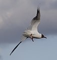 Black headed gull 3 (3685744158).jpg 1,716 × 1,818; 1,001 KB
-
 Black headed gulls (3684932129).jpg 1,690 × 1,082; 1.26 MB
-
 Blue barn and white foxgloves - geograph.org.uk - 1384423.jpg 640 × 480; 96 KB
-
 Boardwalk carrying footpath - geograph.org.uk - 1384427.jpg 640 × 480; 122 KB
-
 Misty View near Bonby - geograph.org.uk - 1383451.jpg 640 × 420; 92 KB
-
 Boudica's Way past Saxlingham Nethergate - geograph.org.uk - 1384242.jpg 640 × 480; 119 KB
-

-
 Bowden Moor Loch with Eildon Hills - geograph.org.uk - 1383737.jpg 640 × 483; 76 KB
-
 Brewery Lane - geograph.org.uk - 1607521.jpg 480 × 640; 87 KB
-
 Bridge - panoramio - Tanya Dedyukhina (4).jpg 1,408 × 1,056; 931 KB
-
 Bridge at Grange - geograph.org.uk - 1386910.jpg 640 × 480; 134 KB
-
 Bridge at the Hermitage - geograph.org.uk - 1657413.jpg 640 × 480; 153 KB
-

-
 Bridge of Bunroy - geograph.org.uk - 1395605.jpg 640 × 421; 64 KB
-
 Bridge over Afon Castell - geograph.org.uk - 1389656.jpg 640 × 480; 103 KB
-

-
 Bridge over the River Valency - geograph.org.uk - 1516566.jpg 640 × 427; 77 KB
-
 Bridge over the Usk - geograph.org.uk - 1385634.jpg 640 × 480; 124 KB
-
 Bridleway near Willaston - geograph.org.uk - 1383371.jpg 480 × 640; 131 KB
-
 Bridleway near Woodborough - geograph.org.uk - 1428309.jpg 640 × 481; 202 KB
-
 Bridleway north of Street Hey Lane - geograph.org.uk - 1383369.jpg 480 × 640; 131 KB
-
 Bridleway to the Lune Valley - geograph.org.uk - 1386708.jpg 640 × 480; 114 KB
-
 Bridleway, Arlington Reservoir - geograph.org.uk - 1384740.jpg 640 × 480; 78 KB
-
 Bright Street - geograph.org.uk - 1394176.jpg 640 × 480; 81 KB
-
 Broken glass, Omagh - geograph.org.uk - 1383604.jpg 479 × 640; 103 KB
-
 Broken gravestone - geograph.org.uk - 1411400.jpg 640 × 480; 157 KB
-
 Bude Haven - geograph.org.uk - 1516181.jpg 640 × 427; 48 KB
-
 Bude Haven - geograph.org.uk - 1516219.jpg 640 × 411; 49 KB
-
 Bulbourne ex-commercial - geograph.org.uk - 1396453.jpg 640 × 480; 102 KB
-
 Bulbourne tugboat - geograph.org.uk - 1397199.jpg 640 × 480; 120 KB
-
 Bullrushes at Bulbourne Junction - geograph.org.uk - 1397216.jpg 640 × 480; 145 KB
-
 Bunting, Woodvale Avenue, Omagh - geograph.org.uk - 1383574.jpg 640 × 480; 52 KB
-
 Burgher Bridge - geograph.org.uk - 1607544.jpg 640 × 480; 135 KB
-
 Bus shelter, Kinnesswood - geograph.org.uk - 1609675.jpg 480 × 640; 71 KB
-
 Bus stops, Portrush - geograph.org.uk - 1384154.jpg 640 × 351; 56 KB
-
 Bus, Portrush - geograph.org.uk - 1384984.jpg 640 × 397; 58 KB
-
 Byway to Aldbourne, west of Baydon - geograph.org.uk - 1384716.jpg 640 × 480; 181 KB
-
 Cabbage field by Loch Leven - geograph.org.uk - 1607542.jpg 640 × 480; 128 KB
-
 Cabbage picking - geograph.org.uk - 1609954.jpg 640 × 480; 93 KB
-
 Cailiness Road Drummore - geograph.org.uk - 1408814.jpg 640 × 457; 264 KB
-
 Calvia quattuordecimguttata (Cream-spot ladybird) - larva - Flickr - S. Rae.jpg 1,628 × 1,527; 315 KB
-

-

-
 Caravan and camping park, Pentewan - geograph.org.uk - 1389545.jpg 640 × 480; 106 KB
-

-
 Carousel, Homefield Rise - geograph.org.uk - 1387217.jpg 640 × 480; 118 KB
-
 Carsegour - geograph.org.uk - 1384454.jpg 640 × 480; 120 KB
-
 Cattle, Potterne Wick - geograph.org.uk - 1431197.jpg 640 × 481; 185 KB
-
 Chance Inn - geograph.org.uk - 1384507.jpg 640 × 480; 85 KB
-
 Chew Valley Lake - geograph.org.uk - 1383415.jpg 640 × 444; 71 KB
-
 Chilley Farmshop - geograph.org.uk - 1383784.jpg 640 × 427; 72 KB
-
 Church and churchyard - geograph.org.uk - 1396363.jpg 640 × 427; 61 KB
-
 Church Farm, Priors Dean - geograph.org.uk - 1519804.jpg 640 × 427; 137 KB
-
 Church Hill meets The Street - geograph.org.uk - 1384420.jpg 640 × 480; 69 KB
-
 Church Hill past Orchard View - geograph.org.uk - 1384416.jpg 480 × 640; 76 KB
-
 Church Hill past Primary School - geograph.org.uk - 1384414.jpg 640 × 480; 113 KB
-

-

-
 Church Street, Omagh - geograph.org.uk - 1383579.jpg 480 × 640; 75 KB
-
 Churchyard at Ysbyty Cynfyn - geograph.org.uk - 1389455.jpg 480 × 640; 118 KB
-

-
 Clevedon sea pool - panoramio.jpg 2,832 × 2,128; 2.24 MB
-
 Cliff Top Path - geograph.org.uk - 1383663.jpg 480 × 640; 96 KB
-
 Coach and Horses - geograph.org.uk - 1385680.jpg 640 × 480; 72 KB
-
 Coast north of Mevagissey - geograph.org.uk - 1389120.jpg 480 × 640; 91 KB
-
 Coast path above Polstreath - geograph.org.uk - 1389212.jpg 480 × 640; 118 KB
-
 Coast path, Portgiskey - geograph.org.uk - 1389349.jpg 640 × 488; 104 KB
-
 Coastal view near Widemouth Bay - geograph.org.uk - 1516405.jpg 640 × 418; 101 KB
-

-
 Cockaluney Beach (2) - geograph.org.uk - 1389331.jpg 640 × 480; 104 KB
-
 Cockaluney Beach - geograph.org.uk - 1389330.jpg 480 × 640; 103 KB
-
 Colne Water - geograph.org.uk - 1394167.jpg 480 × 640; 109 KB
-
 Coloured strata at Hartland Quay - geograph.org.uk - 1518518.jpg 640 × 427; 88 KB
-
-

-

-
 Constitution Hill from the seafront - geograph.org.uk - 1388894.jpg 640 × 480; 79 KB
-
 Construction of New Flyover - geograph.org.uk - 1384357.jpg 640 × 480; 58 KB
-
 Construction of New Flyover - geograph.org.uk - 1385339.jpg 640 × 480; 69 KB
-

-
 Cottage on the corner - geograph.org.uk - 1384442.jpg 640 × 480; 84 KB
-
 Cottages in Bladon - geograph.org.uk - 1386317.jpg 640 × 426; 88 KB
-
 Cottages on Church Hill - geograph.org.uk - 1384444.jpg 640 × 494; 79 KB
-
 Country road above Esgair - geograph.org.uk - 1383427.jpg 599 × 640; 125 KB
-
 Country road to Llanpumpsaint - geograph.org.uk - 1383438.jpg 640 × 480; 94 KB
-
 Courthouse Hill, Omagh - geograph.org.uk - 1383601.jpg 640 × 287; 45 KB
-
 Cove Methodist Church - geograph.org.uk - 1394884.jpg 640 × 478; 75 KB
-
 Cove near Portgiskey - geograph.org.uk - 1389337.jpg 640 × 480; 90 KB
-
 Cove, Church of St Christopher - geograph.org.uk - 1394814.jpg 640 × 480; 75 KB
-
 Cove, Frog Lane railway bridge - geograph.org.uk - 1395033.jpg 640 × 480; 99 KB
-
 Cove, Merrow Brook - geograph.org.uk - 1395240.jpg 640 × 480; 146 KB
-

-

-
 Cove, The Tradesmans Arms - geograph.org.uk - 1394918.jpg 640 × 480; 59 KB
-
 Cove, Wood Lane - geograph.org.uk - 1394964.jpg 640 × 480; 82 KB
-
 Cows in the Long Grass - geograph.org.uk - 1384991.jpg 480 × 640; 88 KB
-
 Crackington Haven Beach - geograph.org.uk - 1518453.jpg 640 × 405; 100 KB
-
 Crackington Haven Beach - geograph.org.uk - 1518490.jpg 640 × 424; 96 KB
-

-
 Cripiau Eisteddfa-fach - geograph.org.uk - 1390270.jpg 640 × 480; 86 KB
-
 Croft Mill - geograph.org.uk - 1392987.jpg 640 × 480; 69 KB
-
 Croft Mill - geograph.org.uk - 1392998.jpg 640 × 480; 77 KB
-
 Cuckmere Cottage - geograph.org.uk - 1384973.jpg 640 × 480; 136 KB
-
 Cuckmere River - geograph.org.uk - 1384773.jpg 480 × 640; 71 KB
-
 Culfoich More - geograph.org.uk - 1396418.jpg 640 × 374; 74 KB
-
 Curves on Aberystwyth seafront - geograph.org.uk - 1388899.jpg 640 × 480; 73 KB
-
 Curzon Street railway station, Birmingham, England-3July2009.jpg 4,650 × 2,940; 7.61 MB
-
 Cycle Track at South Ballachulish - geograph.org.uk - 1389861.jpg 640 × 480; 563 KB
-
 Cycle Track at South Ballachulish - geograph.org.uk - 1389881.jpg 640 × 480; 612 KB
-
 Cycle Track at South Ballachulish - geograph.org.uk - 1389890.jpg 640 × 480; 661 KB
-
 Cycle Track Beside Loch Linnhe - geograph.org.uk - 1389939.jpg 640 × 480; 440 KB
-
 Cycle Track Near South Ballachulish - geograph.org.uk - 1389901.jpg 640 × 480; 630 KB
-
 Cycle Track Near South Ballachulish - geograph.org.uk - 1389911.jpg 640 × 480; 638 KB
-
 Daisies on the foreshore of the Tamar - geograph.org.uk - 1394514.jpg 640 × 425; 171 KB
-
 David Davies Llandinam - geograph.org.uk - 1389119.jpg 414 × 639; 52 KB
-
 David Davies statue beside the A470 - geograph.org.uk - 1389130.jpg 481 × 640; 76 KB
-
 Dead end - geograph.org.uk - 1384524.jpg 640 × 480; 43 KB
-

-
 Digger Graveyard - geograph.org.uk - 1383620.jpg 640 × 480; 77 KB
-
 Digger Graveyard - geograph.org.uk - 1383624.jpg 640 × 480; 107 KB
-
 Digger Graveyard - geograph.org.uk - 1383628.jpg 640 × 480; 98 KB
-
 Dilapidated house in Padstow - geograph.org.uk - 1423324.jpg 640 × 480; 140 KB
-
 Dinas Powys station - geograph.org.uk - 1384252.jpg 640 × 480; 84 KB
-
 Distillery Phone Box - geograph.org.uk - 1396328.jpg 640 × 427; 103 KB
-
 Disused postbox, Bottlesford - geograph.org.uk - 1428304.jpg 480 × 640; 158 KB
-
 Dive Centre, Sound of Kerrera - geograph.org.uk - 1389065.jpg 640 × 480; 68 KB
-
 Donald Cargill Monument - geograph.org.uk - 1400961.jpg 640 × 480; 138 KB
-
 Double yellow lines, Omagh - geograph.org.uk - 1383608.jpg 478 × 640; 104 KB
-
 Down the hill to Tintagel Castle - geograph.org.uk - 1518381.jpg 640 × 427; 98 KB
-
 Down to Crackington Haven Beach - geograph.org.uk - 1518402.jpg 640 × 407; 65 KB
-

-
 Downland west of Baydon - geograph.org.uk - 1384706.jpg 640 × 480; 117 KB
-
 Downs View Lane - geograph.org.uk - 1383931.jpg 640 × 427; 100 KB
-
 Dry Cove Bottom - geograph.org.uk - 1383920.jpg 2,816 × 2,112; 4.36 MB
-

-
 Dunskey Street Portpatrick - geograph.org.uk - 1408702.jpg 640 × 457; 298 KB
-
 Easter Balgedie - geograph.org.uk - 1609637.jpg 640 × 480; 109 KB
-
 Edge of the Severn - geograph.org.uk - 1482912.jpg 640 × 480; 234 KB
-
 Eildon Wester Hill - geograph.org.uk - 1386393.jpg 640 × 480; 40 KB
-
 Eilean Uisneachan, Loch Etive - geograph.org.uk - 1384941.jpg 640 × 257; 159 KB
-

-
 End of forest track. - geograph.org.uk - 1383410.jpg 640 × 480; 84 KB
-
 End of the Track - geograph.org.uk - 1389872.jpg 640 × 480; 473 KB
-
 Enhancing the view, Mevagissey - geograph.org.uk - 1389104.jpg 505 × 640; 117 KB

_Eudonia_mercurella_(3695746568).jpg)


_-_larva_-_Flickr_-_S._Rae.jpg)


.jpg)
.jpg)
.jpg)
.jpg)


.jpg)


_-_larva_-_Flickr_-_S._Rae.jpg)


_-_geograph.org.uk_-_1389331.jpg)


