Category:United Kingdom photographs taken on 2008-08-06
Jump to navigation
Jump to search
Countries of Europe: Austria · Belarus · Belgium · Bulgaria · Croatia · Czech Republic · Finland · France‡ · Germany · Greece · Hungary · Iceland · Republic of Ireland · Italy · Kazakhstan‡ · Montenegro · Netherlands‡ · Norway · Poland · Portugal‡ · Romania · Russia‡ · Serbia · Slovakia · Slovenia · Spain‡ · Sweden · Switzerland · Turkey‡ · Ukraine · United Kingdom
Limited recognition: Kosovo
‡: partly located in Europe
Limited recognition: Kosovo
‡: partly located in Europe
| ← | 6 August 2008 | → | ||
| ← | August 2008 | → | ||

United Kingdom photographs taken on 6 August 2008.
Image files should be categorized here automatically using {{taken on}} template. Direct categorisation is also possible, if automatic is impossible.
Subcategories
This category has the following 3 subcategories, out of 3 total.
Media in category "United Kingdom photographs taken on 2008-08-06"
The following 200 files are in this category, out of 699 total.
(previous page) (next page)-
 "Deepdale" - geograph.org.uk - 912024.jpg 640 × 480; 150 KB
-
 "Dinos" at the Alston - geograph.org.uk - 914375.jpg 616 × 460; 141 KB
-
 ...and another door opens - geograph.org.uk - 914041.jpg 640 × 426; 46 KB
-
 A festoon of colour - geograph.org.uk - 928965.jpg 427 × 640; 115 KB
-
 Across the moor to Coed Taf Fawr - geograph.org.uk - 911589.jpg 640 × 480; 108 KB
-
 Air ambulance float, Sheringham carnival parade, Wyndham Street, Sheringham 2014-08-06.JPG 4,000 × 3,000; 3.83 MB
-
 Alderman Canal - geograph.org.uk - 912302.jpg 640 × 427; 104 KB
-
 Aldridge Court Nursing Home - geograph.org.uk - 911551.jpg 640 × 480; 95 KB
-
 All Saints Church, Porthcawl. - geograph.org.uk - 923226.jpg 640 × 480; 77 KB
-
 Almshouses - geograph.org.uk - 1363553.jpg 640 × 426; 72 KB
-
 Angel Underground Station - geograph.org.uk - 912142.jpg 640 × 480; 83 KB
-
 Apartments, Walsall Wood - geograph.org.uk - 911630.jpg 640 × 480; 58 KB
-
 Approach to Dereham station - geograph.org.uk - 1038325.jpg 640 × 480; 65 KB
-
 Archway Tower - geograph.org.uk - 912054.jpg 640 × 480; 67 KB
-
 Arisaig, Hazel Grove - geograph.org.uk - 918827.jpg 640 × 480; 114 KB
-
 Arisaig, parish church - geograph.org.uk - 918826.jpg 640 × 480; 142 KB
-
 Arisaig, telephone box - geograph.org.uk - 918825.jpg 640 × 480; 115 KB
-
 Arwenack Street, Falmouth - geograph.org.uk - 926079.jpg 640 × 480; 147 KB
-
 Arwenack Street, Falmouth - geograph.org.uk - 926108.jpg 630 × 480; 199 KB
-
 Arwenack Street, Falmouth - geograph.org.uk - 926116.jpg 640 × 457; 218 KB
-
 Arwenack Street, Falmouth - geograph.org.uk - 926122.jpg 640 × 457; 173 KB
-
 Arwenack Street, Falmouth. - geograph.org.uk - 926086.jpg 640 × 457; 162 KB
-
 Ashgate Close, Broomhill - geograph.org.uk - 1142310.jpg 640 × 480; 88 KB
-
 Ashgate Close, Broomhill - geograph.org.uk - 1142324.jpg 640 × 480; 102 KB
-
 Ashgate Lane, Broomhill - geograph.org.uk - 1143337.jpg 480 × 640; 94 KB
-
 Ashgate Lane, Broomhill - geograph.org.uk - 1143360.jpg 640 × 480; 79 KB
-
 Ashgate Lane, Broomhill - geograph.org.uk - 1143411.jpg 480 × 640; 79 KB
-
 Ashgate Lane, Broomhill - geograph.org.uk - 1143590.jpg 480 × 640; 89 KB
-
 Ashgate Lane, Broomhill - geograph.org.uk - 1143600.jpg 640 × 480; 108 KB
-
 Ashgate Lane, Broomhill - geograph.org.uk - 1144067.jpg 480 × 640; 106 KB
-
 Ashgate Lane, Broomhill - geograph.org.uk - 1144079.jpg 640 × 480; 103 KB
-
 Ashgate Lane, Broomhill - geograph.org.uk - 1144090.jpg 480 × 640; 97 KB
-
 Ashgate Road, Broomhill - geograph.org.uk - 1141902.jpg 640 × 480; 82 KB
-
 Ashgate Road, Broomhill - geograph.org.uk - 1141907.jpg 480 × 640; 79 KB
-
 Ashgate Road, Broomhill - geograph.org.uk - 1142305.jpg 640 × 480; 102 KB
-
 Ashgate Road, Broomhill - geograph.org.uk - 1143316.jpg 640 × 480; 91 KB
-
 Aspley Methodist Church - geograph.org.uk - 911147.jpg 640 × 480; 56 KB
-
 Aspley Pentecostal Church - geograph.org.uk - 911150.jpg 640 × 480; 62 KB
-
 B1110 Holt Road - geograph.org.uk - 914479.jpg 640 × 427; 155 KB
-
 Ball clock - geograph.org.uk - 925199.jpg 640 × 480; 56 KB
-
 Barr Common Road - Longwood Road - geograph.org.uk - 911391.jpg 640 × 480; 75 KB
-
 Batcombe Hill - geograph.org.uk - 912239.jpg 640 × 426; 57 KB
-
 Batcombe Hill - geograph.org.uk - 912252.jpg 640 × 426; 64 KB
-
 Batcombe Hill - geograph.org.uk - 912253.jpg 640 × 426; 37 KB
-
 Beasdale, Eilean Gobhlach - geograph.org.uk - 918818.jpg 640 × 480; 106 KB
-
 Beasdale, Prince's Cairn - geograph.org.uk - 918822.jpg 640 × 480; 132 KB
-
 Beasdale, upgrading the A830 - geograph.org.uk - 918016.jpg 640 × 480; 118 KB
-
 Beech Hill Road, Broomhill - geograph.org.uk - 1011579.jpg 640 × 480; 73 KB
-
 Beech Hill Road, Broomhill - geograph.org.uk - 1013324.jpg 640 × 480; 74 KB
-
 Beechwood Grove, Cheadle Hulme - geograph.org.uk - 1430673.jpg 600 × 338; 79 KB
-

-

-
 Bench in Harry's Orchard - geograph.org.uk - 917771.jpg 640 × 480; 144 KB
-
-
 Bend in the Trentishoe Road - geograph.org.uk - 917780.jpg 640 × 480; 112 KB
-

-
 Birtwhistle Street - geograph.org.uk - 925217.jpg 640 × 480; 59 KB
-
 Black Bull Farm and Cottage, Inglewhite - geograph.org.uk - 912058.jpg 640 × 480; 166 KB
-
 Black Bull Farm, Inglewhite, Doorway - geograph.org.uk - 912060.jpg 480 × 640; 163 KB
-
-
 Bound for Rawtenstall - geograph.org.uk - 912312.jpg 640 × 461; 93 KB
-
 Bowls Pavilion, Stockhill Lane - geograph.org.uk - 911171.jpg 640 × 480; 63 KB
-
 Brambles and Gorse on Hunshelf Bank - geograph.org.uk - 916631.jpg 640 × 480; 85 KB
-
 Bridge over River Fleet - geograph.org.uk - 925183.jpg 640 × 480; 134 KB
-
 Bridge over River Fleet - geograph.org.uk - 925205.jpg 640 × 480; 111 KB
-
 Bridge over The River Heddon - geograph.org.uk - 917541.jpg 480 × 640; 122 KB
-
 Bridge over the River Heddon - geograph.org.uk - 917793.jpg 640 × 480; 122 KB
-
 Bridleway - geograph.org.uk - 912630.jpg 600 × 450; 102 KB
-

-
 Briningham Bridleway - geograph.org.uk - 914433.jpg 640 × 427; 159 KB
-
 Briningham Bus Stop - geograph.org.uk - 914424.jpg 640 × 427; 214 KB
-

-
 Broomhill Infants School, Broomhill - geograph.org.uk - 1011700.jpg 480 × 640; 87 KB
-
 Broomhill Infants School, Broomhill - geograph.org.uk - 1013313.jpg 480 × 640; 76 KB
-
 Broomhill Infants School, Broomhill - geograph.org.uk - 1013314.jpg 640 × 480; 106 KB
-
 Broomhill Infants School, Broomhill - geograph.org.uk - 1013317.jpg 640 × 480; 92 KB
-
 Broomhill Infants School, Broomhill - geograph.org.uk - 1013318.jpg 480 × 640; 97 KB
-
 Broomhill Infants School, Broomhill - geograph.org.uk - 1013319.jpg 640 × 480; 84 KB
-
 Broomhill Infants School, Broomhill - geograph.org.uk - 1013320.jpg 640 × 480; 78 KB
-
 Broomhill Infants School, Broomhill - geograph.org.uk - 1013321.jpg 640 × 480; 124 KB
-
 Broughton Castle entrance - geograph.org.uk - 1464252.jpg 640 × 426; 59 KB
-
 Broxtowe Partnership Trust - geograph.org.uk - 911161.jpg 640 × 480; 80 KB
-
 Buxton Memorial and Victoria Tower - geograph.org.uk - 911628.jpg 480 × 640; 64 KB
-
 Canalised section of the River Gipping - geograph.org.uk - 912346.jpg 640 × 427; 100 KB
-
 The Old Synagogue, King's Street - geograph.org.uk - 911281.jpg 640 × 480; 79 KB
-
 Castle Douglas cattle market - geograph.org.uk - 925283.jpg 640 × 480; 56 KB
-
 Castle Douglas public library - geograph.org.uk - 925278.jpg 640 × 480; 103 KB
-
 Castleton station - geograph.org.uk - 912317.jpg 640 × 465; 133 KB
-
 Cattle Pens at market - geograph.org.uk - 925285.jpg 640 × 480; 60 KB
-
 Cedar Tree - geograph.org.uk - 911602.jpg 640 × 480; 67 KB
-

-
 Chedlee Drive, Cheadle Hulme - geograph.org.uk - 1459232.jpg 600 × 338; 56 KB
-
 Chimney Silhouettes - geograph.org.uk - 912200.jpg 640 × 480; 50 KB
-
 Chirdon Head - geograph.org.uk - 912609.jpg 640 × 283; 64 KB
-
 Climbing Hunshelf Bank - geograph.org.uk - 911757.jpg 640 × 480; 97 KB
-
 Clovery Woods of Rest - geograph.org.uk - 911456.jpg 640 × 480; 111 KB
-
 Coat of Arms - geograph.org.uk - 914376.jpg 499 × 550; 171 KB
-
 Coed Cwm Taf across the moor - geograph.org.uk - 911583.jpg 640 × 480; 102 KB
-
 Common Toad - geograph.org.uk - 914480.jpg 640 × 431; 205 KB
-
 Corner Shops - geograph.org.uk - 911388.jpg 640 × 480; 72 KB
-
 Cottages - Forge Lane - geograph.org.uk - 911513.jpg 640 × 480; 80 KB
-
 Cottages on London Road - geograph.org.uk - 913803.jpg 640 × 427; 133 KB
-
 Crag Lough - geograph.org.uk - 928254.jpg 640 × 427; 66 KB
-
 Crematorium Roundabout - geograph.org.uk - 911392.jpg 640 × 480; 87 KB
-
 Crookes Road, Broomhill - geograph.org.uk - 1006933.jpg 640 × 480; 59 KB
-
 Crookes Road, Broomhill - geograph.org.uk - 1009397.jpg 640 × 480; 60 KB
-
 Crookes Road-Whitham Road, Broomhill - geograph.org.uk - 1008005.jpg 640 × 480; 69 KB
-
 Cuddy Point - geograph.org.uk - 1270933.jpg 640 × 428; 72 KB
-

-
 Denne Road Gospel Hall - geograph.org.uk - 911745.jpg 640 × 480; 60 KB
-
 Derelict Car Showroom - geograph.org.uk - 912050.jpg 640 × 480; 76 KB
-
 Dial-a-Ride at Burgh Stubbs - geograph.org.uk - 914471.jpg 640 × 427; 153 KB
-
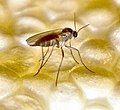 Diptera (2736675397).jpg 542 × 495; 416 KB
-
 Diptera (2737431102).jpg 800 × 426; 90 KB
-
 Diptera (2737431324).jpg 800 × 552; 103 KB
-
 Diptera (2737431466).jpg 800 × 378; 77 KB
-
 Diptera (2737431650).jpg 438 × 800; 78 KB
-
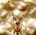 Diptera (2737432568).jpg 532 × 520; 419 KB
-
 Diptera (2737432754).jpg 800 × 526; 110 KB
-
 Diptera (2737433004).jpg 800 × 748; 123 KB
-
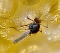 Diptera (2737510592).jpg 362 × 324; 235 KB
-
 Diptera (2738971811).jpg 1,343 × 1,271; 2.24 MB
-
 Diptera (2738976311).jpg 1,423 × 1,110; 2.03 MB
-
 Diptera (2738988545).jpg 591 × 562; 517 KB
-
 Diptera (2739004461).jpg 991 × 1,028; 1.3 MB
-
 Diptera (2739004805).jpg 364 × 325; 179 KB
-
 Diptera (2739005693).jpg 805 × 443; 492 KB
-
 Diptera (2739051969).jpg 1,962 × 1,434; 3.39 MB
-
 Diptera (2739805650).jpg 1,342 × 1,285; 2.36 MB
-
 Diptera (2739819950).jpg 3,072 × 2,304; 2.56 MB
-
 Diptera (2739825674).jpg 1,667 × 1,367; 2.69 MB
-
 Diptera (2739844506).jpg 557 × 424; 391 KB
-
 Diptera (2739850010).jpg 588 × 655; 547 KB
-
 Dorlin, Castle Tioram - geograph.org.uk - 918780.jpg 640 × 480; 112 KB
-
 Dorlin, Castle Tioram causeway - geograph.org.uk - 918781.jpg 640 × 480; 108 KB
-
 Dorlin, reflections of Castle Tioram - geograph.org.uk - 918787.jpg 640 × 480; 104 KB
-
 Dorlin, River Shiel - geograph.org.uk - 918789.jpg 640 × 480; 128 KB
-
 Dorlin, view across Loch Moidart - geograph.org.uk - 918782.jpg 640 × 480; 114 KB
-
 Dorlin, view down South Channel - geograph.org.uk - 918784.jpg 640 × 480; 110 KB
-
 Double Roundabout - geograph.org.uk - 911540.jpg 640 × 480; 52 KB
-
 Down a bit - Left a bit - Fire^ - geograph.org.uk - 911715.jpg 640 × 480; 72 KB
-

-
 Dun Carloway and flowers - geograph.org.uk - 922593.jpg 427 × 640; 128 KB
-
 Dunes at Birkdale - geograph.org.uk - 912635.jpg 640 × 425; 74 KB
-

-

-

-
 Durham Castle - geograph.org.uk - 977790.jpg 640 × 426; 88 KB
-
 Durham Cathedral - Doorway - geograph.org.uk - 977800.jpg 413 × 640; 97 KB
-

-
 Elmwood Avenue, Belfast - geograph.org.uk - 913628.jpg 640 × 446; 239 KB
-
 Entrance to Stalwart Carpet Works - geograph.org.uk - 918561.jpg 640 × 480; 133 KB
-
 Entrance, St George's Market, Belfast - geograph.org.uk - 913635.jpg 488 × 640; 205 KB
-
 Epsom Racecourse - geograph.org.uk - 1580356.jpg 640 × 480; 135 KB
-

-
-
 Farmland by Burgh Stubbs - geograph.org.uk - 914459.jpg 640 × 427; 197 KB
-
 Field edge, Wissett Lodge Farm - geograph.org.uk - 1045589.jpg 640 × 426; 109 KB
-
 Field on Batcombe Hill - geograph.org.uk - 912238.jpg 640 × 426; 52 KB
-
 Findhorn Bay Sailing Boats - geograph.org.uk - 1118426.jpg 640 × 480; 59 KB
-
 Fire engine, Sheringham carnival parade, Wyndham Street, Sheringham 2014-08-06.JPG 4,000 × 3,000; 3.83 MB
-
 Flint wall - geograph.org.uk - 912783.jpg 480 × 640; 80 KB
-
 Flower Trail - geograph.org.uk - 912201.jpg 480 × 640; 119 KB
-

-
 Footbridge, Lanyon Place, Belfast - geograph.org.uk - 913638.jpg 566 × 640; 212 KB
-
 Footpath from Preston Church - geograph.org.uk - 912196.jpg 480 × 640; 132 KB
-
 Footpath junction along The Heddon's Path - geograph.org.uk - 917622.jpg 640 × 480; 123 KB
-
 Footpath sign - geograph.org.uk - 912842.jpg 480 × 640; 67 KB
-
 Footpath sign along the Heddon's Path - geograph.org.uk - 917612.jpg 640 × 480; 142 KB
-
 Footpath to Preston (west) - geograph.org.uk - 911929.jpg 480 × 640; 130 KB
-
 Footpath to Preston (west) - geograph.org.uk - 912199.jpg 480 × 640; 115 KB
-
 Footpath up Hunshelf Bank - geograph.org.uk - 916622.jpg 640 × 480; 80 KB
-
 Footpath west out of Preston - geograph.org.uk - 911936.jpg 480 × 640; 156 KB
-
 Forest Road, Kielder Forest - geograph.org.uk - 912623.jpg 600 × 450; 102 KB
-
 Forest road, Kielder Forest - geograph.org.uk - 912640.jpg 600 × 450; 85 KB
-
 Forest Track, Kielder Forest - geograph.org.uk - 912633.jpg 600 × 450; 103 KB
-
 Forestry Road, Kielder Forest - geograph.org.uk - 912626.jpg 600 × 450; 87 KB
-
 Forestry tracks meet - geograph.org.uk - 912636.jpg 600 × 450; 133 KB
-
 Forge Lane - geograph.org.uk - 911500.jpg 640 × 480; 107 KB
-
 Forge Lane - geograph.org.uk - 911524.jpg 640 × 480; 88 KB
-
 Fox and Duck, Broomhill - geograph.org.uk - 1007162.jpg 640 × 480; 79 KB
-
 From McQueen's Rock - geograph.org.uk - 930076.jpg 640 × 427; 46 KB
-
 Christ Church's hall, Fulwood, Doorway - geograph.org.uk - 912043.jpg 640 × 480; 181 KB
-
 Christ Church, Fulwood - geograph.org.uk - 912034.jpg 640 × 480; 184 KB
-
 Christ Church, Fulwood, Doorway - geograph.org.uk - 912036.jpg 480 × 640; 190 KB
-
 Christ Church, Fulwood, Porch - geograph.org.uk - 912037.jpg 640 × 480; 154 KB
-
 Fulwood Road, Broomhill - geograph.org.uk - 1004601.jpg 640 × 480; 67 KB
-
 Fulwood Road, Broomhill - geograph.org.uk - 1144894.jpg 640 × 480; 72 KB
-
 Fulwood Road, Broomhill - geograph.org.uk - 1144945.jpg 640 × 480; 72 KB
-
 Fulwood Road, Broomhill - geograph.org.uk - 988144.jpg 640 × 480; 77 KB
-
 Fulwood Road, Broomhill - geograph.org.uk - 988259.jpg 640 × 480; 71 KB
-
 Fulwood Road, Broomhill - geograph.org.uk - 988300.jpg 640 × 480; 61 KB
-
 Fulwood Road, Broomhill - geograph.org.uk - 988325.jpg 640 × 480; 73 KB
-
 Fulwood Road, Broomhill - geograph.org.uk - 988440.jpg 640 × 480; 65 KB
-
 Fulwood Road, Broomhill - geograph.org.uk - 995528.jpg 640 × 480; 64 KB
-
 Garden Wall - geograph.org.uk - 912197.jpg 640 × 480; 100 KB
-
 Gardeners Arms, Birch - geograph.org.uk - 912288.jpg 640 × 460; 85 KB
-
 Gardens at the rear of the Hunters Inn - geograph.org.uk - 917814.jpg 640 × 480; 108 KB
-
 Garwnant Fawr - geograph.org.uk - 911571.jpg 640 × 480; 124 KB
-
 Gateway just off the Heddon's Path - geograph.org.uk - 917634.jpg 640 × 480; 129 KB


.jpg)
.jpg)
.jpg)
.jpg)
.jpg)
.jpg)
.jpg)
.jpg)
.jpg)
.jpg)
.jpg)
.jpg)
.jpg)
.jpg)
.jpg)
.jpg)
.jpg)
.jpg)
.jpg)
.jpg)
.jpg)


.JPG)
.JPG)
.JPG)


_-_geograph.org.uk_-_911929.jpg)
_-_geograph.org.uk_-_912199.jpg)


