Category:United Kingdom photographs taken on 2007-12-19
Jump to navigation
Jump to search
Countries of Europe: Belgium · Croatia · France‡ · Germany · Republic of Ireland · Italy · Latvia · Netherlands‡ · Poland · Portugal‡ · Russia‡ · Slovenia · Sweden · Turkey‡ · Ukraine · United Kingdom
‡: partly located in Europe
‡: partly located in Europe
| ← | 19 December 2007 | → | ||
| ← | December 2007 | → | ||

United Kingdom photographs taken on 19 December 2007.
Image files should be categorized here automatically using {{taken on}} template. Direct categorisation is also possible, if automatic is impossible.
Subcategories
This category has only the following subcategory.
Media in category "United Kingdom photographs taken on 2007-12-19"
The following 200 files are in this category, out of 821 total.
(previous page) (next page)-

-
 'Resolution' in Belfast - geograph.org.uk - 636807.jpg 640 × 460; 56 KB
-
 (Part of) Catton - geograph.org.uk - 691049.jpg 640 × 480; 116 KB
-
 (Part of) Station Road - geograph.org.uk - 692142.jpg 640 × 406; 78 KB
-
 19th C cast iron water hydrant - geograph.org.uk - 675831.jpg 370 × 640; 77 KB
-
 A Dale's Barn - geograph.org.uk - 636820.jpg 640 × 480; 119 KB
-

-
 A muddy foreshore, Grays - geograph.org.uk - 636520.jpg 640 × 482; 121 KB
-
 A poem to wet your whistle - geograph.org.uk - 637344.jpg 465 × 640; 132 KB
-
 A sheet of ice - geograph.org.uk - 636434.jpg 480 × 640; 60 KB
-
 A sunlit St Mary's - geograph.org.uk - 652872.jpg 640 × 462; 52 KB
-
 A view down the cliff towards the beach - geograph.org.uk - 654052.jpg 640 × 480; 114 KB
-
 A69 at Whitechapel Farm - geograph.org.uk - 637874.jpg 640 × 480; 74 KB
-
 Acorn Nursing Home - Laisteridge Lane - geograph.org.uk - 636605.jpg 640 × 433; 55 KB
-
 Allendale Town - geograph.org.uk - 648145.jpg 640 × 453; 130 KB
-
 An extended house in Church Street - geograph.org.uk - 652936.jpg 640 × 383; 41 KB
-
 Arable field near Scruton - geograph.org.uk - 636546.jpg 640 × 480; 51 KB
-
 Arriving at Manmoel - geograph.org.uk - 637118.jpg 640 × 477; 135 KB
-
 Bakewell - Bridge Crossing River Wye - geograph.org.uk - 641484.jpg 640 × 480; 72 KB
-
 Bakewell - Car Park - geograph.org.uk - 641488.jpg 640 × 480; 56 KB
-
 Barns at Housty - geograph.org.uk - 683014.jpg 640 × 480; 119 KB
-
 Barton Haven - geograph.org.uk - 636785.jpg 480 × 640; 76 KB
-
 Reedbed with Ducks - geograph.org.uk - 636759.jpg 425 × 640; 118 KB
-

-
 Beachside houses at Bwlch y Brydun - geograph.org.uk - 680226.jpg 640 × 480; 83 KB
-
 St Gregory's Church tower - geograph.org.uk - 636596.jpg 476 × 640; 86 KB
-
 Bedale 'harbour' - geograph.org.uk - 636632.jpg 640 × 480; 94 KB
-
 Bedale Bowls Club - geograph.org.uk - 636610.jpg 640 × 428; 72 KB
-
 Bedale Bridge - geograph.org.uk - 636638.jpg 640 × 480; 99 KB
-
 Bedale Hall - geograph.org.uk - 636593.jpg 640 × 367; 48 KB
-
 Bedale market cross - geograph.org.uk - 636574.jpg 469 × 640; 66 KB
-
 Bedale Methodist Church - geograph.org.uk - 636600.jpg 640 × 480; 87 KB
-

-
 Beech trees, Manmoel - geograph.org.uk - 638206.jpg 640 × 478; 210 KB
-
 Beeston Lads Club - 19th Dec 07 - geograph.org.uk - 636761.jpg 640 × 427; 100 KB
-
 Berrier Hill - geograph.org.uk - 640158.jpg 640 × 480; 155 KB
-
 Besselsleigh pub.jpg 640 × 480; 97 KB
-
 Bla Bheinn from An Dorus Gap - geograph.org.uk - 665932.jpg 640 × 480; 37 KB
-
 Black Bourton, The Old Inn.jpg 640 × 480; 82 KB
-
 Black Bourton war graves.jpg 640 × 480; 107 KB
-

-
 Booton House - geograph.org.uk - 636459.jpg 640 × 480; 87 KB
-
 Brackley Farm - geograph.org.uk - 639182.jpg 640 × 480; 47 KB
-
-

-
 Brandiston Road - geograph.org.uk - 636412.jpg 480 × 640; 79 KB
-
 Broomview House, Sighthill - geograph.org.uk - 636398.jpg 640 × 480; 98 KB
-

-

-
 Cadha Dubh, Ben Rinnes - geograph.org.uk - 636671.jpg 640 × 480; 69 KB
-

-

-
 Carrickfergus harbour (2) - geograph.org.uk - 636815.jpg 640 × 429; 74 KB
-
 Cecil Avenue - geograph.org.uk - 636569.jpg 640 × 420; 50 KB
-

-
 Chesterfield canal Ranby - geograph.org.uk - 637024.jpg 640 × 480; 128 KB
-

-
-

-

-
 Churchyard of St. Mary's, Dymock - geograph.org.uk - 636423.jpg 640 × 480; 161 KB
-
 Cleaning a Bench, St John's Gardens - geograph.org.uk - 636767.jpg 640 × 480; 113 KB
-

-

-
-
 Common Lane, Scruton - geograph.org.uk - 636551.jpg 640 × 480; 66 KB
-
 Cottages in Westwell - geograph.org.uk - 636715.jpg 640 × 480; 95 KB
-
 Cottages of Queen Street, Eynsham - geograph.org.uk - 637541.jpg 640 × 480; 90 KB
-
 Cowshed in Catton - geograph.org.uk - 691050.jpg 640 × 480; 91 KB
-
 Cross Street, Preston - geograph.org.uk - 638349.jpg 640 × 480; 237 KB
-
 Crossley Street - geograph.org.uk - 636571.jpg 640 × 403; 28 KB
-
 Croydon skyline.JPG 2,816 × 2,112; 795 KB
-
 Cumnor pub.jpg 640 × 480; 97 KB
-
 Cupar Beet factory silo - geograph.org.uk - 638792.jpg 640 × 426; 104 KB
-
-
 Deneholme - geograph.org.uk - 692163.jpg 640 × 415; 78 KB
-
 Deneholme noticeboard - geograph.org.uk - 692165.jpg 640 × 480; 91 KB
-
 Departure of the "Causeway", Larne - geograph.org.uk - 636519.jpg 640 × 544; 67 KB
-

-

-
 Disused cement silo, Magheramorne - geograph.org.uk - 636701.jpg 640 × 482; 82 KB
-
 Doocot, Leuchars - geograph.org.uk - 639140.jpg 640 × 428; 110 KB
-
 Early morning looking east down Glen Affric - panoramio.jpg 2,560 × 1,920; 2.18 MB
-

-
 Ebbsfleet3732.JPG 2,848 × 2,136; 1.47 MB
-
 Eden haughs - geograph.org.uk - 638433.jpg 640 × 429; 93 KB
-
 Eden haughs - geograph.org.uk - 638445.jpg 640 × 426; 63 KB
-
 Entrance to colliery tip near Manmoel - geograph.org.uk - 638205.jpg 640 × 481; 136 KB
-
 Farmhouse at Manmoel - geograph.org.uk - 637126.jpg 640 × 480; 145 KB
-
 Farmland near Manmoel - geograph.org.uk - 636455.jpg 640 × 480; 197 KB
-
 Fence near Whinney Covert - geograph.org.uk - 637895.jpg 640 × 480; 70 KB
-

-
-

-
 Fiddler's Reach, Grays - geograph.org.uk - 636530.jpg 640 × 480; 91 KB
-
 Fireman vandal^ - geograph.org.uk - 636943.jpg 640 × 480; 143 KB
-
 Flock of geese near Hanley Swan - geograph.org.uk - 636954.jpg 640 × 480; 82 KB
-
 Footpath at Blackmore End - geograph.org.uk - 637426.jpg 640 × 480; 122 KB
-
 Footpath below Lea Hall - geograph.org.uk - 690983.jpg 640 × 480; 89 KB
-
 Footpath east of Southrop - geograph.org.uk - 636740.jpg 640 × 315; 50 KB
-
 Footpath from Stone Stile to Lea Hall - geograph.org.uk - 690902.jpg 640 × 480; 125 KB
-
 Footpath to Allenmills Bridge - geograph.org.uk - 692132.jpg 640 × 480; 112 KB
-
 Footpath to Forstersteads - geograph.org.uk - 651147.jpg 480 × 640; 138 KB
-
 Footpath to Housty (2) - geograph.org.uk - 651165.jpg 480 × 640; 121 KB
-
 Footpath under the railway - geograph.org.uk - 636492.jpg 427 × 640; 65 KB
-

-

-
 Former Zoar Baptist Chapel - geograph.org.uk - 640588.jpg 640 × 479; 97 KB
-

-
-
 Gennell Farm - geograph.org.uk - 636756.jpg 633 × 475; 151 KB
-

-
 Glenluce Viaduct - geograph.org.uk - 636681.jpg 640 × 443; 66 KB
-

-
 Goonhilly Satellite Earth Station - geograph.org.uk - 726175.jpg 426 × 640; 42 KB
-
 Granby Wood - geograph.org.uk - 637352.jpg 640 × 469; 114 KB
-
 Grays Beach - geograph.org.uk - 636627.jpg 640 × 480; 122 KB
-
 Green Lane - geograph.org.uk - 636462.jpg 480 × 640; 83 KB
-
 Greyfriars Church - geograph.org.uk - 637791.jpg 640 × 480; 127 KB
-
 Guarlford Village Hall - geograph.org.uk - 637602.jpg 640 × 469; 88 KB
-
 Guildhall Street, Preston - geograph.org.uk - 638357.jpg 640 × 480; 162 KB
-

-
 Hambleton 008.jpg 582 × 640; 91 KB
-
 Hanley Swan - geograph.org.uk - 636935.jpg 640 × 480; 80 KB
-
 Hanley Swan - geograph.org.uk - 636951.jpg 640 × 480; 103 KB
-
 Hanley Swan butchers shop - geograph.org.uk - 636944.jpg 640 × 453; 54 KB
-
 Hawthorn on Berrier Hill - geograph.org.uk - 640179.jpg 640 × 480; 167 KB
-
 Hest Bank Bridge, Hest - geograph.org.uk - 641764.jpg 640 × 471; 112 KB
-

-

-

-

-
 Houses at North End - geograph.org.uk - 636585.jpg 480 × 640; 84 KB
-
 Houses on Station Road (2) - geograph.org.uk - 691074.jpg 640 × 480; 67 KB
-
 Housty bastle (2) - geograph.org.uk - 647095.jpg 640 × 480; 114 KB
-
 Housty bastle (3) - geograph.org.uk - 647096.jpg 640 × 480; 98 KB
-
 Housty bastle (4) - geograph.org.uk - 647098.jpg 640 × 480; 96 KB
-
 Housty bastle - geograph.org.uk - 647091.jpg 640 × 480; 103 KB
-
 Jobsworth, Carrickfergus castle - geograph.org.uk - 636799.jpg 640 × 372; 53 KB
-
 Kirkgate (north end) - geograph.org.uk - 636926.jpg 640 × 380; 66 KB
-
 Lag Buidhe, Ben Rinnes. - geograph.org.uk - 636663.jpg 640 × 480; 111 KB
-

-
 Limestone Outcrop, Dudley, Worcestershire - geograph.org.uk - 637494.jpg 640 × 425; 119 KB
-
 Limestone outcrops, Berrier Hill - geograph.org.uk - 640160.jpg 640 × 480; 153 KB
-
 Limestone Pavement - geograph.org.uk - 636837.jpg 640 × 480; 133 KB
-

-

-
 Little Horton Green - geograph.org.uk - 636608.jpg 640 × 417; 41 KB
-
 Lon y Traeth aka Screw Road - geograph.org.uk - 654115.jpg 640 × 495; 57 KB
-
 Looking east past the Booton clay pits - geograph.org.uk - 636458.jpg 480 × 640; 101 KB
-
 Looking north across stubble - geograph.org.uk - 636452.jpg 640 × 480; 56 KB
-
 Looking South on the A1 motorway - geograph.org.uk - 637019.jpg 640 × 445; 52 KB
-
 Looking West on the M18 motorway - geograph.org.uk - 637014.jpg 640 × 299; 60 KB
-
 Magheramorne station (1) - geograph.org.uk - 636649.jpg 640 × 397; 78 KB
-
 Magheramorne station (2) - geograph.org.uk - 636656.jpg 640 × 429; 92 KB
-
 Manmoel Common - geograph.org.uk - 641468.jpg 640 × 481; 146 KB
-
 Manmoel Inn - geograph.org.uk - 637185.jpg 640 × 480; 135 KB
-
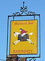 Manmoel Inn Sign - geograph.org.uk - 637187.jpg 482 × 640; 73 KB
-
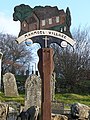 Manmoel village sign - geograph.org.uk - 637181.jpg 480 × 640; 144 KB
-
 Marker post, Hest Bank - geograph.org.uk - 642498.jpg 477 × 640; 133 KB
-
 Marsco from Sligachan - geograph.org.uk - 670943.jpg 480 × 640; 45 KB
-
 Milestone, Slyne, Slyne with Hest - geograph.org.uk - 642494.jpg 464 × 640; 121 KB
-
 Minor road past Gellidara farmhouse - geograph.org.uk - 647808.jpg 640 × 480; 115 KB
-
 Mistletoe near Hanley Swan - geograph.org.uk - 636957.jpg 640 × 480; 160 KB
-
 Mullach na Dheiragain from Sgurr nan Ceathreamhnan - panoramio.jpg 2,560 × 1,920; 2.29 MB
-
 Nefyn Bay from above Porth Nefyn - geograph.org.uk - 654096.jpg 640 × 369; 41 KB
-
 Night Shot On Irvine Moor - panoramio.jpg 3,110 × 2,073; 4.52 MB
-
 Oaken Holt Nursing Home - geograph.org.uk - 636573.jpg 640 × 480; 102 KB
-
 Old barn in Catton - geograph.org.uk - 691054.jpg 640 × 480; 68 KB
-
 Old Black Swan, Bedale - geograph.org.uk - 636567.jpg 640 × 480; 81 KB
-

-
 Old pump, Wycar Green - geograph.org.uk - 636607.jpg 480 × 640; 95 KB
-
 Old railway goods van near The Dene - geograph.org.uk - 651168.jpg 640 × 480; 95 KB
-
 Old roadside building and tree - geograph.org.uk - 638693.jpg 640 × 480; 131 KB
-
 Onslow Road, Southampton - geograph.org.uk - 636707.jpg 510 × 640; 53 KB
-

-

-
 Outflow station at Farmoor Reservoir - geograph.org.uk - 637513.jpg 640 × 480; 55 KB
-
 Pant Glas Farm - geograph.org.uk - 647277.jpg 640 × 480; 41 KB
-

-
 Pasture and forest, Berrier Hill - geograph.org.uk - 639107.jpg 640 × 480; 150 KB
-
 Pasture, Berrier - geograph.org.uk - 640149.jpg 640 × 480; 136 KB
-
 Pasture, Berrier - geograph.org.uk - 640236.jpg 640 × 480; 111 KB
-
 Pasture, Murrah - geograph.org.uk - 640094.jpg 640 × 480; 138 KB
-
 Pastures above Greystoke - geograph.org.uk - 640167.jpg 640 × 480; 152 KB
-
 Pastures above Greystoke - geograph.org.uk - 640171.jpg 640 × 480; 163 KB
-
 Pastures above Housty Bastle - geograph.org.uk - 683050.jpg 640 × 480; 112 KB
-
 Pastures above Stone Stile - geograph.org.uk - 690767.jpg 640 × 480; 77 KB
-

-
 Pastures near Allendale Town - geograph.org.uk - 692160.jpg 640 × 480; 87 KB
-
 Pastures, Murrah - geograph.org.uk - 640086.jpg 640 × 480; 139 KB
-
 Pen y fan Caravan and Leisure Park - geograph.org.uk - 636454.jpg 640 × 480; 163 KB
-
 Pen-y-fan Cottage, Manmoel - geograph.org.uk - 636843.jpg 640 × 480; 168 KB
-
 Penny Close, Guarlford.jpg 640 × 480; 76 KB
-

-
 Picnic area at Farmoor Reservoir - geograph.org.uk - 637507.jpg 640 × 480; 64 KB
-
 Plantation clearing - geograph.org.uk - 636946.jpg 640 × 480; 143 KB
-
 Plaque - geograph.org.uk - 638353.jpg 640 × 480; 136 KB
-
 Play area, Manmoel - geograph.org.uk - 637177.jpg 640 × 477; 126 KB
-
 Polish Scouts Hall at Penrhos - geograph.org.uk - 647022.jpg 640 × 480; 91 KB


_Catton_-_geograph.org.uk_-_691049.jpg)
_Station_Road_-_geograph.org.uk_-_692142.jpg)


_-_geograph.org.uk_-_636815.jpg)


_-_geograph.org.uk_-_651165.jpg)


_-_geograph.org.uk_-_691074.jpg)
_-_geograph.org.uk_-_647095.jpg)
_-_geograph.org.uk_-_647096.jpg)
_-_geograph.org.uk_-_647098.jpg)


_-_geograph.org.uk_-_636926.jpg)


,_Dudley,_Worcestershire_-_geograph.org.uk_-_637369.jpg)


_-_geograph.org.uk_-_636649.jpg)
_-_geograph.org.uk_-_636656.jpg)


