Category:United Kingdom photographs taken on 2007-12-09
Jump to navigation
Jump to search
Countries of Europe: Austria · Belgium · Czech Republic · Finland · France‡ · Germany · Greece · Republic of Ireland · Italy · Latvia · Netherlands‡ · Poland · Portugal‡ · Russia‡ · Spain‡ · Switzerland · Turkey‡ · Ukraine · United Kingdom
‡: partly located in Europe
‡: partly located in Europe
| ← | 9 December 2007 | → | ||
| ← | December 2007 | → | ||

United Kingdom photographs taken on 9 December 2007.
Image files should be categorized here automatically using {{taken on}} template. Direct categorisation is also possible, if automatic is impossible.
Subcategories
This category has the following 2 subcategories, out of 2 total.
Media in category "United Kingdom photographs taken on 2007-12-09"
The following 200 files are in this category, out of 502 total.
(previous page) (next page)-
 "Polite Notice" - geograph.org.uk - 631529.jpg 640 × 480; 189 KB
-
 1950s houses in Redbridge Grove - geograph.org.uk - 632026.jpg 640 × 480; 64 KB
-
 Naked in train.jpg 2,112 × 2,816; 2.32 MB
-

-
 23 bus passes Barncroft Shops - geograph.org.uk - 631927.jpg 640 × 480; 63 KB
-
 3rd Leigh Park Scout Group - geograph.org.uk - 630657.jpg 640 × 480; 56 KB
-
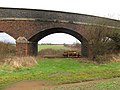 A Bridge through a Bridge. - geograph.org.uk - 629748.jpg 640 × 480; 94 KB
-
 A fox on the roof - geograph.org.uk - 629840.jpg 480 × 640; 44 KB
-
 A lonely walker by the pipeline - geograph.org.uk - 630600.jpg 640 × 480; 37 KB
-
 A track leading to Patervan Farm - geograph.org.uk - 630248.jpg 640 × 480; 133 KB
-
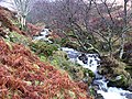 A tumbling hill burn - geograph.org.uk - 631402.jpg 640 × 480; 168 KB
-
 Abovebasta.jpg 640 × 414; 95 KB
-
 African Pygmy Goat - geograph.org.uk - 629846.jpg 640 × 480; 69 KB
-

-
 All lit up - geograph.org.uk - 630602.jpg 638 × 432; 48 KB
-
 Anstruthers famous Christmas tree - geograph.org.uk - 629778.jpg 640 × 426; 97 KB
-
 Asda, Govan - geograph.org.uk - 629991.jpg 640 × 480; 73 KB
-

-
 Bangor War Memorial, by night - geograph.org.uk - 631331.jpg 640 × 431; 27 KB
-
 Barncroft Infant School - geograph.org.uk - 630019.jpg 640 × 480; 40 KB
-
 Barncroft Shops - geograph.org.uk - 631683.jpg 640 × 480; 75 KB
-
 Barnvannoch - geograph.org.uk - 630241.jpg 640 × 480; 96 KB
-

-
 Basingstoke Approach - geograph.org.uk - 630073.jpg 640 × 480; 81 KB
-
 Beached Buoy on the Humber River Bank - geograph.org.uk - 630275.jpg 480 × 640; 87 KB
-
 Birmingham and Solihull Rugby Club - geograph.org.uk - 629871.jpg 640 × 480; 72 KB
-
 Bishop Elphinstone's tomb - geograph.org.uk - 1075695.jpg 640 × 480; 98 KB
-
 Bishop Monkton CE Primary School - geograph.org.uk - 630143.jpg 640 × 480; 72 KB
-
 Bishop Monkton ford - geograph.org.uk - 630125.jpg 480 × 640; 128 KB
-
 Bishop Monkton Mill - geograph.org.uk - 630119.jpg 640 × 480; 97 KB
-
 Black Craig - geograph.org.uk - 630174.jpg 640 × 480; 56 KB
-
 Black Gutter Burn - geograph.org.uk - 630270.jpg 640 × 480; 123 KB
-
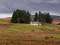
 Blacklaw Cottage - geograph.org.uk - 629948.jpg 640 × 480; 50 KB
-
 Blickling Hall in December - geograph.org.uk - 632483.jpg 640 × 480; 35 KB
-
 Bowling Green, Bishop Monkton - geograph.org.uk - 630180.jpg 640 × 480; 55 KB
-
 Brawns Dod from Capilus Hill - geograph.org.uk - 630777.jpg 640 × 480; 65 KB
-
 Bridge over the Hermitage - geograph.org.uk - 630585.jpg 640 × 480; 44 KB
-
 Bronte bridge and waterfalls - geograph.org.uk - 630928.jpg 518 × 640; 136 KB
-
 Bronze Age Roundhouse - geograph.org.uk - 1083197.jpg 640 × 428; 110 KB
-
 Brooms House Farm - geograph.org.uk - 630113.jpg 640 × 388; 42 KB
-
 Buckingham Palace on a cloudy day.jpg 3,474 × 2,312; 7.14 MB
-
 Burn above Fruid - geograph.org.uk - 630784.jpg 480 × 640; 84 KB
-
 Burnt tree near Barncroft Way - geograph.org.uk - 630645.jpg 640 × 480; 94 KB
-
 Bus stops by Hazelholt Drive - geograph.org.uk - 629928.jpg 640 × 480; 54 KB
-
 Byway, Knollend Down - geograph.org.uk - 631534.jpg 640 × 480; 125 KB
-
 Byway, Knollend Down - geograph.org.uk - 631535.jpg 640 × 480; 132 KB
-
 Cairn on Ill Bell - geograph.org.uk - 645832.jpg 480 × 640; 58 KB
-
 Camden Street, Portslade-by-Sea - geograph.org.uk - 629929.jpg 640 × 479; 90 KB
-
 Canada Water East London roundel.JPG 960 × 1,280; 373 KB
-
 Canes, near Thearne - geograph.org.uk - 629912.jpg 489 × 640; 158 KB
-
 Capilus Hill - geograph.org.uk - 630779.jpg 640 × 480; 65 KB
-
 Car port in Park Lane - geograph.org.uk - 631712.jpg 640 × 480; 59 KB
-
 Caynton Mill. - geograph.org.uk - 629761.jpg 480 × 640; 135 KB
-
 Chapel Burn - geograph.org.uk - 629965.jpg 640 × 480; 31 KB
-
 Chapel of St John the Baptist, Ripon. - geograph.org.uk - 630185.jpg 640 × 480; 126 KB
-
 Christmas decorations on Market Place - geograph.org.uk - 632471.jpg 638 × 450; 50 KB
-
 Christmas lights - geograph.org.uk - 632478.jpg 462 × 639; 49 KB
-
 Clifton Garage - geograph.org.uk - 737430.jpg 640 × 480; 59 KB
-
 Clifton Shops - geograph.org.uk - 737425.jpg 640 × 480; 85 KB
-
 Clouds over Catmore - geograph.org.uk - 631537.jpg 640 × 480; 65 KB
-
 Col below Erie Hill - geograph.org.uk - 630307.jpg 640 × 480; 64 KB
-

-
 Coppull Enterprise Centre - geograph.org.uk - 630967.jpg 640 × 480; 208 KB
-
 Coppull Enterprise Centre - geograph.org.uk - 630969.jpg 450 × 602; 164 KB
-
 Craig Head - geograph.org.uk - 630281.jpg 640 × 480; 120 KB
-
 Cudden Point in heavy seas - geograph.org.uk - 630668.jpg 640 × 480; 47 KB
-
 Cul de sac Winterbourne Road - geograph.org.uk - 629699.jpg 640 × 480; 87 KB
-
 Cycle Path - geograph.org.uk - 630051.jpg 480 × 640; 89 KB
-
 Danes Hill Flats - geograph.org.uk - 630048.jpg 640 × 480; 59 KB
-
 December afternoon. - geograph.org.uk - 630195.jpg 640 × 354; 29 KB
-
 Deerhurst Church - geograph.org.uk - 630106.jpg 640 × 480; 28 KB
-
 Didcot Power Station - geograph.org.uk - 631509.jpg 640 × 427; 85 KB
-
 Dove Bridge - geograph.org.uk - 632649.jpg 640 × 480; 80 KB
-
 Down to Menzion - geograph.org.uk - 630155.jpg 480 × 640; 100 KB
-
 Downland, West Ilsley - geograph.org.uk - 631490.jpg 640 × 480; 93 KB
-
 Downland, West Ilsley - geograph.org.uk - 631527.jpg 640 × 480; 116 KB
-
 Edge of Ward Park by night - geograph.org.uk - 631341.jpg 640 × 387; 53 KB
-

-
 Esker near Shennas - geograph.org.uk - 630212.jpg 640 × 480; 87 KB
-
 Farmland, West Ilsley - geograph.org.uk - 631486.jpg 640 × 480; 153 KB
-
 Farmland, West Ilsley - geograph.org.uk - 631488.jpg 640 × 480; 156 KB
-
 Farmland, West Ilsley - geograph.org.uk - 631493.jpg 640 × 480; 167 KB
-
 Felled area, Menzion - geograph.org.uk - 631219.jpg 640 × 480; 81 KB
-
 Felled area, The Rig - geograph.org.uk - 631221.jpg 640 × 480; 97 KB
-
 Fence Corner, Snipes Dene Wood - geograph.org.uk - 630728.jpg 640 × 427; 97 KB
-
 Fern Hope - geograph.org.uk - 630799.jpg 640 × 480; 50 KB
-
 Festive decoration - The King's Head - geograph.org.uk - 632491.jpg 640 × 480; 52 KB
-
 Festive exterior in Redbridge Grove - geograph.org.uk - 631708.jpg 640 × 480; 91 KB
-
 First tower section of turbine 21 - geograph.org.uk - 630183.jpg 640 × 480; 39 KB
-
 Flats on Middle Street, Brompton - geograph.org.uk - 636919.jpg 640 × 480; 81 KB
-
 Flooded Kempsey Ford - geograph.org.uk - 631100.jpg 640 × 426; 103 KB
-

-
 Folly Down - geograph.org.uk - 631497.jpg 640 × 480; 132 KB
-
 Footpath alongside Hermitage Stream - geograph.org.uk - 630097.jpg 640 × 480; 78 KB
-

-
 Footprints in the Mud - geograph.org.uk - 630528.jpg 640 × 524; 107 KB
-
 Ford at Brookhouse - geograph.org.uk - 632651.jpg 640 × 480; 102 KB
-
 Forest, Capilus Hill - geograph.org.uk - 630772.jpg 480 × 640; 81 KB
-
 Forestry, Craig Law - geograph.org.uk - 630122.jpg 480 × 640; 82 KB
-
 Former Sea Cliffs - geograph.org.uk - 629962.jpg 479 × 640; 99 KB
-
 Foul throw^ - geograph.org.uk - 1075844.jpg 480 × 640; 52 KB
-
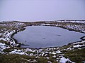 Frozen Tarn, Yoke - geograph.org.uk - 645800.jpg 640 × 480; 74 KB
-
 Fruid - geograph.org.uk - 630802.jpg 640 × 480; 70 KB
-
 Fruid Dam - geograph.org.uk - 629935.jpg 640 × 480; 51 KB
-
 Fruid Dam - geograph.org.uk - 629968.jpg 640 × 480; 78 KB
-
 Fruid Dam - geograph.org.uk - 629987.jpg 640 × 427; 55 KB
-
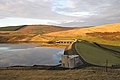
 Fruid Reservoir - geograph.org.uk - 629958.jpg 640 × 480; 31 KB
-
 Fruid Reservoir - geograph.org.uk - 629975.jpg 640 × 480; 38 KB
-
 Fruid Reservoir - geograph.org.uk - 630812.jpg 640 × 480; 61 KB
-
 Fruid road - geograph.org.uk - 630810.jpg 640 × 480; 58 KB
-
 Fruid road - geograph.org.uk - 631216.jpg 640 × 480; 66 KB
-
 Fungi on a treestump - geograph.org.uk - 680126.jpg 640 × 480; 98 KB
-
 Gants Hill roundel.JPG 960 × 1,280; 357 KB
-
 Gas Excavations in Upper Welland Road - geograph.org.uk - 629872.jpg 640 × 420; 265 KB
-
 Gas Work in Upper Welland Road - geograph.org.uk - 629887.jpg 640 × 427; 289 KB
-
 Gate, Craigen Gaw - geograph.org.uk - 630171.jpg 640 × 480; 77 KB
-
 Gathersnow Hill - geograph.org.uk - 629941.jpg 640 × 399; 46 KB
-
 Gigantic puddle near the pipeline - geograph.org.uk - 630594.jpg 640 × 480; 112 KB
-
 Glasshouses, near Thearne - geograph.org.uk - 630056.jpg 640 × 426; 174 KB
-
 Green near Barncroft Shops - geograph.org.uk - 631684.jpg 640 × 480; 58 KB
-
 Hail Storm Hill - geograph.org.uk - 630186.jpg 640 × 480; 73 KB
-
 Charity allotments - geograph.org.uk - 630025.jpg 640 × 427; 89 KB
-
 Darbyshire Close - geograph.org.uk - 630028.jpg 640 × 427; 80 KB
-
 Millfield Close - geograph.org.uk - 630032.jpg 640 × 427; 73 KB
-
 Ox Pasture Drain - geograph.org.uk - 630039.jpg 640 × 427; 77 KB
-
 The Old Vicarage - geograph.org.uk - 630037.jpg 640 × 427; 79 KB
-
 Hartland's Nursery at Draycott.jpg 640 × 426; 66 KB
-
 Havant Day Services - geograph.org.uk - 631139.jpg 640 × 480; 45 KB
-
 Hawthorn Walk - geograph.org.uk - 631136.jpg 640 × 480; 108 KB
-
 Head of the Fruid Reservoir - geograph.org.uk - 630789.jpg 640 × 480; 51 KB
-
 Head of the Menzion Burn - geograph.org.uk - 630163.jpg 640 × 480; 62 KB
-
 Heather Hillside - geograph.org.uk - 630254.jpg 640 × 480; 132 KB
-
 Heavy seas off Cudden Point - geograph.org.uk - 630676.jpg 640 × 388; 46 KB
-
 Hermit's Lea - geograph.org.uk - 630069.jpg 640 × 480; 76 KB
-
 Hidden cemetery, Droitwich - geograph.org.uk - 1071313.jpg 640 × 480; 143 KB
-
 Hilton Clock and Pub.jpg 480 × 640; 56 KB
-
 Hopekist Rig Plantation - geograph.org.uk - 630287.jpg 640 × 480; 145 KB
-

-
 I can't see the point..... - geograph.org.uk - 630669.jpg 640 × 480; 40 KB
-

-
 Inside the sitka, The Rig - geograph.org.uk - 630135.jpg 480 × 640; 113 KB
-

-

-

-

-
 Kempsey Church - geograph.org.uk - 631098.jpg 640 × 426; 64 KB
-
 Kempsey Church - geograph.org.uk - 631099.jpg 426 × 640; 74 KB
-

-
 Kings College Tower - geograph.org.uk - 1075708.jpg 480 × 640; 61 KB
-

-
 Laird's Cleuch Rig - geograph.org.uk - 630290.jpg 480 × 640; 74 KB
-
 Lamp standard - geograph.org.uk - 630012.jpg 640 × 427; 53 KB
-
 Lane, bridge and car - geograph.org.uk - 629757.jpg 640 × 480; 99 KB
-
 Leigh Park Boundary - geograph.org.uk - 630648.jpg 640 × 480; 55 KB
-
 Let it snow, let it snow, let it snow^ - geograph.org.uk - 1075795.jpg 640 × 480; 110 KB
-
 Limefitt Park Reception - geograph.org.uk - 786865.jpg 640 × 480; 62 KB
-
 Localised flooding near Barncroft Way - geograph.org.uk - 629982.jpg 640 × 480; 126 KB
-
 Looking across the Hermitage footbridge - geograph.org.uk - 630587.jpg 640 × 480; 101 KB
-
 Looking down Stockheath Lane - geograph.org.uk - 631131.jpg 640 × 480; 72 KB
-
 Looking right along Redbridge Grove - geograph.org.uk - 631919.jpg 640 × 480; 52 KB
-
 M6 - geograph.org.uk - 631525.jpg 640 × 480; 237 KB
-
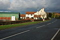
 Masons Arms, Bishop Monkton - geograph.org.uk - 630147.jpg 640 × 444; 73 KB
-

-
 Menzion - geograph.org.uk - 630282.jpg 640 × 480; 104 KB
-
 Menzion weather - geograph.org.uk - 630301.jpg 640 × 480; 58 KB
-
 Mile Stone and Mounting Block with O.S. Bench Mark (geograph 5991588).jpg 4,608 × 3,456; 5.31 MB
-
 Mile Stone and Mounting Block with O.S. Bench Mark (geograph 5991602).jpg 3,456 × 4,608; 5.6 MB
-
 Mile Stone and Mounting Block with O.S. Bench Mark (geograph 5991609).jpg 4,608 × 3,456; 4.7 MB
-
 Milford Close - geograph.org.uk - 631917.jpg 640 × 480; 60 KB
-
 Millers, Bolton Road, Chorley - geograph.org.uk - 630941.jpg 640 × 480; 177 KB
-
 Millers, Bolton Road, Chorley - geograph.org.uk - 630958.jpg 640 × 480; 162 KB
-
 Monadhliath Midwinter - geograph.org.uk - 637659.jpg 480 × 640; 54 KB
-
 Moorland near Gutcher - geograph.org.uk - 630224.jpg 640 × 426; 68 KB
-
 Moorland south of Colvister - geograph.org.uk - 630199.jpg 640 × 426; 61 KB
-
 Moorland south of the A75 - geograph.org.uk - 630388.jpg 640 × 480; 59 KB
-
 Moreton shore - panoramio.jpg 3,072 × 2,304; 2.37 MB
-
 Mosque, central Edinburgh - geograph.org.uk - 1575285.jpg 402 × 640; 45 KB
-

-
 Mr and Mrs Cemlyn - geograph.org.uk - 1061877.jpg 640 × 480; 129 KB
-
 Mudflats at Paull Holme Sands - geograph.org.uk - 630272.jpg 640 × 480; 63 KB
-
 Murton pit.jpg 636 × 363; 41 KB
-
 Nativity scene - geograph.org.uk - 632474.jpg 640 × 480; 56 KB
-
 New flats in Georgia Close - geograph.org.uk - 631141.jpg 640 × 480; 58 KB
-
 New Kings and laid-back modern art - geograph.org.uk - 1075733.jpg 640 × 480; 89 KB
-
 New Kings gateway - geograph.org.uk - 1075759.jpg 640 × 480; 56 KB
-
 New road bridge over the River Yarrow - geograph.org.uk - 630957.jpg 640 × 480; 204 KB
-

-

-
 Nicolson Way - geograph.org.uk - 631128.jpg 640 × 480; 53 KB
-
 North Bar with gate shut - geograph.org.uk - 1074092.jpg 480 × 640; 75 KB
-

-
 North-western end of Long Dale - geograph.org.uk - 630450.jpg 640 × 480; 40 KB
-
 Northern edge of Hooks Lane Rec - geograph.org.uk - 631152.jpg 640 × 480; 50 KB
-
 Number 1 Whitehall Riverside (10) - geograph.org.uk - 630716.jpg 640 × 396; 208 KB
-
 Number 1 Whitehall Riverside (11) - geograph.org.uk - 630720.jpg 613 × 414; 241 KB
-
 Number 1 Whitehall Riverside (12) - geograph.org.uk - 630724.jpg 640 × 427; 252 KB
-
 Number 1 Whitehall Riverside (2) - geograph.org.uk - 630685.jpg 426 × 640; 55 KB
-
 Number 1 Whitehall Riverside (3) - geograph.org.uk - 630690.jpg 640 × 395; 244 KB
-
 Number 1 Whitehall Riverside (4) - geograph.org.uk - 630693.jpg 640 × 414; 209 KB
-
 Number 1 Whitehall Riverside (5) - geograph.org.uk - 630697.jpg 640 × 427; 207 KB


.jpg)
.jpg)
.jpg)


_-_geograph.org.uk_-_630716.jpg)
_-_geograph.org.uk_-_630720.jpg)
_-_geograph.org.uk_-_630724.jpg)
_-_geograph.org.uk_-_630685.jpg)
_-_geograph.org.uk_-_630690.jpg)
_-_geograph.org.uk_-_630693.jpg)
_-_geograph.org.uk_-_630697.jpg)