Category:United Kingdom photographs taken on 2007-11-11
Jump to navigation
Jump to search
Countries of Europe: Austria · Belgium · Croatia · Czech Republic · Denmark · Finland · France‡ · Germany · Greece · Italy · Latvia · Netherlands‡ · Norway · Poland · Portugal‡ · Romania · Russia‡ · Serbia · Slovakia · Slovenia · Spain‡ · Turkey‡ · Ukraine · United Kingdom
‡: partly located in Europe
‡: partly located in Europe
| ← | 11 November 2007 | → | ||
| ← | November 2007 | → | ||

United Kingdom photographs taken on 11 November 2007.
Image files should be categorized here automatically using {{taken on}} template. Direct categorisation is also possible, if automatic is impossible.
Subcategories
This category has only the following subcategory.
S
Media in category "United Kingdom photographs taken on 2007-11-11"
The following 200 files are in this category, out of 1,006 total.
(previous page) (next page)-
-
 "The Chapel", Howle Hill - geograph.org.uk - 609804.jpg 640 × 480; 182 KB
-
 "The Meadows", Hospital Road, Omagh - geograph.org.uk - 609552.jpg 640 × 273; 23 KB
-
 (The site of) Milecastle 40 - geograph.org.uk - 610092.jpg 640 × 480; 88 KB
-
 (The site of) Milecastle 41 - geograph.org.uk - 610141.jpg 640 × 480; 123 KB
-
 A carpet of rhododendrons - geograph.org.uk - 609513.jpg 640 × 480; 90 KB
-
 A drystone dyke by the Coomsdon Burn - geograph.org.uk - 616085.jpg 640 × 480; 115 KB
-
 A moorland fence - geograph.org.uk - 616108.jpg 640 × 480; 111 KB
-

-
 Abernethy Forest - geograph.org.uk - 612624.jpg 640 × 480; 66 KB
-
 Abernethy Forest - geograph.org.uk - 612744.jpg 640 × 480; 70 KB
-
 Abernethy Forest - geograph.org.uk - 612775.jpg 640 × 480; 98 KB
-
 Abernethy Forest - geograph.org.uk - 612811.jpg 640 × 480; 95 KB
-
 Abernethy Forest - geograph.org.uk - 612826.jpg 480 × 640; 112 KB
-
 Abernethy Forest - geograph.org.uk - 613979.jpg 640 × 480; 75 KB
-
 Abernethy Forest, Allt na h-Eìrghe - geograph.org.uk - 613961.jpg 640 × 480; 87 KB
-
 Abernethy Forest, Inchtomach - geograph.org.uk - 612760.jpg 640 × 480; 130 KB
-
 Abernethy Forest, Inchtomach - geograph.org.uk - 612792.jpg 640 × 480; 119 KB
-
 Abernethy Forest, near Loch a' Chnuic - geograph.org.uk - 613988.jpg 640 × 480; 68 KB
-
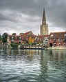 The Thames and Abingdon Church spire - geograph.org.uk - 612766.jpg 515 × 640; 125 KB
-
 Above the Erewash Valley near Trowell - geograph.org.uk - 616353.jpg 640 × 474; 96 KB
-
 Aircraft - geograph.org.uk - 834235.jpg 640 × 480; 47 KB
-
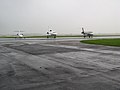
 Airside at Manchester - geograph.org.uk - 610459.jpg 640 × 480; 56 KB
-
 All Saints church Thorpe Abbotts - geograph.org.uk - 610820.jpg 640 × 480; 63 KB
-
 Allt Bheadhair - geograph.org.uk - 612873.jpg 640 × 480; 63 KB
-
 Allt Bheadhair - geograph.org.uk - 613293.jpg 640 × 480; 83 KB
-
 Allt na h-Eìrghe - geograph.org.uk - 613463.jpg 640 × 480; 82 KB
-
 Allt na h-Eìrghe - geograph.org.uk - 613470.jpg 640 × 480; 97 KB
-
 Allt na h-Eìrghe - geograph.org.uk - 613480.jpg 640 × 480; 65 KB
-
 Allt na h-Eìrghe - geograph.org.uk - 613484.jpg 640 × 480; 67 KB
-
 Along the Jack Mytton Way - geograph.org.uk - 609490.jpg 640 × 480; 220 KB
-
 Alpacas resting - geograph.org.uk - 610147.jpg 640 × 451; 171 KB
-
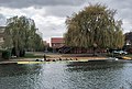 An "Eight" at Abingdon - geograph.org.uk - 612752.jpg 640 × 431; 130 KB
-

-
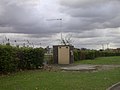 Anglian Water hut, Gazelle Way - geograph.org.uk - 609434.jpg 640 × 480; 57 KB
-
 Approach lights to Cambridge Airport - geograph.org.uk - 609399.jpg 640 × 478; 73 KB
-

-

-
 Auchtitench Lane - geograph.org.uk - 610182.jpg 640 × 480; 175 KB
-
 Autumn footpath - geograph.org.uk - 609611.jpg 480 × 640; 137 KB
-
 Autumn in Whitcliffe - geograph.org.uk - 620836.jpg 640 × 480; 115 KB
-
 Autumn on the A157 - geograph.org.uk - 609733.jpg 640 × 480; 140 KB
-
 Aviary in the park - geograph.org.uk - 609602.jpg 640 × 480; 93 KB
-
 Awsworth.jpg 633 × 465; 57 KB
-
 Babbington Lane, Swingate - geograph.org.uk - 616554.jpg 640 × 466; 64 KB
-
 Babbington Lane, Swingate - geograph.org.uk - 617037.jpg 640 × 464; 43 KB
-
 Babbington Village - geograph.org.uk - 616359.jpg 640 × 466; 47 KB
-
 Babbington Village - geograph.org.uk - 616504.jpg 640 × 466; 41 KB
-
 Back Brook near Outwoods - geograph.org.uk - 609392.jpg 640 × 480; 96 KB
-

-

-
-

-
-

-

-
 Bath Road, Sonning - geograph.org.uk - 612091.jpg 640 × 480; 148 KB
-
 Bavington Hall - geograph.org.uk - 609557.jpg 640 × 470; 105 KB
-

-

-
-

-

-

-
 Beachley pylon.jpg 640 × 480; 61 KB
-
 Beaumont College war memorial.JPG 1,200 × 900; 507 KB
-
 Beech trees in Ness Wood - geograph.org.uk - 610473.jpg 640 × 480; 157 KB
-
 Belfast, Albert Memorial Clock - geograph.org.uk - 613164.jpg 480 × 640; 74 KB
-
 Belfast, an apolitical mural - geograph.org.uk - 611300.jpg 640 × 480; 82 KB
-
 Belfast, Antrim Road Waterworks - geograph.org.uk - 611290.jpg 640 × 480; 68 KB
-
 Belfast, Bank of Ireland building - geograph.org.uk - 611304.jpg 480 × 640; 56 KB
-
 Belfast, Castle Court façade detail - geograph.org.uk - 611315.jpg 640 × 480; 78 KB
-
 Belfast, Castle Court shopping centre - geograph.org.uk - 611306.jpg 640 × 480; 84 KB
-
 Belfast, cathedral church of St. Ann - geograph.org.uk - 613139.jpg 640 × 480; 55 KB
-
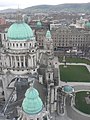
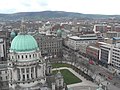 Belfast, City Hall dome and beyond - geograph.org.uk - 611343.jpg 640 × 480; 87 KB
-
 Belfast, City Hall from the northwest - geograph.org.uk - 612272.jpg 640 × 480; 71 KB
-
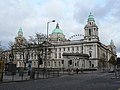 Belfast, City Hall from the southwest - geograph.org.uk - 612275.jpg 640 × 480; 76 KB
-
 Belfast, City Hall frontage - geograph.org.uk - 611347.jpg 480 × 640; 87 KB
-
 Belfast, Donegall Square gardens - geograph.org.uk - 611350.jpg 640 × 480; 84 KB
-
 Belfast, Imperial House - geograph.org.uk - 611346.jpg 640 × 480; 71 KB
-

-
 Belfast, Queen Mary's Gardens - geograph.org.uk - 611294.jpg 640 × 480; 95 KB
-
 Belfast, queuing for the Wheel - geograph.org.uk - 611353.jpg 640 × 480; 77 KB
-
 Belfast, Robinson and Cleaver building - geograph.org.uk - 611336.jpg 640 × 480; 108 KB
-
-

-
 Belfast, roofscape - geograph.org.uk - 612266.jpg 640 × 480; 64 KB
-
 Belfast, Royal Mail building - geograph.org.uk - 611375.jpg 640 × 480; 70 KB
-
-

-

-
 Belfast, Telegraph newspaper office - geograph.org.uk - 611302.jpg 480 × 640; 89 KB
-

-
 Belfast, the cenotaph - geograph.org.uk - 611322.jpg 640 × 480; 79 KB
-
 Belfast, the River Lagan - geograph.org.uk - 611356.jpg 640 × 480; 51 KB
-
 Belfast, The Spires Centre - geograph.org.uk - 611503.jpg 640 × 480; 76 KB
-

-
 Belfast, the Wheel of Belfast - geograph.org.uk - 611335.jpg 480 × 640; 84 KB
-
 Belfast, the Wheel side-on - geograph.org.uk - 612283.jpg 480 × 640; 78 KB
-

-
 Belfast, Waterfront Hall detail - geograph.org.uk - 611376.jpg 640 × 480; 51 KB
-
 Biggleswade, Cemetery mortuary chapels - geograph.org.uk - 611738.jpg 640 × 474; 125 KB
-

-
 Biggleswade, Footpath near Top Field Farm - geograph.org.uk - 610976.jpg 640 × 480; 117 KB
-

-
 Biggleswade, George's Hall - geograph.org.uk - 612474.jpg 640 × 480; 82 KB
-
 Biggleswade, Ivel Mill - geograph.org.uk - 611781.jpg 640 × 480; 95 KB
-

-

-

-

-
 Biggleswade, The Market House - geograph.org.uk - 609922.jpg 640 × 480; 87 KB
-
 Biggleswade, The Saxon Centre - geograph.org.uk - 613200.jpg 640 × 480; 67 KB
-

-
 Biggleswade, The War Memorial - geograph.org.uk - 610236.jpg 640 × 480; 90 KB
-
 Biggleswade.The Crown Hotel.jpg 640 × 480; 68 KB
-
 Bike stores at ARM - geograph.org.uk - 1011557.jpg 640 × 480; 95 KB
-
 Bile Buidhe - geograph.org.uk - 613452.jpg 637 × 429; 71 KB
-
 Bilston Parish Church - geograph.org.uk - 610571.jpg 480 × 640; 72 KB
-
 Bingley Five Rise Locks - geograph.org.uk - 1083371.jpg 480 × 640; 76 KB
-
 Black bales - geograph.org.uk - 1041727.jpg 480 × 640; 75 KB
-
 Black sheep in the woodland - geograph.org.uk - 609753.jpg 640 × 445; 201 KB
-
 Blackhills lochan - geograph.org.uk - 1041218.jpg 640 × 480; 78 KB
-
 Blocking the way to another Geograph^ - geograph.org.uk - 610079.jpg 640 × 480; 108 KB
-
 Board of Guardian's Office - geograph.org.uk - 615893.jpg 640 × 410; 72 KB
-
 Boats in Nigg Bay - geograph.org.uk - 613166.jpg 640 × 480; 97 KB
-
 Bog pool - geograph.org.uk - 613459.jpg 640 × 480; 75 KB
-
 Bog pools on Carn Tarsuinn - geograph.org.uk - 613302.jpg 640 × 450; 90 KB
-
 Bogs on Carn Tarsuinn - geograph.org.uk - 613309.jpg 640 × 480; 89 KB
-
 Bogs, Carn Tarsuinn - geograph.org.uk - 613306.jpg 640 × 480; 79 KB
-
 Boundary wall by track from Pett - geograph.org.uk - 1041743.jpg 480 × 640; 86 KB
-
-

-
 Bridge over the motorway - geograph.org.uk - 616624.jpg 640 × 466; 86 KB
-
 Bridge over the Nethy - geograph.org.uk - 612603.jpg 480 × 640; 110 KB
-

-
 Bridleway to the Jack Mytton Way - geograph.org.uk - 609411.jpg 640 × 480; 357 KB
-
 Bristol South Swimming Pool - geograph.org.uk - 609787.jpg 640 × 480; 74 KB
-
 Broad Street, Reading - geograph.org.uk - 612073.jpg 480 × 640; 120 KB
-
 Broken Back Bridge - geograph.org.uk - 652846.jpg 640 × 427; 138 KB
-
 Broxbourne railway station staircase from ticket office.jpg 2,736 × 3,648; 3.97 MB
-
 Buckland Church - geograph.org.uk - 612328.jpg 426 × 640; 68 KB
-
 Buckland Church viewed from the west - geograph.org.uk - 613174.jpg 640 × 426; 101 KB
-
 Buckland Manor Hotel - geograph.org.uk - 612332.jpg 640 × 426; 103 KB
-
 Bullwood from Ardgowan Point - geograph.org.uk - 611879.jpg 640 × 480; 106 KB
-
 Burnside - geograph.org.uk - 1041143.jpg 640 × 480; 80 KB
-
 Burnside - geograph.org.uk - 1041152.jpg 640 × 480; 84 KB
-
 By the harbour - geograph.org.uk - 610486.jpg 640 × 424; 94 KB
-
 Caerlaverock Castle - geograph.org.uk - 1538522.jpg 640 × 427; 74 KB
-
-
 Can't wait until spring - geograph.org.uk - 609480.jpg 480 × 640; 124 KB
-
 Car salesrooms - geograph.org.uk - 609660.jpg 640 × 480; 60 KB
-
 Carn Bheadhair - geograph.org.uk - 610290.jpg 640 × 480; 78 KB
-
 Carn Bheadhair - geograph.org.uk - 613290.jpg 640 × 480; 87 KB
-
 Carn Bheadhair - geograph.org.uk - 613294.jpg 640 × 480; 72 KB
-
 Carn Bheadhair - geograph.org.uk - 613297.jpg 640 × 448; 69 KB
-
 Carn Tarsuinn - geograph.org.uk - 613299.jpg 638 × 457; 67 KB
-
 Carradale War Memorial - geograph.org.uk - 610671.jpg 640 × 480; 90 KB
-
 Carry Brae, Omagh - geograph.org.uk - 609775.jpg 640 × 327; 54 KB
-
 Castle Hill Hospital Cottingham.jpg 640 × 480; 186 KB
-
 Cat on a Stone Gate Post - geograph.org.uk - 609771.jpg 427 × 640; 293 KB
-
 Cattle above Manor Farm, Buckland - geograph.org.uk - 612325.jpg 640 × 426; 100 KB
-
 Cave in low limestone ridge - geograph.org.uk - 609886.jpg 640 × 472; 112 KB
-
 Cemetery Chapel - geograph.org.uk - 609561.jpg 480 × 640; 84 KB
-
 Central line old and new.JPG 820 × 358; 135 KB
-
 Character in Basingstoke - geograph.org.uk - 609668.jpg 640 × 480; 76 KB
-
 Chelmarsh Sailing Club - geograph.org.uk - 609401.jpg 640 × 480; 297 KB
-
 Christ Church, Charnock Richard - geograph.org.uk - 611168.jpg 640 × 480; 187 KB
-
 Christ Church, Charnock Richard - geograph.org.uk - 611174.jpg 640 × 480; 202 KB
-

-
 Christ Church, Charnock Richard, Lychgate - geograph.org.uk - 611171.jpg 640 × 480; 158 KB
-
 Christ Church, Charnock Richard, Porch - geograph.org.uk - 611172.jpg 640 × 480; 144 KB
-
 Christ Church, Charnock Richard, Sign - geograph.org.uk - 611169.jpg 640 × 480; 143 KB
-

-
 Church Road, Wanlip - geograph.org.uk - 610382.jpg 640 × 480; 67 KB
-
 City Boundary near Swingate - geograph.org.uk - 616632.jpg 466 × 640; 91 KB
-

-
 Clauchrie farm - geograph.org.uk - 609658.jpg 640 × 469; 112 KB
-
 Clauchrie Forest - geograph.org.uk - 609698.jpg 640 × 480; 127 KB
-
 Combe Abbey.JPG 2,048 × 1,536; 840 KB
-

-
 Corner of garden fence - geograph.org.uk - 1041553.jpg 640 × 480; 137 KB
-
 Corner of the wood - geograph.org.uk - 620840.jpg 640 × 480; 102 KB
-
 Cottage in Laverton - geograph.org.uk - 613098.jpg 640 × 426; 81 KB
-
 Cottages in Laverton - geograph.org.uk - 613097.jpg 640 × 426; 66 KB
-

-
-
 Covenanter commemorative wall - geograph.org.uk - 610230.jpg 640 × 480; 178 KB
-
 Covent Garden dressed for Christmas - geograph.org.uk - 788372.jpg 480 × 640; 112 KB
-
 Crabley Creek Level Crossing - geograph.org.uk - 610383.jpg 640 × 480; 76 KB
-
 Crabley Creek Level Crossing - geograph.org.uk - 611432.jpg 640 × 480; 76 KB
-
 Crabley Creek Level Crossing - geograph.org.uk - 611434.jpg 640 × 436; 68 KB
-
 Crabley Farm - geograph.org.uk - 610270.jpg 640 × 383; 53 KB
-
 Crane and fuel pumps - Sawley Marina - geograph.org.uk - 611696.jpg 640 × 427; 86 KB
-
 Cricket field at Stanway - geograph.org.uk - 613602.jpg 640 × 426; 82 KB
-
 Cromarty Firth shoreline near Nigg - geograph.org.uk - 609626.jpg 640 × 458; 108 KB
-
 Culham and cooling - geograph.org.uk - 611008.jpg 640 × 418; 45 KB
-
 Cycle route to town - geograph.org.uk - 609682.jpg 640 × 480; 108 KB
-
 Cypress Avenue - geograph.org.uk - 610125.jpg 640 × 485; 137 KB
-


_Milecastle_40_-_geograph.org.uk_-_610092.jpg)
_Milecastle_41_-_geograph.org.uk_-_610141.jpg)


_-_geograph.org.uk_-_611301.jpg)


_-_geograph.org.uk_-_612263.jpg)


