Category:United Kingdom photographs taken on 2007-08-17
Jump to navigation
Jump to search
Countries of Europe: Austria · Belarus · Belgium · Croatia · Czech Republic · Estonia · Finland · France‡ · Georgia‡ · Germany · Greece · Hungary · Iceland · Republic of Ireland · Italy · Latvia · Malta · Netherlands‡ · Norway · Poland · Portugal‡ · Romania · Russia‡ · Slovakia · Spain‡ · Sweden · Switzerland · Turkey‡ · Ukraine · United Kingdom
Specific status: Gibraltar
‡: partly located in Europe
Specific status: Gibraltar
‡: partly located in Europe
| ← | 17 August 2007 | → | ||
| ← | August 2007 | → | ||

United Kingdom photographs taken on 17 August 2007.
Image files should be categorized here automatically using {{taken on}} template. Direct categorisation is also possible, if automatic is impossible.
Subcategories
This category has the following 3 subcategories, out of 3 total.
Media in category "United Kingdom photographs taken on 2007-08-17"
The following 200 files are in this category, out of 780 total.
(previous page) (next page)-
 "Give Way" on the bridleway - geograph.org.uk - 527913.jpg 640 × 425; 76 KB
-
 "Mondo" Barrow - geograph.org.uk - 530406.jpg 640 × 480; 131 KB
-
 'Rudderman' in Belfast - geograph.org.uk - 590851.jpg 640 × 332; 38 KB
-
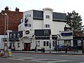
 'The Chequers' inn at Gazeley - geograph.org.uk - 532018.jpg 640 × 425; 65 KB
-

-
 19th Century submarine - geograph.org.uk - 532736.jpg 640 × 426; 118 KB
-
 3one7, Finchley Road - geograph.org.uk - 528500.jpg 640 × 480; 94 KB
-
 A 15th century bridge at Moulton - geograph.org.uk - 532133.jpg 640 × 402; 74 KB
-
 A building at Clydebank College - geograph.org.uk - 1112014.jpg 519 × 640; 59 KB
-
 A Guanaco at Broomilees Farm, Darnick - geograph.org.uk - 762911.jpg 640 × 480; 49 KB
-
 A pink exposure - geograph.org.uk - 529332.jpg 640 × 480; 80 KB
-
 A view of the ford at Moulton - geograph.org.uk - 532118.jpg 640 × 398; 67 KB
-
 A41, Finchley Road - geograph.org.uk - 531456.jpg 640 × 480; 105 KB
-

-

-

-
 A9 at Dalwhinnie - geograph.org.uk - 546648.jpg 640 × 480; 69 KB
-
 A9 junction at Clashmore - geograph.org.uk - 545789.jpg 640 × 475; 79 KB
-
 Accommodation block at RAF West Raynham.jpg 640 × 480; 133 KB
-

-
 Addoldy Y Bedyddwyr - geograph.org.uk - 531622.jpg 480 × 640; 95 KB
-
 Afon Nyfer, upstream of the bridge - geograph.org.uk - 531585.jpg 640 × 466; 98 KB
-
 Alan Day Volkswagen - geograph.org.uk - 528551.jpg 640 × 480; 80 KB
-
 Albion Street, Clitheroe - geograph.org.uk - 531425.jpg 640 × 480; 198 KB
-

-
 Along The Beach. - geograph.org.uk - 632602.jpg 640 × 480; 46 KB
-
 Approaching Talvan - geograph.org.uk - 530834.jpg 640 × 480; 200 KB
-
 Argyle Street, Ullapool - geograph.org.uk - 543618.jpg 640 × 427; 242 KB
-
 Artist at work, Portstewart - geograph.org.uk - 529609.jpg 640 × 479; 68 KB
-
 Arun Valley Line - geograph.org.uk - 528115.jpg 640 × 479; 206 KB
-

-
 Back to normal. - geograph.org.uk - 528416.jpg 640 × 480; 153 KB
-
 Bacup Road, Waterfoot - geograph.org.uk - 528831.jpg 640 × 527; 81 KB
-
 Bank of heather at Strath Rory - geograph.org.uk - 545621.jpg 640 × 498; 76 KB
-
 Baptist Union Chapel, Alvanley Place - geograph.org.uk - 532958.jpg 426 × 640; 119 KB
-
 Barn, Manor Farm - geograph.org.uk - 530562.jpg 640 × 480; 124 KB
-
 Barns and outbuildings, Rudham Grange - geograph.org.uk - 528151.jpg 640 × 480; 116 KB
-
 Bay Horse, Baildon - geograph.org.uk - 529994.jpg 640 × 480; 94 KB
-
 Belgrano, 86 Devonshire Place - geograph.org.uk - 531826.jpg 640 × 426; 115 KB
-
 Berengrave Local Nature Reserve - geograph.org.uk - 994484.jpg 426 × 640; 145 KB
-
 Between Osmington and Black Head - geograph.org.uk - 533209.jpg 426 × 640; 149 KB
-
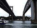 Between the Tamar Bridges - geograph.org.uk - 532360.jpg 640 × 480; 186 KB
-
 Bird Hide, ECOS Centre, Ballymena - geograph.org.uk - 529550.jpg 640 × 409; 65 KB
-
 Birkenhead Central Library - geograph.org.uk - 532728.jpg 640 × 426; 131 KB
-
 Birkenhead Lawn Tennis Club - geograph.org.uk - 531822.jpg 640 × 426; 128 KB
-
 Birkenhead Town Hall - geograph.org.uk - 532954.jpg 426 × 640; 102 KB
-
 Birth of a housing estate - geograph.org.uk - 529288.jpg 640 × 480; 68 KB
-
 Blackberry Season (1148776971).jpg 1,280 × 851; 140 KB
-
 Blas ar fwyd Ffrainc - A taste of France - geograph.org.uk - 530519.jpg 640 × 428; 130 KB
-
 Blisworth Tunnel - geograph.org.uk - 530962.jpg 640 × 428; 99 KB
-
-
 Breakwater, Wdig-Goodwick - geograph.org.uk - 528405.jpg 640 × 480; 124 KB
-
 Bridge across Devonshire Place - geograph.org.uk - 531825.jpg 640 × 426; 150 KB
-
 Bridge over Sinderhope Burn - geograph.org.uk - 529001.jpg 640 × 480; 162 KB
-

-
-

-
 Brixham Breakwater Beach - geograph.org.uk - 1419719.jpg 640 × 480; 61 KB
-
 Broad Head - geograph.org.uk - 528615.jpg 480 × 640; 78 KB
-
 Broch with seagulls at Bay of Stoer - geograph.org.uk - 1025225.jpg 640 × 480; 64 KB
-
 Brockloch Tower, Carsphairn. - geograph.org.uk - 528242.jpg 480 × 640; 84 KB
-

-
 Bubble man in Carlisle - geograph.org.uk - 530423.jpg 640 × 466; 121 KB
-
 Burray Cliffs.jpg 640 × 426; 59 KB
-
 Burray Ness.jpg 640 × 426; 62 KB
-
 Butcher's shop, Abergwaun-Fishguard - geograph.org.uk - 531761.jpg 640 × 480; 81 KB
-
 Butler Street car park, Preston - geograph.org.uk - 954426.jpg 640 × 480; 82 KB
-
-
 Carna Narrows (Caol Charna) - geograph.org.uk - 1093500.jpg 640 × 480; 49 KB
-
 Caroline Square, Skipton, Yorkshire - geograph.org.uk - 529851.jpg 640 × 427; 107 KB
-
 Causeway Garth, Thorpe Audlin - geograph.org.uk - 527963.jpg 640 × 480; 107 KB
-

-
 Century business park. - geograph.org.uk - 528390.jpg 640 × 480; 79 KB
-
 Changes to the front of the Civic Hall - geograph.org.uk - 531431.jpg 640 × 480; 223 KB
-
 Changes to the rear of the Civic Hall - geograph.org.uk - 531415.jpg 640 × 480; 179 KB
-
 Changes to the rear of the Civic Hall - geograph.org.uk - 531422.jpg 480 × 640; 176 KB
-
 Chepstow Library - geograph.org.uk - 527998.jpg 640 × 427; 84 KB
-
 Chirdon Burn - geograph.org.uk - 528387.jpg 640 × 480; 112 KB
-
 Chirdon Burn - geograph.org.uk - 528606.jpg 640 × 379; 61 KB
-
 Chirdon Hope - geograph.org.uk - 528607.jpg 480 × 640; 87 KB
-
 Church of St Mary, Stopham - geograph.org.uk - 528203.jpg 479 × 640; 190 KB
-
 Church path at Elham, Kent - geograph.org.uk - 1520207.jpg 640 × 430; 67 KB
-
 Churnsike Lodge - geograph.org.uk - 528422.jpg 640 × 358; 95 KB
-
 Circus Sydney comes to Omagh - geograph.org.uk - 528712.jpg 640 × 480; 50 KB
-
 Clear Fell in Langdale Forest - geograph.org.uk - 527789.jpg 640 × 480; 176 KB
-
 Cliffs at Birling Gap - geograph.org.uk - 1297420.jpg 640 × 409; 80 KB
-
 Clock's Crags - geograph.org.uk - 528649.jpg 640 × 410; 78 KB
-
 Clydebank College - geograph.org.uk - 1111987.jpg 640 × 400; 64 KB
-
 Common Lane, Thorpe Audlin - geograph.org.uk - 527968.jpg 640 × 480; 150 KB
-
 Converted chapel at Barningham - geograph.org.uk - 528144.jpg 640 × 359; 84 KB
-
 Converted warehouse, Hamilton Square - geograph.org.uk - 532952.jpg 640 × 426; 110 KB
-
 Cors Fynydd - Upland Bog - geograph.org.uk - 528009.jpg 640 × 480; 56 KB
-
 Cors Pwll-yr-ych - geograph.org.uk - 527973.jpg 640 × 480; 61 KB
-
 Cottages at Grove End, Haddenham - geograph.org.uk - 529951.jpg 640 × 480; 93 KB
-
 Cottages, Upper Street, Fittleworth - geograph.org.uk - 528266.jpg 640 × 479; 155 KB
-
 Country lane near Kipton Ash Farm - geograph.org.uk - 530625.jpg 640 × 480; 120 KB
-
 Couse Point on Lamb Holm. - geograph.org.uk - 530073.jpg 640 × 426; 53 KB
-
 Cowbridge Viaduct - geograph.org.uk - 1212115.jpg 640 × 480; 61 KB
-
 Cows on Darren Ddu - geograph.org.uk - 549742.jpg 640 × 480; 69 KB
-
 Croeso y capel - geograph.org.uk - 532324.jpg 480 × 640; 129 KB
-
 Cross's Grave - geograph.org.uk - 531651.jpg 640 × 480; 73 KB
-
 Cuan Sound - geograph.org.uk - 529471.jpg 640 × 480; 73 KB
-
 Darfield Army Cadets rifle range. - geograph.org.uk - 528404.jpg 640 × 609; 146 KB
-

-
 Day Out - geograph.org.uk - 748517.jpg 640 × 426; 78 KB
-
 Demolition site - geograph.org.uk - 532011.jpg 640 × 412; 48 KB
-
 Disused chapel in Main Street - geograph.org.uk - 527966.jpg 640 × 480; 102 KB
-
 Disused Colliery Building, Sharneyford - geograph.org.uk - 528764.jpg 640 × 480; 103 KB
-
 Disused Quarry - geograph.org.uk - 528192.jpg 640 × 480; 134 KB
-
 Disused railway line. - geograph.org.uk - 527883.jpg 640 × 480; 100 KB
-
 Dornfelder at Sharpham Vineyard - geograph.org.uk - 532216.jpg 640 × 427; 109 KB
-
 Drum Castle - geograph.org.uk - 1574266.jpg 640 × 427; 69 KB
-
 Dunnottar Castle, gateway - geograph.org.uk - 1543672.jpg 427 × 640; 115 KB
-
 Dykeraw Farm sign - geograph.org.uk - 528318.jpg 480 × 640; 116 KB
-
 East along farm track - geograph.org.uk - 530603.jpg 640 × 480; 96 KB
-
 Eastbourne from the South Downs - geograph.org.uk - 1297439.jpg 640 × 407; 60 KB
-
 Edinburgh at Sunset (2636373565).jpg 1,600 × 1,202; 1.01 MB
-

-
 Entrance to Birkenhead High School GDST - geograph.org.uk - 531827.jpg 640 × 426; 134 KB
-

-
 Entrance to Portadown Sewerage Works. - geograph.org.uk - 527914.jpg 640 × 480; 95 KB
-
 Ex butcher's shop - geograph.org.uk - 531616.jpg 480 × 640; 93 KB
-
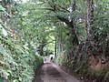
 Fairytale walk through the woods - geograph.org.uk - 1071948.jpg 640 × 360; 132 KB
-
 Falls of Kirkaig - geograph.org.uk - 707647.jpg 480 × 640; 90 KB
-
 Falls of Kirkaig - geograph.org.uk - 707663.jpg 480 × 640; 89 KB
-

-
 Fence post on Glamaig - geograph.org.uk - 528109.jpg 640 × 425; 344 KB
-
 Ferry to Luing - geograph.org.uk - 529473.jpg 640 × 452; 64 KB
-

-
 Field Boundary - geograph.org.uk - 527993.jpg 640 × 480; 150 KB
-
 Fields near Frogmore Farm - geograph.org.uk - 530788.jpg 640 × 480; 190 KB
-

-
 Firebreak in Langdale Forest - geograph.org.uk - 527786.jpg 480 × 640; 206 KB
-
 Fishergate Tramroad Tunnel, Preston - geograph.org.uk - 952735.jpg 640 × 480; 112 KB
-
 Fishergate Tunnel approach ramp, Preston - geograph.org.uk - 954383.jpg 640 × 480; 109 KB
-
 Fleet Mill Reach, River Dart - geograph.org.uk - 533845.jpg 640 × 427; 113 KB
-
 Floods at Packington Ford - geograph.org.uk - 582635.jpg 640 × 360; 76 KB
-
 Footpath in Bagnall Woods - geograph.org.uk - 528020.jpg 453 × 640; 202 KB
-
 Footpath past Whitaker Pits Wood, Clifton - geograph.org.uk - 531852.jpg 640 × 456; 139 KB
-
 Forest Burn, Glenshimmeroch. - geograph.org.uk - 528273.jpg 480 × 640; 117 KB
-
 Forest Pond, Glenshimmeroch. - geograph.org.uk - 528304.jpg 640 × 480; 128 KB
-
 Forest Track - geograph.org.uk - 528179.jpg 640 × 480; 92 KB
-
 Forest Track - geograph.org.uk - 528249.jpg 640 × 480; 119 KB
-
 Forest Track - geograph.org.uk - 528529.jpg 640 × 480; 71 KB
-

-
 Forest Track near Pike Burn - geograph.org.uk - 528169.jpg 640 × 480; 120 KB
-
 Forest Track, Glenshimmeroch Forest. - geograph.org.uk - 528285.jpg 480 × 640; 95 KB
-
 Forestry Equipment - geograph.org.uk - 528536.jpg 640 × 480; 85 KB
-
 Forestry road in Langdale Forest - geograph.org.uk - 527780.jpg 480 × 640; 195 KB
-
 Forestry track in Langdale Forest. - geograph.org.uk - 527798.jpg 640 × 480; 127 KB
-

-
 Former A283 - geograph.org.uk - 528178.jpg 479 × 640; 221 KB
-
 Former driveway off Pits Lane, Clifton - geograph.org.uk - 531880.jpg 640 × 465; 118 KB
-
 Former farmland at Ardfernal - geograph.org.uk - 1656527.jpg 640 × 480; 55 KB
-
 Former vicarage, South Raynham - geograph.org.uk - 530585.jpg 640 × 480; 133 KB
-
 From blue to pink^ - geograph.org.uk - 529287.jpg 640 × 480; 81 KB
-

-

-
 Glen Esk Summer Sunset.JPG 1,600 × 1,200; 322 KB
-
 Goedwig Baptist Chapel - geograph.org.uk - 527954.jpg 640 × 480; 83 KB
-
 Gold Gutter - geograph.org.uk - 528555.jpg 640 × 480; 111 KB
-
 Goodwick bricks - geograph.org.uk - 529483.jpg 640 × 480; 140 KB
-
 Graveyard, Crebilly - geograph.org.uk - 580740.jpg 427 × 640; 134 KB
-
 Green road from Haddenham to Thame - geograph.org.uk - 528427.jpg 640 × 480; 121 KB
-
 Grillagh Townland - geograph.org.uk - 529725.jpg 640 × 479; 51 KB
-
 Gwesty Glendower - geograph.org.uk - 528381.jpg 640 × 486; 94 KB
-
 The Rose and Thistle, Haddenham - geograph.org.uk - 530559.jpg 640 × 480; 89 KB
-
 Hadspen House entrance.jpg 640 × 480; 125 KB
-
 Hafod Dywyll farmhouse - geograph.org.uk - 533234.jpg 640 × 480; 133 KB
-
 Halifax Road area. - geograph.org.uk - 528744.jpg 640 × 319; 60 KB
-
 Footpath Sign - geograph.org.uk - 528363.jpg 640 × 480; 101 KB
-
 Hamilton Square 1.jpg 640 × 426; 109 KB
-
 Hamilton Square and station - geograph.org.uk - 532956.jpg 426 × 640; 109 KB
-
 Hamilton Square station - geograph.org.uk - 532953.jpg 426 × 640; 99 KB
-
 Harbour at Torquay - geograph.org.uk - 649006.jpg 640 × 480; 105 KB
-
 Hastings Castle - geograph.org.uk - 1297448.jpg 640 × 427; 44 KB
-
 Heart shaped stone at the Bay of Stoer - geograph.org.uk - 1025218.jpg 640 × 480; 118 KB
-
 Heather on Stedham Common - geograph.org.uk - 1071974.jpg 640 × 360; 85 KB
-
 Heather on Vereley Hill, Vales Moor - geograph.org.uk - 528895.jpg 640 × 480; 159 KB
-

-
 Hide - geograph.org.uk - 528241.jpg 640 × 480; 130 KB
-
 High Wood, Flasby - geograph.org.uk - 748510.jpg 640 × 426; 111 KB
-
 Holy Trinity Church, Finchley Road - geograph.org.uk - 528527.jpg 640 × 480; 113 KB
-
 Homebase - geograph.org.uk - 528545.jpg 640 × 480; 85 KB
-
 Honister Pass - geograph.org.uk - 1399361.jpg 640 × 427; 65 KB
-
 Hornsea Mere - geograph.org.uk - 1062895.jpg 640 × 427; 357 KB
-
 House and Barn on Carna - geograph.org.uk - 1093492.jpg 640 × 480; 59 KB
-
 House at Balchladich Bay - geograph.org.uk - 1025242.jpg 640 × 480; 84 KB
-
 House in Sandy Way - geograph.org.uk - 531823.jpg 640 × 426; 130 KB
-
 In the Sticks - geograph.org.uk - 530536.jpg 640 × 480; 116 KB
-
 In the Sticks, footpath to Tythrop - geograph.org.uk - 530543.jpg 640 × 480; 69 KB
-
 In the winery, Sharpham Vineyard - geograph.org.uk - 533848.jpg 640 × 427; 106 KB
-
 Incinerator - geograph.org.uk - 531817.jpg 640 × 426; 167 KB
-

-

-
 Inverness Castle - geograph.org.uk - 547905.jpg 640 × 390; 237 KB
-

-
 Keadby Bridge - geograph.org.uk - 528078.jpg 640 × 432; 82 KB
-
 Kingdom Hall, Back York Street, Clitheroe - geograph.org.uk - 531421.jpg 640 × 480; 212 KB
-
 Lamps and view at Woodside ferry terminal - geograph.org.uk - 532731.jpg 640 × 426; 114 KB


.jpg)


_-_geograph.org.uk_-_1093500.jpg)


.jpg)


