Category:United Kingdom photographs taken on 2006-10-12
Jump to navigation
Jump to search
Countries of Europe: Austria · Belgium · Czech Republic · Finland · Germany · Greece · Hungary · Italy · Netherlands‡ · Norway · Poland · Portugal‡ · Romania · Russia‡ · Spain‡ · Switzerland · Turkey‡ · Ukraine · United Kingdom
‡: partly located in Europe
‡: partly located in Europe
| ← | 12 October 2006 | → | ||
| ← | October 2006 | → | ||

United Kingdom photographs taken on 12 October 2006.
Image files should be categorized here automatically using {{taken on}} template. Direct categorisation is also possible, if automatic is impossible.
Subcategories
This category has only the following subcategory.
L
Media in category "United Kingdom photographs taken on 2006-10-12"
The following 200 files are in this category, out of 385 total.
(previous page) (next page)-
 "Click 'em in" Farm and Pasture. - geograph.org.uk - 261137.jpg 640 × 457; 55 KB
-
 'Delight Farm' and Pasture. - geograph.org.uk - 261146.jpg 640 × 480; 65 KB
-
 'Rose's Bower' - geograph.org.uk - 261114.jpg 640 × 457; 70 KB
-
-
 A wood shed at Ellison - geograph.org.uk - 258772.jpg 626 × 437; 79 KB
-
 A500 east of Nantwich - geograph.org.uk - 258791.jpg 640 × 476; 130 KB
-
 An old burial ground at Longnewton - geograph.org.uk - 258779.jpg 640 × 430; 72 KB
-
-

-

-
 Armley Mills Industrial Museum - geograph.org.uk - 260255.jpg 640 × 445; 108 KB
-
 Arran, from the path to Goat Fell - geograph.org.uk - 265538.jpg 640 × 480; 127 KB
-
 Arran, from the path to Goat Fell - geograph.org.uk - 265541.jpg 640 × 480; 79 KB
-
 Arran, Goat Fell - geograph.org.uk - 265534.jpg 640 × 480; 143 KB
-
 Arran, view from Goat Fell - geograph.org.uk - 265549.jpg 640 × 480; 109 KB
-
 Arran, view from the path to Goat Fell - geograph.org.uk - 265545.jpg 640 × 480; 180 KB
-
 At Lion's Mouth - geograph.org.uk - 277871.jpg 640 × 480; 101 KB
-
 Bank Lane, Hollin Edge, Deepcar - geograph.org.uk - 258610.jpg 640 × 480; 50 KB
-

-
 St Mary's Church, Bluntisham cum Earith - geograph.org.uk - 262034.jpg 480 × 640; 129 KB
-
 Water tower and derelict orchard - geograph.org.uk - 262032.jpg 480 × 640; 101 KB
-
 Water tower at Bluntisham - geograph.org.uk - 262030.jpg 480 × 640; 73 KB
-
 Bogs with Birds. - geograph.org.uk - 259072.jpg 640 × 480; 100 KB
-
 Bridge near Buskey House - geograph.org.uk - 258676.jpg 640 × 480; 108 KB
-
 Bridge over dismantled railway - geograph.org.uk - 258783.jpg 640 × 480; 243 KB
-
 Brook - geograph.org.uk - 258764.jpg 640 × 480; 195 KB
-
-
 Buscot lock - geograph.org.uk - 274327.jpg 443 × 640; 78 KB
-
 Buscot weir - geograph.org.uk - 274337.jpg 434 × 640; 100 KB
-
 Byron's Pool - geograph.org.uk - 258645.jpg 640 × 272; 97 KB
-
 Canalside Cottages - geograph.org.uk - 258575.jpg 640 × 426; 104 KB
-
 Carnegie Library, Stratford-upon-Avon.jpg 640 × 480; 61 KB
-
 Cat at Hawthorn Avenue, Crewe Road - geograph.org.uk - 258935.jpg 640 × 497; 188 KB
-
-
-

-

-

-
 Cleveland St, Hull - geograph.org.uk - 258625.jpg 640 × 418; 193 KB
-
 Coleshill Church - geograph.org.uk - 273724.jpg 480 × 640; 105 KB
-
 Colne valley - geograph.org.uk - 260775.jpg 640 × 480; 138 KB
-
 Commando Memorial - geograph.org.uk - 258911.jpg 640 × 479; 39 KB
-
 Coryton railway station.jpg 498 × 800; 78 KB
-
 Cottage in Coleshill - geograph.org.uk - 274321.jpg 480 × 640; 135 KB
-
 Cottages by the B6400 at Bewlie Mains - geograph.org.uk - 258774.jpg 640 × 395; 37 KB
-
 Counter Dike - geograph.org.uk - 259134.jpg 456 × 640; 149 KB
-
 Countryside - geograph.org.uk - 258692.jpg 640 × 424; 38 KB
-
 Crewe Road (A534), E Nantwich - geograph.org.uk - 259369.jpg 640 × 444; 114 KB
-
 Cricket pavilion - geograph.org.uk - 259068.jpg 640 × 480; 123 KB
-
 Crossroads at Kinghay - geograph.org.uk - 258943.jpg 640 × 480; 154 KB
-
 Dallington Cemetery - geograph.org.uk - 261633.jpg 640 × 480; 110 KB
-

-

-
 Dismantled Railway - geograph.org.uk - 258680.jpg 640 × 424; 35 KB
-
 Disused railway - geograph.org.uk - 258469.jpg 640 × 424; 57 KB
-
 Disused well, Royd Lane, Cartworth - geograph.org.uk - 258611.jpg 640 × 480; 126 KB
-

-
 Down the lane,behind the church. - geograph.org.uk - 273740.jpg 443 × 640; 77 KB
-
 Aeroplane crash memorial - geograph.org.uk - 262036.jpg 640 × 480; 114 KB
-
 Easter Cairn and Sheardrum Plantation - geograph.org.uk - 258461.jpg 640 × 424; 49 KB
-
 Elland Road Football Ground - geograph.org.uk - 258503.jpg 640 × 480; 117 KB
-
 Ennerdale Leisure Centre, Hull - geograph.org.uk - 259048.jpg 455 × 640; 137 KB
-
 Ennerdale Leisure Centre, Hull - geograph.org.uk - 259053.jpg 402 × 640; 96 KB
-

-
-
 Five Ways railway station in 2006.jpg 3,456 × 2,304; 3.01 MB
-
 Foot of Wyrams fields - geograph.org.uk - 258561.jpg 640 × 480; 98 KB
-
 Footbridge - geograph.org.uk - 258523.jpg 640 × 480; 124 KB
-
 Footbridge - geograph.org.uk - 258577.jpg 640 × 426; 114 KB
-
 Footbridge over the River Ness - geograph.org.uk - 1008236.jpg 640 × 480; 62 KB
-

-
 Gas Holder, St Marks St, Hull - geograph.org.uk - 258630.jpg 640 × 492; 264 KB
-

-
 Gwern Gôf Isaf sign - geograph.org.uk - 805080.jpg 640 × 583; 162 KB
-
 Harlow Mill Lock - geograph.org.uk - 258526.jpg 480 × 640; 150 KB
-
 Hawksmoor Way - geograph.org.uk - 260983.jpg 640 × 473; 93 KB
-
 Haworth Hall on the River Hull - geograph.org.uk - 259098.jpg 640 × 465; 116 KB
-
 Heage Windmill - geograph.org.uk - 258578.jpg 640 × 480; 91 KB
-
 Heage Windmill drying kiln - geograph.org.uk - 258571.jpg 640 × 480; 108 KB
-
 Heage Windmill sail - geograph.org.uk - 258554.jpg 480 × 640; 70 KB
-
 Heage Windmill with new sails - geograph.org.uk - 258540.jpg 531 × 640; 117 KB
-
 Holme Park Court, Berry Brow, Almondbury - geograph.org.uk - 258873.jpg 640 × 474; 114 KB
-
 Horsham Line - geograph.org.uk - 258372.jpg 640 × 480; 87 KB
-
 House, Bekesbourne, Kent - geograph.org.uk - 328976.jpg 640 × 409; 147 KB
-
 Houses at Bewlie - geograph.org.uk - 258595.jpg 640 × 480; 76 KB
-
 Houses overlooking Swanage Bay - geograph.org.uk - 1052381.jpg 640 × 480; 60 KB
-
 Hull Bank Farm, south of Dunswell - geograph.org.uk - 259122.jpg 485 × 640; 135 KB
-
 Hull's mill - geograph.org.uk - 260750.jpg 426 × 640; 115 KB
-
 Ice Arena, Kingston St, Hull - geograph.org.uk - 258656.jpg 640 × 353; 194 KB
-
 In memoriam. - geograph.org.uk - 259086.jpg 480 × 640; 138 KB
-

-
 Knockhill - geograph.org.uk - 258705.jpg 640 × 424; 48 KB
-

-
 Lane Bottom, Acre Lane, Cartworth - geograph.org.uk - 258651.jpg 640 × 480; 86 KB
-
 Lighthouse at Anvil Point - geograph.org.uk - 1052391.jpg 640 × 480; 48 KB
-
 Lighthouse at Anvil Point - geograph.org.uk - 1052394.jpg 640 × 480; 65 KB
-

-

-

-

-
-
 Main Street, Pennan - geograph.org.uk - 1075915.jpg 404 × 640; 30 KB
-
 Mason's Court, Stratford-upon-Avon - geograph.org.uk - 259038.jpg 640 × 480; 58 KB
-
 Mereworth Church - geograph.org.uk - 562642.jpg 481 × 640; 77 KB
-
 Mereworth Church - geograph.org.uk - 562652.jpg 481 × 640; 81 KB
-
 Mereworth Church.jpg 481 × 640; 76 KB
-
 Middleton Park Golf Course - geograph.org.uk - 258505.jpg 640 × 480; 92 KB
-
 Milestone Bridge, south of Dunswell - geograph.org.uk - 259129.jpg 640 × 474; 124 KB
-
 Mill tower, Albert Street, Lockwood - geograph.org.uk - 259563.jpg 500 × 640; 70 KB
-
 Millennium Plaque - geograph.org.uk - 273732.jpg 404 × 640; 99 KB
-
 Nantwich Veterinary Hospital, Crewe Road - geograph.org.uk - 258937.jpg 538 × 640; 174 KB
-
 Nechells Swimming Baths.jpg 2,536 × 1,532; 534 KB
-

-
 New sowing in Adventurers' Head - geograph.org.uk - 262041.jpg 640 × 384; 70 KB
-

-
 Ogmore Estuary in winter - geograph.org.uk - 843056.jpg 640 × 480; 80 KB
-
 Old and new A9 bridges - geograph.org.uk - 258737.jpg 640 × 480; 70 KB
-
 On the Devil's Jump - geograph.org.uk - 277873.jpg 640 × 480; 134 KB
-

-
 Oulton Hall Hotel, Oulton. - geograph.org.uk - 258514.jpg 640 × 480; 122 KB
-
 Overshot mill - Colne Engaine - geograph.org.uk - 260911.jpg 427 × 640; 93 KB
-
 Palmerston - geograph.org.uk - 259077.jpg 480 × 640; 119 KB
-
 Parsonage Farm, Deepcar - geograph.org.uk - 258581.jpg 640 × 480; 51 KB
-
 Part of the sub-station - geograph.org.uk - 258569.jpg 640 × 426; 135 KB
-
 Pier at Portreath Harbour - geograph.org.uk - 345859.jpg 600 × 450; 216 KB
-
 Plant area at Whitehall Garden Centre - geograph.org.uk - 1079160.jpg 640 × 427; 116 KB
-
 Playing Fields - geograph.org.uk - 258558.jpg 640 × 426; 79 KB
-
 Pontefract Park Water Tower - geograph.org.uk - 258524.jpg 640 × 480; 148 KB
-
 Post-war housing on Crewe Road - geograph.org.uk - 259409.jpg 640 × 388; 112 KB
-
 Potato harvesting - geograph.org.uk - 262047.jpg 640 × 480; 62 KB
-
 Power Station entrance (2) - geograph.org.uk - 258564.jpg 640 × 426; 99 KB
-
 Power Station Entrance - geograph.org.uk - 258562.jpg 640 × 426; 81 KB
-

-
 Rail Bridge near Willington - geograph.org.uk - 258555.jpg 640 × 441; 98 KB
-
 Railway platform garden - geograph.org.uk - 262199.jpg 480 × 640; 151 KB
-

-
 River Bladnoch at Carsindarroch Knowes - geograph.org.uk - 259808.jpg 640 × 480; 112 KB
-
 River Exe at Countess Wear - geograph.org.uk - 260979.jpg 640 × 480; 67 KB
-
 River Humber October morning.jpg 1,029 × 560; 210 KB
-
 River Stort footbridges in Sawbridgeworth, Hertfordshire.jpg 640 × 480; 104 KB
-
 River Thames - geograph.org.uk - 274333.jpg 640 × 434; 94 KB
-
 River Wharfe, Wetherby - geograph.org.uk - 260825.jpg 640 × 480; 113 KB
-
 River Wharfe, Wetherby - geograph.org.uk - 260829.jpg 640 × 480; 98 KB
-
 Road at Annat - geograph.org.uk - 742434.jpg 640 × 480; 93 KB
-
 Road, Bridge of Grudie - geograph.org.uk - 742450.jpg 640 × 480; 66 KB
-
 Rowan Tree in Patterson's Glen - geograph.org.uk - 258699.jpg 640 × 480; 165 KB
-
 Sandy Lane - geograph.org.uk - 261209.jpg 640 × 462; 61 KB
-
 Scots Pines by the Glen Torridon road - geograph.org.uk - 707088.jpg 640 × 480; 123 KB
-
 Shooting Track, Ewden Valley - geograph.org.uk - 258596.jpg 640 × 480; 62 KB
-

-
 Signpost at Kinghay - geograph.org.uk - 258944.jpg 640 × 469; 191 KB
-
 Site of stone circle, Broomhead Moor - geograph.org.uk - 258585.jpg 640 × 480; 61 KB
-
 South Lethans - geograph.org.uk - 258653.jpg 640 × 424; 33 KB
-
 St Albans Church Hall on Hall Road, Hull - geograph.org.uk - 259137.jpg 640 × 515; 153 KB
-
 St Albans Church Hall on Hall Road, Hull - geograph.org.uk - 259138.jpg 470 × 640; 130 KB
-
 St John the Baptist, Sutterby - geograph.org.uk - 474339.jpg 640 × 480; 107 KB
-
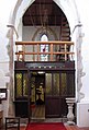
 St Mary, Patrixbourne, Kent - Chancel - geograph.org.uk - 826323.jpg 462 × 640; 76 KB
-

-
 St Mary, Patrixbourne, Kent - Doorway - geograph.org.uk - 328864.jpg 510 × 640; 171 KB
-
 St Mary, Patrixbourne, Kent - Doorway - geograph.org.uk - 826338.jpg 480 × 640; 131 KB
-
 St Mary, Patrixbourne, Kent - East end - geograph.org.uk - 328869.jpg 480 × 640; 110 KB
-

-
 St Mary, Patrixbourne, Kent - Font - geograph.org.uk - 826309.jpg 546 × 640; 74 KB
-
 St Mary, Patrixbourne, Kent - geograph.org.uk - 826334.jpg 458 × 640; 77 KB
-
 St Mary, Patrixbourne, Kent - geograph.org.uk - 826358.jpg 480 × 640; 69 KB
-
 St Mary, Patrixbourne, Kent - Ledger slab - geograph.org.uk - 826301.jpg 608 × 640; 137 KB
-
 St Mary, Patrixbourne, Kent - Mass dial - geograph.org.uk - 826316.jpg 480 × 640; 113 KB
-
 St Mary, Patrixbourne, Kent - Piscina - geograph.org.uk - 826353.jpg 452 × 640; 45 KB
-

-

-
 St Mary, Patrixbourne, Kent - Window - geograph.org.uk - 328860.jpg 558 × 640; 180 KB
-
 St Mary, Patrixbourne, Kent - Window - geograph.org.uk - 826311.jpg 590 × 640; 121 KB
-
 St Mary, Patrixbourne, Kent - Window - geograph.org.uk - 826330.jpg 339 × 640; 93 KB
-
 St Mary, Patrixbourne, Kent - Window - geograph.org.uk - 826333.jpg 266 × 640; 75 KB
-
 St Mary, Patrixbourne, Kent - Window - geograph.org.uk - 826347.jpg 640 × 447; 116 KB
-
 St Mary, Patrixbourne, Kent - Window - geograph.org.uk - 826348.jpg 500 × 640; 119 KB
-
 St Mary, Patrixbourne, Kent.jpg 640 × 573; 121 KB
-
 St Mary, Stodmarsh, Kent - East end - geograph.org.uk - 328903.jpg 480 × 640; 117 KB
-
 St Mary, Stodmarsh, Kent - geograph.org.uk - 328894.jpg 640 × 466; 132 KB
-
 St Mary, Stodmarsh, Kent - geograph.org.uk - 328896.jpg 640 × 491; 137 KB
-
 St Mary, Stodmarsh, Kent - Interior - geograph.org.uk - 328913.jpg 480 × 640; 111 KB
-
 St Michael, Driby - geograph.org.uk - 430573.jpg 640 × 480; 86 KB
-
 St Michael, Driby - geograph.org.uk - 430580.jpg 480 × 640; 124 KB
-

-
 St Peter, Bekesbourne, Kent - East end - geograph.org.uk - 328967.jpg 479 × 640; 140 KB
-
 St Peter, Bekesbourne, Kent - geograph.org.uk - 328946.jpg 640 × 415; 145 KB
-
 St Peter, Bekesbourne, Kent - geograph.org.uk - 328950.jpg 640 × 362; 103 KB
-
 St Peter, Bekesbourne, Kent - geograph.org.uk - 328969.jpg 640 × 474; 154 KB
-

-
 St Vincent, Littlebourne, Kent - East end - geograph.org.uk - 328814.jpg 459 × 640; 102 KB
-
 St Vincent, Littlebourne, Kent - geograph.org.uk - 328806.jpg 640 × 522; 148 KB
-
 St Vincent, Littlebourne, Kent - West end - geograph.org.uk - 328808.jpg 434 × 640; 101 KB
-

-

-

-
 Standing stone near Llynnau Cregennen - geograph.org.uk - 347738.jpg 640 × 480; 107 KB
-
 Statue in East Park - geograph.org.uk - 259064.jpg 480 × 640; 95 KB
-
 Stratford Mop - geograph.org.uk - 259026.jpg 640 × 480; 55 KB
-
 Stratford Mop - geograph.org.uk - 259027.jpg 640 × 480; 61 KB
-
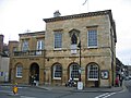 Stratford-upon-Avon Town Hall - geograph.org.uk - 259030.jpg 640 × 480; 56 KB


,_E_Nantwich_-_geograph.org.uk_-_259369.jpg)


_-_geograph.org.uk_-_258564.jpg)


_-_geograph.org.uk_-_258899.jpg)
_-_geograph.org.uk_-_258902.jpg)


