Category:United Kingdom photographs taken on 2006-08-06
Jump to navigation
Jump to search
Countries of Europe: Austria · Belgium · Bosnia and Herzegovina · Bulgaria · Croatia · Czech Republic · Denmark · Finland · France‡ · Georgia‡ · Germany · Greece · Republic of Ireland · Italy · Latvia · Netherlands‡ · Poland · Portugal‡ · Romania · Russia‡ · Slovakia · Spain‡ · Sweden · Turkey‡ · Ukraine · United Kingdom · Vatican City
‡: partly located in Europe
‡: partly located in Europe
| ← | 6 August 2006 | → | ||
| ← | August 2006 | → | ||

United Kingdom photographs taken on 6 August 2006.
Image files should be categorized here automatically using {{taken on}} template. Direct categorisation is also possible, if automatic is impossible.
Subcategories
This category has only the following subcategory.
Media in category "United Kingdom photographs taken on 2006-08-06"
The following 200 files are in this category, out of 555 total.
(previous page) (next page)-
 A chance to rest after passing Beer - geograph.org.uk - 1444879.jpg 480 × 640; 71 KB
-
 A1 at Gonerby Moor - geograph.org.uk - 215766.jpg 640 × 427; 72 KB
-
 A12 from the A414 - geograph.org.uk - 215515.jpg 640 × 426; 90 KB
-
 A22 north of Nutley - geograph.org.uk - 215342.jpg 640 × 480; 303 KB
-
 A31 (Hogs Back) toward Farnham - geograph.org.uk - 215261.jpg 640 × 480; 356 KB
-
 Absailing near Lingmoor House - geograph.org.uk - 215530.jpg 459 × 640; 118 KB
-
 Ace Mill, Chadderton - geograph.org.uk - 216383.jpg 640 × 427; 102 KB
-
 Ace Mill, Chadderton - geograph.org.uk - 216390.jpg 640 × 427; 78 KB
-
 Across fields to Wormington Grange - geograph.org.uk - 215666.jpg 640 × 480; 58 KB
-
 Across Thistle Vale to Buttermilk Farm - geograph.org.uk - 215707.jpg 640 × 480; 114 KB
-

-
 Albrighton - geograph.org.uk - 221453.jpg 640 × 480; 68 KB
-
 Alcester fire station - geograph.org.uk - 215833.jpg 640 × 427; 192 KB
-
 All Saints Ulting - geograph.org.uk - 215675.jpg 640 × 427; 117 KB
-
 Allerston Village Hall - geograph.org.uk - 215543.jpg 640 × 427; 45 KB
-
 Allotment Gardens, Withernsea - geograph.org.uk - 215568.jpg 640 × 468; 172 KB
-
 Ardeley Pump - geograph.org.uk - 215685.jpg 640 × 480; 141 KB
-

-
 Atkinsons Wood Farm, From the West - geograph.org.uk - 215608.jpg 640 × 384; 85 KB
-
 B1007 Galleywood Rd - geograph.org.uk - 215638.jpg 640 × 426; 96 KB
-
-
 Back Skerrs Holy Island - geograph.org.uk - 216550.jpg 640 × 480; 88 KB
-
 Badenyon Cottage, Glenbuchat - geograph.org.uk - 342098.jpg 640 × 480; 97 KB
-
 Bales piled high near Swinton Grange - geograph.org.uk - 215665.jpg 480 × 640; 145 KB
-
 Barclays Bank, Park Lane Branch - geograph.org.uk - 218753.jpg 480 × 640; 98 KB
-
 Beech woods on Terrington Moor - geograph.org.uk - 215656.jpg 640 × 480; 99 KB
-
 Belgrave Mills, Hathershaw - geograph.org.uk - 216528.jpg 640 × 427; 87 KB
-
 Belper Fire Station - geograph.org.uk - 215818.jpg 640 × 427; 189 KB
-
 Bidford fire station - geograph.org.uk - 215835.jpg 640 × 421; 185 KB
-
 Blackpool Tramway - Bispham depot headstone.jpg 800 × 563; 134 KB
-
-

-
 Boundary wall on Little Whernside - geograph.org.uk - 233317.jpg 640 × 480; 97 KB
-
 Bower Farm - geograph.org.uk - 216750.jpg 640 × 480; 107 KB
-
 Bracken Hill near Sheriff Hutton - geograph.org.uk - 215599.jpg 640 × 480; 126 KB
-
 Bridge over River Soar, near Croft - geograph.org.uk - 215353.jpg 640 × 480; 135 KB
-
 Bridge over the Grand Union Canal - geograph.org.uk - 215775.jpg 640 × 480; 112 KB
-
 Bridgewater Road, Alperton - geograph.org.uk - 216335.jpg 640 × 480; 105 KB
-
 Bridleway to Bassett's - geograph.org.uk - 215384.jpg 640 × 426; 126 KB
-
 Brook No. 2 Mill, Hollinwood - geograph.org.uk - 216085.jpg 640 × 427; 91 KB
-

-
 Buckland Manor Hotel - geograph.org.uk - 215657.jpg 640 × 480; 106 KB
-
-
 Burton Latimer Wind farm.jpg 640 × 480; 63 KB
-
 Cairgorms National Park - geograph.org.uk - 215513.jpg 640 × 480; 139 KB
-
 Cairngorm Gliding Club - geograph.org.uk - 215466.jpg 640 × 480; 138 KB
-
 Camasunary - geograph.org.uk - 215457.jpg 640 × 480; 127 KB
-
 Camasunary Track - geograph.org.uk - 215464.jpg 640 × 480; 179 KB
-
 Carlton Vale, NW6 - geograph.org.uk - 215893.jpg 640 × 480; 116 KB
-
 Carlton Vale, NW6 - geograph.org.uk - 215897.jpg 640 × 480; 118 KB
-
-
 Catterick Bridge.jpg 640 × 419; 139 KB
-
 Catterick Racecourse - geograph.org.uk - 215419.jpg 640 × 412; 81 KB
-
 Cattle grid entrance to Court Farm - geograph.org.uk - 217096.jpg 640 × 480; 125 KB
-

-
 Cecil Day Lewis headstone, geograph.jpg 480 × 640; 97 KB
-
 Cefn Campstone - geograph.org.uk - 216739.jpg 640 × 480; 125 KB
-
-
 Central Square, Wembley - geograph.org.uk - 216341.jpg 640 × 480; 117 KB
-
 Chain Bridge, Melrose - geograph.org.uk - 310023.jpg 640 × 480; 115 KB
-
 Chalmers Lighthouse - geograph.org.uk - 217071.jpg 640 × 627; 91 KB
-
 Chapel and graveyard near Greg Lodge - geograph.org.uk - 216747.jpg 640 × 480; 140 KB
-
 Chapel at Waen, near Nantglyn - geograph.org.uk - 215865.jpg 640 × 479; 113 KB
-
 Chelmer Navigation - geograph.org.uk - 215525.jpg 640 × 426; 122 KB
-
 Chelmer Towpath - geograph.org.uk - 215389.jpg 426 × 640; 130 KB
-
 Chelmsford RFC - geograph.org.uk - 215625.jpg 640 × 426; 83 KB
-
 Church at Llanddewi Skirrid - geograph.org.uk - 215801.jpg 640 × 480; 147 KB
-
 Church at Llanddewi Skirrid - geograph.org.uk - 215802.jpg 640 × 480; 137 KB
-
 Church at Llanvetherine Llanwytherin - geograph.org.uk - 217415.jpg 640 × 480; 132 KB
-
 Church Oast, Church Hill, Hernhill, Kent - geograph.org.uk - 565884.jpg 640 × 490; 156 KB
-
 Church of St John - Allerston - geograph.org.uk - 215533.jpg 640 × 427; 53 KB
-
 Clach Choutsaich - geograph.org.uk - 215484.jpg 640 × 480; 145 KB
-
 Clifton Road, W9 - geograph.org.uk - 215914.jpg 640 × 480; 132 KB
-

-
 Cockwood Harbour - geograph.org.uk - 665457.jpg 640 × 425; 102 KB
-
 Cockwood harbour and railway. - geograph.org.uk - 665458.jpg 640 × 425; 78 KB
-
 Coles Green Farm - geograph.org.uk - 215698.jpg 640 × 480; 95 KB
-
 Collecting the Bales - geograph.org.uk - 215616.jpg 640 × 480; 83 KB
-
 Conduit Mews, W2 - geograph.org.uk - 218750.jpg 640 × 480; 126 KB
-
 Country road near Cliffe - geograph.org.uk - 215310.jpg 640 × 480; 52 KB
-

-
 Crimble Mill - geograph.org.uk - 215721.jpg 640 × 407; 101 KB
-
 Croft Castle 3.jpg 1,202 × 1,600; 257 KB
-
 Crossroads to the south-west of Cross Ash - geograph.org.uk - 217404.jpg 640 × 480; 104 KB
-
 Crumbling gravestone - geograph.org.uk - 215539.jpg 427 × 640; 90 KB
-
 Denham Lock - geograph.org.uk - 215776.jpg 640 × 480; 121 KB
-
 Dere Street Brompton on Swale North Yorks.jpg 640 × 479; 90 KB
-
 Devon Mill, Hollinwood - geograph.org.uk - 1383726.jpg 415 × 640; 74 KB
-
 Devon Mill, Hollinwood - geograph.org.uk - 215705.jpg 640 × 427; 67 KB
-
 Dilapidated barn near Cliffe - geograph.org.uk - 215317.jpg 640 × 480; 61 KB
-
 Disused Chapel, Pantygelli - geograph.org.uk - 216215.jpg 480 × 640; 183 KB
-
 Disused reservoir beside the B4521 - geograph.org.uk - 215970.jpg 640 × 480; 138 KB
-
 Driveway to Brook House - geograph.org.uk - 215606.jpg 640 × 480; 136 KB
-
 Driveway to Swerford Park Farm - geograph.org.uk - 215452.jpg 640 × 480; 85 KB
-
 Driveway to Wern-gounsel - geograph.org.uk - 216741.jpg 640 × 480; 121 KB
-
 Duffield fire station - geograph.org.uk - 215821.jpg 640 × 427; 176 KB
-
 Dunblanehydro angela mudge.jpg 640 × 480; 139 KB
-
 Durban Mill, Hollinwood - geograph.org.uk - 216102.jpg 640 × 402; 82 KB
-
 Earl Mill, Hathershaw - geograph.org.uk - 216532.jpg 640 × 414; 100 KB
-
 Earthworks at Llanfair Gilgoed - geograph.org.uk - 217243.jpg 640 × 480; 122 KB
-
 Eastern End of Lowdales Beck ford - geograph.org.uk - 215640.jpg 640 × 427; 83 KB
-
 ECML Crosses River Trent - geograph.org.uk - 372742.jpg 640 × 480; 75 KB
-
 Entrance to Cliff Farm - geograph.org.uk - 215744.jpg 640 × 427; 81 KB
-
 Entrance to Maindiff Court Hospital - geograph.org.uk - 215972.jpg 640 × 480; 156 KB
-

-
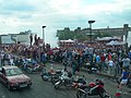
 Event at the Ace Cafe (1) - geograph.org.uk - 215422.jpg 640 × 480; 128 KB
-
 Event at the Ace Cafe (2) - geograph.org.uk - 215425.jpg 640 × 480; 117 KB
-
 Evesham fire station - geograph.org.uk - 215828.jpg 640 × 427; 221 KB
-
 Failsworth Mill (^) - geograph.org.uk - 216537.jpg 640 × 427; 95 KB
-
 Fairwarp - geograph.org.uk - 215296.jpg 640 × 480; 267 KB
-
 Farm buildings at Ty-Deri - geograph.org.uk - 217409.jpg 640 × 480; 128 KB
-

-
 Farmland near Buntingford - geograph.org.uk - 215717.jpg 640 × 480; 145 KB
-
 Farmland near Marston - geograph.org.uk - 215751.jpg 640 × 427; 87 KB
-
-
 Farmland off Tollbar Road, Marston - geograph.org.uk - 215735.jpg 640 × 427; 108 KB
-
 Farmland to the south of Pentre Farm - geograph.org.uk - 215803.jpg 640 × 480; 152 KB
-
 Field above Echo Hill, Sleights - geograph.org.uk - 217832.jpg 640 × 480; 102 KB
-
 Field near Muircambus - geograph.org.uk - 215297.jpg 640 × 424; 100 KB
-
 Fields Off Stone Stoup Hill - geograph.org.uk - 215603.jpg 480 × 640; 92 KB
-
 Footpath from Swerford - geograph.org.uk - 215446.jpg 640 × 480; 93 KB
-
 Footpath to Malham Cove - geograph.org.uk - 447399.jpg 640 × 480; 137 KB
-
 Forestry Road - geograph.org.uk - 215468.jpg 640 × 480; 150 KB
-
 Forss Water - geograph.org.uk - 1727450.jpg 2,304 × 1,728; 965 KB
-
 Garage on B4521 - geograph.org.uk - 215797.jpg 640 × 480; 112 KB
-
 Garn fawr - geograph.org.uk - 482783.jpg 640 × 480; 100 KB
-
 Gem Mill, Chadderton - geograph.org.uk - 216409.jpg 427 × 640; 55 KB
-
 Glen Feshie - geograph.org.uk - 215511.jpg 640 × 480; 160 KB
-
 Glossop Road, Broomhill - geograph.org.uk - 990622.jpg 640 × 480; 82 KB
-
 Glossop Road, Broomhill - geograph.org.uk - 990682.jpg 640 × 480; 75 KB
-
 Glossop Road, Broomhill - geograph.org.uk - 990723.jpg 640 × 480; 62 KB
-
 Glossop Road, Broomhill - geograph.org.uk - 990749.jpg 640 × 480; 64 KB
-
 Gloucester House, Cambridge Road NW6 - geograph.org.uk - 215899.jpg 640 × 480; 117 KB
-
 Gorse (and Rugby) Mill, Chadderton - geograph.org.uk - 216400.jpg 640 × 427; 80 KB
-
 Gorse Mill, Chadderton - geograph.org.uk - 216395.jpg 427 × 640; 94 KB
-
 Grace's Walk - geograph.org.uk - 215428.jpg 640 × 426; 134 KB
-
 Grace's Walk 2 - geograph.org.uk - 215509.jpg 426 × 640; 158 KB
-
 Hangman's rope, Skirrid Inn - geograph.org.uk - 216736.jpg 480 × 640; 101 KB
-
 Harvesting - geograph.org.uk - 215719.jpg 640 × 480; 95 KB
-

-
 Heat in London Tube.jpg 1,603 × 1,070; 743 KB
-
 Heather - geograph.org.uk - 215481.jpg 640 × 480; 141 KB
-
 Heather, Carn Barra, West Penwith - geograph.org.uk - 660296.jpg 640 × 480; 107 KB
-
 Heron Mill, Hollinwood - geograph.org.uk - 216098.jpg 640 × 427; 74 KB
-
 High Road, Wembley (1) - geograph.org.uk - 216336.jpg 640 × 480; 117 KB
-
 High Road, Wembley (2) - geograph.org.uk - 216337.jpg 640 × 480; 130 KB
-
 Hillside - geograph.org.uk - 215500.jpg 640 × 480; 136 KB
-
 Hillside near Bylchau - geograph.org.uk - 215867.jpg 640 × 479; 81 KB
-

-
 Mill & Church - Oldham.jpg 427 × 640; 68 KB
-
 Hook Norton Cutting - geograph.org.uk - 215453.jpg 640 × 480; 87 KB
-
 Inside Sutton on Derwent Village Hall - geograph.org.uk - 215578.jpg 640 × 480; 134 KB
-
 Jaguar 'E' type at Wroughton airfield - geograph.org.uk - 318037.jpg 640 × 411; 81 KB
-
 Juniper bush - geograph.org.uk - 215470.jpg 640 × 480; 140 KB
-
 Kilburn Lane, W10 - geograph.org.uk - 421115.jpg 640 × 480; 107 KB
-
 Kilmarie Beach - geograph.org.uk - 215482.jpg 640 × 480; 194 KB
-
 Kilmarnock Arms Hotel in Cruden Bay - geograph.org.uk - 1440702.jpg 640 × 480; 215 KB
-
 King William IV , Brompton on Swale - geograph.org.uk - 215413.jpg 640 × 479; 115 KB
-
 Knighton, (Radnorshire) - geograph.org.uk - 221881.jpg 640 × 480; 93 KB
-
 Lamorna Harbour - geograph.org.uk - 560625.jpg 640 × 427; 59 KB
-
 Lelant Towans - geograph.org.uk - 470207.jpg 640 × 474; 74 KB
-

-
 "Disco" Fording - geograph.org.uk - 215480.jpg 426 × 640; 96 KB
-
 Little Baddow - geograph.org.uk - 215417.jpg 640 × 426; 127 KB
-
 Little Baddow Chapel - geograph.org.uk - 215424.jpg 640 × 426; 116 KB
-
 Llanddewi'r Cwm and surrounding countryside.jpg 640 × 426; 82 KB
-
 Llanvihangel Crucorney Church - geograph.org.uk - 216737.jpg 640 × 480; 147 KB
-
 Llwyncelyn - geograph.org.uk - 216600.jpg 640 × 480; 128 KB
-
 Llyn y Gwaith - geograph.org.uk - 432695.jpg 640 × 480; 85 KB
-
 Loch nam Ban, Islay - geograph.org.uk - 341056.jpg 640 × 428; 193 KB
-
 Locks on Peak Forest Canal - geograph.org.uk - 985966.jpg 640 × 480; 110 KB
-
 Lodge Farm - geograph.org.uk - 215696.jpg 640 × 480; 89 KB
-

-
-

-
 Lowdales beck at low water level - geograph.org.uk - 215636.jpg 640 × 427; 77 KB
-
 Lycaena phlaeas - geograph.org.uk - 215679.jpg 640 × 571; 289 KB
-
 Maida Vale, W9 (1) - geograph.org.uk - 215917.jpg 640 × 480; 121 KB
-
 Maida Vale, W9 (2) - geograph.org.uk - 215922.jpg 640 × 480; 145 KB
-
 Malham Cove - geograph.org.uk - 447359.jpg 480 × 640; 159 KB
-
 Malham Cove - geograph.org.uk - 447364.jpg 480 × 640; 141 KB
-
 Malham Cove - geograph.org.uk - 447376.jpg 640 × 480; 162 KB
-
 Malham Cove - geograph.org.uk - 447382.jpg 480 × 640; 163 KB
-
 Malham Cove - geograph.org.uk - 447388.jpg 480 × 640; 124 KB
-
 Manor Mill, Chadderton - geograph.org.uk - 215714.jpg 427 × 640; 67 KB
-
 Manor mill, Chadderton - geograph.org.uk - 216542.jpg 427 × 640; 53 KB
-
 Maple Mills, Hathershaw - geograph.org.uk - 216117.jpg 640 × 427; 59 KB
-
 Maple Mills, Hathershaw. - geograph.org.uk - 216113.jpg 640 × 427; 73 KB
-
 Maple No. 1 Mill, Hathershaw. - geograph.org.uk - 216120.jpg 640 × 427; 76 KB
-
 Meallneveron - geograph.org.uk - 216579.jpg 640 × 478; 98 KB
-
 Microlight Airstrip - geograph.org.uk - 215584.jpg 640 × 480; 84 KB
-
 Middlesex House, Alperton - geograph.org.uk - 216332.jpg 480 × 640; 92 KB
-
 Mill House - geograph.org.uk - 253281.jpg 650 × 432; 373 KB
-
 Mist lifting - geograph.org.uk - 215489.jpg 640 × 480; 151 KB
-
 Mist lifting - geograph.org.uk - 215498.jpg 640 × 480; 154 KB
-
 Moorland - geograph.org.uk - 217426.jpg 640 × 480; 86 KB
-
 Mount Pleasant - geograph.org.uk - 215309.jpg 640 × 424; 79 KB
-
 Mount Pleasant, Bont - geograph.org.uk - 217099.jpg 640 × 480; 119 KB
-
 Narrow Gauge at Tanygrisiau - geograph.org.uk - 1280348.jpg 498 × 413; 156 KB
-
 Near West Muircambus - geograph.org.uk - 215285.jpg 640 × 424; 98 KB


_toward_Farnham_-_geograph.org.uk_-_215261.jpg)


_-_geograph.org.uk_-_215422.jpg)
_-_geograph.org.uk_-_215425.jpg)

_-_geograph.org.uk_-_216537.jpg)


_Mill,_Chadderton_-_geograph.org.uk_-_216400.jpg)


_-_geograph.org.uk_-_216336.jpg)
_-_geograph.org.uk_-_216337.jpg)


_-_geograph.org.uk_-_221881.jpg)


_to_Meldreth_(North_End)_-_geograph.org.uk_-_235119.jpg)


_-_geograph.org.uk_-_215917.jpg)
_-_geograph.org.uk_-_215922.jpg)


