Category:United Kingdom photographs taken on 2006-04-18
Jump to navigation
Jump to search
Countries of Europe: Austria · Belgium · Croatia · Finland · France‡ · Germany · Greece · Hungary · Italy · Netherlands‡ · Poland · Romania · Russia‡ · Slovakia · Spain‡ · Ukraine · United Kingdom
‡: partly located in Europe
‡: partly located in Europe
| ← | 18 April 2006 | → | ||
| ← | April 2006 | → | ||

United Kingdom photographs taken on 18 April 2006.
Image files should be categorized here automatically using {{taken on}} template. Direct categorisation is also possible, if automatic is impossible.
Subcategories
This category has only the following subcategory.
S
Media in category "United Kingdom photographs taken on 2006-04-18"
The following 200 files are in this category, out of 414 total.
(previous page) (next page)-
 319427 east croydon station.jpg 1,280 × 960; 309 KB
-
 A259, north of Hastings - geograph.org.uk - 155404.jpg 640 × 480; 118 KB
-
 A303 north of Barton Stacey - geograph.org.uk - 155824.jpg 640 × 480; 296 KB
-
 A325 at Farnham - geograph.org.uk - 158227.jpg 640 × 480; 106 KB
-
 Abney Wood on Welby Heath - geograph.org.uk - 155089.jpg 640 × 427; 80 KB
-
 Across the Motray - geograph.org.uk - 154612.jpg 640 × 480; 306 KB
-
 Afon Llugwy - geograph.org.uk - 157086.jpg 640 × 480; 104 KB
-
 All Saint's Church, Barton Stacey - geograph.org.uk - 155311.jpg 640 × 480; 277 KB
-
 Along the Kent Estuary - geograph.org.uk - 154442.jpg 640 × 480; 72 KB
-
 Alvington Church - geograph.org.uk - 154422.jpg 640 × 480; 314 KB
-
 Ash Priors - geograph.org.uk - 154868.jpg 640 × 480; 114 KB
-
 Aylesbeare Common - geograph.org.uk - 154682.jpg 640 × 480; 98 KB
-

-
 Balreavie - geograph.org.uk - 154486.jpg 640 × 480; 98 KB
-
 Barn at Manor Farm, Aylesbeare - geograph.org.uk - 154672.jpg 640 × 480; 105 KB
-
 Barn near Birthorpe - geograph.org.uk - 154623.jpg 640 × 427; 79 KB
-
 Barn near Pry Hill Farm - geograph.org.uk - 155710.jpg 640 × 480; 77 KB
-
 Barns near Knossington - geograph.org.uk - 154713.jpg 640 × 377; 43 KB
-
 Barrow Haven Wharf - geograph.org.uk - 169561.jpg 640 × 479; 82 KB
-
 Reedbed at Barrow Haven - geograph.org.uk - 169533.jpg 640 × 479; 120 KB
-
 Beach west of Seatown - geograph.org.uk - 1017075.jpg 640 × 480; 142 KB
-
 Ben Griam Beg - geograph.org.uk - 162523.jpg 640 × 480; 94 KB
-
 Bendarroch School, Aylesbeare - geograph.org.uk - 154666.jpg 640 × 480; 156 KB
-
 Brackmont Mill - geograph.org.uk - 154624.jpg 640 × 480; 332 KB
-
 Bream Cove, near Falmouth - geograph.org.uk - 182296.jpg 640 × 480; 62 KB
-
 Bridlington Harbour - geograph.org.uk - 546996.jpg 640 × 464; 83 KB
-
 Bridlington Harbour - Marina - geograph.org.uk - 547001.jpg 640 × 480; 67 KB
-
 Brook Farm with Sheep and hens - geograph.org.uk - 155438.jpg 640 × 480; 142 KB
-
 Brooklandsboatinglake.jpg 640 × 479; 72 KB
-

-
 St Augustine of Canterbury RC Church - geograph.org.uk - 154739.jpg 640 × 480; 97 KB
-
 Carreglefn, Anglesey. - geograph.org.uk - 154630.jpg 640 × 487; 63 KB
-
 Chapman's Lane - geograph.org.uk - 154767.jpg 640 × 480; 144 KB
-
 Chapmans Lane (East) - geograph.org.uk - 154768.jpg 640 × 480; 190 KB
-
 Charcott Farm - geograph.org.uk - 154299.jpg 640 × 480; 98 KB
-
 Church tower north of Guestling green - geograph.org.uk - 155407.jpg 480 × 640; 84 KB
-
 Clarencefield - geograph.org.uk - 154735.jpg 640 × 431; 45 KB
-
 Cliffs at Rubh' a' Chairn Leith - geograph.org.uk - 154429.jpg 640 × 480; 114 KB
-
 Coal Tax Pillar - geograph.org.uk - 154334.jpg 480 × 640; 92 KB
-

-
 Coul Reservoir - geograph.org.uk - 154474.jpg 640 × 480; 78 KB
-
 Covered gateway, Cummertrees church - geograph.org.uk - 154746.jpg 480 × 640; 58 KB
-
 Crags on Glas Bheinn - geograph.org.uk - 158505.jpg 640 × 480; 123 KB
-
 Cropredy Bridge - geograph.org.uk - 156145.jpg 640 × 480; 118 KB
-
 Cycle Route 5 - geograph.org.uk - 158245.jpg 640 × 480; 51 KB
-
 Deer Abbey Ruins. - geograph.org.uk - 164081.jpg 640 × 435; 122 KB
-

-
 Drive to Conquest Farm. - geograph.org.uk - 154876.jpg 640 × 480; 88 KB
-
 Dual Pipeline - geograph.org.uk - 156710.jpg 640 × 479; 77 KB
-
 Dun Liath - geograph.org.uk - 154427.jpg 640 × 480; 91 KB
-
 Dun Liath - geograph.org.uk - 154428.jpg 640 × 480; 125 KB
-
 East Lomond junction - geograph.org.uk - 154680.jpg 640 × 480; 97 KB
-
 Edingham Moss WWII cordite works - geograph.org.uk - 392562.jpg 640 × 427; 106 KB
-
 Edingham Moss WWII cordite works - geograph.org.uk - 392566.jpg 640 × 427; 125 KB
-
 Edingham Moss WWII cordite works - geograph.org.uk - 392571.jpg 640 × 427; 97 KB
-
 Eglwys Figel Sant - geograph.org.uk - 157667.jpg 640 × 480; 113 KB
-
 Enham Arch Retail Park, Andover - geograph.org.uk - 156413.jpg 640 × 480; 290 KB
-
 Entrance road to Teversal Manor Gardens, Notts. - geograph.org.uk - 1491113.jpg 1,024 × 694; 238 KB
-

-
 Entrance to St. Mary Cray station, Kent - geograph.org.uk - 154550.jpg 640 × 480; 109 KB
-

-
 Farm - geograph.org.uk - 160109.jpg 640 × 480; 105 KB
-
 Farm workers' cottages - geograph.org.uk - 171227.jpg 640 × 480; 94 KB
-

-
 Farmland by Broomfield - geograph.org.uk - 154769.jpg 640 × 480; 270 KB
-
 Farmland near Sapperton and Braceby - geograph.org.uk - 155301.jpg 640 × 427; 104 KB
-
 Farmland near Sapperton and Braceby - geograph.org.uk - 155302.jpg 640 × 480; 85 KB
-
 Farmland near the A52, Lincolnshire - geograph.org.uk - 155184.jpg 640 × 427; 94 KB
-
 Farmland on Ropsley Heath - geograph.org.uk - 155101.jpg 640 × 427; 83 KB
-
 Farmland on Welby Heath, Lincolnshire - geograph.org.uk - 155085.jpg 640 × 427; 86 KB
-
 Farnham Leisure Centre - geograph.org.uk - 158229.jpg 640 × 480; 103 KB
-
 Field at Lower Link Farm - geograph.org.uk - 156172.jpg 640 × 480; 284 KB
-
 Field of sheep - geograph.org.uk - 155419.jpg 640 × 480; 60 KB
-
 Field, Carlow Hill - geograph.org.uk - 154603.jpg 640 × 480; 63 KB
-
 Fields Off Sandpit Lane - geograph.org.uk - 154658.jpg 640 × 480; 70 KB
-
 Fields South Of Cultsykefoot - geograph.org.uk - 1156724.jpg 640 × 480; 65 KB
-
 Fields Surrounding Thimbleby Grange - geograph.org.uk - 154605.jpg 640 × 480; 66 KB
-
 FirstGreatWestern @ Radley.JPG 1,508 × 1,047; 315 KB
-
 Fold Farm, Hollow Meadows - geograph.org.uk - 154786.jpg 640 × 480; 44 KB
-
 Footbridge and weir near Llynon Hall - geograph.org.uk - 171262.jpg 640 × 480; 115 KB
-
 Footpath near Ropsley, Lincolnshire - geograph.org.uk - 155118.jpg 640 × 427; 79 KB
-
 Ford at Little Humby - geograph.org.uk - 155322.jpg 640 × 427; 150 KB
-
 Formartine and Buchan Way by Deer Abbey. - geograph.org.uk - 164086.jpg 640 × 438; 180 KB
-

-

-

-
 Formartine and Buchan Way, East of Maud. - geograph.org.uk - 164056.jpg 640 × 439; 138 KB
-

-
 Forsinard Station - geograph.org.uk - 161936.jpg 640 × 480; 111 KB
-
 Freston Tower from gatehouse - geograph.org.uk - 1048262.jpg 640 × 480; 113 KB
-
 Gatehouse at Llynnon Hall - geograph.org.uk - 158155.jpg 640 × 480; 122 KB
-
 Gawthorpe Hall.jpg 640 × 480; 125 KB
-
 Glebe Farm near Ropsley - geograph.org.uk - 155113.jpg 640 × 427; 74 KB
-
 Gloucester to Chepstow Railway Line - geograph.org.uk - 154274.jpg 640 × 480; 281 KB
-
 Humby Chapel - geograph.org.uk - 155345.jpg 640 × 427; 109 KB
-

-
 Gritstone Trail - geograph.org.uk - 1530726.jpg 640 × 426; 116 KB
-
-
 Haceby, Lincolnshire - geograph.org.uk - 155362.jpg 640 × 427; 101 KB
-
 Halladale River - geograph.org.uk - 161906.jpg 640 × 480; 143 KB
-
 Harewood Garage, Andover - geograph.org.uk - 156390.jpg 640 × 480; 269 KB
-
 Heath Farm near Ropsley, Lincolnshire - geograph.org.uk - 155123.jpg 640 × 427; 84 KB
-
 Hever Golf and Country Club - geograph.org.uk - 155641.jpg 640 × 480; 166 KB
-
 Hever Railway Station.jpg 640 × 480; 124 KB
-
 Hever Village Hall - geograph.org.uk - 155866.jpg 640 × 480; 124 KB
-
 Hewelsfield church.jpg 640 × 472; 318 KB
-
-
 Hillside above Glossop - geograph.org.uk - 1745569.jpg 2,272 × 1,712; 787 KB
-
 Hillside below Ogden Clough - geograph.org.uk - 1745528.jpg 2,272 × 1,712; 907 KB
-
 Hockenden House, Kent - geograph.org.uk - 154770.jpg 640 × 480; 102 KB
-
 Holloway Barton - geograph.org.uk - 154645.jpg 640 × 480; 72 KB
-
 Horseplay - geograph.org.uk - 154511.jpg 640 × 480; 71 KB
-
 Horses Grazing Baas Hill Broxbourne - geograph.org.uk - 155154.jpg 640 × 480; 69 KB
-
 Hutton Bonville - geograph.org.uk - 154500.jpg 640 × 480; 74 KB
-
 Hutton Bonville caravan park - geograph.org.uk - 154509.jpg 640 × 480; 73 KB
-
 Kettleholm - geograph.org.uk - 154751.jpg 640 × 480; 55 KB
-
 Kinbrace - geograph.org.uk - 162554.jpg 626 × 464; 83 KB
-
 Kirkcudbright harbour at high tide - geograph.org.uk - 171186.jpg 640 × 479; 91 KB
-
 Kirkforthar Chapel - geograph.org.uk - 154687.jpg 640 × 480; 110 KB
-
 Kirkforthar Farm - geograph.org.uk - 154708.jpg 640 × 480; 74 KB
-
 Lane near Splatford - geograph.org.uk - 155291.jpg 480 × 640; 79 KB
-
 Little Haceby Wood, Lincolnshire - geograph.org.uk - 155358.jpg 427 × 640; 84 KB
-
 Llwyn Onn - geograph.org.uk - 158169.jpg 640 × 480; 120 KB
-
 Lochmuir Wood - geograph.org.uk - 154692.jpg 640 × 486; 118 KB
-
 Lockskinners Oast - geograph.org.uk - 154306.jpg 640 × 480; 150 KB
-
 Long Hollow near Braceby - geograph.org.uk - 155207.jpg 640 × 427; 122 KB
-
 Lost Cyclists - geograph.org.uk - 154830.jpg 640 × 480; 114 KB
-
 Lovesome hill water tower and hamlet - geograph.org.uk - 154513.jpg 640 × 480; 66 KB
-
 Lower float farm - geograph.org.uk - 155491.jpg 640 × 480; 126 KB
-
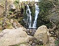 Lower Waterfall, Posforth Gill - geograph.org.uk - 426841.jpg 640 × 501; 161 KB
-
 MacHinery clan gathering - geograph.org.uk - 162584.jpg 640 × 480; 133 KB
-

-
 Maud From Station.jpg 640 × 438; 132 KB
-
 Mausoleum of the Shaw-Stewart Family - geograph.org.uk - 158233.jpg 640 × 480; 135 KB
-
 Methlick Bridge, Aberdeenshire.jpg 640 × 480; 82 KB
-
 Mill Hill, Humby - geograph.org.uk - 155315.jpg 640 × 427; 71 KB
-
 Minchinhampton Church from Ram Inn - geograph.org.uk - 1734381.jpg 900 × 600; 589 KB
-
 Moscar House Farm and cottage - geograph.org.uk - 154610.jpg 640 × 480; 67 KB
-
 Motray Burn by Brackmont Mill - geograph.org.uk - 154593.jpg 640 × 480; 319 KB
-
 Motray Burn by Brackmont Mill - geograph.org.uk - 154597.jpg 640 × 480; 310 KB
-
 Mountain Refuge Hut Near Lamb Hill - geograph.org.uk - 268442.jpg 640 × 480; 100 KB
-
 Muirhouse - geograph.org.uk - 1124971.jpg 640 × 426; 84 KB
-
 New Inn Roundabout - geograph.org.uk - 154686.jpg 640 × 480; 57 KB
-
 Newburn Riverside - geograph.org.uk - 235277.jpg 640 × 480; 67 KB
-
 Newton of Falkland - geograph.org.uk - 154492.jpg 640 × 480; 86 KB
-

-
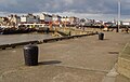 North Pier, Bridlington Harbour - geograph.org.uk - 770222.jpg 640 × 408; 158 KB
-
 Nottingham - geograph.org.uk - 154696.jpg 640 × 480; 84 KB
-
 Old Coatham School, Redcar - geograph.org.uk - 370244.jpg 640 × 427; 68 KB
-
 Old Deer.jpg 640 × 438; 100 KB
-
 Old farm buildings - geograph.org.uk - 1745558.jpg 2,272 × 1,712; 954 KB
-
 Old house, Davochbeg - geograph.org.uk - 162583.jpg 640 × 480; 139 KB
-
 Old snow fence - geograph.org.uk - 161964.jpg 640 × 480; 79 KB
-
 Old trig pillar - Ben Griam Beg - geograph.org.uk - 162527.jpg 640 × 480; 92 KB
-
 On Ben Griam Beg - geograph.org.uk - 162518.jpg 640 × 480; 99 KB
-
 Once a moat - geograph.org.uk - 154712.jpg 640 × 497; 112 KB
-
 Ox Drove and Harewood Mobile Home Park - geograph.org.uk - 156397.jpg 640 × 480; 275 KB
-

-
-
 Part of Scredington Station - geograph.org.uk - 154596.jpg 640 × 427; 104 KB
-
 Path to Markinch by Star - geograph.org.uk - 154578.jpg 640 × 480; 296 KB
-
 Path to Star - geograph.org.uk - 154585.jpg 640 × 480; 289 KB
-
 Pipeline, East Worthing - geograph.org.uk - 156165.jpg 640 × 480; 38 KB
-
 Pittillock Farm - geograph.org.uk - 171231.jpg 640 × 480; 90 KB
-
 Place farm - geograph.org.uk - 155433.jpg 640 × 480; 179 KB
-
 Podgers Pit - geograph.org.uk - 154676.jpg 640 × 480; 122 KB
-
 Pond near Mattocks - geograph.org.uk - 154662.jpg 640 × 480; 151 KB
-
 Purin Den - geograph.org.uk - 154483.jpg 480 × 640; 143 KB
-
 Purin Hill - geograph.org.uk - 154471.jpg 640 × 480; 53 KB
-
 Queen Elizabeth II Hospital W.G.C. - geograph.org.uk - 154430.jpg 640 × 480; 97 KB
-

-
 Regent Cinema, Redcar - geograph.org.uk - 370235.jpg 640 × 427; 69 KB
-
 River Brede - geograph.org.uk - 155492.jpg 640 × 480; 106 KB
-
 River Crouch East of Fambridge - geograph.org.uk - 154498.jpg 640 × 426; 58 KB
-
 River Dever, west of A34 - geograph.org.uk - 155247.jpg 640 × 480; 381 KB
-
 River East Allen - geograph.org.uk - 155755.jpg 640 × 480; 101 KB
-
 River Fleet - geograph.org.uk - 162588.jpg 640 × 480; 114 KB
-
 Road sign - geograph.org.uk - 154722.jpg 509 × 640; 86 KB
-
 Roe Deer - geograph.org.uk - 155796.jpg 640 × 480; 123 KB
-
-
 Roundabout with standing stones - geograph.org.uk - 154501.jpg 640 × 413; 73 KB
-
 Ruins, Gwaen-ydog, Nr Mynydd Mechell. - geograph.org.uk - 154647.jpg 640 × 480; 69 KB
-
 Ruthwell - geograph.org.uk - 154738.jpg 640 × 480; 56 KB
-
 Ruthwell - geograph.org.uk - 154740.jpg 640 × 470; 34 KB
-

-
 Sandstones - Ben Griam Beg - geograph.org.uk - 162526.jpg 640 × 480; 89 KB
-
 Sandyhill track - geograph.org.uk - 154711.jpg 640 × 480; 97 KB
-
-
 Sapperton, Lincolnshire - geograph.org.uk - 155294.jpg 640 × 427; 99 KB
-
 Scredington Station - geograph.org.uk - 154559.jpg 640 × 427; 97 KB
-
 Serpentine Lake, Hyde Park - geograph.org.uk - 154668.jpg 640 × 464; 122 KB
-
 Sheepfold on Wardlaw Ettrick Valley - geograph.org.uk - 557020.jpg 640 × 480; 107 KB
-
 Shops at Seafield, Aberdeen - geograph.org.uk - 158277.jpg 640 × 480; 116 KB
-
 Shoreham Church - geograph.org.uk - 156737.jpg 640 × 479; 103 KB
-
 ShorehamChurch(BobEmbleton)Apr2006.jpg 640 × 479; 175 KB
-
 Short Hollow near Braceby - geograph.org.uk - 155269.jpg 640 × 427; 117 KB
-
 Silo and Barn. - geograph.org.uk - 154872.jpg 640 × 480; 74 KB
-
 Sleeperzzz, Rogart - geograph.org.uk - 162561.jpg 640 × 480; 144 KB
-
 Soper Grove 'semis' - geograph.org.uk - 1284980.jpg 640 × 480; 143 KB
-


_-_geograph.org.uk_-_154768.jpg)


Apr2006.jpg)


