Category:United Kingdom photographs taken on 2004-08-22
Jump to navigation
Jump to search
Countries of Europe: Austria · Belgium · Czech Republic · Germany · Greece · Republic of Ireland · Italy · Netherlands‡ · Poland · Portugal‡ · Russia‡ · Spain‡ · Sweden · Switzerland · Ukraine · United Kingdom
‡: partly located in Europe
‡: partly located in Europe
| ← | 22 August 2004 | → | ||
| ← | August 2004 | → | ||

United Kingdom photographs taken on 22 August 2004.
Image files should be categorized here automatically using {{taken on}} template. Direct categorisation is also possible, if automatic is impossible.
Media in category "United Kingdom photographs taken on 2004-08-22"
The following 97 files are in this category, out of 97 total.
-

-

-
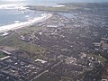 Aberdeen from above - geograph.org.uk - 4283.jpg 640 × 479; 63 KB
-
 Bakie Skerry, off Knowe of Skea - geograph.org.uk - 489672.jpg 640 × 473; 78 KB
-

-

-
 Bickleigh, The River and the Bridge - geograph.org.uk - 211545.jpg 640 × 480; 138 KB
-
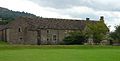
 Blackwell - The Arts and Crafts House - geograph.org.uk - 7579.jpg 640 × 480; 86 KB
-
 Boundary Stone on Helton Fell - geograph.org.uk - 786825.jpg 640 × 369; 54 KB
-
 Calgary Beach - geograph.org.uk - 95751.jpg 640 × 480; 56 KB
-
 Castle Campbell - geograph.org.uk - 912584.jpg 640 × 480; 103 KB
-
 Chaldon church - panoramio - franek2.jpg 960 × 1,280; 442 KB
-
 Chaldon church - panoramio.jpg 1,280 × 960; 457 KB
-
 Clatt Church - geograph.org.uk - 122156.jpg 640 × 480; 57 KB
-
 Clatt Village Hall - geograph.org.uk - 122127.jpg 640 × 480; 65 KB
-
 Clovelly Post Office - geograph.org.uk - 207103.jpg 640 × 480; 134 KB
-
 Clovelly's Cobbled Street - geograph.org.uk - 207099.jpg 640 × 480; 110 KB
-
 Clovelly, Seascape - geograph.org.uk - 207092.jpg 640 × 480; 105 KB
-

-
 Clovelly, The Sea in the Distance - geograph.org.uk - 211428.jpg 640 × 480; 130 KB
-
 Compass Head, from the sea - geograph.org.uk - 1780623.jpg 1,632 × 1,232; 428 KB
-
 Countryside around Clatt - geograph.org.uk - 94209.jpg 640 × 480; 67 KB
-
 Craobh Haven - geograph.org.uk - 70955.jpg 640 × 480; 81 KB
-
 Cuan Sound - geograph.org.uk - 43324.jpg 640 × 480; 106 KB
-
 Derwent Water from Surprise View - geograph.org.uk - 361828.jpg 640 × 480; 63 KB
-
 Didling Church, West Sussex - geograph.org.uk - 52330.jpg 640 × 480; 83 KB
-
-
 Edlesborough Church St Mary the Virgin - geograph.org.uk - 149674.jpg 640 × 480; 118 KB
-

-
 Eilean a' Chàr 1188782.jpg 640 × 480; 56 KB
-
 Funfair at the GLA Building - geograph.org.uk - 95739.jpg 640 × 480; 147 KB
-
 Gadie Burn and Countryside near Clatt - geograph.org.uk - 122143.jpg 640 × 480; 76 KB
-
 Glas-leac Mòr - geograph.org.uk - 1188711.jpg 640 × 480; 51 KB
-
 Happy Valley - panoramio.jpg 2,816 × 2,120; 1.43 MB
-

-
 Helmsley Castle - geograph.org.uk - 270691.jpg 480 × 640; 49 KB
-
 Heulwen - Sunshine - geograph.org.uk - 588626.jpg 640 × 430; 103 KB
-
 Hooley church - panoramio - franek2.jpg 1,280 × 960; 476 KB
-
 Hooley church - panoramio.jpg 1,280 × 960; 473 KB
-
 Hyde, church of the Holy Ascension - geograph.org.uk - 446905.jpg 640 × 429; 81 KB
-
 Knightshayes Court - geograph.org.uk - 211445.jpg 640 × 480; 95 KB
-
 Landing on Tanera Beg - geograph.org.uk - 1194447.jpg 640 × 480; 94 KB
-
 Liberty Stadium - under construction - geograph-1382628.jpg 640 × 480; 100 KB
-
 Lifeboat at Clovelly - geograph.org.uk - 207094.jpg 640 × 480; 91 KB
-
 Llandrinio Bridge - geograph.org.uk - 588647.jpg 640 × 430; 107 KB
-

-
 Mae Sands, Westside, Westray - geograph.org.uk - 489669.jpg 640 × 473; 68 KB
-
 WSR Minehead Station - geograph.org.uk - 865807.jpg 640 × 427; 82 KB
-
 Montgomery Canal south of Pool Quay - geograph.org.uk - 588637.jpg 640 × 435; 111 KB
-
 Monument to heavy industry - geograph.org.uk - 10691.jpg 427 × 640; 88 KB
-
 Mountain landscape west of An Cliseam - geograph.org.uk - 1258993.jpg 640 × 480; 108 KB
-
 PAR SANDS - panoramio.jpg 1,704 × 2,272; 1.11 MB
-
 Preston Island - geograph.org.uk - 27304.jpg 640 × 480; 81 KB
-
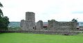
 Raglan Castle - geograph.org.uk - 25916.jpg 640 × 480; 33 KB
-
 Rawfold Bridge, River Duddon - geograph.org.uk - 7728.jpg 640 × 480; 399 KB
-
-
 Rhynie Village Green and Tap O'Noth.jpg 640 × 480; 78 KB
-
 River Ure by Boroughbridge,Yorkshire - geograph.org.uk - 58221.jpg 640 × 480; 147 KB
-

-
 Church of St. Egelwyn, Scalford - geograph.org.uk - 73801.jpg 640 × 480; 143 KB
-
 Small waterfall - geograph.org.uk - 102166.jpg 480 × 640; 95 KB
-
 South Sands, Bridlington - geograph.org.uk - 747501.jpg 640 × 480; 59 KB
-
 St James' Church, Selham, West Sussex - geograph.org.uk - 52717.jpg 640 × 480; 82 KB
-
 Steel Foundry, Bathgate, West Lothian - geograph.org.uk - 10689.jpg 640 × 427; 88 KB
-
 Stormy evening at Llyn Gwynant - geograph.org.uk - 1279656.jpg 480 × 640; 66 KB
-
 Street performers - geograph.org.uk - 16438.jpg 640 × 433; 80 KB
-

-
 Tetbury - geograph.org.uk - 143684.jpg 554 × 640; 133 KB
-
 The Bunnet Stane - geograph.org.uk - 640250.jpg 640 × 480; 63 KB
-
 Tretower Castle.jpg 640 × 336; 20 KB
-
 Tretower Court - geograph.org.uk - 25906.jpg 640 × 324; 22 KB
-
 Tràigh Niosaboist, Harris - geograph.org.uk - 1259036.jpg 640 × 480; 48 KB
-
 Two long distance paths - geograph.org.uk - 588644.jpg 640 × 436; 75 KB
-
 Underneath the Humber Bridge - geograph.org.uk - 768791.jpg 640 × 480; 121 KB
-
 Washford Station - geograph.org.uk - 867796.jpg 426 × 640; 86 KB
-
 Westray Firth - geograph.org.uk - 489676.jpg 640 × 473; 113 KB
-
 WSR Bishop Lydeard Station - geograph.org.uk - 865802.jpg 640 × 443; 98 KB
-
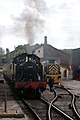
 WSR Engine 5542 - geograph.org.uk - 865804.jpg 640 × 443; 92 KB
-
 WSR Williton Station "On to Minehead" - geograph.org.uk - 865810.jpg 426 × 640; 64 KB
-
 Belle Vue Road, Mexborough - geograph.org.uk - 493253.jpg 640 × 480; 100 KB
-
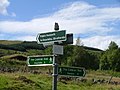 Cateran Trail signposts - geograph.org.uk - 8925.jpg 640 × 480; 99 KB
-

-
 Clough Head - geograph.org.uk - 496785.jpg 640 × 480; 60 KB
-
 Coire - geograph.org.uk - 102163.jpg 640 × 480; 107 KB
-

-
 Glas Mheall Liath - geograph.org.uk - 122799.jpg 640 × 480; 79 KB
-
 Ionic Temple - geograph.org.uk - 271257.jpg 640 × 480; 47 KB
-
 Leith Hall Gardens - geograph.org.uk - 94142.jpg 640 × 480; 145 KB
-
 Loch nan Dailthean - geograph.org.uk - 26558.jpg 640 × 480; 83 KB
-
 Martock - geograph.org.uk - 31720.jpg 640 × 464; 73 KB
-
 Nursery and Walled Garden - geograph.org.uk - 237543.jpg 640 × 480; 60 KB
-
 Rievaulx Terrace - geograph.org.uk - 237565.jpg 640 × 480; 64 KB
-
 River Tweed downstream from Yair - geograph.org.uk - 39012.jpg 640 × 480; 86 KB
-
 Sheep at Lower House Farm - geograph.org.uk - 588653.jpg 640 × 435; 87 KB
-

-
 Turnberry Golf Course - geograph.org.uk - 137693.jpg 640 × 480; 86 KB
-
 Waterfall near Duddon Bridge - geograph.org.uk - 7727.jpg 640 × 480; 152 KB
.jpg)


