Category:United Kingdom photographs taken on 2004-05-31
Jump to navigation
Jump to search
Countries of Europe: Austria · Belgium · France‡ · Germany · Italy · Netherlands‡ · Norway · Poland · Russia‡ · Slovakia · Sweden · Switzerland · United Kingdom
‡: partly located in Europe
‡: partly located in Europe
| ← | 31 May 2004 | → | ||
| ← | May 2004 | → | ||

United Kingdom photographs taken on 31 May 2004.
Image files should be categorized here automatically using {{taken on}} template. Direct categorisation is also possible, if automatic is impossible.
Subcategories
This category has only the following subcategory.
Media in category "United Kingdom photographs taken on 2004-05-31"
The following 145 files are in this category, out of 145 total.
-
 158955 at Ely.jpg 1,376 × 1,030; 297 KB
-
 170205 at Ely.JPG 2,048 × 1,536; 650 KB
-
 Aerial view of Apethorpe - geograph.org.uk - 726711.jpg 640 × 480; 51 KB
-
-
 Barnhill from the track - geograph.org.uk - 1451233.jpg 640 × 480; 120 KB
-
 Barpa Langass - geograph.org.uk - 15677.jpg 640 × 408; 49 KB
-
 Bend on the A846 south-west of Lagg - geograph.org.uk - 1450866.jpg 480 × 640; 139 KB
-
-
 Bow Bridge, West Scrafton - geograph.org.uk - 610615.jpg 640 × 480; 127 KB
-
 Bramham Park.jpg 640 × 476; 119 KB
-
 Busy Bee - geograph.org.uk - 379612.jpg 640 × 480; 97 KB
-

-

-

-
 Cave on Garbh Eilean, Shiant Isles - geograph.org.uk - 85271.jpg 640 × 480; 113 KB
-
 Chesterfield Canal Clayworth - panoramio - PJMarriott.jpg 2,048 × 1,536; 767 KB
-
 Chesterfield Canal Clayworth - panoramio.jpg 2,048 × 1,536; 722 KB
-
 Clayworth Church - panoramio.jpg 1,536 × 2,048; 779 KB
-
 Cloverley Hall Entrance House - geograph.org.uk - 80837.jpg 640 × 480; 59 KB
-
-
-
 Cripplegate, Friday Street - geograph.org.uk - 643369.jpg 640 × 480; 108 KB
-
 Cromarty Ferry - geograph.org.uk - 924658.jpg 640 × 480; 55 KB
-
 Crògearraidh Mòr - geograph.org.uk - 929562.jpg 640 × 319; 28 KB
-
 Cultivated Poppies - geograph.org.uk - 379603.jpg 640 × 480; 159 KB
-
 Dawlish seafront - stormy evening - geograph.org.uk - 24619.jpg 640 × 480; 54 KB
-

-
 Distribution Centre near Loanhead - geograph.org.uk - 14059.jpg 640 × 400; 31 KB
-
 Dolphin Sailing Barge Museum - geograph.org.uk - 1215.jpg 640 × 480; 59 KB
-

-
 Dundonald Castle - geograph.org.uk - 39815.jpg 640 × 480; 87 KB
-
 Enfield Playing Fields, Enfield - geograph.org.uk - 334497.jpg 640 × 480; 115 KB
-
 Entrance and Barrells at Lurgashall Winery - geograph.org.uk - 51059.jpg 640 × 480; 129 KB
-
 Fair-Harpenden-Common-20040531-002.jpg 2,272 × 1,704; 2.26 MB
-
 Ferry from North Lee. - geograph.org.uk - 15600.jpg 640 × 427; 48 KB
-
 Fishbourne Palace - geograph.org.uk - 19254.jpg 640 × 480; 122 KB
-

-
 Footpath Under Fell End - geograph.org.uk - 76400.jpg 640 × 480; 99 KB
-
 Footpaths in Graylands Plantation - geograph.org.uk - 643380.jpg 640 × 480; 160 KB
-
 Garvellachs - geograph.org.uk - 19587.jpg 640 × 425; 93 KB
-
 Groynes on the beach at Overstrand - geograph.org.uk - 1018340.jpg 2,142 × 1,606; 1,013 KB
-
 Honister Hause - geograph.org.uk - 3099.jpg 640 × 395; 32 KB
-
 Huisinis beach - geograph.org.uk - 1038538.jpg 800 × 600; 173 KB
-
 Kinuachdrachd - geograph.org.uk - 1451245.jpg 640 × 480; 102 KB
-
 Kinuachdrachd from above - geograph.org.uk - 1451262.jpg 640 × 480; 95 KB
-
 Kinuachdrachd over harbour - geograph.org.uk - 1087278.jpg 640 × 480; 107 KB
-
 Landslip fissures - geograph.org.uk - 14219.jpg 480 × 640; 92 KB
-
 Li a Tuath (North Lee) - geograph.org.uk - 934854.jpg 640 × 480; 70 KB
-
 Li a Tuath - North Lee - geograph.org.uk - 929581.jpg 640 × 480; 74 KB
-
 Lindisfarne Castle - geograph.org.uk - 1059905.jpg 480 × 640; 52 KB
-
 Lindisfarne Castle - geograph.org.uk - 109811.jpg 480 × 640; 40 KB
-
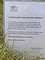 Lindisfarne Grazing Project - geograph.org.uk - 69654.jpg 480 × 640; 89 KB
-
 Lindisfarne Priory ruins - geograph.org.uk - 1059896.jpg 640 × 480; 85 KB
-
 LNER Class A3 4472 Flying Scotsman at NRM 31 May 2004.jpg 1,024 × 768; 223 KB
-
 Loch Gheornais - geograph.org.uk - 929572.jpg 640 × 369; 47 KB
-
 Loch Lee - geograph.org.uk - 15668.jpg 640 × 480; 118 KB
-
 Loch Oich - geograph.org.uk - 401239.jpg 640 × 480; 59 KB
-
 Loch Oich - geograph.org.uk - 401240.jpg 640 × 480; 38 KB
-
 Loch Osgaig looking South East - geograph.org.uk - 61122.jpg 640 × 480; 63 KB
-
 Lochmaddy-Loch nam Madadh - geograph.org.uk - 934844.jpg 640 × 404; 40 KB
-

-
 Looking out of Barpa Langass - geograph.org.uk - 934872.jpg 480 × 640; 92 KB
-
 Malcolm's Point - Mull - geograph.org.uk - 17622.jpg 640 × 425; 114 KB
-
 Maryport Harbour - geograph.org.uk - 101451.jpg 640 × 480; 77 KB
-
 Millennium Stadium, Cardiff - geograph.org.uk - 1346.jpg 640 × 354; 75 KB
-
 Naming ceremony for 31271 'Stratford 1840-2001' 01.jpg 1,024 × 768; 190 KB
-
 Naming ceremony for 31271 'Stratford 1840-2001' 02.jpg 1,024 × 768; 179 KB
-
 Naming ceremony for 31271 'Stratford 1840-2001' 03.jpg 1,024 × 768; 201 KB
-
 Nigg ferry slip - geograph.org.uk - 924699.jpg 640 × 480; 74 KB
-
 North Lee trig. - geograph.org.uk - 15605.jpg 640 × 480; 98 KB
-

-
 Oitir an t-Samhla - geograph.org.uk - 15685.jpg 640 × 480; 40 KB
-
 On Beinn Langais - geograph.org.uk - 934879.jpg 635 × 326; 29 KB
-
 Pendolino-eurostar.jpg 1,024 × 768; 228 KB
-
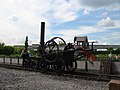
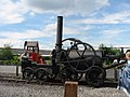 Penydarren replica at NRM 01.jpg 1,024 × 768; 250 KB
-
 Penydarren replica at NRM 02.jpg 1,024 × 768; 236 KB
-
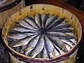 Pilchards - "Cornish Sardines" - geograph.org.uk - 73778.jpg 640 × 480; 160 KB
-

-
 Reflection of the Storr in Loch Fada - geograph.org.uk - 88046.jpg 640 × 459; 46 KB
-
 Rhubodach Farm. - geograph.org.uk - 414731.jpg 640 × 427; 86 KB
-
 River Conwy - geograph.org.uk - 1401686.jpg 640 × 480; 59 KB
-
 River Tyne from South Shields - geograph.org.uk - 260134.jpg 640 × 480; 62 KB
-
 Ruin and Loch nam Madadh - geograph.org.uk - 934863.jpg 640 × 480; 40 KB
-
 Ruined Chapel, Holy Island - geograph.org.uk - 1059893.jpg 640 × 480; 55 KB
-
 Ruined Chapel, Holy Island - geograph.org.uk - 109808.jpg 640 × 480; 106 KB
-
 Ruins of Lindisfarne Priory - geograph.org.uk - 1059894.jpg 640 × 480; 80 KB
-
 St Ives Priory Wall 2004 05 31.jpg 640 × 427; 157 KB
-
 Scalpay Bridge - geograph.org.uk - 85288.jpg 640 × 480; 84 KB
-
 Shiant Isles.jpg 640 × 179; 31 KB
-
 Shipwreck at Ettrick Bay - geograph.org.uk - 414749.jpg 640 × 427; 98 KB
-
 Slopes of North Lee-Li a Tuath - geograph.org.uk - 929578.jpg 640 × 480; 74 KB
-
 SR USA Class DS238 at NRM.jpg 1,024 × 768; 173 KB
-

-
 St Marys RC School Market Weighton.jpg 640 × 480; 172 KB
-
 Stephenson's Rocket at rail200 railfest 01.jpg 1,024 × 768; 225 KB
-
 Stephenson's Rocket at rail200 railfest 02.jpg 768 × 1,024; 190 KB
-
 Stephenson's Rocket at rail200 railfest 03.jpg 768 × 1,024; 192 KB
-
 Tarr Steps - geograph.org.uk - 746419.jpg 640 × 480; 154 KB
-
 Tattershall Church - geograph.org.uk - 1063016.jpg 480 × 640; 239 KB
-
 The Azalea Garden at Hazlehead Park - geograph.org.uk - 93992.jpg 640 × 480; 118 KB
-
 The Colintraive Ferry. - geograph.org.uk - 414734.jpg 640 × 427; 96 KB
-
 The ferry to Bute. - geograph.org.uk - 414729.jpg 640 × 427; 92 KB
-

-
 The Macgillivray Centre - geograph.org.uk - 1038559.jpg 640 × 435; 99 KB
-
 The Obelisk - geograph.org.uk - 38627.jpg 476 × 640; 144 KB
-
 The Old Man of Storr - geograph.org.uk - 88057.jpg 640 × 480; 78 KB
-

-
 The Storr - geograph.org.uk - 88052.jpg 480 × 640; 77 KB
-
 Timble Inn - geograph.org.uk - 467725.jpg 640 × 480; 58 KB
-
 Trevithick Road Loco 01.jpg 768 × 1,024; 262 KB
-
 Trevithick Road Loco 02.jpg 768 × 1,024; 227 KB
-
 View from the Storr - geograph.org.uk - 88049.jpg 640 × 480; 61 KB
-
 Walk to the Gulf of Corryvreckan - geograph.org.uk - 1451266.jpg 640 × 480; 93 KB
-
 Water Pump - geograph.org.uk - 379586.jpg 480 × 640; 151 KB
-
 West Scrafton - geograph.org.uk - 610609.jpg 640 × 480; 103 KB
-
 West Scrafton - geograph.org.uk - 610624.jpg 640 × 480; 85 KB
-
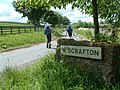 West Scrafton Village Sign - geograph.org.uk - 610607.jpg 640 × 480; 136 KB
-
 Wester Rynaballoch - geograph.org.uk - 18868.jpg 640 × 416; 43 KB
-
 Where Dane's Dyke meets the North Sea - geograph.org.uk - 8723.jpg 640 × 480; 132 KB
-
 Windsock at Davidstow airfield - geograph.org.uk - 945253.jpg 640 × 480; 82 KB
-
 Wiseton - panoramio - PJMarriott (1).jpg 2,048 × 1,536; 760 KB
-
 Wiseton - panoramio - PJMarriott.jpg 2,048 × 1,536; 776 KB
-
 Wiseton - panoramio.jpg 2,048 × 1,536; 763 KB
-
 Anglezarke Moor - geograph.org.uk - 27189.jpg 640 × 480; 97 KB
-
 Bend in the Road by Druim Bad a Ghaill - geograph.org.uk - 61121.jpg 640 × 480; 73 KB
-
 Boggy moorland above Barnhill - geograph.org.uk - 1451265.jpg 640 × 480; 102 KB
-
 Brandelhow Point - geograph.org.uk - 5422.jpg 640 × 435; 49 KB
-
 Buttermere - geograph.org.uk - 103321.jpg 640 × 235; 52 KB
-
 Carradale Bay and Point. - geograph.org.uk - 56719.jpg 640 × 480; 105 KB
-
 Cloverley Hall Pool - geograph.org.uk - 80836.jpg 640 × 480; 145 KB
-
 Colintraive Hotel. - geograph.org.uk - 414738.jpg 640 × 427; 139 KB
-
 Eddisbury Hill Farm above Delamere - geograph.org.uk - 63149.jpg 640 × 480; 69 KB
-
 Great Gill (just south of West Scrafton) - geograph.org.uk - 610619.jpg 640 × 480; 114 KB
-
 Green Path and Trough Gutter - geograph.org.uk - 610633.jpg 640 × 480; 82 KB
-
 Lead Mines Clough - geograph.org.uk - 27204.jpg 640 × 480; 101 KB
-
 Loch na Cleabheag - geograph.org.uk - 616876.jpg 800 × 600; 162 KB
-
 Loftus Cemetery Chapel - geograph.org.uk - 582851.jpg 640 × 480; 132 KB
-
 Newlands Beck - geograph.org.uk - 3100.jpg 640 × 480; 64 KB
-
 Otterbield Bay - geograph.org.uk - 5423.jpg 640 × 427; 68 KB
-
 Scarba with Dorus Mor in foreground - geograph.org.uk - 517036.jpg 640 × 480; 65 KB
-
 Sea front - geograph.org.uk - 69658.jpg 640 × 480; 99 KB
-

-
 Summit, South Lee - geograph.org.uk - 15675.jpg 640 × 457; 86 KB
-
 Swinside - geograph.org.uk - 3103.jpg 640 × 480; 33 KB
-


_-_geograph.org.uk_-_934854.jpg)


_Molesworth,_England_(ENG),_post_the_colors_during_a_Memorial_Day_ceremony_held_at_the_Madingley_American_Cemetery_nea_-_DPLA_-_05156ea7d20c5eba6205460ad8954b08.jpeg)


.jpg)


_-_geograph.org.uk_-_610619.jpg)


