Category:United Kingdom photographs taken on 2003-07-14
Jump to navigation
Jump to search
Countries of Europe: Austria · Estonia · France‡ · Germany · Italy · Norway · Romania · Russia‡ · Spain‡ · United Kingdom
‡: partly located in Europe
‡: partly located in Europe
| ← | 14 July 2003 | → | ||
| ← | July 2003 | → | ||

United Kingdom photographs taken on 14 July 2003.
Image files should be categorized here automatically using {{taken on}} template. Direct categorisation is also possible, if automatic is impossible.
Media in category "United Kingdom photographs taken on 2003-07-14"
The following 78 files are in this category, out of 78 total.
-
 "Five sisters" Shale Bings West Lothian - geograph.org.uk - 15634.jpg 640 × 427; 194 KB
-
 Common Darter in Alford Car Park - geograph.org.uk - 469717.jpg 640 × 480; 77 KB
-
 Bay north of Porth Oer - geograph.org.uk - 240374.jpg 480 × 640; 88 KB
-
 St Silas, Bollingham - Bell turret - geograph.org.uk - 984357.jpg 425 × 640; 111 KB
-
 Botanic Gardens and Hothouses - geograph.org.uk - 127459.jpg 640 × 480; 187 KB
-
 Bourton Lock on the Southern Oxford Canal - geograph.org.uk - 30568.jpg 640 × 480; 138 KB
-
 Cardigan Island Carreg Lydan.jpg 640 × 423; 82 KB
-
 Castle Car Park - geograph.org.uk - 278330.jpg 640 × 480; 78 KB
-
 Cenarth Falls - geograph.org.uk - 13728.jpg 640 × 423; 105 KB
-
 Cenarth Water Mill - geograph.org.uk - 13727.jpg 640 × 423; 128 KB
-
 Cross and Town Wall - geograph.org.uk - 278881.jpg 481 × 640; 82 KB
-
 Cyclepath - geograph.org.uk - 90151.jpg 640 × 480; 154 KB
-
 Deer Enclosure - geograph.org.uk - 278906.jpg 640 × 480; 96 KB
-

-
 Fauldhouse, West Lothian - geograph.org.uk - 15636 (cropped).jpg 640 × 385; 90 KB
-
 Fauldhouse, West Lothian - geograph.org.uk - 15636.jpg 640 × 427; 96 KB
-
 Galleon in Scarborough Harbour - geograph.org.uk - 392390.jpg 640 × 480; 110 KB
-
 Gathurst Lock - geograph.org.uk - 43606.jpg 640 × 480; 157 KB
-
 Glenlair House - geograph.org.uk - 156704.jpg 640 × 480; 68 KB
-
 Great Lake from Castle Howard - geograph.org.uk - 747765.jpg 640 × 480; 73 KB
-
 From the north end of Scottman's Pit - geograph.org.uk - 419863.jpg 640 × 480; 102 KB
-
 Keevil Airfield - geograph.org.uk - 103194.jpg 640 × 480; 50 KB
-
 Mynedd Carreg - geograph.org.uk - 240392.jpg 640 × 480; 52 KB
-
 Porth Oer - geograph.org.uk - 240378.jpg 640 × 480; 58 KB
-
-
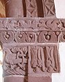
 Rowlestone tympanum.jpg 640 × 425; 110 KB
-
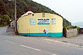
 Shore Rd, Rostrevor - geograph.org.uk - 676098.jpg 426 × 640; 69 KB
-
 South Stack - geograph.org.uk - 240396.jpg 480 × 640; 80 KB
-
-
 St Andrew, Bredwardine, Heref - geograph.org.uk - 346020.jpg 640 × 425; 109 KB
-
 St Hilary's Church, Denbigh - geograph.org.uk - 241986.jpg 640 × 480; 70 KB
-
 St Mary, Kentchurch, Heref - East end - geograph.org.uk - 346054.jpg 425 × 640; 81 KB
-
 St Mary, Kentchurch, Heref - Window - geograph.org.uk - 346056.jpg 350 × 640; 109 KB
-

-
 St Peter, Rowlestone, Heref - geograph.org.uk - 346085.jpg 640 × 425; 97 KB
-
 St Silas, Bollingham - Brass - geograph.org.uk - 984311.jpg 640 × 460; 74 KB
-
 St Silas, Bollingham - Brass - geograph.org.uk - 984327.jpg 640 × 418; 85 KB
-
 St Silas, Bollingham - Corbel - geograph.org.uk - 984326.jpg 450 × 640; 39 KB
-
 St Silas, Bollingham - Corbel - geograph.org.uk - 984352.jpg 425 × 640; 114 KB
-
 St Silas, Bollingham - East end - geograph.org.uk - 984334.jpg 640 × 419; 54 KB
-
 St Silas, Bollingham - East end - geograph.org.uk - 984336.jpg 426 × 640; 54 KB
-
 St Silas, Bollingham - Floor grill - geograph.org.uk - 984340.jpg 382 × 640; 119 KB
-
 St Silas, Bollingham - Flue - geograph.org.uk - 984349.jpg 425 × 640; 49 KB
-
 St Silas, Bollingham - Font - geograph.org.uk - 984309.jpg 446 × 640; 67 KB
-
 St Silas, Bollingham - geograph.org.uk - 984362.jpg 640 × 425; 112 KB
-
 St Silas, Bollingham - Ledger slab - geograph.org.uk - 984338.jpg 450 × 640; 103 KB
-
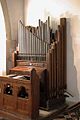 St Silas, Bollingham - Organ - geograph.org.uk - 984322.jpg 425 × 640; 56 KB
-
 St Silas, Bollingham - Pew - geograph.org.uk - 984342.jpg 425 × 640; 67 KB
-
 St Silas, Bollingham - Pulpit - geograph.org.uk - 984316.jpg 425 × 640; 44 KB
-
 St Silas, Bollingham - Roof - geograph.org.uk - 984325.jpg 640 × 425; 87 KB
-
 St Silas, Bollingham - Sanctuary - geograph.org.uk - 984331.jpg 640 × 425; 86 KB
-
 St Silas, Bollingham - Stoup - geograph.org.uk - 984313.jpg 640 × 425; 57 KB
-
 St Silas, Bollingham - Tiles - geograph.org.uk - 984329.jpg 465 × 640; 129 KB
-
 St Silas, Bollingham - Tiles - geograph.org.uk - 984330.jpg 640 × 616; 164 KB
-
 St Silas, Bollingham - Window - geograph.org.uk - 984314.jpg 261 × 640; 72 KB
-
 St Silas, Bollingham - Window - geograph.org.uk - 984317.jpg 396 × 640; 92 KB
-
 St Silas, Bollingham - Window - geograph.org.uk - 984320.jpg 274 × 640; 23 KB
-
 St Silas, Bollingham - Window - geograph.org.uk - 984344.jpg 398 × 640; 36 KB
-
 St Silas, Bollingham - Window - geograph.org.uk - 984355.jpg 413 × 640; 124 KB
-
 St Silas, Bollingham - Window - geograph.org.uk - 984360.jpg 640 × 430; 124 KB
-
 St Silas, Bollingham, Herefordshire - geograph.org.uk - 308261.jpg 640 × 425; 148 KB
-

-

-
 Threipmuir Reservoir - geograph.org.uk - 136270.jpg 640 × 480; 111 KB
-
 Tramway Depot, Rostrevor - geograph.org.uk - 346733.jpg 640 × 426; 132 KB
-
 Tramway Depot, Rostrevor - geograph.org.uk - 346735.jpg 426 × 640; 157 KB
-
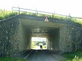 Underpasses under two arms of the M6 - geograph.org.uk - 130296.jpg 640 × 480; 82 KB
-
 Harlaw - geograph.org.uk - 136271.jpg 640 × 480; 91 KB
-
 Holme Fell, near Sedbergh - geograph.org.uk - 130288.jpg 640 × 480; 76 KB
-
 Moorland road at Middle Busk - geograph.org.uk - 130307.jpg 640 × 480; 64 KB
-
 Porth Y Wrach - geograph.org.uk - 240377.jpg 640 × 480; 58 KB
-
 River Clwyd - geograph.org.uk - 241979.jpg 640 × 480; 60 KB
-
 River Teifi at Cenarth - geograph.org.uk - 13722.jpg 640 × 423; 123 KB
-

-

-
 Tarn Moor near Sunbigin Tarn - geograph.org.uk - 130304.jpg 640 × 480; 64 KB
-
 The "Fair Mile" in the Lune Gorge - geograph.org.uk - 130293.jpg 640 × 480; 83 KB
-
 White Shaw Moss - geograph.org.uk - 130282.jpg 640 × 480; 66 KB


.jpg)


