Category:Underbarrow and Bradleyfield
Jump to navigation
Jump to search

civil parish in Cumbria, United Kingdom  | |||||
| Upload media | |||||
| Instance of | |||||
|---|---|---|---|---|---|
| Location | South Lakeland, Cumbria, North West England, England | ||||
 | |||||
English: Underbarrow and Bradleyfield is a civil parish in the South Lakeland district, in the county of Cumbria, UK.
Subcategories
This category has the following 3 subcategories, out of 3 total.
Media in category "Underbarrow and Bradleyfield"
The following 200 files are in this category, out of 285 total.
(previous page) (next page)-
 'Our Daddy's Bench', Scout Scar - geograph.org.uk - 2819330.jpg 640 × 480; 138 KB
-
 'Tarn' near Mountjoy Wood - geograph.org.uk - 2937030.jpg 640 × 480; 109 KB
-
 A work in progress^ - geograph.org.uk - 2822872.jpg 640 × 480; 98 KB
-
 Above Bradleyfield - geograph.org.uk - 2037352.jpg 640 × 427; 259 KB
-
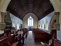
 All Saint's Church Underbarrow (interior) - geograph.org.uk - 3230745.jpg 3,264 × 2,448; 1.79 MB
-
 All Saint's Church Underbarrow - geograph.org.uk - 3229267.jpg 3,264 × 2,448; 3 MB
-
 All Saints Church, Underbarrow - geograph.org.uk - 4671067.jpg 800 × 600; 174 KB
-
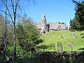
 All Saints' Church, Underbarrow - geograph.org.uk - 1835179.jpg 640 × 480; 123 KB
-
 All Saints' Church, Underbarrow - geograph.org.uk - 1835525.jpg 480 × 640; 72 KB
-
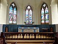 All Saints' Church, Underbarrow, Altar - geograph.org.uk - 1835465.jpg 626 × 468; 135 KB
-

-
 All Saints' Church, Underbarrow, Doorway - geograph.org.uk - 1835430.jpg 480 × 640; 104 KB
-

-
-

-
-
-

-

-
-

-

-

-

-

-
 All Saints, Underbarrow, aisle - geograph.org.uk - 4365548.jpg 640 × 480; 63 KB
-
 All Saints, Underbarrow, altar - geograph.org.uk - 4365541.jpg 640 × 480; 78 KB
-

-
 All Saints, Underbarrow, churchyard (1) - geograph.org.uk - 4365488.jpg 640 × 467; 115 KB
-
 All Saints, Underbarrow, churchyard (2) - geograph.org.uk - 4365502.jpg 640 × 480; 117 KB
-
 All Saints, Underbarrow, churchyard (3) - geograph.org.uk - 4365505.jpg 640 × 480; 122 KB
-
 All Saints, Underbarrow, churchyard (4) - geograph.org.uk - 4365559.jpg 640 × 480; 100 KB
-
 All Saints, Underbarrow, churchyard (5) - geograph.org.uk - 4365560.jpg 640 × 480; 106 KB
-
 All Saints, Underbarrow, churchyard (6) - geograph.org.uk - 4365565.jpg 640 × 480; 113 KB
-

-
 All Saints, Underbarrow, entrance - geograph.org.uk - 4364684.jpg 640 × 480; 125 KB
-
 All Saints, Underbarrow, font - geograph.org.uk - 4365513.jpg 640 × 480; 60 KB
-
 All Saints, Underbarrow, front - geograph.org.uk - 4365499.jpg 640 × 480; 94 KB
-

-

-
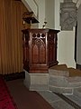
 All Saints, Underbarrow, pulpit - geograph.org.uk - 4365529.jpg 640 × 480; 73 KB
-

-
 An impressive bit of amateur work on Scout Scar - geograph.org.uk - 3742445.jpg 1,600 × 899; 453 KB
-
 An old field barn - geograph.org.uk - 3230841.jpg 3,264 × 2,448; 2.77 MB
-

-
 Approaching Capplerigg Farm - geograph.org.uk - 3377724.jpg 2,048 × 1,536; 518 KB
-
 Approaching the dip on Cunswick Scar - geograph.org.uk - 2483831.jpg 800 × 548; 67 KB
-
 Ash Spring Wood - geograph.org.uk - 946387.jpg 640 × 480; 103 KB
-
 Ashstead Fell, Mabbin Crag and Castle Fell - geograph.org.uk - 2483733.jpg 1,024 × 636; 141 KB
-
 Back toward Hollins Wood - geograph.org.uk - 3230852.jpg 3,264 × 2,448; 2.24 MB
-
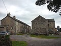
 Barn at Broom Farm - geograph.org.uk - 3229253.jpg 3,264 × 2,448; 2.77 MB
-
 Barn at The Broom - geograph.org.uk - 2936950.jpg 640 × 445; 123 KB
-
 Barn on Third Moss Lane - geograph.org.uk - 1831852.jpg 640 × 480; 158 KB
-
 Barrow field Farm - geograph.org.uk - 1192214.jpg 640 × 480; 82 KB
-
 Barrowfield - geograph.org.uk - 2252365.jpg 2,592 × 1,944; 1.49 MB
-
 Barrowfield - geograph.org.uk - 3050255.jpg 1,280 × 856; 306 KB
-
 Barrowfield Farm and Fingerpost - geograph.org.uk - 3230868.jpg 3,264 × 2,448; 2.6 MB
-
 Barrowfield from Scout Scar - geograph.org.uk - 2819445.jpg 800 × 600; 132 KB
-
 Barrowfield from the path up Scout Scar - geograph.org.uk - 1894050.jpg 1,600 × 900; 318 KB
-
 Barrowfield Wood - geograph.org.uk - 946472.jpg 640 × 480; 146 KB
-
 Bell Hill - geograph.org.uk - 4338610.jpg 640 × 480; 85 KB
-
 Bench mark on gatepost, Gamblesmire Lane - geograph.org.uk - 2483525.jpg 493 × 640; 135 KB
-

-
 Bench mark, Scar Foot - geograph.org.uk - 2819166.jpg 640 × 480; 142 KB
-
 Bluebells beside Mountjoy Wood - geograph.org.uk - 2936962.jpg 480 × 640; 118 KB
-
 Bonfire Hall - geograph.org.uk - 2482462.jpg 640 × 480; 93 KB
-
 Bridging Tanyard Beck - geograph.org.uk - 3230823.jpg 3,264 × 2,448; 3.06 MB
-
 Bridleway north of Bell Hill - geograph.org.uk - 4668176.jpg 640 × 480; 99 KB
-
 Bridleway north of Knott Farm - geograph.org.uk - 3377637.jpg 2,048 × 1,536; 522 KB
-
 Bridleway north of Lindreth Brow - geograph.org.uk - 3377668.jpg 2,048 × 1,536; 645 KB
-
 Bridleway northeast of Knott Farm - geograph.org.uk - 3377634.jpg 2,048 × 1,536; 595 KB
-
 Bridleway south of Lindreth Brow - geograph.org.uk - 4668189.jpg 640 × 480; 108 KB
-
 Bridleway west of Long Wood - geograph.org.uk - 2482450.jpg 640 × 480; 141 KB
-
 Cairn on Cunswick Fell - geograph.org.uk - 2483993.jpg 1,024 × 768; 288 KB
-
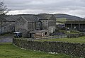
 Capplerigg farm - geograph.org.uk - 3377726.jpg 2,048 × 1,536; 645 KB
-
 Capplerigg Lane - geograph.org.uk - 4338607.jpg 640 × 480; 109 KB
-

-

-

-
 Cattle near Ellerbeck Farm - geograph.org.uk - 2039830.jpg 640 × 416; 80 KB
-
 Chapel Beck and Beckside - geograph.org.uk - 2937267.jpg 640 × 480; 100 KB
-
 Chapel House from Chapel Lane - geograph.org.uk - 1058136.jpg 640 × 418; 88 KB
-
 Chapel Lane - geograph.org.uk - 1058150.jpg 640 × 425; 116 KB
-

-
 Clapper Bridge over Tanyard Beck - geograph.org.uk - 3230832.jpg 3,264 × 2,448; 2.55 MB
-
 Common ground ^ limestone outcrops on Helsington Barrows - geograph.org.uk - 6009579.jpg 5,184 × 2,920; 6.36 MB
-
 Communications mast - geograph.org.uk - 2934212.jpg 1,600 × 1,200; 241 KB
-
 Communications Tower , Cunswick Fell - geograph.org.uk - 946456.jpg 640 × 480; 132 KB
-
 Craggy outcrop near Blakebank - geograph.org.uk - 885282.jpg 640 × 479; 58 KB
-
 Crook Ford - geograph.org.uk - 6199489.jpg 3,662 × 2,744; 3.07 MB
-
 Cunswick Fell - geograph.org.uk - 4404493.jpg 2,592 × 1,944; 1.21 MB
-
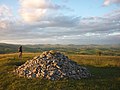
 Cunswick Fell, summit cairn - geograph.org.uk - 3383050.jpg 4,320 × 3,240; 5.47 MB
-

-
 Dairy herd on Cunswick Fell - geograph.org.uk - 4152131.jpg 800 × 600; 134 KB
-
 Disused Sheep Dip Near Bradleyfield - geograph.org.uk - 2037329.jpg 640 × 427; 279 KB
-
 Dog at Capplerigg - geograph.org.uk - 2482439.jpg 640 × 480; 147 KB
-
 Drystone Wall and Footpath Bradleyfield - geograph.org.uk - 3231202.jpg 3,264 × 2,448; 2.1 MB
-
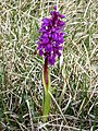 Early Purple Orchid - geograph.org.uk - 2934183.jpg 1,200 × 1,600; 609 KB
-
 East side of Nigh Hill - geograph.org.uk - 2825456.jpg 640 × 480; 104 KB
-
 End of Scout Scar - geograph.org.uk - 3080295.jpg 640 × 480; 275 KB
-
 Entrance to Knott Farm - geograph.org.uk - 3377630.jpg 2,048 × 1,536; 577 KB
-
 Evening on Cunswick Scar - geograph.org.uk - 2483547.jpg 1,024 × 768; 229 KB
-
 Evening on the summit of Cunswick Scar - geograph.org.uk - 2483841.jpg 1,024 × 768; 230 KB
-
 Fell Gate - geograph.org.uk - 2482436.jpg 640 × 480; 101 KB
-
 Fell Gate farm - geograph.org.uk - 1058198.jpg 640 × 435; 77 KB
-
 Field strip in Forestry - geograph.org.uk - 3230863.jpg 3,264 × 2,448; 2.4 MB
-
 First Moss Lane - geograph.org.uk - 2819020.jpg 640 × 480; 124 KB
-
 Flaming gorse - geograph.org.uk - 4473722.jpg 2,560 × 1,920; 3.19 MB
-
 Floral Barn near Kirkby House - geograph.org.uk - 885297.jpg 640 × 479; 93 KB
-
 Footbridge over the A591 - geograph.org.uk - 3134144.jpg 4,596 × 2,174; 1.83 MB
-
 Footpath across rough pasture - geograph.org.uk - 3229238.jpg 3,264 × 2,448; 2.34 MB
-
 Footpath across the A591 - geograph.org.uk - 4152551.jpg 480 × 640; 160 KB
-
 Footpath through Ash Spring - geograph.org.uk - 5155166.jpg 480 × 640; 171 KB
-
-

-
 Ford on the bridleway east of Bell Hill - geograph.org.uk - 3377662.jpg 2,048 × 1,536; 518 KB
-
 Gamblesmire Lane by Cunswick Fell - geograph.org.uk - 946434.jpg 640 × 480; 97 KB
-
 Gamblesmire Lane west of Gamblesmire Wood - geograph.org.uk - 3377619.jpg 2,048 × 1,536; 516 KB
-

-
 Gate from Bradleyfield to Bradley Field Farm - geograph.org.uk - 3231211.jpg 3,264 × 2,448; 2.24 MB
-
 Gate on Gamblesmire Lane - geograph.org.uk - 3377597.jpg 2,048 × 1,536; 646 KB
-
 Gate on the path across Bradleyfield - geograph.org.uk - 3377397.jpg 2,048 × 1,536; 621 KB
-
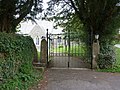
 Gateway to Bradleyfield - geograph.org.uk - 3231180.jpg 3,264 × 2,448; 2.97 MB
-
 Giant vegetables at Fallen Yew - geograph.org.uk - 4667041.jpg 480 × 640; 132 KB
-
 Golf course on Kendal Fell - geograph.org.uk - 2483975.jpg 800 × 502; 88 KB
-
 Grazing land above Mountjoy Wood - geograph.org.uk - 2937013.jpg 640 × 480; 79 KB
-
-
 Heading north on Scout Scar - geograph.org.uk - 3231189.jpg 3,264 × 2,448; 2.24 MB
-
 Heading west along Gamblesmire Lane - geograph.org.uk - 1058210.jpg 640 × 427; 94 KB
-
 Helicopter at The Broom - geograph.org.uk - 4668530.jpg 800 × 600; 137 KB
-
 Helpot Farm from Scout Scar - geograph.org.uk - 2819356.jpg 600 × 800; 144 KB
-
 High Cragg near Crook - geograph.org.uk - 2937251.jpg 640 × 480; 141 KB
-
 High Pool Bridge - geograph.org.uk - 1831845.jpg 640 × 480; 140 KB
-
 High Pool Bridge - geograph.org.uk - 1831849.jpg 640 × 480; 151 KB
-
 Hodgson’s Leap - geograph.org.uk - 6098719.jpg 640 × 427; 91 KB
-
 Hollin Wood - geograph.org.uk - 2819036.jpg 800 × 600; 166 KB
-
 House on road to Tranthwaite Hall - geograph.org.uk - 1058230.jpg 640 × 425; 103 KB
-
 Houses below The Heights, Kendal Fell - geograph.org.uk - 4152765.jpg 640 × 479; 129 KB
-
 Ill Bell and the fells around Kentmere - geograph.org.uk - 2483719.jpg 1,024 × 768; 122 KB
-
 Inside All Saints, Underbarrow (a) - geograph.org.uk - 4365512.jpg 640 × 480; 67 KB
-
 Inside All Saints, Underbarrow (b) - geograph.org.uk - 4365518.jpg 640 × 480; 66 KB
-
 Inside All Saints, Underbarrow (c) - geograph.org.uk - 4365520.jpg 640 × 480; 38 KB
-
 Inside All Saints, Underbarrow (d) - geograph.org.uk - 4365523.jpg 640 × 480; 41 KB
-
 Inside All Saints, Underbarrow (e) - geograph.org.uk - 4365524.jpg 640 × 480; 62 KB
-
 Inside All Saints, Underbarrow (f) - geograph.org.uk - 4365532.jpg 640 × 480; 33 KB
-
 Inside All Saints, Underbarrow (g) - geograph.org.uk - 4365534.jpg 640 × 480; 61 KB
-
 Inside All Saints, Underbarrow (h) - geograph.org.uk - 4365537.jpg 640 × 480; 63 KB
-
 Inside All Saints, Underbarrow (i) - geograph.org.uk - 4365540.jpg 640 × 480; 50 KB
-
 Kirkby House - geograph.org.uk - 1192201.jpg 640 × 480; 104 KB
-
 Kirkby House - geograph.org.uk - 885303.jpg 640 × 479; 90 KB
-
 Kissing Gate 200 metres east of Scout Scar - geograph.org.uk - 3353206.jpg 1,528 × 1,016; 1.47 MB
-

-
 Lime kiln, Cunswick Scar - geograph.org.uk - 2483519.jpg 640 × 480; 146 KB
-
 Limestone meadow - geograph.org.uk - 3070437.jpg 640 × 491; 354 KB
-
 Limestone pasture - geograph.org.uk - 3070405.jpg 640 × 480; 263 KB
-
 Lindreth Brow - geograph.org.uk - 4668184.jpg 640 × 480; 89 KB
-
 Lindreth Brow from Chapel Lane track - geograph.org.uk - 1058153.jpg 640 × 425; 93 KB
-
 Looking Across the Lyth Valley in Crosthwaite - geograph.org.uk - 2618447.jpg 3,872 × 2,592; 2.95 MB
-
 Looking east from Cunswick Scar - geograph.org.uk - 2483539.jpg 800 × 600; 112 KB
-
 Looking north from above Scout Scar - geograph.org.uk - 2203396.jpg 640 × 425; 277 KB
-

-

-
 Looking south-east on Scout Scar - geograph.org.uk - 3742462.jpg 640 × 360; 84 KB
-
 Looking west from above Scout Scar - geograph.org.uk - 2203391.jpg 640 × 425; 324 KB
-
 Lord's Lot from Nigh Hill - geograph.org.uk - 2825463.jpg 640 × 480; 69 KB
-
 Mile stone, Underbarrow Road - geograph.org.uk - 2819112.jpg 480 × 640; 221 KB
-
 Mountjoy Brow by the church - geograph.org.uk - 4363715.jpg 640 × 480; 109 KB
-
 Muck spreading - geograph.org.uk - 1831848.jpg 640 × 480; 133 KB
-
 Nearing the Underbarrow Road car park - geograph.org.uk - 4404510.jpg 2,592 × 1,944; 1.51 MB
-
 North from Cunswick Scar - geograph.org.uk - 5155145.jpg 800 × 586; 114 KB
-

-

-
 Old Schoolhouse, Underbarrow - geograph.org.uk - 2936931.jpg 640 × 480; 100 KB
-
 On Cunswick Fell - geograph.org.uk - 3383590.jpg 4,320 × 3,240; 5.77 MB
-
 On Cunswick Fell - geograph.org.uk - 4404483.jpg 2,592 × 1,944; 1.4 MB
-
 On Cunswick Fell - geograph.org.uk - 4404498.jpg 2,592 × 1,944; 1.16 MB
-
 On Cunswick Fell - geograph.org.uk - 4404503.jpg 2,592 × 1,944; 1.27 MB
-
 On Scout Scar - geograph.org.uk - 3080315.jpg 640 × 480; 274 KB
-
 On Scout Scar - geograph.org.uk - 4404518.jpg 2,592 × 1,944; 1,023 KB
-
 Parkspring Wood - geograph.org.uk - 3080305.jpg 640 × 480; 319 KB
-
 Pasture and woodland below Scout Scar - geograph.org.uk - 1894029.jpg 1,600 × 900; 236 KB
-
 Pasture below Mountjoy Wood - geograph.org.uk - 2936956.jpg 640 × 480; 69 KB
-

-
 Pastureland near Blakebank, Underbarrow - geograph.org.uk - 4668547.jpg 800 × 600; 133 KB
-

-
 Pastures south of Gamblesmire Lane - geograph.org.uk - 2482541.jpg 800 × 525; 76 KB
-
 Path on Scout Scar - geograph.org.uk - 3070448.jpg 640 × 480; 359 KB
-
 Path through woods near Cunswick Hall - geograph.org.uk - 1058218.jpg 640 × 429; 106 KB
-
 Pond at Broom Farm - geograph.org.uk - 3229247.jpg 3,264 × 2,448; 2.13 MB
-
 Pond east of Tarn Hill - geograph.org.uk - 2711467.jpg 640 × 480; 62 KB
-
 Ponds near Mountjoy Wood - geograph.org.uk - 2825436.jpg 640 × 480; 80 KB
-

-

-
 Private Road, Lyth Valley - geograph.org.uk - 946545.jpg 640 × 480; 127 KB
-
 Public footpath on Cunswick Fell - geograph.org.uk - 4152534.jpg 800 × 600; 68 KB
-
 Rising ground - geograph.org.uk - 4473733.jpg 2,560 × 1,920; 3.31 MB
-
 River Pool or Underbarrow Pool - geograph.org.uk - 1831842.jpg 640 × 480; 114 KB
-
 Rivet benchmark near the ford east of Bell Hill - geograph.org.uk - 3377661.jpg 2,048 × 1,536; 693 KB
-
 Road NE of Low Plain Farm - geograph.org.uk - 1835028.jpg 640 × 480; 162 KB
-
 Scour Scar - geograph.org.uk - 1894057.jpg 1,600 × 1,068; 475 KB


_-_geograph.org.uk_-_3230745.jpg)


_-_geograph.org.uk_-_4365488.jpg)
_-_geograph.org.uk_-_4365502.jpg)
_-_geograph.org.uk_-_4365505.jpg)
_-_geograph.org.uk_-_4365559.jpg)
_-_geograph.org.uk_-_4365560.jpg)
_-_geograph.org.uk_-_4365565.jpg)
_-_geograph.org.uk_-_4365567.jpg)


_-_geograph.org.uk_-_4365512.jpg)
_-_geograph.org.uk_-_4365518.jpg)
_-_geograph.org.uk_-_4365520.jpg)
_-_geograph.org.uk_-_4365523.jpg)
_-_geograph.org.uk_-_4365524.jpg)
_-_geograph.org.uk_-_4365532.jpg)
_-_geograph.org.uk_-_4365534.jpg)
_-_geograph.org.uk_-_4365537.jpg)
_-_geograph.org.uk_-_4365540.jpg)


