Category:US National Archives series: Annotated Maps, ca. 1944 - ca. 1944
Jump to navigation
Jump to search
Media in category "US National Archives series: Annotated Maps, ca. 1944 - ca. 1944"
The following 7 files are in this category, out of 7 total.
-
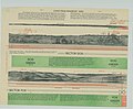 D-Day Sectors Chart - NARA - 84786162.jpg 13,820 × 11,360; 10.49 MB
-
 D-Day Sectors Chart - NARA - 84786164.jpg 13,818 × 11,360; 9.24 MB
-
 D-Day Sectors Chart - NARA - 84786166.jpg 13,811 × 11,392; 22.58 MB
-
 Defences- Colleville sur Mer - NARA - 84786160.jpg 11,680 × 15,693; 9.87 MB
-
 Map of Ryes - NARA - 84786170.jpg 14,391 × 11,712; 20.07 MB
-
 Map of St. Lo - NARA - 84786154.jpg 14,801 × 11,648; 24.41 MB
-
 Map of St. Lo Area - NARA - 84786168.jpg 22,635 × 13,984; 63.86 MB


