Category:US Army Transportation Museum, taken by Lar
Jump to navigation
Jump to search
Images taken at, or related to, the U.S. Army Transportation Museum, Fort Eustis, Virginia |
A - Aviation Pavilion and exhibits B - Boats and amphibious transport exhibits V - Vehicle Park E - Indoor exhibits and dioramas T - Train/Railway exhibits |
Media in category "US Army Transportation Museum, taken by Lar"
The following 11 files are in this category, out of 11 total.
-
 DUKW-353 USArmyTransportationMuseum DSCN7534.JPG 1,600 × 1,200; 342 KB
-
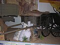
 Escort Wagon USArmyTransMuseum DSCN7459.JPG 1,600 × 1,200; 440 KB
-
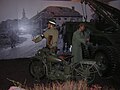 Harley model 50WLA USArmyTransportationMuseum DSCN7481.JPG 1,600 × 1,200; 422 KB
-
 Jeep USArmyTransportationMuseum DSCN7479.JPG 1,600 × 1,200; 424 KB
-
 Liberty Truck USArmyTransMuseum DSCN7465.JPG 1,600 × 1,200; 428 KB
-
 M29 Weasel Arctic USArmyTransMuseum.jpg 1,600 × 1,200; 402 KB
-
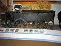
 Quartermaster Wagon USArmyTransMuseum DSCN7462.JPG 1,600 × 1,200; 432 KB
-
 Railway Handcar USArmyTransMuseum DSCN7467.JPG 1,600 × 1,200; 436 KB
-
 Railway Jeep USArmyTransMuseumDSCN7473.JPG 1,600 × 1,200; 359 KB
-
 Transport Wagon USArmyTransMuseum DSCN7458.JPG 1,600 × 1,200; 439 KB
-
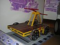
 WalkingMachine USArmyTransportationMuseum DSCN7543.JPG 1,600 × 1,200; 355 KB