Category:U.S. Route 6 in Utah County, Utah
Jump to navigation
Jump to search
Subcategories
This category has the following 6 subcategories, out of 6 total.
E
M
- Moark Junction (6 F)
T
- Thistle Slide Road (5 F)
- Tie Fork Rest Area (10 F)
- Tucker Rest Area (4 F)
Media in category "U.S. Route 6 in Utah County, Utah"
The following 179 files are in this category, out of 179 total.
-
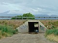 Bamberger Rd tunnel under I-15 in Payson, Utah, Jun 16.jpg 2,592 × 1,944; 2.44 MB
-
 Bear Fire - Carbon County, Utah 01.jpg 6,000 × 4,000; 4.02 MB
-
 Bridge over Diamond Fork, Jul 15.jpg 2,816 × 2,112; 2.65 MB
-
 Confluence of Starvation Creek & Soldier Creek, Tucker, Utah, May 17.jpg 2,592 × 1,944; 2.24 MB
-
 East across US-6 at Narrows, Utah, Dec 16.jpg 2,592 × 1,944; 2.3 MB
-
 East at Billies Mountain grade cut in Spanish Fork Canyon, Jul 15.jpg 2,816 × 2,112; 2.53 MB
-
 East at I-15 & SR-164 interchange, Benjamin, Utah, Jun 16.jpg 2,592 × 1,944; 2.35 MB
-
 East at junction of I-15, US-6, & SR-198, Santaquin, Utah, May 16.jpg 2,592 × 1,944; 2.36 MB
-
 East at train in Kyune, Utah, May 17.jpg 2,592 × 1,944; 2.38 MB
-
 East at US-6 & Dividend Rd intersection from Dividend Rd, May 16.jpg 2,592 × 1,944; 2.36 MB
-
 East at US-6 & Dividend Rd intersection from US-6, May 16.jpg 2,592 × 1,944; 2.36 MB
-
 East at US-6 & SR-68 junction, Elberta, Utah, May 16.jpg 2,592 × 1,944; 2.44 MB
-
 East at US-6 in Tucker, Utah, May 17.jpg 2,592 × 1,944; 2.09 MB
-
 East at US-6, Elberta Slant Rd, & Dividend Fork Rd intersection, May 16.jpg 2,592 × 1,944; 2.32 MB
-
 East in east end of The Red Narrows at most narrow part, Dec 16.jpg 2,592 × 1,944; 2.44 MB
-
 East in east end of The Red Narrows, Dec 16.jpg 2,592 × 1,944; 2.42 MB
-
 East in west end of The Red Narrows, Dec 16.jpg 2,592 × 1,944; 2.43 MB
-
 East on eastbound US-6 in Solder Summit, Utah, Dec 16.jpg 2,592 × 1,944; 2.32 MB
-
 East on Main Street, Santaquin, Utah, May 16.jpg 2,592 × 1,944; 2.36 MB
-
 East on SR-147 under US-6,.jpg 2,592 × 1,944; 2.38 MB
-
 East on US 6 in Soldier Summit, Utah, May 17.jpg 2,592 × 1,944; 2.45 MB
-
 East on US-6 across Goshen Valley from Big Canyon, May 16.jpg 2,592 × 1,944; 2.37 MB
-
 East on US-6 at Goshen, Utah, May 16.jpg 2,592 × 1,944; 2.36 MB
-
 East on US-6 from Elberta, Utah, May 16.jpg 2,592 × 1,944; 2.42 MB
-
 East toward I-15 & SR-178 interchange.jpg 2,816 × 2,112; 2.42 MB
-
 East-northeast on US-6 from east of Goshen, Utah, May 16.jpg 2,592 × 1,944; 2.32 MB
-
 East-southeast at US-6 & US-89 junction in Spanish Fork, Utah, May 16.jpg 2,592 × 1,944; 2.41 MB
-
 Eastbound Elevated Transit bus on US-6 in Spanish Fork, May 16.jpg 2,592 × 1,944; 2.31 MB
-
 Erroneous UT-6-US-89 Signs at Thistle UT - panoramio.jpg 1,600 × 1,200; 416 KB
-
 Family Tree Restaurant, Santaquin, Utah, May 16.jpg 2,592 × 1,944; 2.4 MB
-
 Former gas station along US-6 & SR-68 in Elberta, May 16.jpg 2,592 × 1,944; 2.38 MB
-
 Hot Rod Diner, Santaquin, Utah, May 16.jpg 2,592 × 1,944; 2.37 MB
-
 I-15-US-6 Shields at junction Santaquin - panoramio.jpg 1,600 × 1,200; 600 KB
-
 Montañas nevadas.jpg 3,056 × 2,292; 875 KB
-
 National Scenic Byway - Nebo Loop (Utah) - NARA - 68886696.jpg 600 × 600; 62 KB
-
 New Directional Sign - panoramio.jpg 1,600 × 1,200; 790 KB
-
 North across US-6 at Narrows, Utah, Dec 16.jpg 2,592 × 1,944; 2.28 MB
-
 North across US-6 at Tintic High School, May 16.jpg 2,592 × 1,944; 2.33 MB
-
 North and down at Thistle Slide Road, Jul 15.jpg 2,816 × 2,112; 2.73 MB
-
 North at I-15 & SR-115 interchange, Payson, UT, Jun 16.jpg 2,592 × 1,944; 2.34 MB
-
 North at I-15 & SR-178 interchange, May 16.jpg 2,592 × 1,944; 2.31 MB
-
 North at US-6 & SR-141 junction, Genola, Utah, May 16.jpg 2,592 × 1,944; 2.4 MB
-
 North at US-6 & SR-68 junction, Elberta, Utah, May 16.jpg 2,592 × 1,944; 2.42 MB
-
 North at US-6, Elberta Slant Rd, & Dividend Fork Rd intersection, May 16.jpg 2,592 × 1,944; 2.34 MB
-
 North on US-6 in at Utah-Carbon county line, Dec 16.jpg 2,592 × 1,944; 2.4 MB
-
 Northeast at US-6 & Dividend Rd west junction, May 16.jpg 2,592 × 1,944; 2.4 MB
-
 Northeast at US-6 & SR-141 junction, Genola, Utah, May 16.jpg 2,592 × 1,944; 2.35 MB
-
 Northeast at US-6 & SR-198 junction in Spanish Fork, Utah, May 16.jpg 2,592 × 1,944; 2.34 MB
-
 Northeast at US-6 & SR-96 junction, Dec 16.jpg 2,592 × 1,944; 2.35 MB
-
 Northeast on Tintic Branch Line from Bamburger Rd, Utah County, Utah, Jun 16.jpg 2,592 × 1,944; 2.32 MB
-
 Northeast on Tintic Branch Line from Utah Avenue Payson, Utah, Jun 16.jpg 2,592 × 1,944; 2.44 MB
-
 Northeast on Tintic Branch Line from West Utah Avenue Payson, Utah, Jun 16.jpg 2,592 × 1,944; 2.4 MB
-
 Northeast US-6 & Emma Park Road junction, Dec 16.jpg 2,592 × 1,944; 2.36 MB
-
 Northwest across US-6 & S State Rd intersection west of Genola, Utah, May 16.jpg 2,592 × 1,944; 2.35 MB
-
 Northwest along US-6 in west Santaquin, Utah, May 16.jpg 2,592 × 1,944; 2.35 MB
-
 Northwest at US-6 & Emma Park Road junction, Dec 16.jpg 2,592 × 1,944; 2.35 MB
-
 Northwest at US-6 & SR-198 junction in Spanish Fork, Utah, May 16.jpg 2,592 × 1,944; 2.35 MB
-
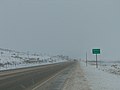
 Northwest at US-6 Price River bridge in Utah County, Utah, Dec 16.jpg 2,592 × 1,944; 2.27 MB
-
 Northwest on US-6 on westbound at Utah-Wasatch Utah county line, Dec 16.jpg 2,592 × 1,944; 2.29 MB
-
 Passing vehicle I-15 rural Utah July 2011.jpg 3,456 × 2,304; 2.89 MB
-
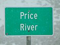 Price River sign along US-6 in Utah County, Utah, Dec 16.jpg 2,592 × 1,944; 2.71 MB
-
 Solo Pole in I-15 Median - panoramio.jpg 1,600 × 1,200; 398 KB
-

-
 South at I-15 & SR-115 interchange, Payson, UT, Jun 16.jpg 2,592 × 1,944; 2.35 MB
-
 South at I-15 from SR-147 overpass, Utah County, Utah, Jun 16.jpg 2,592 × 1,944; 2.33 MB
-
 South at junction of SR-51 & SR-147 in Spanish Fork, Utah, Apr 16.jpg 2,592 × 1,944; 2.36 MB
-
 South at Skyline Dr & US-6, Tucker, Utah, May 17.jpg 2,592 × 1,944; 2.3 MB
-
 South at Thistle Gun Range, Jul 15.jpg 2,816 × 2,112; 2.8 MB
-
 South at US-6 & SR-141 junction, Genola, Utah, May 16.jpg 2,592 × 1,944; 2.42 MB
-
 South at US-6 & SR-68 junction, Elberta, Utah, May 16.jpg 2,592 × 1,944; 2.4 MB
-
 South at US-6, Elberta Slant Rd, & Dividend Fork Rd intersection, May 16.jpg 2,592 × 1,944; 2.37 MB
-
 South on US-6 in at Utah-Carbon county line, Dec 16.jpg 2,592 × 1,944; 2.33 MB
-
 South-soutwest across US-6 & US-89 junction in Spanish Fork, Utah, May 16.jpg 2,592 × 1,944; 2.37 MB
-
 Southeast at I-15 & SR-164 interchange, Benjamin, Utah, Jun 16.jpg 2,592 × 1,944; 2.36 MB
-
 Southeast at US-6 & Emma Park Road junction, Dec 16.jpg 2,592 × 1,944; 2.32 MB
-
 Southeast at US-6 & SR-198 junction in Spanish Fork, Utah, May 16.jpg 2,592 × 1,944; 2.37 MB
-
 Southeast at US-6 & SR-96 junction, Dec 16.jpg 2,592 × 1,944; 2.31 MB
-
 Southeast at US-6 & US-89 junction in Spanish Fork, Utah, May 16.jpg 2,592 × 1,944; 2.38 MB
-
 Southeast at US-6 Price River bridge in Utah County, Utah, Dec 16.jpg 2,592 × 1,944; 2.28 MB
-
 Southeast on eastbound US-6 at Wasatch-Utah county line, Dec 16.jpg 2,592 × 1,944; 2.32 MB
-
 Southeast on US 6 in Mill Fork, Utah, May 17.jpg 2,592 × 1,944; 2.39 MB
-
 Southeast toward US-6 & SR-198 junction in Spanish Fork, Utah, May 16.jpg 2,592 × 1,944; 2.42 MB
-
 Southwest across US-6 & SR-198 junction in Spanish Fork, Utah, May 16.jpg 2,592 × 1,944; 2.35 MB
-
 Southwest at US-6 & Emma Park Road junction, Dec 16.jpg 2,592 × 1,944; 2.3 MB
-
 Southwest at US-6 & SR-141 junction, Genola, Utah, May 16.jpg 2,592 × 1,944; 2.36 MB
-
 Southwest at US-6 & SR-96 junction, Dec 16.jpg 2,592 × 1,944; 2.34 MB
-
 Southwest at US-6 & US-89 junction in Spanish Fork, Utah, May 16.jpg 2,592 × 1,944; 2.3 MB
-
 Southwest on Tintic Branch Line from West 450 South Payson, Utah, Jun 16.jpg 2,592 × 1,944; 2.42 MB
-
 Southwest on Tintic Branch Line from West 8000 South, Benjamin, Utah, Jun 16.jpg 2,592 × 1,944; 2.32 MB
-
 Southwest on Tintic Branch Line from West Utah Avenue Payson, Utah, Jun 16.jpg 2,592 × 1,944; 2.42 MB
-
 Southwest on US-6 from Homansville, Utah, May 16.jpg 2,592 × 1,944; 2.38 MB
-
 State-named I-15 Shields at Santaquin - panoramio.jpg 1,600 × 1,200; 891 KB
-
 Thistle landslide.png 2,600 × 2,000; 794 KB
-
 Union Pacific train in Spanish Fork Canyon.JPG 2,816 × 2,112; 2.69 MB
-
 US 6, SR 198 (30275854127).jpg 4,032 × 3,024; 1.38 MB
-
 US Highway 6 - Utah - 7688466550.jpg 3,072 × 2,304; 675 KB
-
 US Highway 6 - Utah - 7688467246.jpg 3,072 × 2,304; 558 KB
-
 US Highway 6 - Utah - 7688467984.jpg 3,072 × 2,304; 542 KB
-
 US Highway 6 - Utah - 7688468406.jpg 3,072 × 2,304; 483 KB
-
 US Highway 6 - Utah - 7688468946.jpg 3,072 × 2,304; 551 KB
-
 US Highway 6 - Utah - 7688469508.jpg 3,072 × 2,304; 567 KB
-
 US Highway 6 - Utah - 7688470180.jpg 3,072 × 2,304; 703 KB
-
 US Highway 6 - Utah - 7688470616.jpg 3,072 × 2,304; 537 KB
-
 US Highway 6 - Utah - 7688471172.jpg 3,072 × 2,304; 505 KB
-
 US Highway 6 - Utah - 7688471692.jpg 3,072 × 2,304; 565 KB
-
 US Highway 6 - Utah - 7688472134.jpg 3,072 × 2,304; 476 KB
-
 US Highway 6 - Utah - 7688472514.jpg 3,072 × 2,304; 411 KB
-
 US Highway 6 - Utah - 7688472888.jpg 3,072 × 2,304; 402 KB
-
 US Highway 6 - Utah - 7688473362.jpg 3,072 × 2,304; 452 KB
-
 US Highway 6 - Utah - 7688473998.jpg 3,072 × 2,304; 487 KB
-
 US Highway 6 - Utah - 7688476150.jpg 3,072 × 2,304; 393 KB
-
 US Highway 6 - Utah - 7688477066.jpg 3,072 × 2,304; 461 KB
-
 US Highway 6 - Utah - 7688477824.jpg 3,072 × 2,304; 468 KB
-
 US Highway 6 - Utah - 7688478536.jpg 3,072 × 2,304; 469 KB
-
 US Highway 6 - Utah - 7688478992.jpg 3,072 × 2,304; 479 KB
-
 US Highway 6 - Utah - 7688481200.jpg 3,072 × 2,304; 467 KB
-
 US Highway 6 - Utah - 7688481932.jpg 3,072 × 2,304; 500 KB
-
 US Highway 6 - Utah - 7688482640.jpg 3,072 × 2,304; 477 KB
-
 US Highway 6 - Utah - 7688483196.jpg 3,072 × 2,304; 531 KB
-
 US Highway 6 - Utah - 7688484078.jpg 3,072 × 2,304; 486 KB
-
 US Highway 6 - Utah - 7688484840.jpg 3,072 × 2,304; 535 KB
-
 US Highway 6 - Utah - 7688485408.jpg 3,072 × 2,304; 598 KB
-
 US Highway 6 - Utah - 7688485850.jpg 3,072 × 2,304; 419 KB
-
 US Highway 6 - Utah - 7688486294.jpg 3,072 × 2,304; 489 KB
-
 US Highway 6 - Utah - 7688486868.jpg 3,072 × 2,304; 633 KB
-
 US Highway 6 - Utah - 7688487614.jpg 3,072 × 2,304; 441 KB
-
 US Highway 6 - Utah - 7688488220.jpg 3,072 × 2,304; 398 KB
-
 US Highway 6 - Utah - 7688488632.jpg 3,072 × 2,304; 397 KB
-
 US Highway 6 - Utah - 7688489120.jpg 3,072 × 2,304; 504 KB
-
 US Highway 6 - Utah - 7688489598.jpg 3,072 × 2,304; 439 KB
-
 US Highway 6 - Utah - 7688490644.jpg 3,072 × 2,304; 384 KB
-
 US Highway 6 - Utah - 7688491020.jpg 3,072 × 2,304; 346 KB
-
 US Highway 6 - Utah - 7688491662.jpg 3,072 × 2,304; 392 KB
-
 US Highway 6 - Utah - 7688492176.jpg 3,072 × 2,304; 489 KB
-
 US Highway 6 - Utah - 7688492864.jpg 3,072 × 2,304; 397 KB
-
 US Highway 6 - Utah - 7688493780.jpg 3,072 × 2,304; 372 KB
-
 US Highway 6 - Utah - 7688494418.jpg 3,072 × 2,304; 450 KB
-
 US Highway 6 - Utah - 7688494730.jpg 3,072 × 2,304; 311 KB
-
 US Highway 6 - Utah - 7688495356.jpg 3,072 × 2,304; 407 KB
-
 US Highway 6 - Utah - 7688495682.jpg 3,072 × 2,304; 357 KB
-
 US Highway 6 - Utah - 7688496102.jpg 3,072 × 2,304; 433 KB
-
 US Highway 6 - Utah.jpg 3,072 × 2,304; 490 KB
-
 US Highway 89 - Utah - 7688581524.jpg 3,072 × 2,304; 518 KB
-
 US Highway 89 - Utah - 7688582714.jpg 3,072 × 2,304; 470 KB
-
 US Highway 89 - Utah - 7688583136.jpg 3,072 × 2,304; 413 KB
-
 US Highway 89 - Utah - 7688583814.jpg 3,072 × 2,304; 492 KB
-
 US Highway 89 - Utah - 7688584298.jpg 3,072 × 2,304; 497 KB
-
 US Highway 89 - Utah - 7688584744.jpg 3,072 × 2,304; 468 KB
-
 US Highway 89 - Utah - 7688585138.jpg 3,072 × 2,304; 442 KB
-
 US Highway 89 - Utah - 7688585596.jpg 3,072 × 2,304; 510 KB
-
 US Highway 89 - Utah - 7688586084.jpg 3,072 × 2,304; 595 KB
-
 US Highway 89 - Utah.jpg 3,072 × 2,304; 524 KB
-
 UT-178 Advance BGS - panoramio.jpg 1,600 × 1,200; 435 KB
-
 UTAH MK50-3 at Thistle, Utah.jpg 4,000 × 2,469; 3.28 MB
-
 UTAH MK50-3 Price Canyon 3.jpg 4,395 × 2,713; 5.05 MB
-
 UTAH MK50-3 Soldier Summit 5.jpg 3,497 × 2,159; 1.8 MB
-
 UTAH MK50-3 Soldier Summit 7.jpg 4,752 × 2,933; 3.11 MB
-
 UTAH MK50-3 Thistle, Utah 12.jpg 4,700 × 2,901; 4.41 MB
-
 West along SR-147 passing under US-6, Apr 16.jpg 2,592 × 1,944; 2.4 MB
-
 West along SR-164 at I-15 & SR-164 interchange in Utah County, Utah, Jun 16.jpg 2,592 × 1,944; 2.39 MB
-
 West along US-6 towards Homansville Canyon, closer, May 16.jpg 2,592 × 1,944; 2.41 MB
-
 West along US-6 towards Homansville Canyon, May 16.jpg 2,592 × 1,944; 2.38 MB
-
 West at I-15 & SR-164 interchange in Utah County, Utah, Jun 16.jpg 2,592 × 1,944; 2.37 MB
-
 West at junction of I-15, US-6, & SR-198, Santaquin, Utah, May 16.jpg 2,592 × 1,944; 2.35 MB
-
 West at US-6 & Dividend Rd intersection, May 16.jpg 2,592 × 1,944; 2.4 MB
-
 West at US-6 & SR-68 junction, Elberta, Utah, May 16.jpg 2,592 × 1,944; 2.39 MB
-
 West at US-6, Elberta Slant Rd, & Dividend Fork Rd intersection, May 16.jpg 2,592 × 1,944; 2.4 MB
-
 West in east end of The Red Narrows, Dec 16.jpg 2,592 × 1,944; 2.35 MB
-
 West in very east end and most narrow part of The Red Narrows, Dec 16.jpg 2,592 × 1,944; 2.37 MB
-
 West on Main Street, Santaquin, Utah, May 16.jpg 2,592 × 1,944; 2.43 MB
-
 West on S State Rd toward Genola, Utah, May 16.jpg 2,592 × 1,944; 2.36 MB
-
 West on US-6 at Goshen, Utah, May 16.jpg 2,592 × 1,944; 2.34 MB
-
 West on US-6 from Elberta, Utah, May 16.jpg 2,592 × 1,944; 2.41 MB
-
 West on US-6 from Goshen, Utah, May 16.jpg 2,592 × 1,944; 2.39 MB
-
 West on westbound US-6 at Solder Summit in Utah, Dec 16.jpg 2,592 × 1,944; 2.29 MB
-
 West toward western end of SR-178, Feb 16.jpg 2,816 × 2,112; 2.5 MB
-
 Westbound U.S. Route 6 in Tucker, Utah, Dec 16 1.jpg 2,592 × 1,944; 2.38 MB
-
 Westbound U.S. Route 6 in Tucker, Utah, Dec 16 2.jpg 2,592 × 1,944; 2.38 MB
-
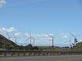 Wind turbines mouth of Spanish Fork Canyon, Jul 15.jpg 2,816 × 2,112; 2.41 MB


_-_NARA_-_68886696.jpg)


.jpg)


